(Photos by Los Angeles Times staff: Brian van der Brug, Gina Ferazzi, Robert Gauthier, Dania Maxwell, Francine Orr, Christopher Reynolds, Raul Roa, Allen J. Schaben; Karla Ann Cote/NurPhoto via Getty Images; lettering and animation by Jacky Sheridan/For The Times; video editing by Li Anne Liew/For The Times)
The 101 best West Coast experiences
- Share via
A brilliant, enduring moment can happen to anyone, any time, anywhere. But if you’re giving me a choice, I’d rather go looking for that moment at dawn on the salt flats of Death Valley.
Or at the base of the Yosemite waterfall.
Or on a busy night in Vancouver’s only Native restaurant.
Or on a southern Baja beach with sunset coming.
What secret thread runs through these places? Well, the same migrating gray whale might show up in Baja or British Columbia, depending on the season. Beyond that, these destinations are all on the West Coast, which we like to think of as our backyard, even though it rises, falls and sprawls for thousands of miles.
We’re spoiled for choice as travelers living in Southern California: The beaches, deserts, mountains, towns, cities and people — some familiar, some startling — all roar for our attention. This list aims to cover 101 West Coast experiences that roared loudest when we showed up, looked and listened.
Ahead you’ll find fresh information on plenty of destinations you’ve long meant to visit or revisit — the half-hidden glories of Yosemite’s Hetch Hetchy Valley, the stalls and buskers of Seattle’s Pike Place Market, the rugged slopes of Catalina Island’s back country. And because the West keeps changing, I’m hoping this list will alert you to many places and adventures you’ve never considered before. Maybe that means a weekend of eating your way through the restaurants along Bell Street in Los Alamos, a night of music on the waterfront in downtown San Diego or a steamy sauna on a reconditioned warship in the Inner Harbor of Victoria, British Columbia.
How did we choose? By going everywhere. I have visited 87 of these places, from the southern tip of Baja (which you can reach in a see-through boat) to the forests of British Columbia (where you can tiptoe across a suspension bridge that’s 230 feet above the Capilano River). For the other 14, all in the Pacific Northwest, we’ve relied on contributor Elisa Parhad. We’ve left out a few of the usual L.A. suspects (Disneyland, Disney Hall, the Getty, Griffith Observatory, the Hollywood Bowl and the Santa Monica Pier, for instance), because they’re so well known and close to home. This list starts in the Baja California peninsula and heads north, taking you through California, Oregon, Washington and British Columbia.
“One cannot be pessimistic about the West. This is the native home of hope,” wrote author Wallace Stegner.
Maybe hope is the thread connecting these places. They raise possibilities — even the scenes of wrongdoing and tragedy. If we meet these destinations with enough humility and curiosity, surely the sights and people will encourage us in ways we can’t imagine now. What’s more inspiring, more hopeful, than a West Coast road?
Now, let’s hit that road, along with the beaches, the rivers and the slopes. Keep an eye out for gray whales. And please, write to [email protected] if you’ve got an idea for a place I should go next — or if you just want to tell me I forgot San Francisco’s cable cars.
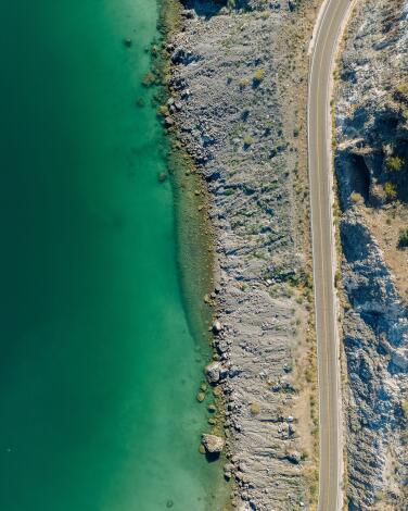
Coast alongside the blue-green waters of Baja's Bahía Concepción
No such luck. The bay ends 28 miles later, about 50 miles north of Loreto. Before you move on, your inner desert rat and beach bum need a pause by those cactus-covered slopes and turquoise waters.
As you head south on the Baja Highway (Mexico 1), the bay begins near Playa Naranjos. From there the highway runs past about a dozen named beaches, some of which have rustic inns, restaurants or hook-ups for RV camping. There are no towns and no four-star resorts, just miles of sea, sand and cactus.
Playa Buenaventura, about 25 miles south of Mulegé, includes the Buenaventura restaurant and Argghh bar (it’s about pirates). There you can get a hot shower for 50 pesos (about $3). Neighboring beaches with camping include Playa Santispac, El Burro and Coyote to the north and the highly scenic (and sometimes crowded) Playa El Requesón about a mile southeast. There’s a 0.8-mile hiking trail at Requesón.
Before travel to Mexico, check U.S. State Department travel guidance on safety.
Bonus tip: Punta Concepción is at the tip of the peninsula that shelters the bay. If your vehicle is ready for rugged roads and you get permission to camp from one of the ranchers on the point, you won’t find a more peaceful place to watch sunset and sunrise.
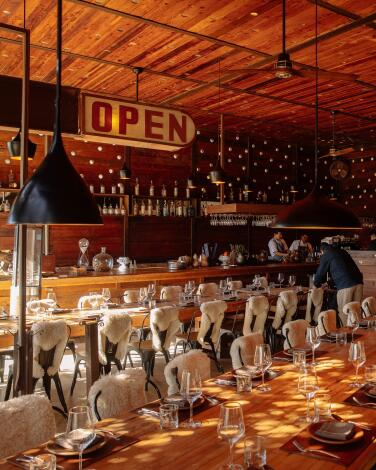
Sample sophisticated dishes at Fauna in Baja's Guadalupe Valley
Fauna makes a lot of best-of lists and is priced accordingly. The chef’s tasting menu is about $105. But a tremendous lunch can be had for about $50. I ordered a lettuce-with-mackerel starter, followed by broccoli with chiltepín peppers, then cabbage with chilhuacle peppers, then lamb — possibly the best meal I’ve ever had in Mexico, and one of the best I had anywhere last year.
The restaurant, opened in 2017, serves lunch and dinner, beginning at 1 p.m. daily.
Bonus tip: If you can, leave time to tour the rest of the 200-acre Bruma winery complex. And if you haven’t been near Ensenada in a few years, the proliferation of wineries, restaurants and upscale lodgings in Guadalupe Valley may amaze you. Bruma tastings come with a short tour (cost $30-$35 per person). The Bruma property also has rentable villas and a B&B, Casa 8.
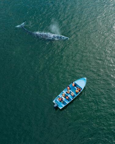
Commune with whales in a Baja lagoon
In their wake come thousands of whale watchers. The lagoon, part of UNESCO’s El Vizcaino Biosphere Reserve, includes three primary areas for whale watching.
About 20 pangas (small boats) have permits to take people out. In late January and early February, there can be 100 people per day watching whales. A typical tour would include 10 people on a 23-foot boat for about two hours at $58 each. Tour operators include Malarrimo Eco-tours, Mario’s Tours and The Californias.
Though U.S. wildlife officials urge people to stay at least 100 yards away from the whales, Mexico takes a more relaxed approach. Sometimes whales approach boats and allow people to touch them. Sometimes the whales never get that close. Similar whale-watching tours are offered by many companies in San Ignacio Lagoon (about 100 miles south) and Magdalena Bay.
Bonus tip: These gray whales, often more than 40 feet long, typically spend summers in waters of the Pacific Northwest, swim 5,000 miles south for the winter, then swim back again. The newborn calves are usually about 15 feet long. The gray whale’s average lifespan is unknown.
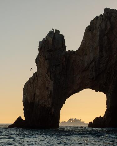
Bob in a see-through boat at Land's End in southern Baja
All day every day (weather permitting), tour companies and panga captains take visitors out to the waters near the rocks. Depending on price, surf and time, some will drop you for a while on nearby Lover’s Beach. (Divorce Beach, where the water is more treacherous, is also close at hand.)
I used Enva Tours, which has an office in the marina at Cabo San Lucas and runs boats out just about every hour at $29 to $39 per person. The boats are made of translucent plexiglass, which gives better views of the fish below and rocks around. (The hostess and captain said they work for tips only.)
Don’t expect solitude, especially near sunset, when two dozen or more boats routinely jostle for position. Do expect a memorable, multisensory scene with laughter, chatter in various languages, sea spray and a setting sun.
Bonus tip: If you pay more, you can also do this by catamaran or yacht or glass-bottom kayak.
Follow a mountain road to one of Baja's oldest, most atmospheric missions
Yet for many seasoned Baja explorers, the Loreto mission isn’t even the most intriguing church in the neighborhood.
Many Baja mission aficionados say their favorite site about 25 miles southeast of Loreto in the rural hamlet of San Javier (population: about 40 families).
To reach the San Javier mission (formally: Misión San Francisco Javier de Viggé-Biaundó.), you drive a twisty mountain road that will remind you of the raw landscape the missionaries faced. It takes about an hour. The church (built 1744-58) is younger than Loreto’s, but more of its original architecture has survived, including many elegant details. Moreover, it’s surrounded by rugged hills and enduring farms.
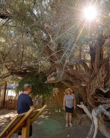
Bonus tip: A short stroll for the mission you’ll find a 300-year-old olive tree and ancient irrigation system. (There’s an admission of a few dollars.) A couple of rustic restaurants operate across the street from the mission. A priest comes on Sundays to celebrate Mass. If you’d rather not brave the road from Loreto to San Javier, several tour companies in Loreto offer day trips.
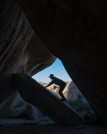
Creep into a Baja cave full of ancient art
Be sure to leave the site as you found it — and consider that cave paintings are scattered throughout the peninsula. The same harsh setting that discourages many visitors has acted to save these markings from long ago.
Bonus tip: The Baja rock art I’d love to see some day is the series of murals farther south, near the town of San Ignacio, in the Sierra de San Francisco. Those murals, which include human figures 8 feet tall, are said to be at least 7,000 years old (the oldest art known on the peninsula), attributed to the Cochimí people. To reach them, you need a permit — and the hardiness to hike several days with guides and pack animals.
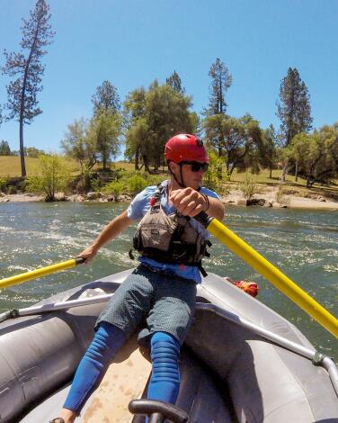
Paddle rapids on the South Fork of the American River
The season typically runs April through September. Most guides agree that the American River’s South Fork, in the Sierra foothills’ Gold Country, is an ideal spot for rookie rafters and families, thanks to its evocative scenery and relatively mild Class II and III rapids. (I’ve done it at ages 11 and 57.) Unless you’re a seasoned river runner, sign on with a licensed, experienced company. More than a dozen operate on the river, many based in the Coloma-Lotus area.
Rafting trips on the American’s South Fork typically begin north of Placerville, below the Chili Bar Reservoir. One-day floats usually cover the 13 miles of the Lower Gorge area. Two-day trips often cover 20 miles. As you might expect, the rides typically get gentler as spring turns to summer and summer eases into fall. Half-day and all-day rafting trips typically cost $150 to $200 per person.
Less than 10 miles from the South Fork’s Chili Bar put-in, you’ll find Marshall Gold Discovery State Historic Park, where the Gold Rush began. Placerville, the nearest town to the rafting, has plenty of restaurants and shops, a few lodgings and an Old West feel along Main Street.
Bonus tip: Statewide, you’ll find plenty of river-rafting outfitters, including many along the Middle and North forks of the American (both more challenging than the South fork) and the Merced, Tuolumne, Stanislaus, Lower Klamath, Kern, Kaweah and Truckee rivers.
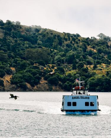
Step through greenery into history on Angel Island
It’s the biggest natural island in San Francisco Bay, about 740 acres. But there’s far more to Angel Island than its marina at Ayala Cove, its bay views, campgrounds, visitor center, hiking paths and bike rentals. It’s a key landmark in Asian American history, often described as the Ellis Island of the west.
From 1910 to 1940, this was the U.S. entry point for almost 1 million immigrants, including 175,000 from China. Scorned by U.S. immigration laws of the time, those from China typically spent weeks or months locked in barracks before being allowed to enter. Some etched poetry on walls in the Immigration Station and barracks, a roughly 1.5-mile walk or bike ride from the Ayala Cove ferry landing. If you visit Wednesday through Sunday, you can see the Detention Barracks Museum and the Angel Island Immigration Museum (in the island’s former hospital).
Bonus tip: Downtown Tiburon has its own bit of history: Several buildings on Main Street were built from old boats and now are known as “ark row.” Among them you can browse boutiques, grab a taco or admire the vintage and new specimens for sale in Schoenberg Guitars.
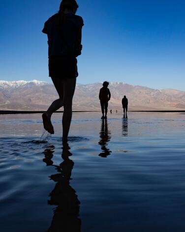
Walk the vast salt flats of Badwater Basin in Death Valley
Badwater Basin in Death Valley National Park is 282 feet below sea level, the lowest point in the continental U.S. It’s been a popular spot for years because the crusty old lake bed sprawls like a moonscape between forbidding mountains.
Then in 2023, the valley got 2 inches of rain in a single day and suddenly Badwater had a lake again. It was only a few inches deep in most spots, but it stretched for more than a mile, lasted months and yielded astonishing panoramas, from the water’s edge and from Dante’s View, on a mountaintop 5,500 feet above.
In February 2024 the lake remained. In fact, the valley got more rain that month, prompting rangers to declare Death Valley open for kayaking.
Alas, evaporation happens. Especially in Death Valley. Kayaking season lasted about three weeks and ended March 4. The lake remained in early May, but it was smaller and only inches deep.
Unless you arrive after another freak storm, chances are good that Badwater will be dry and crunchy when you get there. But you still need to get there, ideally for sunrise or sunset.
Bonus tip: Badwater, the Mesquite Flat Sand Dunes, Zabriskie Point and Dante’s View all deliver epic sunsets and sunrises, and all are within 25 miles of Furnace Creek, where most of the park’s hotel rooms are. Also, the gas station at Stovepipe Wells, next to Mesquite Flat, is usually much less expensive than the one at Furnace Creek.
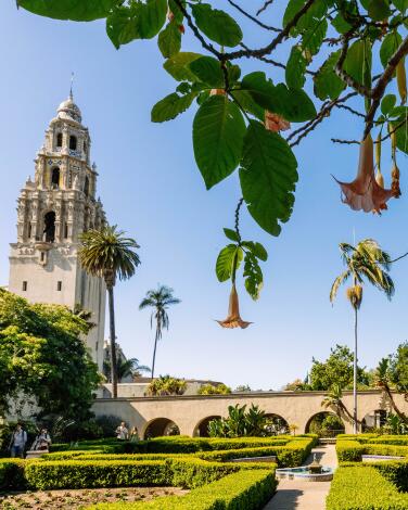
Soak up art, science, culture and greenery at Balboa Park in San Diego
The park’s emblematic 1914 Botanical Building is due to reopen this fall after major reconstruction. The Mingei International Museum, which focuses on global folk art, has been boosted by a $55-million renovation in 2021 and Michelin praise in 2023 for its eclectic restaurant, Artifact at Mingei (which serves lunch Tuesday through Sunday, dinner Thursday and Friday).
The park’s museums and other institutions cover art (fine, folk, contemporary and photographic), natural history, anthropology, flight and all the imagined worlds that come with Comic-Con (which opened its museum here in 2021). The Old Globe theater complex includes three stages. The big lily pond between the promenade and the Botanical Building may be the most wholesome over-the-counter tranquilizer in town.
Bonus tip: When you’re chasing butterflies in the park’s Zoro Garden (between the Reuben H. Fleet Science Center and the Museum of Photographic Arts), remember that civic boosters staged the “nudist colony” there in 1935 to lure more visitors into the park’s Pacific International Exposition that year.
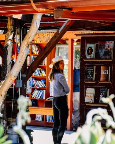
Thumb through pages at Bart’s Books under an open sky in Ojai
Since the late Richard “Bart” Bartinsdale opened this place in 1964 (and left town soon thereafter), Bart’s Books has become a town emblem, catering to bookish locals and visitors with a disarming layout: Most of it is open-air, with bits of tin roof to shield books on those rare occasions when Ojai gets rain.
The indoor portion is a converted house, with cookbooks in the kitchen and art and design books in the former garage. There are some rare books too. (A recent find: “The Year of Magical Thinking” in hardback, signed by its late author, Joan Didion: $400.) The shop is open daily from 10 a.m. to 6 p.m., with occasional readings and community events. But you can browse any time among the hundreds of used books shelved along Bart’s exterior walls, facing the sidewalk. The shop’s inventory was once all used, but now there are many new titles as well. The grand total: about 130,000 volumes.
Bonus tip: Used-book prices are marked in pencil on the upper right corner of the first blank page. The average: about $8.
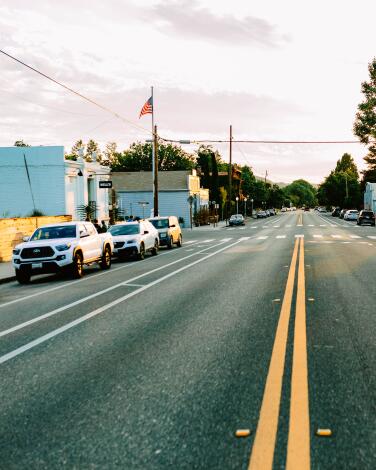
Feel the Old West vibes on charming Bell Street in Los Alamos
So what does Bell Street have? A refined Old West vibe, several stylish restaurants, a handful of tasting rooms and a few antique shops. Bell’s Restaurant, whose bistro fare has a Michelin star, sometimes includes San Barbara sea urchins and is offered via a $110 prix fixe dinner menu Thursday through Monday. (Bell’s also does lunch on those days.)
Bob’s Well Bread Bakery (Thursday through Monday) and Plenty on Bell (Tuesday through Sunday) are popular for breakfast and lunch. Full of Life Flatbread does big dinner business with its gourmet pizzas (Thursday through Sunday). Pico (that’s the building with the “General Store” sign out front) is another popular dinner spot, with a creative cocktail menu.
Bear in mind: Much of the town is closed Tuesday and Wednesday
Bonus tip: You could stay at a trendy motel (Alamo Motel) or a bed-and-breakfast in an 1864 Victorian home with six elaborately themed, not-at-all-Victorian suites (Victorian Mansion). If you’re splurging, the hilltop Skyview Los Alamos may be the answer. Several shops and restaurants in town also rent cottages through Airbnb, including Bob’s Well Bread Bakery, Bodega Wine and Beer Garden and Pico.
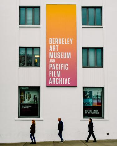
See moving pictures at BAMPFA, Berkeley’s reimagined art center
The vibe outside is neo-Art Deco, because about half of the museum was adapted from the university’s 1939 printing plant and the rest followed in 2016. Inside, the Berkeley Art Museum and Pacific Film Archive curators make magic with temporary exhibitions and a collection that’s all over the place, including Ming Dynasty paintings, American Abstract Expressionist works and Soviet propaganda films.
Through July 7, BAMPFA is showing “What Has Been and What Could Be,” a exhibition full of striking juxtapositions from the museum’s permanent collection. In the “Serenity Now!” room, Albert Bierstadt’s 1872 “Yosemite Winter Scene” hangs near “Ichiren-bozu,” a luminous blue wool sculpture made by Berkeley artist Masako Miki in 2018. In the “Rad Women” room, one of Sojourner Truth’s 19th-century calling cards neighbors a 17th-century Giuseppe Cesari painting of the biblical hero Judith showing off the severed head of Holofernes.
The museum is open Wednesday through Sunday and the film archive presents about 450 screenings a year.
Bonus tip: After BAMPFA, check out the Berkeley campus — or, as locals would say, the Cal campus — and the commercial chaos that is Telegraph Avenue. For $5 per adult you can ride an elevator to the top of the university’s 307-foot Campanile, a.k.a. Sather Tower. Or eat lunch on nearby North Shattuck Avenue, where Chez Panisse and the Cheese Board Collective have endured since 1971.
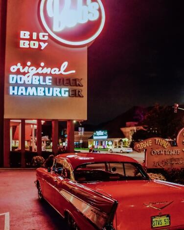
Munch burgers alongside classic cars at the oldest Bob’s Big Boy
The answer is both. Burbank’s Bob’s Big Boy, open since 1949, is the oldest surviving Bob’s and it draws legions with its free Classic Car Show every Friday night. The car people gather around the restaurant’s 70-foot neon sign — a landmark of midcentury design — with gleaming chrome, rumbling pipes and upholstery smooth as a baby’s bottom.
From 4 to 10 p.m. each Friday, the restaurant suspends its one-hour parking limit so that these gearheads can show off their rides and check out the competition. Inside, you can get the Original Big Boy combo ($14.99) or all sorts of merch, 7 a.m. to midnight daily. But if you show up on a Friday at 9 p.m., as I did recently, you may face an hourlong wait, despite seating for 166. Alas, Bob’s carhop service is no more.
But you might see a ’57 Chevy Bel Air. Or a Russian Volga. Or a DeLorean. Some owners like to leave their hoods up, including more than a few silver-haired car guys who were teenagers in the ’60s.
Bonus tip: Jay Leno has been a frequent visitor. Director David Lynch came here daily for years in the 1970s and always ordered a chocolate milkshake. And when the Beatles showed up one day in 1965, they sat in the last booth on the right.
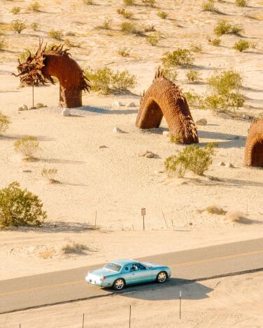
Confront a serpent under starry skies in Borrego Springs
Breceda, a Southern California sheet-metal sculptor commissioned by local philanthropist Dennis Avery, has since 2008 placed about 130 metal works around Borrego Springs, a desert getaway that’s as sleepy as Palm Springs and Joshua Tree are trendy. Breceda’s works include dinosaurs, a scorpion the size of a Subaru and the artist’s magnum opus, a fearsome, whiskered, half-submerged serpent of the sand.
That 350-foot-long serpent — actually a medley of five segments rising from the sand — lies along Borrego Springs Road, 2.3 miles north of Christmas Circle. The Anza-Borrego Desert Natural History Assn. store near Christmas Circle sells sculpture maps.
Before or after beast-hunting, get a cool beverage at Carlee’s or see what’s on the walls at the Borrego Art Institute. Then take a hike.
Out in the surrounding state park land, most hikers head first for the Borrego Palm Canyon Nature Trail (3 miles round-trip) or the Slot (a 2.2-mile loop through a slot canyon). Photographers rise early and take their four-wheel-drive vehicles up a four-mile dirt road to capture the sunrise badlands panoramas from Font’s Point.
Bonus tip: Expect brilliant night skies. Borrego is one of about 17 areas in the American West to be designated an International Dark Sky Community, a prime place for stargazing and night-sky photography.
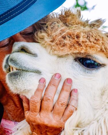
Nuzzle an alpaca in Carpinteria, one of California's last great beach towns
But they’re overlooking the alpacas. In the small city’s rural foothills, the Canzelle Alpaca Farm offers hourlong tours. Sign up and you’ll find yourself on a 20-acre hillside property where furry creatures with tiny heads gather next to a tall, red barn.
These are the alpacas, cousins to the llama, friendly to most people. More than 40 live on the ranch, along with two llamas, one black sheep, one water buffalo and a peacock. The alpacas get fleeced every spring.
Alpacas are native to South America. The Lonson family, owners of the farm, acquired their first ones about 20 years ago. Since the animals have mellow dispositions and only bottom teeth, they’re not much of a bite threat. Under guide Karen Putnam’s direction, a dozen of us took turns petting and nuzzling the animals, then feeding them carrots — in some cases, mouth to mouth.
Tours are offered Friday through Sunday. To join a group tour, the price is $25 to $30 per person, advance reservations required; children are welcome, dogs banned.
Bonus tip: For $65 a head, you can take a 15-person sound bath in the pasture, surrounded by alpacas and resonating crystal bowls.
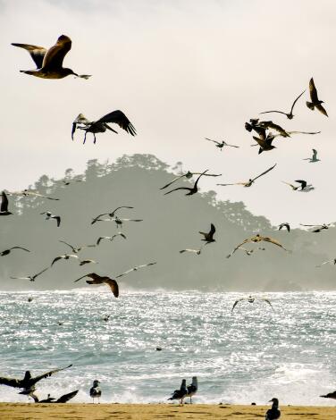
Comb the beach that separates the Carmel River from the sea
It’s mesmerizing. And it’s a bracing contrast to the storybook architecture and steep prices that dominate downtown Carmel. (Did I mention that it’s free?)
The beach has its own parking lot, and it’s on the loop route for people driving Scenic Road. It’s also popular with local dog-walkers. Yet somehow it never seems as crowded as Carmel Sunset Beach at the foot of busy Ocean Avenue.
Bonus tip: Be sure to drive — or, better yet, pedal or walk — all of Scenic Road. It’s a one-way, 3-mile loop that begins at the foot of Ocean Avenue, taking you past rocky ocean cliffs on the right, highly coveted residential real estate on the left. You can rent a bike from the Mad Dogs & Englishmen shop on Ocean Avenue.
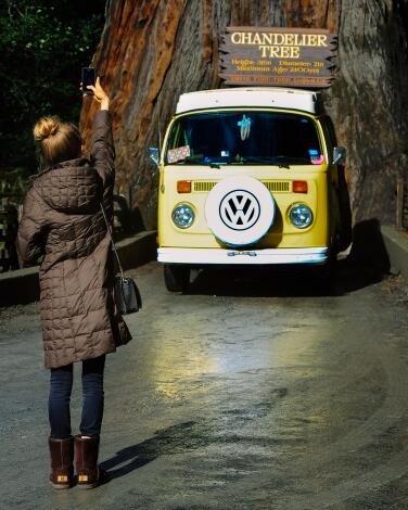
Drive through the living redwood that is the Chandelier Tree
Me too. In fact, I’ve driven through all three of the remaining drive-through redwoods in California. Leggett’s Chandelier Drive-Thru Tree is the tallest, straightest standout, the Clint Eastwood of redwoods.
Since it was carved in 1937, giddy visitors have been steering vehicles through it. (So you’re not damaging a tree as much as you are recycling a roadside attraction.) Truth be told, there’s not a lot else to do in sleepy little Leggett, which is right along U.S. 101. The tree is estimated at 315 feet tall. The price is $15 per car and it’s open 9 a.m. to 6 p.m. daily, weather permitting. There’s a big gift shop. It’s a family operation, now in its fourth generation.
Also: If somebody mentions the drive-through tree in Yosemite, gently inform them it that fell over in 1969. Also, before you drive through, tuck in your mirrors.
Bonus tip: About 30 miles farther north on U.S. 101, you’ll reach the 31-mile-long Avenue of the Giants, a corridor of natural wonder and roadside kitsch that includes Humboldt Redwoods State Park. Once there, be sure to inspect the magnificent 362-foot-long corpse of the Dyerville Giant, once thought to be the world’s tallest tree. It fell in 1991, causing an impact so violent that some neighbors feared a train crash.
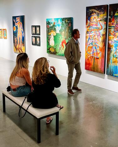
See bold and joyful art at the Cheech in Riverside
Which fits. It’s a breath of fresh air, a spectrum of bold colors, a grito, celebration and lamentation of the Mexican American experience. The Cheech’s two-story building, once the city’s central library, makes a good home for art, especially the unnamed kaleidoscopic 26-foot-high installation by brothers Einar and Jamex de la Torre and Frank Romero’s 8-by-12-foot canvas “The Arrest of the Paleteros” (which shows police shutting down vendors in L.A.’s Echo Park).
Most of the art here has been made since 1965. Many works address simmering social issues. And many, thanks to their saturated colors and thick brushstrokes, look like they’re still wet. Adult admission is $15.95, which also gets you into the neighboring Riverside Art Museum. Both venues are closed on Monday and Tuesday.
Bonus tip: Riverside has no mission, but across the street from the Cheech it has the Mission Inn, a gargantuan Mission Revival hotel that dates to the 1870s and fills a city block with 238 guest rooms, a spa, several restaurants, all manner of European architectural flourishes and an immensely popular winter Festival of Lights.
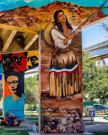
Smile up at the colors and concrete of San Diego's Chicano Park
When state and local officials expanded Interstate 5 through San Diego and built the Coronado Bridge in the 1960s, they split the blue-collar neighborhood of Barrio Logan. Then in 1970, when the California Highway Patrol started building an office where a park was expected, the neighbors rose up, occupied the site for 12 days and at last got a 7-acre park set aside. Soon after came the murals, followed by restaurants, galleries and the barrio’s designation as a cultural district. Now there are more than 50 murals, some celebrating Mexican icons such as Pancho Villa and Frida Kahlo. In 2016, federal officials added the park to the National Register of Historic Places, crediting artists Salvador Torres, Mario Torero, Victor Ochoa and others. In late 2022, the Chicano Park Museum debuted next door.
Bonus tip: Within two blocks along Logan Avenue, you can get flautas at Las Cuatro Milpas, tacos at Salud! and beer at Border X Brewing.
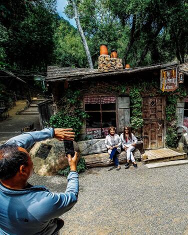
Grab grub at Cold Spring Tavern to the sound of acoustic blues
Built in the 1880s and run by the same family since the 1940s, the tavern interior features four stone fireplaces. Lunch options include three kinds of chili. (Last time in, I had the sampler plate.)
But it’s weekend afternoons that make this place memorable. On Saturday and Sunday, the tavern’s Log Cabin Bar becomes a sprawling indoor-outdoor operation. Hundreds of diners tear into tri-tip sandwiches ($14 each) from an outdoor grill, starting around 11:30 a.m. Then comes the live music, about 1:30 p.m. Acoustic blues specialists Tom Ball and Kenny Sultan, a duo for 44 years, have been playing Sundays at this venue for most of that time.
Bonus tip: The fanciest part of the property is its dim, rustic restaurant interior, where buffalo, venison, duck and boar often turn up on the menu for Friday and Saturday dinners (5-8 p.m., reservations required). The tavern is closed on Tuesday and Wednesday.
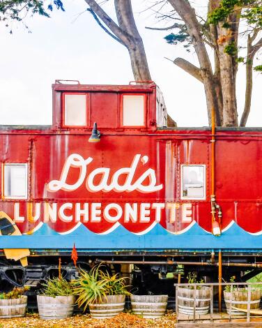
Dig into a sandwich from the caboose-kitchen of Dad's Luncheonette in Half Moon Bay
As the setting suggests, Dad’s is an eccentric operation, one that aims to deliver “satisfying comfort food to be enjoyed quickly, messily, on our patio, or on the hood of your car.” (There’s some outdoor space where you can eat, but no dining room.)
There’s often a line. Some weeks, without warning, pistachio orange cannoli materializes. Sometimes the kitchen runs out of ingredients and closes early. But the restaurant is usually open from 11 a.m. to 4 p.m. Thursday through Sunday.
The backstory is that chef and co-owner Scott Clark used to work in Michelin-star-winning kitchens but chucked that after becoming, yes, a dad. He and his partner, Alexis Liu, opened Dad’s in 2017. The menu is short and affordable — nothing pricier than the $14.50 hamburger sandwich (or, if you prefer, mushroom sandwich). The soup of the week is $8, homemade potato chips $4.
We got our lunch there on a cold (but still busy) day and ate in our car. Still, the flavors and textures were so good that the interior went quiet for a good, long while.
Bonus tip: Sometimes, on Father’s Day, dads get free beer.
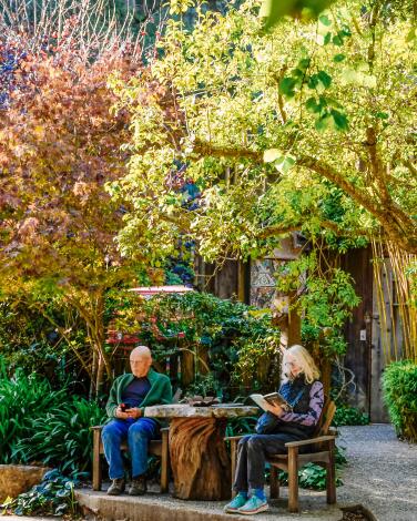
Sleep by the sea amid the Norwegian woodwork at Deetjen's Big Sur Inn
For a while in those years, the inn was where the pavement stopped in Big Sur — the end of civilization for southbound drivers. Now the highway goes through, except when it’s closed for mudslide damage and repairs, which we’ll get back to in a moment.
The old Deetjen’s barn is now the dining room, warmed by a cozy stone fireplace. Though Deetjen died in 1972, he set up a nonprofit entity to keep the inn and restaurant going with as little change as possible. That’s why the Norwegian vernacular architecture has never seen a design update, the five units in the Hayloft Hostel building share two bathrooms and there are no televisions, phones or Wi-Fi in guest rooms. Reservations are taken by phone only. Rates are $100 to $340 for the rooms sharing baths, $250 to $435 for the others.
Since January 2023, Highway 1 in Big Sur has been closed by mudslides and repairs in multiple places. Caltrans announced a partial reopening May 16. Before you head north, check Highway 1’s status on the Caltrans website.
Bonus tip: The restaurant serves breakfast daily, dinner Friday through Tuesday. If you have breakfast in the dining room, Mr. Deetjen’s favorite classical music will be playing, and the old man will be looking down at you from a portrait on the wall.
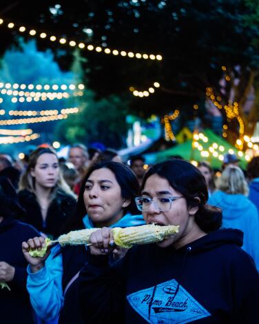
Queue up with college kids and cowboys at the Downtown SLO Farmers Market
This is a market that comes close to being a full-blown street party. It takes over Higuera Street (SLO’s main drag) from 6 p.m. to 8:30 or 9, giving pedestrians free rein to nibble, sip, shop and hang out in the heart of downtown. From March through October, the market stays open until 9. If it rains, the market is usually canceled (check Instagram for updates).
The market fills five blocks with more than 100 vendors, including produce sellers, street-food makers, assorted artisans and live music. It’s all a little bit collegiate (because the Cal Poly campus is close by) and a little bit cowboy. You can get ribs here, and pulled pork, corn on the cob, kombucha, soap, tamales, honey, mushrooms and that particular secular sacrament (a crescent-shaped bit of beef, grilled over red oak) that SLO folk call tri-tip. Some vendors take cash only. Bring the family (but not the dog). And be reassured: The lines may be long for barbecue from F. McLintocks Saloon and cold-brew boba tea from Sequel Cold Brew Tea, but they move fast.
Cal Poly students make up an estimated 60% or more of the workers and a large chunk of the browsers. For further proof of collegiate influence, have a look at downtown’s Bubblegum Alley between Garden and Broad streets.
Bonus tip: If you’d rather dodge crowds, take a hike among the raw slopes and experimental architecture projects in Poly Canyon, just north of the Cal Poly campus.
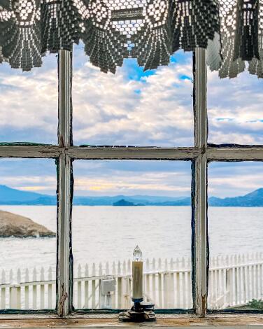
Spend a night in a San Francisco Bay island lighthouse
But we’re talking about a lighthouse on an island.
The East Brother Light Station is three buildings on a ¾-acre island near the eastern shore of San Francisco Bay. The main attraction is an 1873 Victorian home, topped by a beacon you can see for 13 miles. Its four bedrooms (plus one in a neighboring building) are rentable by the night, fancy dinner and breakfast included.
Rates are $475 to $525 per night — or $2,500 to rent the island for a one-night “house party.” It’s open four nights a week.
The lighthouse operated from 1873 until the 1960s. It reopened in 1980 as a B&B, run by a volunteer group dedicated to preserving the site. To get there, head to Point San Pablo Harbor in Richmond, where innkeepers Dre and Charity Elmore will pick you up by boat. It’s about 10 minutes to reach the island, with a 4- to 12-foot ladder climb likely on arrival.
Bonus tip: When you arrive at the harbor, you’ll be greeted by a 40-foot-long steel-and-ceramic crocodile, a hippo-sized cat statue and several other large, odd objects, neighbored by the Sailing Goat restaurant (open Friday through Sunday). The sculptures were made for Burning Man (many of the houseboat people are artists) and this is their retirement home.
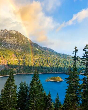
Take in the postcard-worthy views at Emerald Bay State Park
In any season, you get drop-dead views from Emerald Bay Overlook, the rocks next to the park’s main parking lot and its Eagle Falls Vista Point — panoramas that include the lake’s southwestern corner, the beaches around it and the forested slopes above. To punctuate the whole scene, you have tiny Fannette Island, plopped into the middle of the bay and topped by a stone teahouse ruin.
Emerald Bay is one of my two favorite views on the lake (the other is the stony shallows of Sand Harbor Beach on the North Shore’s Nevada side). If you do the 72-mile drive around the lake — highly recommended — you can see both. In warmer months there’s camping. Close to the water’s edge (at the end of a fairly steep 1-mile trail) is Vikingsholm Castle, a Scandinavian-style mansion from the 1920s.
Bonus tip: Beginning in late May, Kayak Tahoe usually has kayaks for rent at Vikingsholm, but the operation is first come, first serve (no reservations) and the paddle to Fannette Island is considered a stiff challenge for beginners.
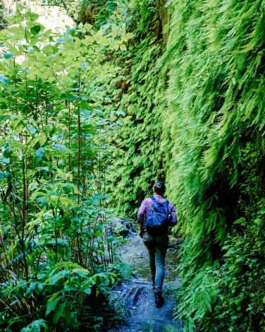
Hike Fern Canyon, the lush trail with ‘Jurassic Park’ vibes
The Fern Canyon Loop Trail, which neighbors Gold Bluffs Beach, measures barely a mile. But the path takes you up a narrow canyon into primordial greenery between walls that rise 50 to 80 feet on each side. Parts of “The Lost World: Jurassic Park” were shot here 25 years ago, as were parts of the BBC’s “Walking With Dinosaurs.”
Bring water shoes. And book it a week or two ahead (up to six months). Rangers have imposed a requirement from May 15 to Sept. 15 that hikers reserve permits for their canyon-adjacent parking in advance.
With a limit of about 250 reservations per day, rangers aim to ease backups and reduce damage to the narrow, muddy road to the trailhead. The day-use fee is $12 cash at the entrance. No dogs.
Bonus tip: The second half of the loop hike is a less interesting route through Sitka spruce forest. When done, you might want to reverse your route and do the wet bit again.
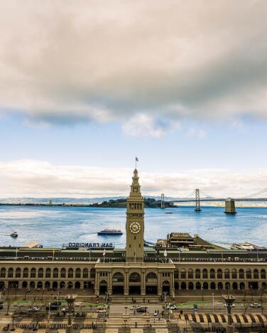
Walk, ride or glide from San Francisco's Ferry Building to the Golden Gate Bridge
Start at the foot of Market Street in the 1898 Ferry Building, with its restaurants, food-focused retailers and farmers market (Tuesday, Thursday and Saturday). Blue Bottle coffee! Far West Fungi! Hog Island oysters!
Now work your way north and west on the Embarcadero, by foot, bike or throwback streetcar. You’ll find hands-on science at the Exploratorium (Pier 15); an old-school lunch spot at Pier 23; a vast cruise terminal at Pier 27; a tourist-driven shopping scene (with sea lion soundtrack) at Pier 39; and a whole lot of T-shirt vendors, seafood restaurants and the Boudin Bakery at Fisherman’s Wharf.
You’ll know you’re nearly halfway to the bridge when you reach the Hyde Street cable car turnaround on your right, the Buena Vista cafe on your left. (Celebrate, if you like, with an Irish coffee. You wouldn’t be the first.)
A block after that, you leave Embarcadero and follow a much-trafficked route past Fort Mason, Marina Green, Crissy Field, the Warming Hut (a good snack stop) and Fort Point. All along the way, you’ll have epic views of the bridge above, the bay to your right and the green space and historic buildings of the Presidio to your left. (It’s a short detour to even more bridge views, along with some grass for picnicking, at Presidio Tunnel Tops, an addition to the park that opened in 2022.)
Bonus tip: Yes, you could ride a bike across the bridge to Sausalito (1.7 miles) and catch a ferry back, but on the route to Fort Point, you’ll have fewer cars roaring past, less wind and more pleasant places to stop.
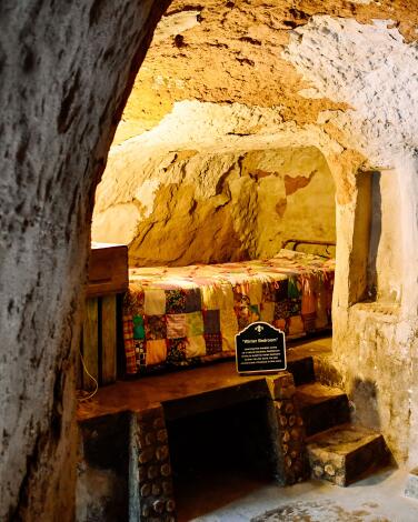
Enter a subterranean world at Forestiere Underground Gardens in Fresno
An immigrant from Sicily, Baldassare Forestiere reached the U.S. in 1901. After several years of digging subway lines on the East Coast, he bought land in Fresno, where he planned to start a citrus farm.
On arrival, he learned that his acreage was topped by three or more feet of hardpan — sedimentary rock that made farming impossible. So he took jobs selling fruit and digging canals for other farmers.
On his own land, he dug a downstairs kitchen to avoid the summer heat. Then, using pick, shovel, wheelbarrow and construction skills, he dug out another room. And another. For 40 years.
Forestiere died in 1946, but a warren of rooms, grottos, patios and courtyards remains, often shaded by citrus trees that Forestiere grew and grafted. Often their trunks begin below ground, branches reaching up through skylights.
Though Forestiere never married (or added plumbing), he hosted parties and imagined his project as a resort someday. That didn’t happen. But more than 10 acres of his compound remain, owned and managed by his great-nieces, protected as a historic monument.
The gardens close from early December through late March. Adult admission for a one-hour escorted tour is $23, reservations recommended. Children are welcome, pets are not.
Bonus tip: Novelist T.C. Boyle was so fascinated by Forestiere that he wrote a fictional story based on his life. It’s in a 2001 Boyle short-story collection called “After the Plague.”
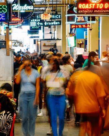
Graze the world at DTLA's Grand Central Market
Bonus tip: Across Hill Street, you’ll find the Angels Flight Railway, a 298-foot-long funicular that dates to 1901. (Its two orange cars charge $1 each way for a short, steep ride up Bunker Hill to California Plaza.) Across Broadway you’ll find the Bradbury Building, whose skylighted 1893 atrium was a key setting for Ridley Scott’s film “Blade Runner” (1982).
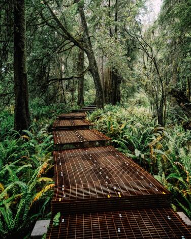
Look up at 300-foot redwoods in the Grove of Titans
They’ve been part of Jedediah Smith Redwood State Park since 1929. (They’re part of Redwood National and State Parks too.) As you follow the 3-mile trail to the grove, remember that for years, rangers kept mum about this place because they were worried about damage from overzealous hikers. Fortunately, in 2022 a park construction crew completed the rerouting of Mill Creek Trail, adding a quarter-mile elevated metal walkway that protects the forest floor.
As you gape, remember the names that earlier Grove of Titans hikers have given to favorite trees: Screaming Titans. Lost Monarch. El Viejo del Norte. The trailhead is about seven miles east of Crescent City via the narrow, winding, rugged, 10-mile Howland Hill Road, once a stagecoach route.
Bonus tip: Save an hour or two in Crescent City for the 1856 Battery Point Lighthouse, which stands on a tidal island along a gorgeous stretch of coastline. At low tide, you can walk from the mainland to the lighthouse.
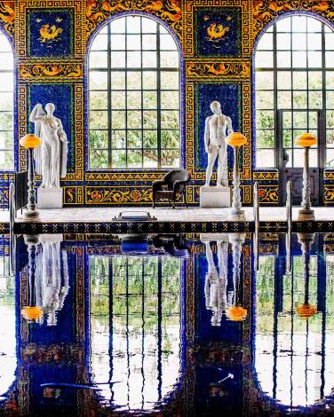
Roam California's first mega-mansion (and spot the ketchup bottles)
There are 165 rooms in the compound, designed by Julia Morgan for newspaper magnate William Randolph Hearst (who died in 1951). Now run by the state park system and open after a closure from 2020 to 2022, the hilltop castle is surrounded by three guest houses, one elaborate tiled indoor pool and another pool outdoors, all on 127 acres of gardens and grounds. Keep an eye out for the occasional roaming zebra.
The rooms are festooned with art and furnishings Hearst collected abroad, sometimes arranged in mind-bending juxtaposition. In the Refectory room, the monastery vibe is complemented by silver candlesticks and bottles of Heinz ketchup. If this all seems vaguely familiar, it’s because writer-director-actor Orson Welles was thinking about Hearst when he made the 1941 movie “Citizen Kane.”
Several different public tours are offered (some wheelchair-accessible, some not), plus evening tours in spring and fall. Tickets start at $30 per adult, $15 for children ages 5-12.
Bonus tip: Seven miles north of the castle along the rugged San Luis Obispo County coast, you’ll reach the Piedras Blancas Elephant Seal Rookery, home to dozens or hundreds of whiskered beasts (depending on the season), basking, sparring, giving birth or mating. It’s free. There’s a parking lot, wheelchair-accessible boardwalk and usually a few volunteer docents. Stay at least 25 feet away from the seals. No dogs, no drones.
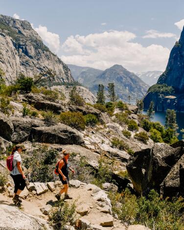
Hike beneath falls in Yosemite's half-forgotten valley
The Hetch Hetchy Valley is full of granite walls and tall falls, and it’s part of Yosemite National Park. Yet it remains half-forgotten — because this spot, about 40 miles’ drive south of Yosemite Valley, is where the Tuolumne River was dammed in 1923 to feed San Francisco’s thirst.
There’s just one road in — Hetch Hetchy Road, open sunrise to sunset, often closed in winter. There’s no campground, no swimming, no concessions. But you’ll find a handful of hiking trails, including the 5-mile round-trip to Wapama Falls.
That’s the one you want, especially in spring or summer. First you park by the 430-foot-high O’Shaughnessy Dam. Then you walk across the top and through a tunnel. If it’s sunny, look for a rainbow in the mist.
As you walk the trail along the reservoir’s edge, you’ll see gently curving Kolana Rock, the 1,900-foot-high Wapama Rock and 1,300-foot Wapama Falls. To the left of Wapama Falls, sometimes, is seasonal Tueeulala Falls.
Most of the trail is easy. Near the Wapama Falls turnaround point, you’ll find a series of footbridges across Falls Creek, which roars, rises and flings whitewater across your path if runoff is heavy. This can be risky. If in doubt, turn around. There’s no point finding secret treasure if you don’t return to tell the tale.
Bonus tip: Hetch Hetchy makes a great day trip if you’re already headed to Yosemite or Gold Country towns like Groveland, Jamestown, Sonora or Columbia, or if you’re staying at the park-adjacent Evergreen Lodge. In fact, that’s where the builders of O’Shaughnessy Dam stayed a century ago, before the lodge had aromatherapy.
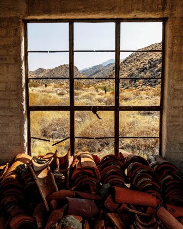
Hike the Indian Canyons of Palm Springs
In Andreas Canyon, you follow a 1.2-mile round-trip path along the year-round Andreas Creek, which is lined with Washingtonia filifera, the California fan palm. In Palm Canyon, a few miles away, the looping 2.7-mile Victor Trail drops into a shady fold in the desert hills where native palms congregate, then returns along a ridge.
Those canyons, along with Murray Canyon and Tahquitz Canyon (which has a seasonal waterfall and history that includes ancient myth and Jim Morrison), are all part of the Indian Canyons network owned and managed by Agua Caliente leaders.
Adult admission is $12; open daily Oct. 1 through July 4 and on Friday, Saturday and Sunday in summer. No pets. Keep an eye out for desert bighorn sheep (on the slopes above) and rattlesnakes (underfoot).
Bonus tip: There is an easier way to see this desert, of course — the Palm Springs Aerial Tramway, which climbs 6,000 feet to a mountain station while you stand in the dangling gondola, oohing and ahhhing. Each gondola holds up to 80 people. You pay $30.95 per adult and slowly rotate as the gondola climbs 2.5 miles to Mountain Station (elevation 8,516 feet). It’s often 35 degrees cooler there, with snow in winter. The last tram leaves the top at 9:30 p.m. or 10:30 p.m., depending on the day, so there’s time to catch sunset and eat at one of the two restaurants at the top.
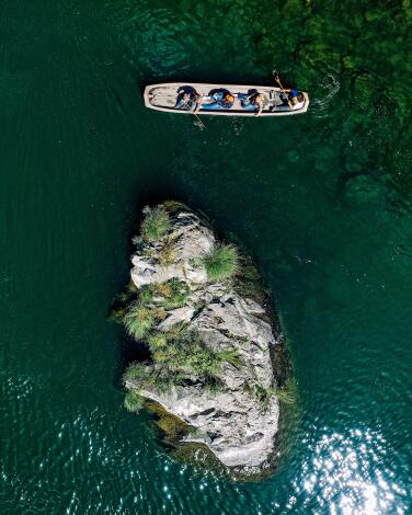
Paddle a redwood canoe in Klamath's Yurok country
If you want to cover more territory at higher speed, the tribe also offers summer jet-boat tours lasting one or two hours. On the longer tour you cover 22 miles of the river. Adult prices: $45 to $59.
Bonus tip: Klamath River Overlook, at the end of Requa Road in Klamath, offers a spectacular view from on high of the river meeting the sea.
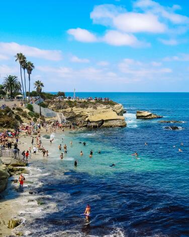
Tour the caves and coves of La Jolla
When the water is calm enough, you can paddle into one of the caves. This is part of a typical La Jolla kayak tour, which takes 90 minutes to two hours. I did mine with La Jolla Kayak (adult rates: $44 for a single kayak, $69 for a double), but there are several rental shops within a few blocks on Avenida de la Playa. (In cooler months, you can rent a wet suit with the kayak.)
There’s also plenty to see on land around La Jolla Cove. At Boomer Beach, crashing waves throw spray above rocks. At Point La Jolla, sea lions have basically taken over. (Give them room.) The grassy expanses of Ellen Browning Scripps Park practically demand that you lay out a picnic. And then there’s the Cave Store, which looks like a basic souvenir shop. Inside, there’s a tunnel — 145 steps carved through sandstone in 1902-03 by Chinese immigrant laborers, whose names were not recorded, on the orders of entrepreneur Gustav Schultz. At its bottom, the tunnel connects with Sunny Jim Cave, which opens to the ocean. You might see sea lions there — or kayakers. Admission is $10 per adult.
Bonus tip: A few steps from the Cave Store, the Coast Walk Trail offers a 0.6-mile clifftop path past homes most of us can only dream about.
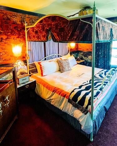
Go over the top at San Diego's LaFayette Hotel
Besides its 139 guest rooms and pool, the five-building complex includes a lobby bar that may remind you of a grand hotel in London; a Oaxacan restaurant (Quixote) that’s as dim and mysterious as a church crypt; a faux-’40s diner (Beginner’s) that’s open all hours; a pool bar designed to evoke Italy’s Amalfi Coast; and a basement bar (called Gutter) with a two-lane bowling alley.
In January, the LaFayette added Lou Lou’s Jungle Room, a 580-seat supper club and live-music venue. (This is the space where Tom Cruise sang “You’ve Lost That Lovin’ Feeling” in “Top Gun.”) In April, Esquire magazine named the LaFayette its 2024 new hotel of the year. A fine-dining restaurant is expected later this year.
The San Diego company behind this venture, Consortium Holdings, runs several restaurants and bars in North Park, but this is Consortium’s first hotel. It’s Vegas without a casino, a cruise ship without an ocean, Hearst Castle with bartenders. Room rates begin at about $200.
On the eve of opening, I asked Consortium co-founder Arsalun Tafazoli about the hotel’s governing philosophy. “More is more,” he said.
Bonus tip: You can buy a day pass to use the pool for $46.
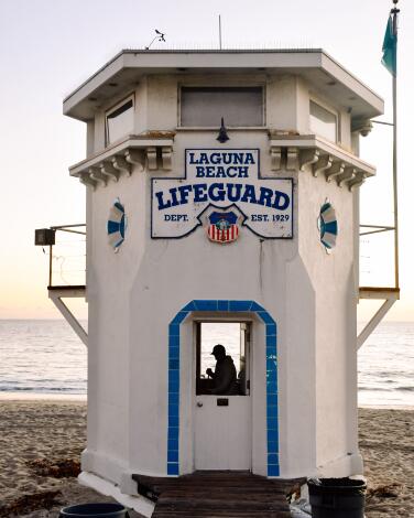
Tread the sand and probe the tidepools of Laguna Beach
The last time I did this was January, late afternoon, the sun throwing golden light everywhere. Beginning near the beach’s iconic lifeguard tower, I tiptoed along the sand and stones at low tide past Bird Rock and Recreation Point, following the water’s edge past couples and families peeking at tidepools. At Picnic Beach, where a stairwell rises from the sand, I climbed up to the walkway that’s officially known as the California Coastal Trail. Then I headed south again, enjoying the same scenery from 100 feet higher up.
This route takes you through Heisler Park, which has grass, bathrooms, a dozen picnic tables and a gazebo with such a compelling view that it’s often crammed full of tourists at sunset.
The trail runs close to the Laguna Art Museum and Las Brisas restaurant (which goes back to the 1970s, has sea views from its patio and offers a $49 brunch on weekends). You’re also steps from the start of high-toned Forest Avenue, which has been a one-block pedestrian promenade since the first year of the pandemic.
Bonus tip: If you’re exploring with kids, forget Forest Avenue in favor of Main Beach Toys & Games, which has had its spot facing Main Beach for many decades.
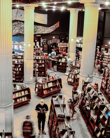
Dig for rare books and vinyl in the Last Bookstore
The Last Bookstore opened in 2005 as booksellers were faltering across the land. Since then it has expanded twice and has been housed in this 22,000-square-foot space since 2011. The ground floor is filled with new and used books; used vinyl, CDs and DVDs; an annex for art and rare books; and a stage for readings and other performances. The tall, white columns, circa 1915, suggest you may be sifting through the ruins of a lost civilization. Dangling artworks hint at magic in progress, while the Last Wall offers books for $1 each.
But the flashiest bit is yet to come. On the upstairs mezzanine, you find the Horror Vault and the Labyrinth, where used books might be arranged by subject, color or shape. Don’t miss the tunnel. Around the periphery, studios harbor makers with work for sale. If literature is dead, or downtown is, don’t tell this place’s 150,000 Instagram followers. Open daily, 11 a.m. to 8 p.m. And the bookstore has a smaller sibling location (with books, plants and vinyl) in Montrose: Lost Books.
Bonus tip: There are at least two other cool bookshops downtown: Hennessey + Ingalls (art and architecture, Arts District) and Kinokuniya (lots of manga, Little Tokyo). And the Central Library (with its mural-filled upstairs rotunda) is four blocks away at 630 W. 5th St.
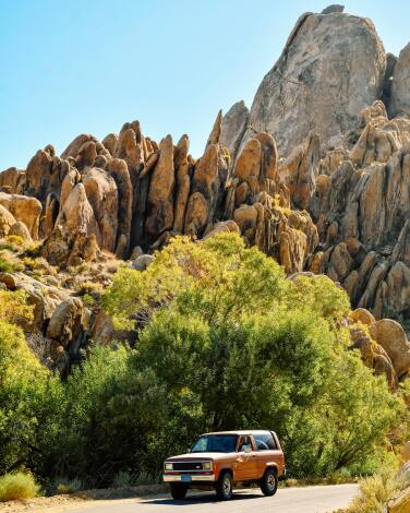
Prospect for treasures in Lone Pine's western movie museum
The museum offers maps of the filming locations in the neighboring Alabama Hills, which is part two of this excursion. These boulder-strewn hills may not be quite as red and stately as Arizona’s Monument Valley, but they’re just as essential to the history of the western genre.
This will become clear as you head up the gravel road into the Alabama Hills. Perhaps 500 movies — not to mention scores of TV shows and ads — have been filmed here, beginning in the 1920s. These hills feature in “Django Unchained” (2012), and in “Iron Man” (2008) they stood in for Afghanistan.
Bonus tip: The Museum of Western Film History mostly looks back to the past, but its parking lot includes eight Tesla charging stations.
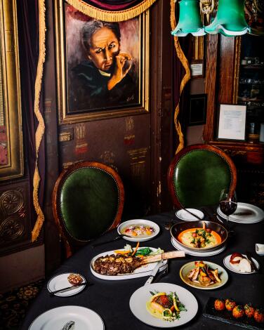
Get dressed up and deceived at the Magic Castle
Bonus tip: The Magic Castle Hotel is a converted 1950s apartment building, not nearly as fancy as the castle. Room rates start about $225 (and most units have kitchens). The furniture and grounds are worn, but we had alert service. And that red phone by the pool? That’s the free popsicle hotline.
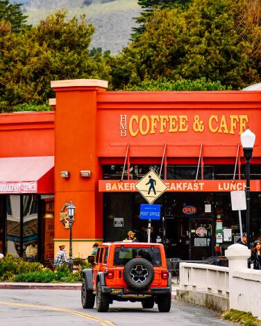
Meander the supremely charming Main Street, Half Moon Bay
Most of the buildings along Main Street, Half Moon Bay, date back to the 1950s or earlier, and the wide sidewalks and slow pace all but cry out for you to ditch your car and walk for a while. Its five or six busiest blocks include enough shops and restaurants to keep you going for a few hours.
Half Moon Bay’s population is about 11,000. Within 100 steps of Half Moon Bay Feed & Fuel (founded in 1911), you’ll find a couple of art galleries, a gourmet olive oil retailer and the Barterra Winery tasting room. Elsewhere on Main, you will find Garden Apothecary (garden products, herbal skincare, herbs and teas); Earth Impact (plants, gifts); LuzLuna Imports (fair-trade goods from Latin America); and Coastside Books (where I found a book on Willie Mays I’d never seen before).
Main Street is also where the annual Art & Pumpkin Festival takes place, and this is no small thing. The 2023 winner, Travis Gienger, drove about 35 hours from Anoka, Minn., to deliver his prize pumpkin, which weighed in at 2,749 pounds, a world record. (The next fest: Oct. 19-20.)
Bonus tip: Savvy locals line up before the 10 a.m. opening time at the city’s beloved Garden Deli Cafe so they can get first crack at the operation’s fresh bread (three varieties) and sandwiches.
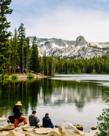
Drive scenic Highway 395 to Mammoth Mountain
The mountain ski operation was founded in 1953. And the destination has greatly strengthened its summer game in recent years. Once the snow melts — which may take longer than usual after this year’s ample snowfall — the mountain’s summer offerings include more than 80 miles of single-track trails for mountain bikers, a via ferrata for climbers, assorted hiking trails and gondola rides to the summit. There’s also golf and fishing.
Bonus tip: If you’re headed to Mammoth in summer, pay special attention to the possibilities in the Reds Meadow Valley. That includes horseback riding at Red’s Meadow Resort, a short hike to the frothy, 101-foot-high Rainbow Falls and Devils Post Pile and a chance to hike a portion of the Pacific Crest Trail and John Muir Trail, which converge in the valley.
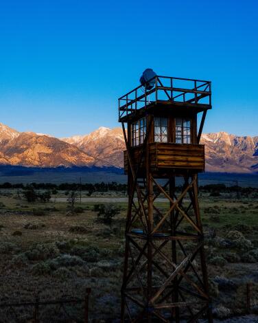
See the barracks that held the prisoners of Manzanar
When you drive the camp’s periphery, pause at the cemetery, where six people remain buried and a tall monument is etched with Japanese characters. There’s a visitor center (open Thursday-Monday), theater, museum and reconstructed barracks, where exhibits explain how families lost property, converted fruit crates into furniture and debated whether their mess hall should serve Japanese or American dishes. The U.S. government paid some reparations in 1948 and more in 1988, when President Reagan declared the incarcerations “a mistake.”
The site is free, open daily from sunrise to sunset.
Bonus tip: At least 10 white Americans were convicted of spying for Japan in that era. But NPS research found that no person of Japanese ancestry living in the United States was ever convicted of any serious act of espionage or sabotage during the war.
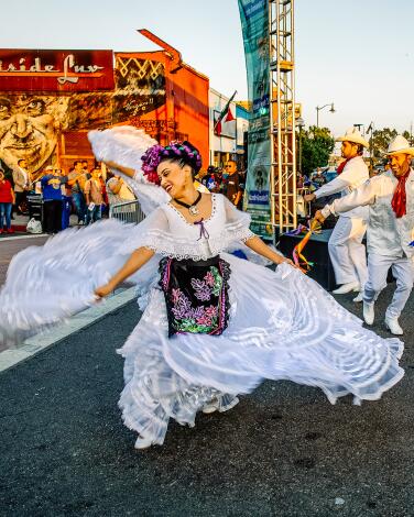
Listen for Mexican echoes in Mariachi Plaza
To the west, there’s the historic Boyle Hotel, once a hangout for wayward musicians, now the ground-floor site of a La Monarca Bakery & Cafe and the Libros Schmibros Lending Library.
Bonus tip: If you have time for a 2-mile detour to the southwest, the 6th Street Bridge between Boyle Heights and downtown (opened in 2022) is so theatrically handsome, especially at dusk, your jaw may drop.
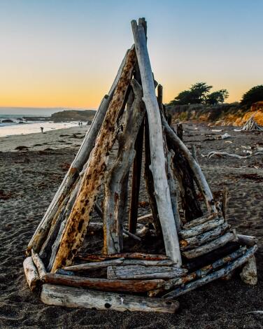
Make some driftwood magic on Moonstone Beach in Cambria
Which means that an enterprising beachcomber can gather up sticks and bits, lean them together and create just about anything. Even if the effort doesn’t launch your career in architecture, you’ll have a renewed relationship with the beach.
And this beach has much to offer. Just a few steps from the sand and rocks you’ll find a pleasant boardwalk, then two-lane Moonstone Beach Drive, then a row of about 10 inns, some best suited for family retreats, some for romantic getaways.
One of my favorite family lodgings is Oceanpoint Ranch, which has 61 rooms on its generous 9-acre property, along with a pool, shuffleboard, horseshoes and a casual canteen restaurant. Summer weekend rates start at about $265, but weekdays can dip under $200. For a more romantic vibe, try White Water down the street.
Cambria’s east and west villages sit a bit inland, and Main Street includes abundant restaurants, art galleries and boutiques but no chain stores.
Bonus tip: Moonstone isn’t the only walkable beach in town. North of the boardwalk, Leffingwell Landing Park begins, offering more trails and coastal views. To the south, there’s the 437-acre Fiscalini Ranch Preserve.
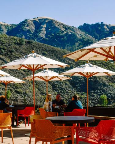
Take a bite out of Big Sur at Nepenthe
In all the California coastline, it’s often said, there is no more dramatic meeting of land and water than the 75-mile stretch known as Big Sur. Nepenthe is a highlight of that stretch. Since 1949, diners have gaped at the surf and rocks 800 feet below.
It’s often busy, for multiple reasons. (Besides its views and style, Nepenthe has one of the most spacious parking lots in Big Sur.) While you’re there, leave some time for browsing the Phoenix gift shop a level below. Leave even more for exploring the rest of Big Sur.
Since January 2023, Highway 1 has been closed by mudslides and repairs in multiple places. Caltrans announced a partial reopening May 16. Before you head north, check Highway 1’s status on the Caltrans website.
Bonus tip: For a breakfast overlooking that prime Nepenthe view, head for Nepenthe’s on-site offshoot, Cafe Kevah, open 9 a.m.-2:30 p.m. daily, weather permitting.

Get to know Richard Nixon better at his library and museum
As shown in dozens of exhibits on the 9-acre site, Nixon negotiated the U.S. withdrawal from Vietnam, created the Environmental Protection Agency and led a diplomatic breakthrough with China. But operatives of his campaign were caught breaking into Democratic National Committee headquarters (in the Watergate office complex), and Nixon and aides were caught trying to cover it up. His own secret tapes sealed his fate. He is the only U.S. president to resign.
Nixon and his wife, Pat, are buried here next to the modest home where Nixon was born. (There’s also a presidential helicopter on site.) She died in 1993; he died in 1994.
Adult admission to the library is $28. This year, the museum also includes a temporary exhibition on American POWs during the Vietnam War.
Bonus tip: The National Archives has digitized 4,042 reels of Nixon’s infamous White House tapes. Whether you’re in the library or on a computer at home, you can eavesdrop on Nixon.
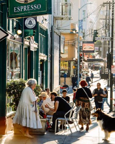
Savor Italian food and bohemian books in North Beach
You also can’t miss Coit Tower’s views and Depression-era murals ($10 per adult if you live outside San Francisco) or the sandwiches at Molinari Delicatessen (established 1896), which you can eat on a bench in Washington Square. Get coffee at Caffe Trieste (since 1956). Buy a pie at Tony’s Pizza Napoletana on Stockton Street or seafood at Sodini’s on Green Street.
Bonus tip: If you’ve found North Beach, you’re a few steps from Chinatown. Dinner at the stylish China Live restaurant complex on Broadway? (It’s about 400 feet from City Lights.) Two other lively, upscale Chinatown restaurants are handy: Empress by Boon on Grant Avenue and Mister Jiu’s on Waverly Place.
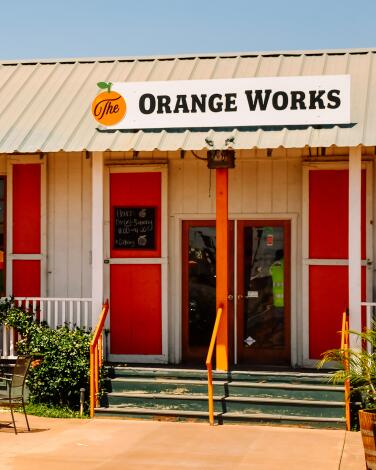
Save room for dessert at the Orange Works Cafe
The cafe, a family business along Highway 65 in Strathmore between Lindsay and Porterville, is surrounded by miles of orange orchards. Some of that fruit goes to the packing house across the street, then into the cafe’s desserts. A 6-ounce serving of ice cream ($3.99) delivers the creamy texture of a vintage 50-50 bar with a sharp tang of freshness.
The Orange Works people (who also have a Visalia location) rotate other homemade, farm-fresh ice cream flavors too, including persimmon, pomegranate, gingerbread cookie in December and Peeps at Easter time (I’d like to see those orchards). The cafe makes turkey, ham, pastrami and roasted eggplant sandwiches, along with a popular one combining tri-tip and roasted garlic.
Bonus tip: For $13, you can get the lunch special — a sandwich, potato chips, a drink and 6 ounces of ice cream. The Strathmore cafe is open 11 a.m. to 4 p.m. Tuesday through Saturday.
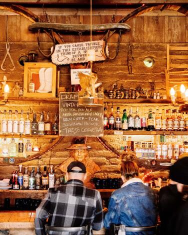
Drink from a jar in Pappy & Harriet's in the desert
The joint, about 15 miles west of Joshua Tree National Park’s west entrance, was built as a movie-set cantina in 1946 and has operated under its current name since 1982. The current owners arrived in 2021. But it all feels as native as a creosote bush.
Steaks are cooked on an outdoor grill (Santa Maria barbecue style), beer is served in Mason jars and all meal service (hearty portions) is first come, first served. A beer is $8, a burger $16. Expect lines on weekends. There’s one stage outdoors, another indoors, and there’s no telling who might show up. One night several years ago, it was Paul McCartney. Among the 2023 performers: Phoenix, Cody Jinks, Interpol, Pretenders and Ramblin’ Jack Elliot.
Bonus tip: You’ll want time to nose around the rest of Pioneertown, all of which was built as a movie set. It’s edging its way back toward becoming a true western town with a motel, saloon, shops, occasional theater and weekend Wild West reenactments on a pedestrian-only main street that’s spelled M-A-N-E.
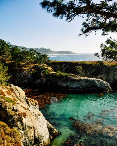
Get schooled in marine biodiversity at Point Lobos
Like a lot of people, I like to start by driving to the end of the park’s main road, parking and strolling around the 0.8-mile loop trail through China Cove and Bird Island.
No matter what’s happening in the sky, the waters of the cove always seem to glow an eerie green. From there, if I have time, I move on to Weston Beach (named for photographer Edward Weston, who haunted these shores for years) and the Cypress Grove Trail. (Be warned, however, that many trails were damaged in winter high surf and flooding, and may still be closed.)
As you check out the birds, rocks and greenery, bear in mind that Native people gathered here for thousands of years. By the late 19th century, Chinese fishermen, Portuguese whalers and Japanese abalone divers had arrived, all now gone. The waters offshore are part of the Monterey Bay National Marine Sanctuary.
Admission is $10 per car, plus an additional $2 for a map/brochure. No dogs (except service animals).
Bonus tip: On busy days, the reserve’s 150 parking spaces often fill up, so it’s wise to come early. The reserve is open 8 a.m. to 7 p.m. daily, with last entry at 6:30 p.m.
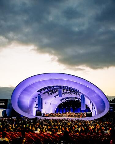
See a show at the Rady Shell while watching boats in the harbor
The Shell, which opened in 2021, has a layout that’s flatter and simpler than the Hollywood Bowl’s. (But you can’t bring your own picnic.) It stands on a 3.7-acre finger of land that reaches from downtown’s convention center into San Diego Bay. A few blocks to the north stands Petco Park, home to the Padres.
The shell is home to the San Diego Symphony and a summer schedule of classical and pop shows, including “movies in concert” with the symphony playing the score. You can sometimes eavesdrop on orchestra rehearsals on Wednesdays, Thursdays and Fridays. The symphony posts a schedule here.
Bonus tip: This isn’t the only music on the water in the neighborhood. On nearby Shelter Island, Humphreys Concerts by the Bay (next to Humphreys Half Moon Inn) has been staging summer concert series (actually spring through November) in its 1,400-seat outdoor theater since the early 1980s — offering just about every genre except classical music.
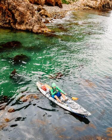
Spot a fox or launch a kayak from Santa Cruz Island
The island’s Scorpion Anchorage, where most visitors arrive, is about an hour’s boat ride via Island Packers from Ventura Harbor. You can do a day trip or camp. Either way, you can kayak in sea caves with a guide and rented vessel from Channel Islands Adventure Co. Or hike to Smugglers Cove. On your way, keep an eye out for island foxes, which have grown bold and numerous in recent years.
Once, the island’s hills and valleys were home to 11 Chumash villages (and Santa Cruz served as a sheep ranch as recently as 1984). Nowadays, there’s one 31-site campground about half a mile’s walk from Scorpion Anchorage. The park service controls about a quarter of Santa Cruz. The rest, owned by the Nature Conservancy, is off-limits.
Bonus tip: For a shorter day trip, consider nearby Anacapa Island, home to a 1932 lighthouse, spectacular views, two miles of trails, seven campsites and, during the March-through-August nesting season, enough swooping, shrieking, pooping seabirds to trouble Alfred Hitchcock’s dreams.
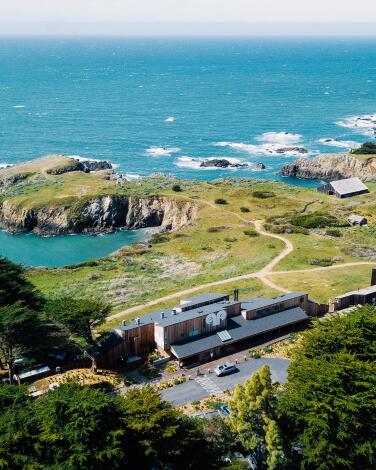
Blend into the rugged coast at Sea Ranch
If you’re coming from a densely populated coastal neighborhood in Southern California, this place might look like a nature lover’s dream, and it has won design prizes from the American Institute of Architects. Yet from its start in the 1960s, the builders of Sea Ranch tangled with some environmental groups. Many say frustration over Sea Ranch helped provoke the creation of the California Coastal Commission in 1972.
Nobody denies that these handsome homes are in the middle of a beautiful place. It includes six publicly accessible trails, a links-style golf course and an iconic curvy chapel of stone, redwood and stained glass by artist-designer James Hubbell. Rental homes typically go for $350 to $950 nightly, often with multiple-night minimums, and are available through various vacation rental companies and in some cases the Sea Ranch Lodge. All of Sea Ranch’s roads and most of its trails are private and intended for use only by owners, renters and their guests.
Pro tip: The Sea Ranch Lodge has a dining room (lunch and dinner), cafe (breakfast and lunch), bar and general store, along with 17 guest rooms. Summer rates for those rooms start around $450 per night.
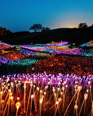
Roam the electric superbloom that is Sensorio in Paso Robles
This series of solar-powered, glow-in-the-dark art displays by Bruce Munro began in 2019 with “Field of Light,” a 15-acre installation illuminated by 100,000 spheres with optic fibers inside. Later Munro added 69 “Light Towers” made of wine bottles whose colors change to music. In 2023 came two more works, including “Fireflies” (almost 10,000 flickering points of light).
Now comes another new work, “Dimensions,” a work of “light, sound, movement and shadow” by an L.A.-based sculptural duo known as HYBYCOZO. It’s scheduled to open May 24 .
There’s no better place to be at dusk in these hills than Sensorio, surrounded by stately oaks cast into silhouette. Most people stay 60 to 90 minutes, but there’s a bar, a kitchen making burgers and sandwiches, a taco truck and frequently live music, so you might linger longer.
Adult admission starts at $45 for the Munro works, $30 for “Dimensions,” $65 for both. Through the end of May, Sensorio is open from 7 to 10:30 p.m. Thursday through Sunday, but hours are adjusted as the time of sunset changes (and in winter the attraction is closed on Sunday night).
Bonus tip: Between forays to the scores of tasting rooms of greater Paso Robles, walk a lap around Downtown City Park, a green space surrounded by restaurants and shops with a small-town atmosphere.
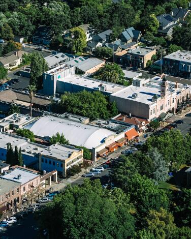
Listen for history in Sonoma Plaza
This didn’t last long, but it inspired somebody to design a flag with a bear. And it underlined Mexico’s vulnerability. By 1848, the U.S. had grabbed control of Alta California in the Mexican-American War.
Now Sonoma County is at the heart of Northern California wine country, with more than 425 wineries doing their best to contend with Napa Valley’s roughly 475. Downtown Sonoma (population: about 10,700) is filled with bistros, tasting rooms and shops.
Don’t miss the Sonoma State Historic Park, which includes Mission San Francisco Solano de Sonoma, founded in 1823. You’ll find a commemorative display, added in 1999, listing names of more than 800 baptized Native “neophytes” buried in the cemetery. At most California mission cemeteries the Native dead go unnamed, but the keepers of the Sonoma mission, a unit of the state park system, made this gesture of respect a priority.
Bonus tip: Two great venues outside town for wine tasting and history: Gundlach Bundschu Winery (since 1858) and Buena Vista Winery (since 1857).
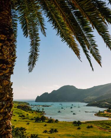
Hike, bike or kayak at Two Harbors on Catalina Island
Basically, it’s a dock and village at the island’s skinniest point, so you can stroll the half-mile from Catalina’s leeward Isthmus Cove to its windward Catalina Harbor. This is where the demanding Trans Catalina Trail (38.5 miles, usually four days) ends, and many visitors hike and bike the hills while pitching tents at Two Harbors Campground, (which rents equipment). The village includes a general store; two restaurants; a few rental villas; a yacht club; a dive center; kayak rentals; and the Banning House Lodge, a 12-room hotel in a 1910 Craftsman home.
On a spring visit, I stayed in the lodge, which housed hunters in decades past. It sits on a ridge 400 yards from the dock with dual harbor views, a bison head in the game room and a strong continental breakfast. Rooms start at $400-$440 in summer. The Catalina Express sails between San Pedro and Two Harbors several times daily in warmer months, a roughly 75-minute ride.
Bonus tip: The Cat Harbor Overlook makes a great challenging hike from the lodge. It’s a 4-mile out-and-back route (a.k.a. Upper Ballast Point) with about 1,000 feet of elevation gain to a gazebo overlooking Cat Harbor and miles of the island’s raw windward coast.
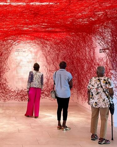
Walk on the UCLA campus, starting with the Hammer Museum
For a sense of the UCLA campus (which has 31,600 undergrads and drew about 145,900 freshman applications in 2023), I suggest walking a 2-mile loop from the Hammer. Head north on Westwood Boulevard to Bruin Plaza (where a big, bronze Bruin bear statue awaits your selfies). If the campus is calm, climb Election Walk to Shapiro Fountain, where pro-Palestinian protesters and counterprotesters clashed in April and early May. The big brick behemoth to your right will be Powell Library. To your left: Royce Hall, host to many a concert. Circling back, you’ll pass the Fowler Museum (global cultures) and the student store in Bruin Plaza. So even if you don’t get admitted, you can get outfitted.
Bonus tip: In the Hammer Museum courtyard, Lulu, a restaurant by California cuisine pioneer Alice Waters and David Tanis, serves lunch (Tuesday through Sunday) and dinner (Wednesday through Sunday) under orange lanterns. Thumbs up on the $18 mozzarella, prosciutto and arugula sandwich.
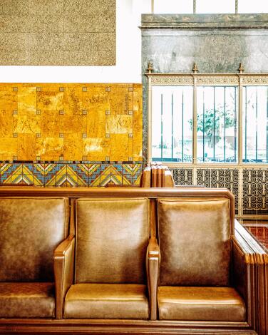
Travel back to 1939 at the last grand American train station
It’s the last of the grand American train stations, a marriage of Mission Revival and Streamline Moderne styles that has been a landmark since its 1939 opening. It’s also a point of convergence for Amtrak, local light-rail service and buses. (And I’m not sure how this happened, but it hosted the Oscars in 2021.)
Take a good look at the high ceiling, the grand arches and the 286 built-in mahogany chairs (for ticket-bearing travelers). Every time I step in, I imagine boarding the Coast Starlight for the 35-hour, 1,370-mile journey to Seattle, the grandest American train ride this side of the Rockies.
Whether you’re going to step aboard or not, you can get a snack at the station. Traxx bar and restaurant’s kitchen is open 11 a.m. to 8 p.m. weekdays, 12 p.m. - 7 p.m. weekends.
Bonus tip: Across Alameda Street stands Olvera Street, a mostly Mexican marketplace created in the 1930s to boost tourism on one of the city’s oldest streets. Walkways are lined with souvenir vendors, eateries and a handful of shops.
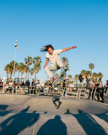
Stroll or roll along Venice Beach
Romp on the wide, sandy beach. Join the foot traffic on Ocean Front Walk or pedal the bike path. Stand and watch the daredevils who swoop through the skating bowls. Grab a selfie at the rainbow-painted lifeguard tower. Tip the opera singer, or the stand-up comedian — really, any sidewalk performer who can compete with these distractions deserves a dollar or two.
On Sunday evenings, you might catch the Venice Electric Light Parade (people in costume and on bikes with elaborate LED rigs). Whatever the hour, you can count on seeing Rip Cronk’s mural of Venus on roller skates (near Speedway and Windward Avenue) and the dangling VENICE letters at Pacific and Windward.
Not that Venice is all sweetness. This area can worry you with its hucksterism and squalor, the scent of weed, the troubled people who may be sleeping a few blocks inland in tents and under tarps. But its best moments are brilliant.
Bonus tip: Just a few blocks from the beach you’ll find the boutiques and restaurants on mile-long Abbot Kinney Boulevard. Beginning at Westminster Avenue, these upscale sidewalks are a world away from the souvenir vendors at the beach. Here you might see $195 Scandinavian tea kettles (at Huset) or taste impeccable orecchiette con salchiccia ($25 at Piccolo).
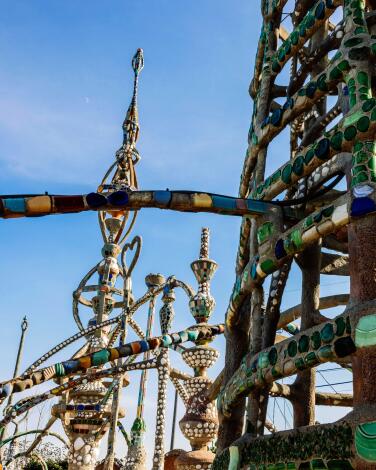
Learn what keeps the Watts Towers upright
Sabato (Simon) Rodia, a wiry immigrant from Italy, not quite 5 feet tall, started this backyard project in 1921 and spent 33 years putting up Watts Towers (up to 99 feet high), using rebar, concrete, cast-off tiles, bottle caps and bits of colored glass. (Weirdly, Italian immigrant Baldassare Forestiere was doing something similar in Fresno through most of those years, but working his way down, not up.)
Rodia walked away from his project in 1954 and died in 1965. For decades, arts advocates and government officials tangled over the city’s sometimes corrupt and incompetent maintenance of the landmark. Yet his towers survived, credited as inspirations by local heroes including artist Betye Saar and jazz great Charles Mingus.
The triangular property is now a state historic park and community arts center, and after years of restoration, the scaffolding is down. The area inside the property’s walls is open for guided tours (about 30 minutes, $7 per adult) on Thursday and Friday, but the window of availability is small: 11 a.m. to 12:30 p.m. and 1:30 to 3 p.m. Fortunately, you can see a lot of the towers from outside the walls.
Bonus tip: The towers play host to annual Day of the Drum and jazz festivals each fall, typically the last weekend in September.
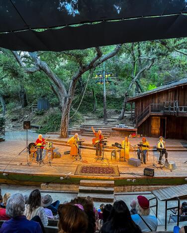
Take in Shakespeare under the oaks at Will Geer Theatricum Botanicum in Topanga
The 299-seat open-air theater, tucked into a 14-acre Topanga Canyon property, offers several shows each summer, usually including two or three by Shakespeare.
The 2024 summer season includes “The Winter’s Tale” and “A Midsummer Night’s Dream” by Shakespeare, a retelling of the Peter Pan story, an adaptation of Molière’s “Tartuffe” and “The Hispanic/Latino/Latina/Latinx/Latine Vote” by Bernardo Cubría.
Though Will Geer is best known for playing the grandfather in “The Waltons” in the 1970s, his career in acting, folk music and labor activism spanned four decades. Geer was blacklisted during the McCarthyism of the 1950s, which is when he and his wife, Herta Ware, moved from Santa Monica to the Topanga property, planted extensive gardens and invited other blacklisted artists to come entertain one another. Woody Guthrie briefly lived in a shack there.
“They did Shakespeare in the dirt,” Theatricum office manager Gina Shansey likes to say.
Though Geer died in 1978, the theater company remains a family operation, led by producing artistic director Ellen Geer (Will’s daughter) and associate artistic director Willow Geer (Ellen’s daughter). Adult admission to the plays is usually $30 to $40.
Bonus tip: Seating is wooden benches. Be sure to grab one of the cushions that staffers offer as audiences enter. It’s also wise to bring mosquito repellent.
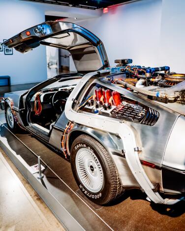
Do a Wilshire Boulevard museum marathon
I’d start with the Academy Museum, largest of its kind in the U.S. But my answer could change in late 2024, with the anticipated opening of LACMA’s controversial new main building (part of which will hover over the boulevard). In any case, no matter where you start, you’ll eventually need to check out the tar pits’ tragically mired mammoth and the 202 cast-iron lamps of Chris Burden’s LACMA installation “Urban Light.” They flicker to life each evening at dusk and dim at dawn. (Need to know right now if the lights are on? Check here.)
Bonus tip: Technically, those pits of goo are filled with asphalt, not tar. Also, reaching these museums will get easier in 2025, when a new Metro subway station is due to open at Wilshire and Fairfax.
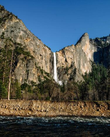
Feel the roar of waterfalls in Yosemite Valley
Why? After dropping peak-season reservation requirements last summer, the park has brought them back.
There are lots of details to this, but for Yosemite visits on weekends and holidays between 5 a.m. and 4 p.m. through June 30, rangers say drivers must reserve in advance through recreation.gov. The same goes for drivers entering the park any day July 1 through Aug. 16. From Aug. 17 through Oct. 27, the requirement reverts to weekends and holidays.
The reservation fee is $2, on top of the park’s usual $35-per-car entry fee. If you have an overnight reservation in the park, you don’t need a day-trip reservation.
Also, if you want a view from higher up, Glacier Point — with its dizzying views of Half Dome and the valley floor 3,200 feet below — will be accessible once Glacier Point Road opens for the summer (typically in May or June). The road was closed in 2022 and only partially reopened in summer 2023.
Bonus tip: Here are three waterfall hikes to ponder. First there’s Yosemite Falls, a 2,425-foot medley of cascades that is California’s tallest waterfall. It’s a 2-mile round-trip climb up the Yosemite Falls Trail to Columbia Rock, with 1,000 feet of elevation gain. Or aim a little higher and try the Mist Trail to Vernal Falls, a 2.4-mile journey, same elevation gain. And if you’re brave, you can keep going on the Mist Trail up to Nevada Fall. That will make it a 5.4-mile round trip, a 2,000-foot elevation gain, and now I’m tired.
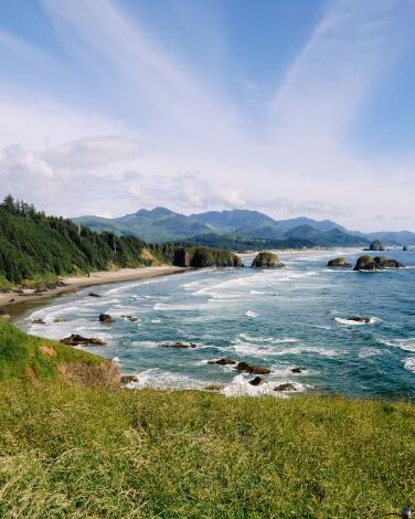
Enjoy the glow of a bonfire on Cannon Beach
DIY bonfires are easy to assemble with a quick stop at the grocery store for a bundle of wood and s’mores supplies. (Given that Oregon is renowned for its local wines, brews and cheeses, why not load up on charcuterie fixings as well? For the best selection of local varieties, head to Fresh Foods Marketplace.) Just remember these simple beach bonfire safety rules: Keep your fire to 3 feet in diameter, away from driftwood or dune grass; and completely douse the fire with water when done.
Cannon Beach’s expansive sandy shore, at 4 miles long and half a mile wide, means that the bonfire scene rarely feels crowded, but a twilight walk likely will find fires concentrated (understandably) at the iconic landmark of Haystack Rock. For a quieter experience, head to Arcadia Beach, with sea-stack views of Lion Rock that are just as stunning.
Bonus tip: For ease and an upscale experience, several local resorts offer a bonfire with s’mores package as an add-on, including Hallmark Resort and Spa ($25), Surfsand Resort ($50), the Ocean Lodge ($99), and Stephanie Inn ($129), where a butler will assemble a fire for you with premium fixings.
Dive into Astoria's joyful maritime museum
The museum sits at the mouth of the Columbia River, where intense Pacific Ocean currents meet up to wrestle with the domineering forces of the river. The sandy deposits beneath the turbulent waters constantly change positions, making this bar crossing one you’d prefer to face with one of the world’s best river bar pilots, many of whom get some schooling here in town
This seagoing drama makes excellent exhibit fodder, ranging from tidal science to shipwrecks to the visual beauty of cannery labels. My kids got a kick out of playing storm-watching newscasters in front of a green screen, as well as the display of CG-4300, a life-size U.S. Coast Guard Motor Lifeboat in the midst of a nail-biting rescue. The building’s backside has floor-to-ceiling windows that showcase the realities of day-to-day life on the Columbia River outside.
Included with admission ($18 for adults, $8 for kids) is a visit to the Lightship Columbia, a national historic landmark that once navigated ships through the area.
Bonus tip: Get an elevated view of the Columbia River Bar from nearby Fort Stevens State Park at the South Jetty of the Columbia River viewing platform at parking area C. While there, walk past the Peter Iredale, the beached skeleton of a 1906 shipwreck.
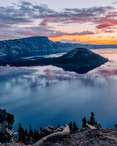
Stand on the rim of a sleeping volcano at Crater Lake
Beyond that, the place isn’t so simple. Because so much snow falls there, it’s sometimes impossible to reach a viewpoint. This year, rangers expect the park’s Rim Drive (a 33-mile loop around the rim) to open in June or July, but the park’s main visitor center is closed for renovation until late winter 2024. Also, the National Park Service in March fired the park’s concession company.
A new operator, ExplorUS, signed on to take over and said it planned to open the Crater Lake Lodge for the summer as usual. The lodge, perched on the crater’s rim since 1915, is set to open May 17 through Sept. 30, snow permitting. Rooms start at about $250.
Why is the lake so blue? It’s about 1,940 feet down, the deepest in the U.S., created when Mt. Mazama erupted, the caldera filling with water from snow and rain. Scientists say this happened only 7,700 years ago, so Indigenous people may have seen it all.
In summer visitors can hike portions of the rim or drive around it. You can hike down the steep 1.1-mile trail to water’s edge at Cleetwood Cove. If you can make that hike, you can take a boat tour, allowing a three-hour visit to Wizard Island.
Bonus tip: Fishing for trout and salmon is encouraged (if you buy a ticket for the boat tour).
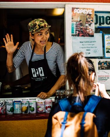
Explore the culinary delights of Portland's thriving food pod scene
More than 500 carts across the city offer everything from Texas- and Korean-style BBQ to locally sourced sushi and gluten-free Indian food.
This thriving scene is far more than just food. These are evolving communities with unique vibes, constructs and personalities. Midtown Beer Garden, popular with the downtown working crowd at lunchtime, is one of the oldest food pods in town. Prost! Marketplace, on NE Mississippi Avenue, is another. The BIPOC- and queer-focused food pod/brewery Lil’ America in southeast Portland hosts drag shows, markets and yoga, while the long-standing Hawthorne Asylum features quirky public art. Sometimes high-profile food carts, such as the venerable Kim Jong Grillin (which just moved to the Cart Blocks downtown), act like headliners, bringing crowds to fledgling pods.
To figure out where to go, use Travel Portland’s Food Cart Finder and Near Me Now tool.
Bonus tip: New pods crop up frequently, such as the latest Alberta cArts, which brings together Paladin Pie, Baon Kainan, Chubby Bunny and others in the Alberta Arts District in northeast Portland.
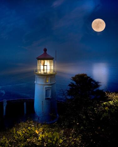
Play lightkeeper at the historic Heceta Head lighthouse, which still shines
At the turn of the 20th century, Heceta Head’s lighthouse required three families to keep the oil-fueled First Order Fresnel lens burning, turning and clean from soot. But don’t worry: You’ll be kept busy with more relaxing activities.
Turns out there are a million different ways to enjoy the gifts of this lush coastal hamlet. First, you’ll be welcomed with a tour of the lightkeeper’s cottage and shown to your room. At 4:30 p.m., head to the wine-and-cheese social, featuring many Oregon products. After dinner (not included in a stay), take your lantern on an evening stroll to peek inside the lighthouse tower, which still sends pulses of light 21 miles out to sea. Come morning, you’ll enjoy a delightfully meandering seven-course brunch.
If a $200 to $600 stay isn’t doable, experience the views, stories and culinary delights of the property at the interpretive center between 11 a.m. and 3 p.m. (seasonally).
Bonus tip: On special occasions a few times a year, including Valentine’s Day and Easter, the lighthouse offers a seven-course brunch ($74) to non-overnight guests.
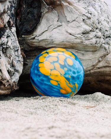
Seek glass floats along the Oregon coastline in Lincoln City
This activity takes place year-round, inspiring beachgoers to keep special vigilance for roughly 3,000 colorful signed and numbered orbs. Floats are placed during the day in the space between the high-tide mark and the embankment. If you get lucky, register your float by calling (541) 996-1274, texting FLOATS to (866) 943-0443 or visiting Explore Lincoln City to receive a certificate of authenticity and information about the artist who crafted it.
If you happen upon a special float drop day, there may be extras to discover, such as 50 red, white and blue floats for Memorial Day or 100 Japanese antique floats for Antique Week.
Bonus tip: If, like me, you don’t find a float, consider making your own at the Lincoln City Glass Center ($75 and up), one of several local glass studios where you can explore the local art of glass.
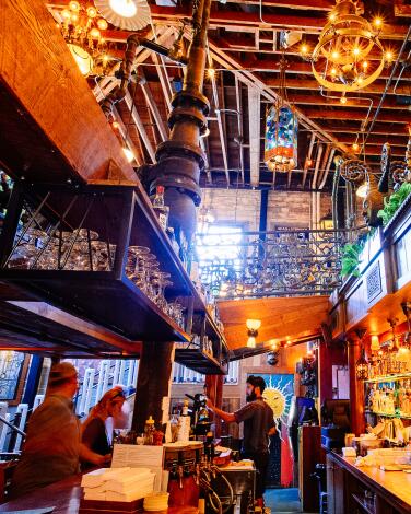
Stay in a former classroom at McMenamins Kennedy School
Like the entire portfolio of McMenamins properties — 57 rehabbed buildings converted to hotels, pubs, breweries, music venues and movie theaters throughout Oregon and Washington — the Kennedy School is a universe unto itself. The history here is palpable, and you’ll want to explore the campus in detail.
Start at one of the three bars serving brews made on-site at the brewery in the former girls bathroom. My favorite is the Boiler Room, where you can inspect the beautiful railings made of vintage plumbing parts by McMenamins’ own plumber (and artist), John Allen. Depending on the night, rooms go for $150 to $300. Pets are an extra $25 per night.
Bonus tip: If the scholastic atmosphere has you aching for homework, get a McMenamins Passport ($35) at the front desk to collect stamps and a prize for up to seven sites on the property. If you like historic properties built on quirky vibes and hand-crafted community, collect stamps at all of the McMenamins sites; fill up a booklet to reach Cosmic Tripster status for plenty of cool rewards.
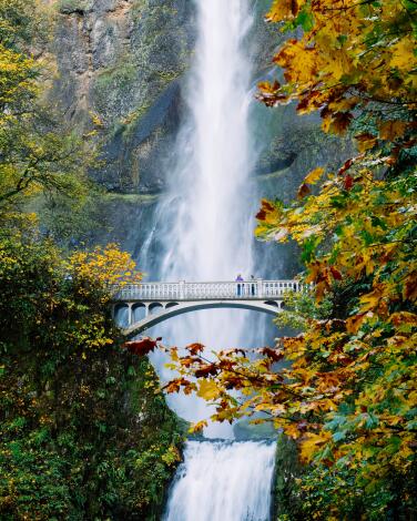
Catch your breath beneath stunning Multnomah Falls
I’m not sure which element of the Benson Bridge I like better: the view of it with the Upper Falls as a backdrop, or the view you get from it of both Upper Falls and Lower Falls. Both are spectacular.
Make your way to the top of the falls for a revelatory view of the Columbia River. It’s worth the effort — you’ll clock in 2.4 miles on the steep, round-trip journey.
With great beauty comes great popularity. In an attempt to quell the crowds, timed entry is required between Memorial Day and Labor Day. Once you’re within 14 days of your visit date, you can make advance reservations ($2 per vehicle) at Recreation.gov. More openings become available two days ahead, and a limited supply of same-day passes can be had at the Gateway to the Gorge Visitor Center or Cascade Locks Historical Museum.
Bonus tip: You can avoid the summer reservation requirement (and the job of driving) by taking a tour bus. Options include Columbia Gorge Express and the summertime Waterfall Trolley.
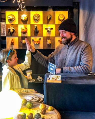
Shop for handmade goods at the Portland Saturday Market
Among my many irresistible Saturday Market purchases since my first visit in 1998, I love my Olander Earthworks sand spheres — carved ceramic balls that create mesmerizing impressions on sand.
The Portland Saturday Market was started in 1974, modeled after the Eugene Saturday Market, and has become the largest continuously run outdoor arts and crafts market in the U.S. This summer it celebrates 50 years at a blowout event on June 29.
The market runs from March through December on Saturday (10 a.m. to 5 p.m.) and Sunday (11 a.m. to 4:30 p.m.)
Bonus tip: Pair your visit with a stroll or ride along the Willamette River in Tom McCall Waterfront Park (where the market is located), a peaceful riverside greenway that functioned as a six-lane highway from 1943 to 1974.
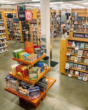
Browse for books in the largest used and new bookstore in the world
There is a lot to love about Powell’s besides the sheer magnitude of its bound and printed stock (roughly 600,000 titles at the main Burnside location): knowledgeable staff ready to go along with you on any requested book journey; the incredible organization of its books throughout three floors of color-coded rooms; the antiquarian feel of the Rare Book Room; and the shop’s packed calendar of literary events. I cannot think of a David-sized bookstore anywhere that can take down this Goliath. Even if books aren’t your thing, the carefully curated assortment of gifts and souvenirs surely will impress you.
The inspiration I get from browsing the shelves at Powell’s leaves me both exhausted and exhilarated. For a respite (followed by an immediate dive into my stack of purchased books) I hit the light-drenched Guilder Cafe, inspired by “The Princess Bride.”
Bonus tip: Legend says that touching the stone Book Pillar, which lists eight iconic books at the store’s entrance, will give you good luck in finding your next book. But at a place like Powell’s, I doubt you’ll need it.
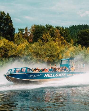
Take a fast and furious jetboat ride down Oregon's Rogue River
But nothing beats the thrill of a Hellgate Jetboat Excursions trip, and anyone, regardless of age or ability, can join in the fun. (Multigenerational travelers, take note.) You’ll ride fast and furiously downriver in a specially designed boat made to skim the surface of the water, taking in bow dunks and 360-degree spins on the way. If you don’t think you’ll get wet, think again.
But it’s not all just for amusement’s sake. When the boat slows down to navigate beneath Hellgate Canyon’s soaring cliffs, you’ll have time to take in the gorgeous scenery, complete with unique geology and wildlife, including river otters and bald eagles. While scenic wilderness cruising and high-speed jetboating may seem like opposing activities, this iconic Rogue ride has been going strong for 65 years. A one-hour ride (adult ticket: $38.95) covers 14 miles of the river.
When the boat pulls in, those on the dinner or brunch excursion head to the historic Hellgate River Lodge Restaurant (an old homesteader’s property) for a meal served family-style on a covered outdoor patio facing the river. Hellgate Jetboat Excursions run seasonally from May 1 through September.
Bonus tip: Other touring options offered by the company include the River Run (one hour), Quick and Scenic (two hours) and White Water (five hours). The brunch and dinner options are 36-mile rides that last approximately four hours.
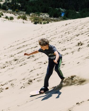
Sandboard Oregon dunes at the world's first sandboarding park
Lon Beale, a.k.a. Doctor Dune, owns Sand Master Park in Florence, a 200-acre property that includes dunes and a shop. Considered the godfather of modern sandboarding, he offers rentals (of boards he invented for the sport) and lessons ($55 an hour). For first-timers, sandboarding is a fast, bum-aching cousin to snowboarding, skateboarding and surfing. Incredibly fun, but just know that sand isn’t as soft as snow or water.
Board rentals are a bargain at $18 for 24 hours ($16 for sand sleds) — a timeframe that allows you to take the boards wherever you please. Given that dunes stretch 47 miles from Florence to Coos Bay, boarders have plenty of options. We took our boards back to our campground on the dunes at Jessie M. Honeyman Memorial State Park, where we spent the afternoon sliding dunes that overlook Cleawox Lake and the distant ocean coastline. We even ended up catching a fish in the lake. We cooked it right on the sand with our portable camp stove. All the while howls of joy continued on the dunes until twilight.
Bonus tip: The Sand Master Park store includes a library of sand (Beale calls it a sandbrary) that Dr. Dune has collected from all over the world.
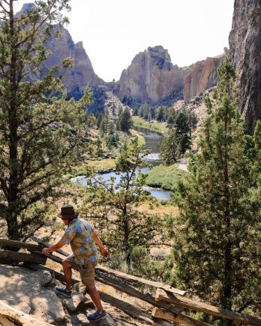
Camp, hike and climb at Smith Rock State Park
Its towering spires, pillars and cliffs are made of solidly compact tuff, making Smith Rock highly scalable — so much so that modern rock climbing is said to have been born here. Climbers have access to more than 2,000 wide-ranging climbing routes, including the iconic 350-foot tower known as Monkey Face. (Yes, it really looks like a monkey’s face.) Try a climb with Smith Rock Climbing Guides or one of the many local companies offering guided climbs for all ages and abilities.
Rock climbers aren’t the only ones who can enjoy stunning views of the park and the entire Cascade Range from on high. Hikers can take the 3.7-mile hike to Misery Ridge, a looped extension of the 2.5-mile River Trail. Wildland Guiding Company leads free community hikes here on some weekends during the summer — a time when heat can become extreme, so be sure to stay hydrated.
Bonus tip: Between early spring and late fall, extend your stay at the Bivouac Campground (known locally as the Bivy), a walk-in tent campground at the south rim of the canyon. Overnight permits cost $8 per person per night and include restrooms, showers and a charging station.
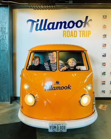
Stuff yourself with cheese at the Tillamook Creamery
Before you pull into the sleek, renovated headquarters of the Tillamook County Creamery Assn., you’ll probably pass many of the family-owned farms that contribute milk for Tillamook products. That’s right, this section of Oregon’s coast, 75 miles from Portland, is cow country.
For a cheesy snack, head to the Dining Hall, where said cheese dreams are there for the trying, in addition to cheeseburgers, mac ’n’ cheese, pizza and root beer floats. This is also one of the few places you can try Tillamook’s fried cheddar cheese curds (absolutely do it). A separate line leads you to ice cream heaven, where the three-scoop sampler is the obvious choice. Not a dairy consumer? Nondairy foods and other allergy-friendly items are on offer, including soups, salads and sorbet.
After feasting on cheese, you can take the free, self-guided tour to learn about how Tillamook products are made, test how fast you can change out a milking pump on cow udders and peer onto the production floor, where the cheese loaves are crafted. The Tillamook Creamery is open daily from 10 a.m. to 6 p.m.
Bonus tip: For a deeper dive into the world of Tillamook products, book a premium experience, such as the specialty cheese Tour + Tasting for $15 or Exclusive Ice Cream Experience, offered at $45.
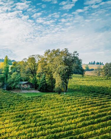
Ramble through wine country in Oregon's Willamette Valley
A meandering, multiday romp through the Willamette Valley is the best way to experience the region’s award-winning restaurants, wine-tasting experiences and cozy accommodations in McMinnville and smaller towns nearby. While the sunny summer is a popular time to go, I’m a sucker for the fall harvest and winter cellar seasons, when you can enjoy some wine by the fire as the fog rolls in between the fir trees. I also love the small inns and bed-and-breakfasts that perfectly suit this place and time. For a luxury farm stay in Carlton, Inn the Ground offers farm and permaculture tours and a view of cows grazing outside your room. Sleep at a vineyard in Stoneycrest Cottage (part of Durant at Red Ridge Farms) or in one of the three grain silos that make up the lodging at Carlton’s Abbey Road Farm.
Bonus Tip: Wild Oregon truffles are another delicacy of the Willamette Valley, flavoring hazelnuts, french fries, cheeses and chocolate during fall and winter. Around this time, fervent hunters seek the fungi (about the size of a ping pong ball) beneath the roots of Douglas fir trees. First Nature Tours offers an all-day foraging excursion from Portland, or eat your way through decadent truffle flavor on Taste Newberg’s Truffle Trail.
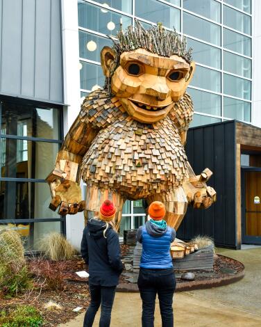
Prowl Ballard's locks, shops and troll
I strolled the avenue at length, ogled the throwback murals in Hattie’s Hat (a diner and bar established in 1904), admired the equally old flatiron building that holds McLeod’s Scottish pub and wished I could hear the Yonder Mountain String Band at the Tractor Tavern that night — but it was sold out. The Tractor Tavern has offered a full schedule of live music shows, heavy on the Americana, for 30 years.
If you’re into engineering, the neighborhood highlight surely is Ballard Locks, an enormous 1917 maritime landmark that allows boats (and salmon) to transit between the freshwater of Salmon Bay and the saltwater of the Puget Sound. The site includes a fish ladder observation room where, in summer months, you can peer through an underwater window at salmon struggling against the current.
That’s still not all. You can stroll the beach and wetlands at nearby Golden Gardens Park, and bike or walk on the Burke-Gilman Trail, which runs 19 miles between Golden Gardens and Bothell. Or you can walk 300 yards up Market Street from the locks to the National Nordic Museum, whose building opened in 2018. Like so much Danish design, it’s minimalist and elegant, a two-story building devoted to the cultures that many Seattle immigrants brought with them from homelands including Denmark, Finland, Iceland, Norway, Sweden and Greenland.
Bonus tip: In front of the National Nordic Museum you will find a 14-foot-tall troll with a shingled trunk, a.k.a. Frankie Feetsplinter. Everyone’s favorite troll in Seattle is supposed to be the one under the bridge in the nearby Fremont area, but Ballard’s is friendlier and made of recycled wood, not concrete. Frankie is one of six trolls scattered around the Pacific Northwest by Danish artist Thomas Dambo.
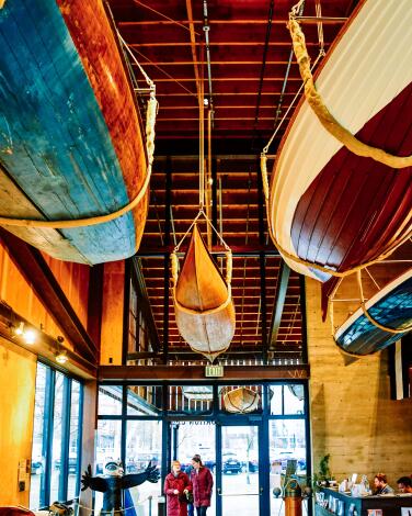
Row, row, row at the Center for Wooden Boats
First about the boats for nothing at the Center for Wooden Boats: They’re rowboats, also known as peapods because of their shape. Under the center’s Public Peapod Program, you can borrow one for up to an hour from 11 a.m. to 7 p.m. Wednesday to Sunday, advance reservations required.
The center also manages a fleet of rentals, from kayaks to large sailboats, and runs charter cruises.
Founded in 1976, the center now includes a dockside complex with an education building (completed in 2018) holding several boats on display. It’s free, open Wednesday through Sunday except for three down weeks in winter. There’s also a workshop, a roster of courses in how to build and navigate boats and further facilities on Camano Island.
“That’s the core of the center, getting people out on the water,” said Jonathan Tune, a volunteer at the front desk. “Even on a miserable day, it’s pretty fun.”
Bonus tip: Before you leave the southern end of Lake Union, also check out MOHAI, Seattle’s Museum of History & Industry. It’s housed in a big, white building (once a naval reserve armory) at water’s edge and includes multiple exhibits (including Boeing’s first commercial plane, from 1919), a cafe and a store. Through June 2, one exhibit details the history of rowing in Seattle, including the University of Washington team’s 1936 Olympics win, which inspired the 2023 film “The Boys in the Boat.” Adult admission: $22.
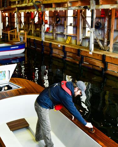
Soak in a floating hot tub boat
Naturally, this has become a thing among Seattle folks. You recruit a group of six and spend two hours floating on Lake Union, heedless of the lake and air temperature, in a 104-degree tub/boat.
You’ll need to choose between Hot Tub Boats, originator of the concept in 2011, and Lake Union Hot Tub Boats, which came along in 2019. Either way, you’ll be out on Lake Union for up to two hours, spending $400 (and up) for up to six people.
Some people may lean toward Lake Union Hot Tub Boats because that company allows alcohol and features wood-burning stoves on its boats. But I wanted to see the company that started this, so I went to Hot Tub Boats’ headquarters on Lake Union.
The company, founded by Adam Karpenske, makes its own boats, which are 16 feet long and about 6 feet wide. The hot tubs inside them are 8 feet long and about 4 feet wide. A drybox holds phones and water-vulnerable valuables while a water-resistant Bluetooth speaker delivers tunes. Boats are emptied and washed between customers. Children are allowed with life jackets.
“In the summer, we are bombarded with people from out of town,” Hot Tub Boats manager Jared Smith told me. “A lot of people, just walking in, are mind-blown.”
Bonus tip: You steer the Hot Tub Boats with a simple joystick. The decks are teak. LED lights illuminate on the boat and in the tub.
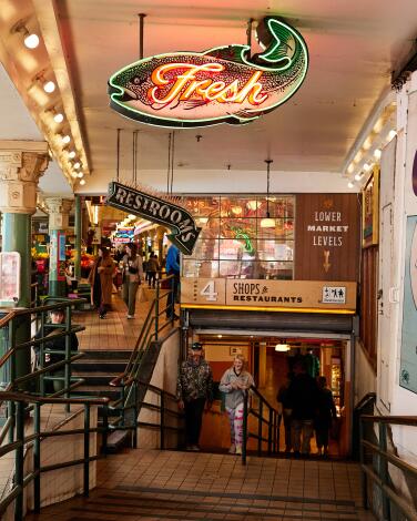
See fish fly and buskers jam at Pike Place Market
At risk of destruction 50 years ago, the market has grown into one of the city’s top tourist attractions, alive with more than 220 vendors, artisans and performers on 9 acres. The Pike Place Fish mongers, renowned for their hollering and flinging of salmon and halibut, are a crowd favorite. (Newbies, beware the booby-trapped monkfish.)
Browsing stalls, you may be offered a Chilean nectarine at Sosio Produce or a card trick at the magic shop. Downstairs, there’s an alley plastered with bubble gum. At 1912 Pike Place, caffeine seekers line up for coffee from the original Starbucks (it opened in 1971). Meanwhile, a massive waterfront redevelopment project continues along Alaskan Way.
What you won’t notice in the market, at first, is my favorite restaurant there. That’s the Pink Door, founded by Jackie Roberts in 1981. It hides unsigned behind a pink door on Post Alley yet has room for 500 or more diners. Its Italian menu makes the most of local seafood. Tarot readers, cabaret singers and trapeze artists perform. (For the aerial performances, try a Tuesday or Saturday night.)
Bonus tip: That piano player at Pike Place and Pine Street? His name is Jonny Hahn and he’s been working that corner for 37 years.
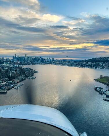
Soar and swoop in a Seattle seaplane
And if you sign on with one of the two seaplane companies that fly from Lake Union, a spectacular series of sights will follow, beginning with the Cascade Mountains to the east, Puget Sound and the Olympic Mountains to the west. On the afternoon flight I took with Seattle Seaplanes, our 20-minute, 30-mile journey included the University of Washington campus, the lakeside estates of Bill Gates’ neighborhood, the lonely West Point lighthouse, the active machinery of Ballard Locks and the idle machinery of Gasworks Park. From about 1,000 feet up, the wake of a lone boat on Lake Washington looked as elegant as a calligrapher’s script. The views get doubly interesting when the plane tilts to turn.
Pilot Yvette Meadows gave us a good look at the waterfront and the Space Needle too before our gentle return to the water. We flew in a five-passenger Cessna 206 (and yes, before signing on, I checked that the company had a clean safety record). The cost was $136.
The other company doing sightseeing flights from Lake Union is Kenmore Air, which advertises 30-minute flights for $119.
Bonus tip: You could fly farther. Seattle Seaplanes and Kenmore both do longer sightseeing flights and charters, and Kenmore offers scheduled flights to the San Juan Islands and Victoria, British Columbia.
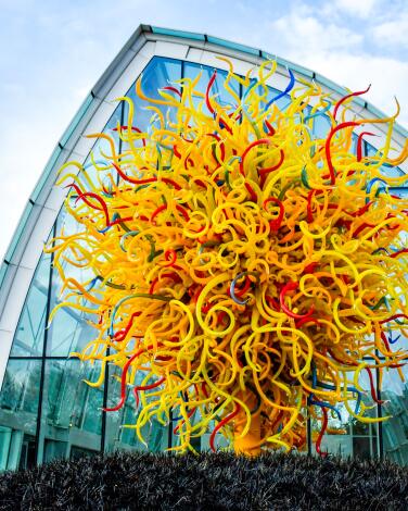
Gawk at Chihuly Garden and Glass
Mission accomplished. These days, you’ll find glass art spread among eight rooms at Chihuly Garden and Glass, including a translucent, 40-foot-high greenhouse and a walled garden where the colors and shapes harmonize and contrast with plants and trees.
Even many visitors who arrive skeptical (I was one) are knocked out by the colors, shapes and glass-blowing demonstrations.
Chihuly, born in Tacoma in 1941, taught at the Rhode Island School of Design before emerging as an international artist in the 1970s. (He lives in Seattle.) The Chihuly Garden and Glass space is open daily; adult admission, $35.
Bonus tip: Don’t miss Chihuly’s collections. In early 2023, the Chihuly team replaced its on-site restaurant with a bar (which also serves food) that is decorated with the artist’s sketches and two dozen of his many collections.
They’re hung on the walls and inset into tabletops: tin toys, pocket knives, fishing reels, electric irons, alarm clocks, shaving brushes, Mexican ashtrays and, on the ceiling, accordions.
“There are 83 of them here,” bartender Jojo Buharaksa told me, pointing up. “And there are more in his studio. Way more.”
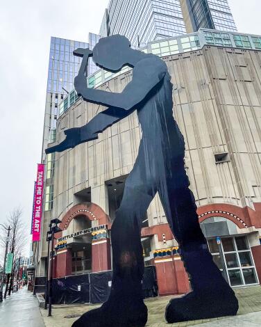
See the art behind Seattle's big hammering man
You can’t miss the kinetic sculpture out front — Jonathan Borofsky’s 48-foot-tall “Hammering Man,” which may remind you of Borofsky’s “Molecule Man” in Little Tokyo, DTLA. The museum is closed on Monday and Tuesday.
Through Aug. 4, SAM will feature an Alexander Calder exhibition that’s startling in its variety, from the massive dangling metal works to the delicate miniatures affixed to the wall like rare butterflies. All 45 works are owned by the museum.
And then, coming June 21 and staying through Sept. 2, there’s “Poke in the Eye: Art of the West Coast Counterculture,” which looks closely at the 1960s and ’70s.
One caveat: Adult admission to SAM is $29.99 to $32.99, which makes it one of the priciest art museums in the West.
Bonus tip: SAM also runs the Seattle Asian Art Museum in Volunteer Park and the 9-acre Olympic Sculpture Park, a great (and free) waterfront destination on a sunny day, a mile northwest of the museum.
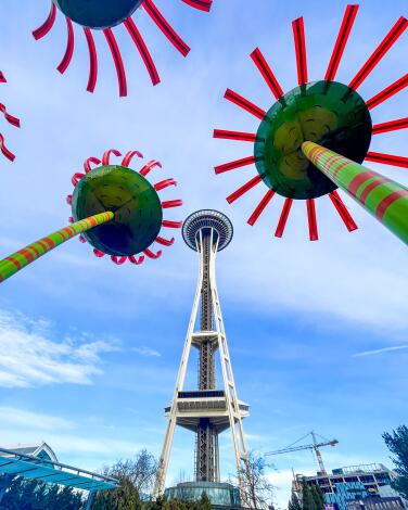
Zip to the top of the Space Needle
Is it tired? A little. But the family-owned attraction got a renovation in 2018, and there’s no better place to see the city and Puget Sound from 520 feet up, especially around sunset when the mountains are clear. The observation level rotates.
Adult admission is $35 to $39. (Or you can get a combined entry with the Chihuly Garden and Glass for $59.50. That’s $20 less than they cost separately.) While aloft, you can get a drink or bar food in the Loupe Lounge.
The ride to the top takes 43 seconds, and at least one elevator operator (his name plate said Isaac) has developed a brilliant deadpan spiel lasting exactly that long.
Bonus tip: There’s good food, and good browsing, waiting near the Needle’s base. Try the dumplings at Sichuan-inspired Tyger Tyger. Or for a cup of coffee, dip into the studio and hangout area of public radio station KEXP. There you can get Caffe Vita coffee or browse vintage vinyl at the tiny Light in the Attic Record Shop. The Seattle Center’s other attractions include the Museum of Pop Culture (in a Frank Gehry building), the Seattle Center Monorail, the Climate Pledge Arena and the Pacific Science Center.
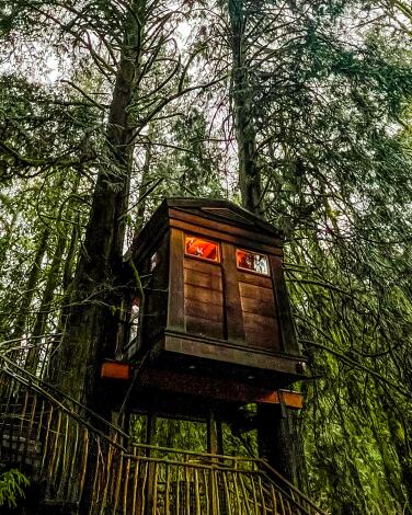
Climb into a treehouse outside Seattle and sleep there
It’s a treehouse hotel, with seven elevated perches (and one ground-level bedroom) woven into the greenery. Guests, including many wedding parties, wake up surrounded by clever carpentry, the burbling river and birdsong.
Treehouse builder and author Pete Nelson bought the property with his wife, Judy Nelson, in 2004. Since then, the Nelsons and their team have built seven treehouses on 4 acres with an event space, lodge and pond. If you’ve heard of the Nelsons and treehouses before, it may be because Pete hosted 100 episodes of the series “Treehouse Masters” on Animal Planet from 2013 to 2018, building and touring tree structures worldwide.
Though weekend wedding business is brisk, that still leaves plenty of weekday nights for the rest of us. The treehouses, each a unique design, are priced at $325 to $625 a night, usually with a two-night minimum. (For a one-night stay, try a Sunday.)
Five have their own water flush toilets and sinks. One has a composting toilet. And one, called Bonbibi, relies on shared access to the bathhouse’s toilets and showers. That’s where I slept. There was a 40-step rain-spattered journey in the wee hours, but I survived.
Still, the room was well-heated and watertight, the setting was spectacular, the sound of the river was calming and the photo possibilities were laughably rich.
If you can’t spend an overnight, you can book a tour.
Bonus tip: Breakfast is included, but there’s no restaurant on site, and once you check in, you won’t want to leave. So if you’re there in warm weather, try a picnic dinner by the river.
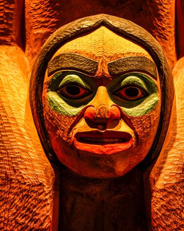
Study Huskies on the University of Washington campus
The Burke Museum of Natural History and Culture, a sleek 2019 building at the northwestern corner of the campus, shows and explains thousands of artifacts, along with some 21st century curatorial rethinking. One display of carved cedar logs, commissioned from Tlingit carvers Nathan and Stephen Jackson, has replaced a pair of totem posts that were stolen from the Tlingit in 1899. (The museum returned them in 2001.) Also, there are dinosaur skeletons on the third floor. Adult admission: $22.
If you get hungry, turn to Off the Rez, the museum’s Native-owned order-at-the-counter cafe, where I had a hearty, juicy braised bison Indian taco ($7.80).
From the Burke, head to monumental Red Square (officially Central Plaza) and the Quad, where cherry trees bloom in spring. You can’t miss the neo-Gothic Suzzallo Library, which has a great origin story. The university president who approved it was fired for overspending in 1927, while it was still under construction. But the library (closed Saturday) is named after him anyway.
Bonus tip: The Henry Art Gallery, known for contemporary exhibitions, is steps from Red Square. If the day is gray, head for the gallery’s “Light Reign” installation by James Turrell. The artwork is an oval room with a blue ceiling that’s eerily like a cloudless sky. Suggested adult admission is $20.
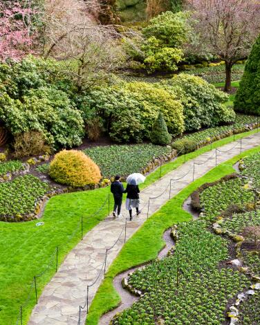
Roam among riotous flowers at Butchart Gardens
Some 900 varieties of plants grow here. Yet part of the gardens were an industrial site. When Robert and Jennie Butchart moved here in 1904, it was to run a quarry and cement plant, drawing on local limestone deposits. By 1912, those deposits had been exhausted, family finances were flush and Jennie Butchart had hit on the idea of carting in topsoil to fill the quarry areas. So began a sunken garden. By the 1920s, the Butcharts (and workers) had created Japanese, Italian and rose gardens.
The gardens are about 14 miles outside Victoria. Even in late winter, when bulbs haven’t popped up and many flower displays are indoors, it’s spectacular. Ponds and fountains. A carousel for kids. Twenty-six greenhouses and 50 gardeners. It will remind some people of Huntington Gardens in San Marino, but not for long. There’s no library or art collection at the Butchart Gardens — but pets are allowed.
There is a gift shop, and a dining room, casual restaurant, coffee shop and ice cream stand. Adult admission ranges from about $16 to $30, depending on the season.
Bonus tip: If you want to take afternoon tea on Vancouver Island, as many travelers do, why not try it in the Butchart Gardens dining room for $38, rather than spending twice as much at the Fairmont Empress Hotel in Victoria?
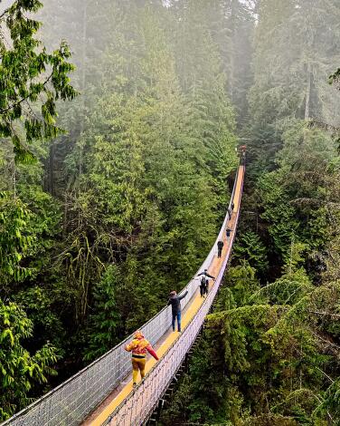
Tiptoe high above a misty forest on the Capilano Suspension Bridge
The park also has a Treetops area, a series of platforms high in the trees, connected by elevated walkways, but it’s closed for an upgrade in 2024.
But really, the bridge is worth the price of admission (about $45 and up for adults, $18 to $25 for minors). It’s 450 feet long, 230 feet above the Capilano River, about 5 feet wide.
“My first time on a suspension bridge. It moves a lot,” Raul Cruz of Chicago told me, standing shakily midspan.
“My God! This is dangerous,” said another man as a teenage girl snickered behind him. I’m guessing they were related.
More than 3,000 people per day come through on busy days, so it’s wise to arrive soon after opening (8:30 a.m. in summer).
Bonus tip: The park operates free shuttle buses that run several times a day, so you can catch a ride at Canada Place, the Hyatt Regency or the Blue Horizon Hotel.
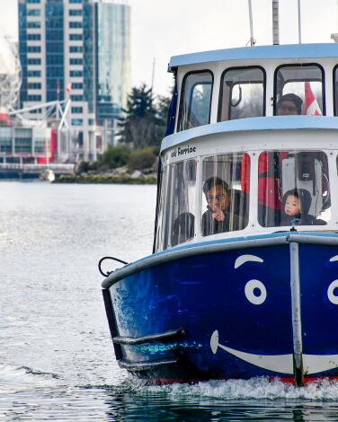
Cruise False Creek by ferry
These vessels carry adults, children and pets, up to 20 people at a time. Of the two companies running ferry service, I liked False Creek Ferries (about 15 vessels, calling at nine stops) because those boats go west of the Burrard Street Bridge and because they look like little tugboats.
That said, the rival Aquabuses (about 13 of them, calling at eight stops) are decorated in rainbow colors and most are platform boats (barges) that accept bicycles and wheelchairs. They don’t go west of the Burrard Street Bridge but are in and out of Granville Island constantly.
With either company, you can buy one ride at a time, a round-trip or a day pass ($14-$15). Be sure to ride at least once after dark, when the city lights are reflected in the water.
Bonus tip: Both companies offer service as early at 7 a.m., as late as 9 p.m. You’ll rarely wait more than 10 or 15 minutes for a ride.

Taste and shop postindustrial Granville Island
Now you shouldn’t miss it. Entirely industrial in the early 1970s, this waterfront beneath the Granville Street Bridge has been 99% transformed into a place where visitors and locals eat, drink, play and watch one another. It began in 1979 with a public market (open 9 a.m. to 7 p.m. daily), now joined by artists, artisans, performing arts, dozens of shops and the Granville Island Hotel. It’s also the hub of False Creek Ferry and Aquabus traffic.
“It’s a bit of an eye-opener — fresh produce and some of the best seafood in the world,” False Creek Ferry skipper Brad Parker told me as he sidled our vessel to the dock. I liked the pickle stand, Nanaimo bars (a B.C. favorite) and the provocative Nooroongji Books too.
I love everything about public markets except that moment when you’re looking at strawberries but beginning to smell fish.
Otherwise, fish are fine. In fact, get lunch at Go Fish, which operates in a tin shack 100 yards west of Granville Island on Island Park Walk. Order a grilled salmon tacone (sort of a taco, sort of a cone, with salsa, cream and slaw; about $6). It’s heartier than a taco, tastier than you can imagine.
Bonus tip: Even the portion of Granville Island that’s still industrial — the Ocean Concrete factory — has gone artsy. Brazilian artists Gustavo and Otávio Pandolfo have painted immense, amusing murals on its 70-foot storage silos. You can see them from the creek.
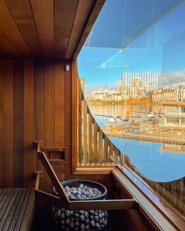
Board a Victoria Harbor warship that's been taken over by sauna people
A: It’s called HAVN (and pronounced hahven). It was built to serve in World War II as a U.S. Navy barge. Now it’s a sort of floating day spa, with three sauna rooms, each with a different temperature, scent and view. There are two hot tubs, two cold pools, exfoliation shower, relaxation cabin, boutique and a decktop lounge with views of the harbor.
The enterprise, which is locally owned, opened in June 2023. The wooden slats are salvaged cedar driftwood from British Columbia’s Haida Gwaii islands.
It never leaves the dock, which is a short stroll from the grandest old buildings on Victoria’s waterfront. Guests get three hours’ run of the place for about $65. Instead of labeling it a spa, management calls it a “floating park environment.”
It’s open daily, 9 a.m. to 9:45 p.m., with herbal tea and snacks available, including cheese and charcuterie boards.
“We’re a cellphone-free facility. Part of our whole M.O. is to be in the present moment,” said general manager Jayme Beaudry.
Bonus tip: Beaudry said HAVN has been booking up four to six weeks in advance.
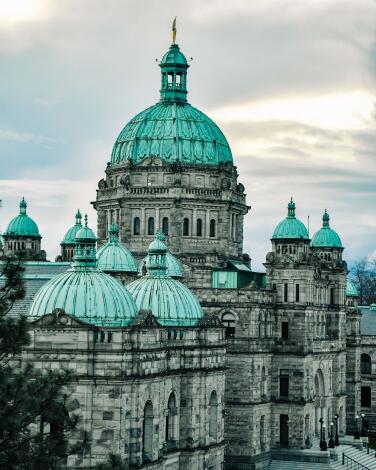
Chase history around Victoria's Inner Harbor on Vancouver Island
Just look at the Parliament Buildings, home to British Columbia’s Legislative Assembly, designed by Francis M. Rattenbury and completed in the 1890s. The main dome is a knockout when the sun hits its green skin of oxidized copper. Then at dusk it gets better: Thousands of lights illuminate the buildings’ contours. On weekdays, you can take free guided tours and the Parliamentary Dining Room is open for breakfast and lunch.
A block away stands the Fairmont Empress Hotel, designed by the same architect, completed in 1908, revered for its traditional tea service (11 a.m. to 2 p.m. daily; about $70 per person). In that tea room, British Columbia feels especially British.
Also nearby is the Royal B.C. Museum, a humdrum 1960s building that’s open but in awkward transition. Its First Peoples displays have been closed since 2021 “as we work to reimagine them with communities.”
For more hints of Victoria 120 years ago, walk down Government Street, Bastion Square and Wharf Street. I loved dinner in the evocative, windowless dining room of Little Jumbo (mushroom risotto, about $24) and wished for more time in the 1909 bank building that houses Munro’s Books.
Bonus tip: The 30-room Abigail’s Hotel is a pleasant, adults-only lodging half a mile from the harbor. Most of the bedrooms are upstairs in historic buildings without elevators. My room cost about $160 at off-season rates, with a three-course breakfast included.
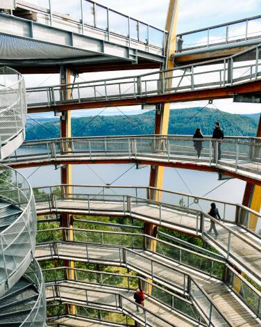
Climb and slide the open-air Malahat Skywalk
The tower is about half an hour northwest of Victoria. Even after parking, you don’t see it at first. After paying ($27 per adult), you walk about 500 yards of elevated boardwalk through a forest of arbutus (Pacific Madrone) trees. Then the cylindrical tower of Douglas fir and steel rises before you, a woodsy Guggenheim Museum. You see a ramp. And no elevator.
The ramp, wheelchair-friendly, spirals gently upward. As you rise, you feel the breeze and see more on the horizon, more of the waters at the foot of the slope.
“Just gorgeous,” said Maliana Kaui, visiting from Tacoma, as she stood on top.
“We get quite a lot of people in wheelchairs,” maintenance worker Travis Nickel told me. “Even on the slide. It was all designed to be accessible.”
“The slide” is a 165-foot-long twisting steel tube, beginning atop of the tower. As you zoom down, the tube drops 65 feet. It takes about 10 seconds — very smooth, very shiny, like being sucked into a mirror.
Bonus tip: There’s a snack bar with ice cream, a few fire pits and an alternative return path through the woods on the way out. The round trip on foot from the entrance is about 1.4 miles.
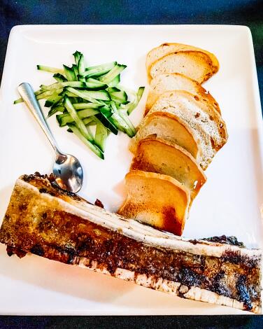
Savor the game (or veggies) at Vancouver's only Indigenous restaurant
If you’re a full-on carnivore, try the bison bone marrow. If not, you’ll find a great veggie risotto further down the menu. (You can get a 4-ounce hunk of salmon on top.)
There’s plenty to look at inside. One wall is red. The dining room is crowded full of Native art for sale.
For most of my evening there, the background music was First Nations chants and drumming. Then the hostess called the restaurant to attention so we could sing “Happy Birthday” to a guest — and then the Indigenous family at another table volunteered to sing it in their native language. Smiles all around. (There are hundreds of Native languages in the part of North America that’s now Canada, and the restaurant staff’s heritage includes more than a dozen First Nations.)
Main dishes are generally $15 to $30. For another $4.50 or so, you can finish up with fresh berries on ice cream.
Bonus tip: The restaurant has a satellite location, Salmon & Bannock On the Fly, at the Vancouver airport. By the way, “bannock” means fry bread but it’s not a wholly Native word. The Canadian Encyclopedia says it came from Gaelic.
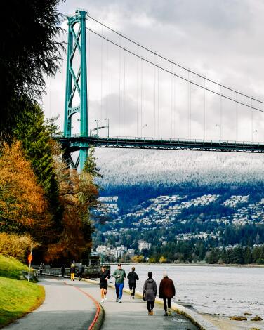
Pedal (or walk or skate) along the scenic Stanley Park Seawall
The park is surrounded on three sides by water — and by the Stanley Park Seawall, a path that draws walkers, runners and cyclists in all seasons. It’s a 6-mile route around the park, taking you past almost as many spectacular views as Tim Horton has doughnuts. (It’s part of the 17-mile Seaside Greenway from Canada Place to Spanish Banks Park.)
Start on Denman Street, near the entrance to Stanley Park, where several rental companies compete within two blocks, renting bikes for as little as $5.50 hourly. I chose an e-bike from Bikes and Blades (about $22 for two hours) and paid extra to keep the bike a bit longer.
That was worth it. I stopped for the Brockton Point lighthouse, the totem poles, the 364-foot-high Lions Gate bridge, the dramatic outcropping of Siwash Rock and in English Bay, where Yue Minjun’s “A-Maze-Ing” bronze sculptures of 14 laughing men charms children and adults alike.
Bonus tip: There’s often a hot dog vendor next to Morton Park. If you buy one, beware those gulls.
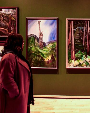
Meet a pioneering painter in the Vancouver Art Gallery
“Emily Carr: A Room of Her Own,” an exhibition of 25 Carr paintings owned by the museum, will be up through Jan. 5. Born in 1871, Carr studied in San Francisco and Europe but returned to spend most of her life on Vancouver Island, painting landscapes and First Nations villages. She also did illustrations and cartoons, taught, bred sheepdogs, kept a pet monkey and wrote several volumes of memoirs. She died in 1945 at 73.
“There is something bigger than fact: the underlying spirit, all it stands for, the mood, the vastness, the wildness,” Carr wrote.
Bonus tip: There’s much more to the museum than Carr. Look for the Group of Seven, a collection of Canadian landscape artists. And you’re bound to smile at “Horizons,” a presentation by artist Gary Neill Kennedy (through Aug. 25) in which dozens of the museum’s paintings are rehung so that their horizons line up.
Sign up for The Wild
We’ll help you find the best places to hike, bike and run, as well as the perfect silent spots for meditation and yoga.
You may occasionally receive promotional content from the Los Angeles Times.

