Advertisement

I live on Cecil B. DeMille’s old airfield. What’s your L.A. neighborhood’s backstory?

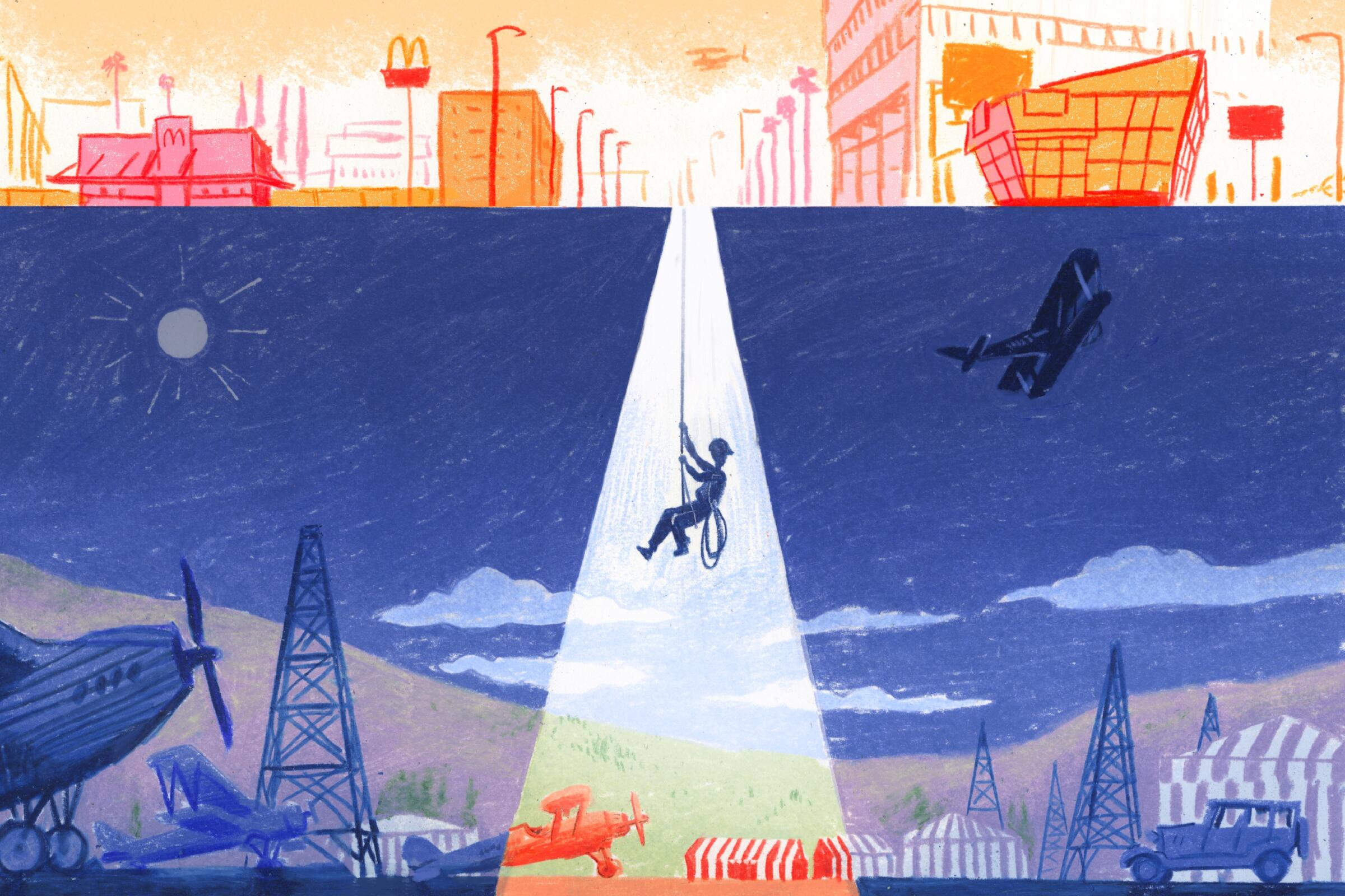
A person descends by rope from today's intersection of Wilshire and Fairfax into a 1920s version with old-timey airplanes.
A chance encounter with two old photographs of the intersection of Wilshire Boulevard and Fairfax Avenue — one taken in 1922 and one in 1929 — sent the author down a research rabbit hole that revealed, among other things, his neighborhood played a pivotal role in L.A.’s early aviation history.
(Sam Alden / For the Times)
1

In the early 1920s, famous Hollywood director of yesteryear Cecil B. DeMille used to have an airfield where my Beverly Grove neighborhood — and quite possibly my house — sits today. At the same time, at the southwestern corner of Fairfax Avenue and Wilshire Boulevard, stood another airfield owned by Syd Chaplin (half-brother of silent film star Charlie Chaplin) with what appeared to be striped awnings.

And what today is the diagonal stretch of San Vicente Boulevard, slashing northwest to southeast from West Hollywood to Venice Boulevard, follows the path of onetime trolley tracks.

When I discovered all those things about my neighborhood by accident more than a dozen years ago, it felt almost as if I’d suddenly unearthed a complete T. Rex skeleton or a trove of ancient cave paintings. It connected me back through time and made history come alive and almost crackle with electricity that I could feel pulse up through the ground. As a result, I’ve looked at L.A.’s vast cityscape with a different eye ever since, wondering where else I might find that jolt of electricity, curious about how to find out what other loosely held historical secrets might lurk just below the dusty, sun-drenched surface of Los Angeles’ neighborhoods.

Advertisement

Know where to find a soothing café de olla? Or where to sing karaoke all night? How about the best spot for DTLA skyline views? Our guides are here to show you it all.

For the record:

10:23 a.m. Jan. 8, 2024An earlier version of this story incorrectly described the location of Johnie’s Coffee Shop Restaurant. It is located at the northwestern corner of Wilshire Boulevard and Fairfax Avenue, not the southeastern corner.

2

The discovery

My adventures as an armchair neighborhood time traveler began at the Los Angeles County Museum of Art’s 2011-12 exhibition “California Design 1930-1965: ‘Living in a Modern Way,’” when I found myself standing before two framed black-and-white photos on the gallery wall. On the left was an aerial view of the intersection of Fairfax Avenue and Wilshire Boulevard looking west.

Taken in 1922 by Spence Air Photos, it depicts mostly wide-open fields dotted with the occasional oil derrick and a cluster of long, low buildings fronting the western side of Fairfax just south of Wilshire. On the north side of Wilshire was a scrubby rectangle carved out of the field, bounded by three more long, low buildings to the north.

Find the best gifts for travelers, creatives, gadget geeks, food lovers, book fans, white elephant parties and more in our gift guide.

Hanging to the right of this photo was a second aerial view of the same intersection, by the same company and from almost the same angle, taken in 1929.

While the two roads ribboning away from the intersection were easily identifiable, everything else in the frame had changed. What was once fields and scrubby rectangles was now rows and rows of houses as far as the eye could see, with only a small square of land at the northeast corner of Wilshire and Fairfax left unoccupied. (A decade after this photo was taken, the May Company building, now home to the Academy Museum, would rise on that spot.)

The juxtaposition of the photos was meant to illustrate the effect of the 1920s population boom on Los Angeles. “By the late 1920s undeveloped space began to fill with single-family homes and low scale commercial buildings,” reads the text in the accompanying exhibition catalog, which noted that the population that decade soared from “a little more than 900,000 to more than two million.”

Advertisement

For me, though, they were something more: before and after photos of the Beverly Grove neighborhood where I live. The photos were lined up so perfectly that it was easy to compare what occupied the same spot seven years apart.

I must have stood in that LACMA gallery for a good 15 minutes, shifting my gaze from one photo to the other, gauging distances and counting streets before I spotted something small — several somethings actually — lined up along the western side of Fairfax that appeared to be ... airplanes. This came as a surprise not only because of where those planes were — a swath of my present-day neighborhood — but when. That first photo was taken in the earliest years of the country’s aviation industry and roughly six years before Mines Field (which would eventually become Los Angeles International Airport) began operation.

3

The research rabbit hole

That discovery sent me down a rabbit hole that not only eventually revealed a clearer backstory to Beverly Grove but also the vast resources that can be mustered in just a few mouse clicks by any L.A. dweller curious about their own ’hood’s history. Before I get to those, here’s what I’ve managed to puzzle-piece together about what was happening just over a century ago in what’s now my neighborhood.

Based on the treasure trove of photos, The Times archives and a couple of extensively detailed websites compiled by aviation enthusiasts (including a site that lists the latitude, longitude and dimensions of long-defunct airfields), it appears that DeMille field No. 2, owned by DeMille’s Mercury Aviation Co., opened at the northwestern corner of Wilshire and Fairfax (then known as Crescent Boulevard) in 1918. In a move worthy of the modern-day Bezos-Branson space race, Syd Chaplin opened one the next year on the south side of Wilshire.

Advertisement

Situated on a steep hillside on the Palos Verdes Peninsula with breathtaking views of the Pacific Ocean, Wayfarers Chapel is one of the most photographed places of worship in Southern California.

If DeMille’s east-west airfield, which, according to one account, measured 1,800 feet by 500 feet, was flush against the northwestern corner of Wilshire and Fairfax (the spot currently occupied by Johnie’s Coffee Shop Restaurant), it would have been bounded roughly by what today is Sixth Street to the north and Crescent Heights Boulevard to the west.

It’s clear from the 1922 photo, though, that the scrubby rectangle didn’t sit right against Wilshire but appeared to be further north — perhaps as much as 500 feet — which would have put the southern edge along Sixth Street and the northern edge right through my backyard.

However, the location of DeMille field No. 2 squared with today’s grid of urban streets shows that it wasn’t there long; in 1921, it was merged with Chaplin’s nearby holdings to become Rogers Airport (described in a Times piece announcing the news as “the largest commercial aviation field in America”), and just two years after that, a company called Evans-Ferguson Corp. announced in a Times ad that it had purchased the property “to be subdivided immediately and offered to the public under the name of the Wilshire-Fairfax Tract.”

Today, the only visual clue to the neighborhood’s role in early aviation history is the David Geffen Theater at the Academy Museum. Located just across Fairfax from where the airfield once stood, the eye-catching spherical building’s design is, according to my Times colleague Carolina Miranda, “inspired by the dirigibles that used to touch down in the area.” (Take that, Goodyear Blimp!)
4

Four easy-to-access portals to L.A.’s past

My portal to the past may have come by way of a museum exhibition, but one of the serendipitous discoveries of my research was just how many good, reliable and easily accessible resources are out there for anyone interested in exploring the early days of their own L.A. neighborhood. Here are a few solid starting points.

Advertisement
5

1. USC Libraries’ California Historical Society Collection, 1860-1960

The deeper I went down my research rabbit hole, the more I found myself looking at black-and-white images credited to this ginormous collection of more than 25,000 photographs from the state’s past, with a particular emphasis on the development and growth of the Los Angeles area. In addition to more aerial photographs of my neighborhood (comparing the same view from Wilshire and San Vicente in 1923, 1926 and 1930), I discovered an advertisement for DeMille’s Mercury Aviation Co. (“Flying, the New Industry”). All of the photos were accompanied by detailed, context-rich descriptions.

Curious about what Larchmont Boulevard looked like in 1930? You’ll find it here. Boyle Heights circa 1880? They’ve got that too. Same with the Silver Lake Reservoir (circa 1935 to 1939; an aerial view from 1940) and Koreatown (in 1895, 1924 and an aerial shot from 1968, among others). And that’s just the tip of the iceberg. (Speaking of which, I recently ran across a photo circa 1920-30 of a fellow outside the orange groves of Puente Hills wrangling a block of ice the size of a filing cabinet.) Your time machine awaits at digitallibrary.usc.edu.

6

2. Los Angeles Public Library Collections & Resources

In addition to more historical photos than you can shake a bookmark at, the LAPL’s holdings include links to historical L.A. maps, county tract and parcel maps, census data and multiple ways to contact an actual librarian if you need a little help along the way. lapl.org

7

3. Los Angeles City Historical Society

This nonprofit organization was founded in 1976 with the mission of preserving and educating people about the history of the city. That makes it an invaluable resource, both for its own work (which includes a lecture series, sponsored research and a photo database of images from the Los Angeles City Archives) and for the extensive online resources listed on its website. (That’s how I found out about Los Angeles Almanac and that site’s equally extensive list of L.A. County historical societies, museums and archives.) lacityhistory.org

8

4. Local news media

Subscribing to The Times won’t get you access to the paper’s archives all the way back to its 1881 founding, but it does get you the next best thing: access to a whole bunch of folks who do. When columnist Patt Morrison starts waxing on about SoCal’s unique place in fast-food history, the Hollywood sign or L.A.’s start as an aerospace capital in 1910, you know she’s done her homework. And she drops enough hard-core historical bread crumbs along the way — about the city’s places and people — that any armchair exploration of L.A.’s past will eventually lead you to a piece she’s written. There’s also The Times’ @latimes.404 Instagram account, which serves up meme-worthy, easily digestible nuggets of city history from time to time (including the recent backstory of the Hollywood Forever Cemetery and plumbing the mystery that is the oil field beneath the Beverly Center).

Advertisement

The owner of a WeHo sex-toy boutique has opened the doors of an ambitious three-business, two-story, one-stop vice shop on Santa Monica Boulevard.

But those aren’t the only sources in the city’s media landscape with a love of and access to historical Los Angeles that might be helpful as you embark on a keyboard walkabout of the city’s past. Los Angeles magazine is another good resource, particularly Chris Nichols’ back-page Ask Chris feature, which almost always serves up something about the city’s past that I never knew before. Same with LAist’s L.A. Explained series (not to be confused with @laexplained, an Instagram account/TikTok feed/bus tour series that covers much the same territory).

Also, Westways, the Auto Club of Southern California’s member magazine, provides the occasional window (make that windshield) into early L.A., having been around since 1900. A recurring column called Off-Ramp juxtaposes archival photos with more recent ones and has long been one of my favorite features.

Maybe that’s why I spent so much time in that LACMA exhibition, studying those side-by-side images in an attempt to determine where in my neighborhood that long-ago airfield once was. And how I ultimately ended up discovering my neighborhood’s place in early aviation — and Hollywood — history.

Advertisement