Two California fires in the Sierra Nevada have very different outcomes. Why?

- Share via
The two fires started just 17 miles apart in the rugged terrain of California’s western Sierra Nevada — but their outcomes couldn’t have been more different.
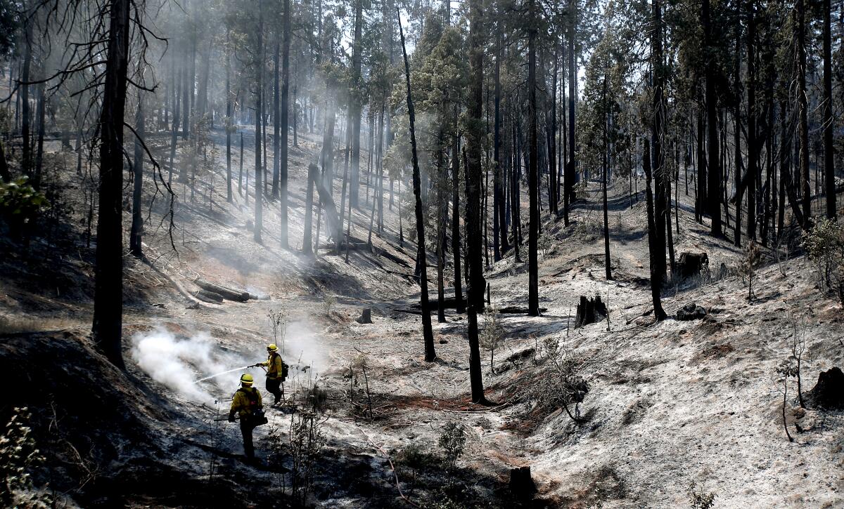
The Washburn fire, which ignited July 7 along a forested trail in Yosemite National Park, was nearly contained, with no damage to structures or to the famed Mariposa Grove of giant sequoias.
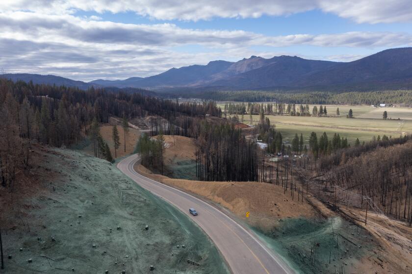
But the Oak fire, which sparked almost two weeks later in the foothills near Midpines, confounded firefighters as it exploded to four times the size of Washburn and forced thousands to flee as it destroyed at least 106 homes. At times, the wildfire’s smoke plume could be seen from space.
Why was one fire so much more destructive?
Experts attribute the difference to variations in weather, vegetation and topography. The management history of each landscape also played a role: Yosemite boasts decades of active stewardship, including prescribed burns, while areas outside the park bear a legacy of industrial logging and fire suppression.
The Washburn fire started along a trail on the edge of the Mariposa Grove, just downhill from the road used by shuttle buses to ferry tourists from a parking lot.
Since vegetation along the trail was dense, and flames travel more quickly uphill, officials worried that the fire would grow hotter, gain speed and slam into the sequoia grove, said Yosemite Fire Chief Dan Buckley. That could result in a high-severity crown fire similar to those that have destroyed an estimated 20% of the world’s population of the ancient giants since 2020, he said.
But luck was on the side of the fire officials: Two Yosemite battalion chiefs were teaching a chainsaw class to a sizable contingent of firefighters in the nearby Wawona area and were able to quickly respond, along with a water tender, two engines and the park’s water-dropping helicopter.
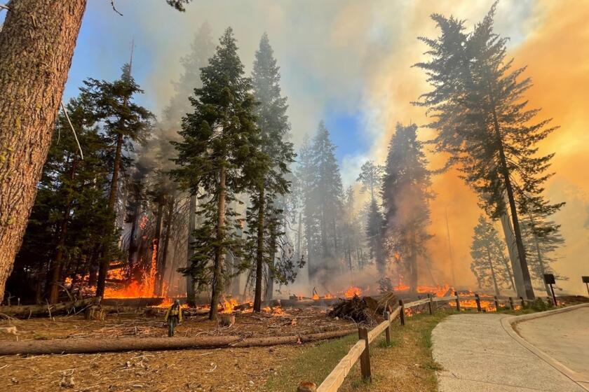
Crews scramble to protect giant sequoias in Yosemite’s Mariposa Grove as the Washburn fire burns 1,190 acres in the national park.
As the engines sprayed burning sequoias, park rangers enlisted civilian tour bus drivers to evacuate more than 450 visitors from the grove.
“They actually had to drive through flames on both sides of the road when they were taking these people out,” Buckley said. The rescue was completed in about 90 minutes, allowing firefighters to focus on the flames, he said.
When the fire spread to the Mariposa Grove, it met a prescribed burn area that crews had treated in 2017, reducing the amount of brush and duff, or decaying vegetation, that would otherwise have helped the flames travel faster. Also, the winds picked up slightly and pushed flames away from the heart of the grove and downhill toward Wawona.
Those factors allowed firefighters to build a flanking line and steer flames around the grove, said Mike Theune, fire information officer for the National Park Service’s Pacific West region.
When the Oak fire started the afternoon of July 22 in a patch of oak grassland, temperatures reached the 90s, and humidity was in the single digits. It took just 16 hours for the blaze to leapfrog the Washburn fire in size as it burned through steeper, less accessible, more populated terrain.
“The Oak fire started much lower in elevation. It’s much drier,” said Adrienne Freeman, fire information officer with the U.S. Forest Service. “And the key thing is it’s a different fuel type. There’s a heavy brush component.”
Parched brush and grass helped spread flames into stands of dense timber littered with conifers that had been killed by drought and bark beetles, Freeman said.
An increase in catastrophic wildfires has reduced California tree cover by 6.7% since 1985, and researchers fear the lost trees will never grow back.
California’s drought, which has been intensified by climate change, has killed upward of 100 million trees in the central and southern Sierra, said Scott Stephens, professor of fire science at UC Berkeley. Dead and fallen trees that are overgrown by shrubs burn extremely effectively. When enough ignite at once, they draw in oxygen that increases the burning rate, Stephens said. Researchers call this a “mass fire,” a term that was coined to describe the effects of incendiary bombing attacks in World War II, he said.
“It actually creates a localized low-pressure system,” he said.
Stephens was part of a team of researchers that documented this behavior in the 2020 Creek fire for a study published in May in Forest Ecology and Management. They found dead biomass, followed by live tree density, to be the two most important variables when it comes to predicting fire severity.
“Someone showed me a picture of the Oak fire, and it had a pyrocumulus cloud created above it at least 20,000 feet in height,” Stephens said. “That gets me wondering if we’re seeing similar behavior, at least in parts of that fire.”
The density of the vegetation is tied to the history of the land, which was logged starting in the mid-1800s.
“The Oak fire is burning in areas that have had big trees removed and lots of moderate and small trees brought in, and that homogeneity is going to make it worse,” Stephens said.
Also, Mariposa County is the ancestral home of the Southern Sierra Miwuk, who regularly set controlled fires — that is, until white settlers criminalized cultural burning. Its absence has upended the balance of the ecosystems, the Miwuk and fire scientists say. The area where the Oak fire began had not burned in nearly 100 years, according to fire history maps.
“This landscape here specifically needs healthy fire,” said Clay River, director of the Miwumati Healing Center, which serves as the hub for Miwuk health and social services.
After the Miwuk were violently evicted from Yosemite Valley for the formation of the national park, they were forcibly relocated to the foothills along what is now Highway 140, where the fire began, River said. Many are now watching their homes and cultural sites burn, she said.
As authorities began lifting evacuation orders, some Oak fire residents were learning whether they had homes to return to.
Acknowledging the benefits that cultural burning once offered to forest resilience, park officials have sought to bring low-intensity fire back to the landscape in the last 50 years. They have managed fires in the backcountry for resource benefits since 1972, resulting in a mosaic of small fire footprints that self-limit new starts, Buckley said. They have also performed a series of prescribed burns, including 22 in the Mariposa Grove alone.
Still, in the days that followed the Washburn fire’s initial advance, officials worried that it might circle back around and threaten the grove. The area contained dead trees and brush from a January 2020 wind event that blew down 28 mature giant sequoias and thousands of other trees.
But firefighters reported a major victory about three days into the fight, when they were able to hold the fire at Wawona Road to the west.
Officials credited a 2020 biomass removal project led by Garrett Dickman, a park forest ecologist, and the Mariposa County Resource Conservation District, with funding from a California Climate Investments grant. Teams removed close to 9,000 tons of vegetation along three miles of the road between Wawona and the Mariposa Grove, which they hope to follow with a series of prescribed fires, Dickman said.
When flames reached the site of the project, they dimmed and in some places extinguished, Dickman said. Firefighters were able to stand on the road and douse hot spots, freeing up personnel to aggressively protect Wawona and the grove.
Some models indicated that had the fire launched embers over the road, it could have burned into Wawona, Fish Camp, Ponderosa Basin or Lushmeadows, Dickman said.
“It would have been a very, very, very different fire,” he said.
More to Read
Sign up for Essential California
The most important California stories and recommendations in your inbox every morning.
You may occasionally receive promotional content from the Los Angeles Times.


