California rainstorm drenches L.A. County after setting records in north
- Share via
The powerful storm that walloped Northern California over the weekend moved into the Southland on Monday, bringing with it heavy rain and wind.
Several parts of Los Angeles County saw more than an inch of rain, particularly in the foothills and mountains, according to the National Weather Service.
La Cañada Flintridge saw 1.31 inches as of around 5:30 p.m., the Weather Service said. Updated 24-hour rainfall totals were not available Monday night.
Pasadena saw 1.11 inches, Eagle Rock Reservoir got 1.21 inches, and at Opids Camp — a school camp in the San Gabriel Mountains — the storm dumped 2.61 inches, the most of any area measured in the county, according to the Weather Service.
The storm also saw record-setting rainfall for this date in Long Beach, according to the Weather Service. The 0.13 inches recorded on Monday broke the old record of 0.08 inches, set in 2010.
The system is “unusual for this time of year in terms of its strength,” said David Sweet, a meteorologist with the National Weather Service in Oxnard. “It’s a very, very powerful storm.”
Water from the downpour made its way into flood control channels in the foothills, gathering intensity before emptying into the Los Angeles River where the raging current prompted a water rescue.
Firefighters were called at 1:39 p.m. to a section of the river in Boyle Heights where a woman in her 40s was reported in the water, according to the Los Angeles Fire Department. Crews were able to get the woman out of the river safely.

In anticipation of the wet weather, Long Beach had announced all its coronavirus testing and COVID-19 vaccination sites — at the Long Beach City College Pacific Coast campus, Veterans Stadium, Houghton Park and Cal State Long Beach — would close at 1 p.m. Monday. Any canceled appointments will be rescheduled.
A morning flood advisory was issued for southern and eastern San Luis Obispo County, where forecasters said rain could come pouring down at rates of up to 0.75 of an inch per hour.
Some areas of the county — including Cal Poly San Luis Obispo and Rocky Butte — recorded more than 5 inches of precipitation during the 24-hour period ending at 5:35 p.m. Monday, according to the Weather Service.
Downed power lines temporarily forced the California Highway Patrol to reroute traffic on Interstate 5 near Bakersfield shortly before 11 a.m. The thoroughfare fully reopened about half an hour later.
The storm also created some concern in Santa Barbara County, where a flash flood warning was issued near the burn scar of the Alisal fire. That expired shortly before 11:30 a.m.
Heavy rain in Northern California unleashed mud and debris flows and shut down at least one critical highway by Sunday morning.
The first major storm of the season had already shattered records.
Downtown Sacramento had an all-time-record 24-hour rainfall total of 5.44 inches, surpassing a mark set in 1880, officials announced early Monday. Rainfall totals that extreme would likely qualify as a “200-year storm,” which has about a 0.5% chance of happening in a given year, officials said.
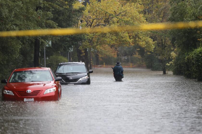
Monday brought some relief to the capital city after a night of relentless rain toppled trees and flooded streets. Sunday night, many roads in the downtown area were inches-deep in water, backing up traffic and forcing cars to precariously cross water that reached halfway up their tires.
Creeks overflowed near the American River, where many homeless camps are located, prompting officials to open emergency shelters.
Blue Canyon in Placer County received 10.4 inches, breaking its previous record from 1964.
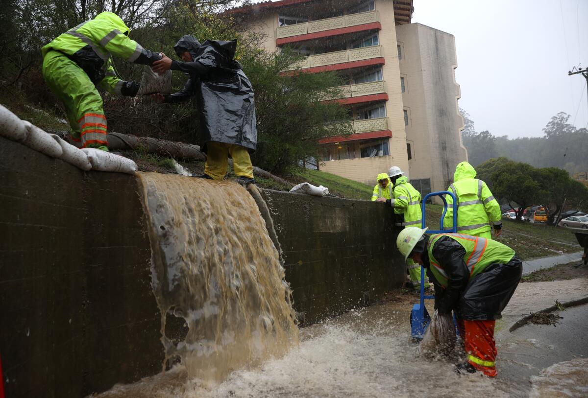
And in the Bay Area, the 4.02 inches of rain that fell Sunday marked the wettest October day ever in downtown San Francisco, and the city’s fourth-wettest day in history.
A massive storm barrels toward Southern California after causing flooding and mud flows in areas burned by wildfires across Northern California.
About 125,000 residents across the state — from the Bay Area to Sacramento and Lake Tahoe and down to San Luis Obispo — were without power Monday morning, according to PG&E.
Power was out on the Bay Bridge around 7 a.m. — only hours after video circulated of big rigs on the Richmond-San Rafael Bridge being blown over by the storm.
In some areas, the rain turned to snow, creating dangerous conditions that prompted the closure of multiple major roads and passes across the state, according to the California Department of Transportation.
Along the Bay Area peninsula Monday morning, crews and homeowners were tending to downed branches in the streets, leaf-gummed gutters and toppled basketball hoops.
Large puddles formed at some roads and intersections. A 6-inch-deep pool of standing water made driving especially unnerving at the corner of El Camino Real and Valparaiso Avenue in Menlo Park.
Up in the Santa Cruz Mountains, however, first responders to fire and debris flows were feeling relieved.
“We dodged a bullet,” said Chief Mark Bingham of the Boulder Creek Fire Protection District. Evacuation orders had been in place over the weekend due to the risk of debris flows and flooding.
A wind advisory in San Luis Obispo County called for gusts as strong as 50 mph through midday, with the potential for downed trees and power lines. Officials also issued a high surf warning until 9 p.m. Monday for the central coast of San Luis Obispo and Santa Barbara counties, as “powerful waves and strong rip currents will pose an exceptional risk of ocean drowning and damage to coastal structures.”
“Everyone should remain out of the water due to life-threatening surf conditions,” officials wrote in an advisory. “Stay off of jetties, piers and other waterside infrastructure.”
The Santa Barbara County Sheriff’s Office on Sunday ordered evacuations for residents near the Alisal fire burn scar, including those west of Las Flores Canyon, east of Mariposa Reina, south of West Camino Cielo and down to the ocean. That order was lifted Monday afternoon, after the bulk of the storm had moved out of the area.
Sacramento and San Francisco both set records for rainfall on Sunday.
The fall rains come as welcome relief after California reported its hottest summer on record and its driest water year in nearly a century, conditions that helped stoke a long and active wildfire season.

The storm cloaked the Los Angeles area in cool weather with temperatures Monday in the mid-to-low 60s.
But torrential rainfall also brought new risks, particularly in areas impacted by recent wildfires.
Flash flood and excessive rain warnings blared across road signs and phone screens, with some officials declaring that for those in the Dixie fire burn area who had not yet evacuated, it could be too late.
“If you are near a burn scar, it may be too late to evacuate,” officials at the National Weather Service in Sacramento said on Twitter. “Do not attempt to cross a debris flow. Take shelter in the highest floor of your home.”
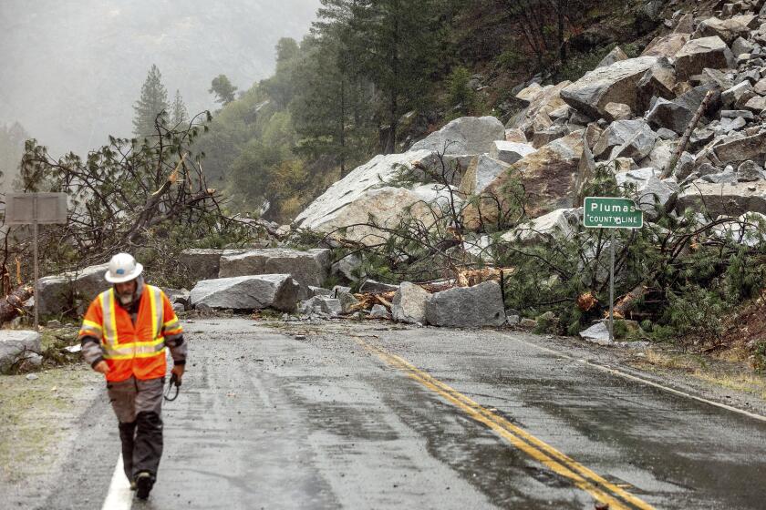
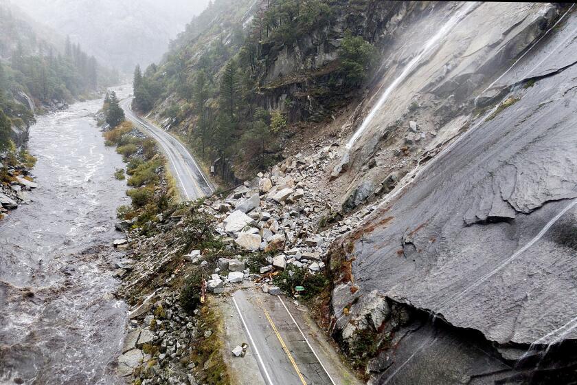
Multiple debris flows shut down Highway 70 between Jarbo Gap and Greenville, a historic mountainside community in Plumas County that had already lost so much to the Dixie fire. A photo circulating on social media showed a dramatic slide near the community of Tobin, where a huge pile of rock, trees and debris collapsed onto both lanes of the highway.
Times staff writers Alex Wigglesworth, Gregory Yee and Rosanna Xia contributed to this report.
More to Read
Sign up for Essential California
The most important California stories and recommendations in your inbox every morning.
You may occasionally receive promotional content from the Los Angeles Times.
