Fire risk returns to Southern California as Santa Ana winds are forecast for Thanksgiving weekend

- Share via
A Santa Ana wind event expected over the holiday weekend is the latest sign that California’s worst wildfire season on record may still have some fuel left in the tank.
In a pair of fire weather forecasts released by the National Weather Service, meteorologists warn that warm, dry inland winds are expected to sweep over the Southland from Santa Barbara to Orange counties from Thursday through Sunday, raising the risk that a fire would burn out of control.
Record heat. Raging fires. What are the solutions?
Get Boiling Point, our newsletter about climate change, the environment and building a more sustainable California.
You may occasionally receive promotional content from the Los Angeles Times.
“After quiet conditions on Wednesday, northerly winds are expected to increase on Thursday, with winds shifting to the northeast by late afternoon, bringing lowering humidities and elevated fire weather concerns to the mountains and Santa Clarita Valley,” the agency’s Oxnard office said. “There is increasing confidence that a moderate Santa Ana wind event with further drying will bring widespread elevated to brief critical fire weather conditions for Los Angeles and Ventura counties Thursday night into Friday.”
In Santa Barbara, the winds are called “sundowners,” and they contributed to the explosive growth of the Thomas fire in 2017 and were expected to return this weekend. In Orange County, the winds are due to arrive Thursday night and “bring locally critical fire weather conditions,” the weather service said.
Should a fire break out in the mountains, valleys or foothills, the flames will be feeding on bone-dry grass and shrubs, parched from a rainy season that is underperforming in its first months.
“We are still high in our fire season, and we haven’t had nearly enough rainfall to shut it down,” said Ryan Kittell, a National Weather Service forecaster in Oxnard, which covers much of the Southland. “We like to see 5 inches of rain in our area before we start having that conversation, and we aren’t really anywhere near that. Pretty much everywhere is under an inch.”
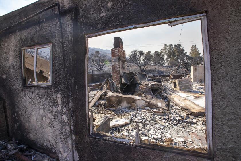
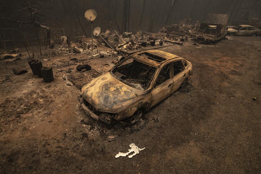
The forecast comes during the state’s worst fire year on record. So far this year, wildfires have burned across more than 4 million acres, killed at least 31 people and destroyed thousands of homes and buildings.
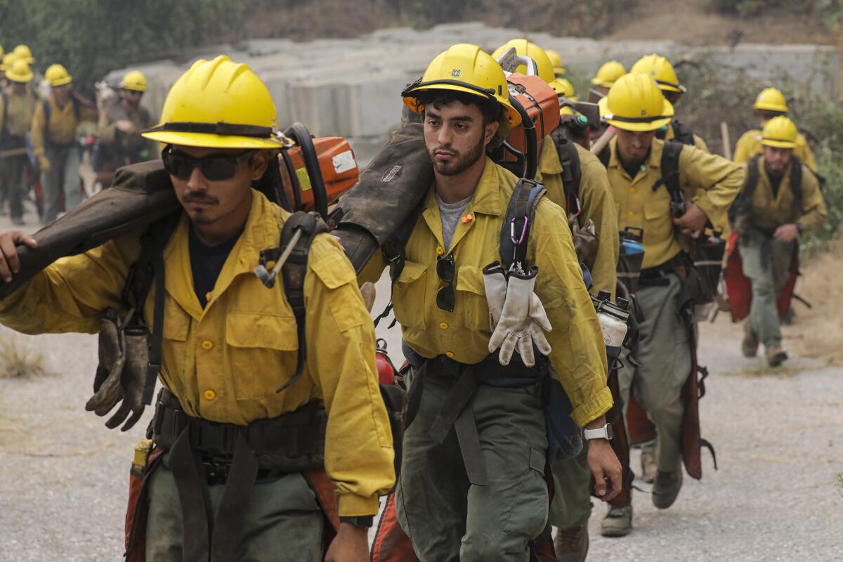
The San Bernardino National Forest on Monday announced it was implementing fire restrictions for the entire Thanksgiving week and extending the hours its firefighters are on duty.
“Despite one winter storm in early November, vegetation in much of the Forest continues to be very dry. Some lower elevation areas are even drier than in the summer, when numerous large fires broke out,” officials said in a statement.
Millions of homes are ensured coverage for another year as insurers deal with fire risks.
Though the winds are bringing an elevated threat to this region specifically, experts say wildfire risks remain for most of California.
“The fire season hasn’t ended for the southern two-thirds of the state,” said Dan Collins, a meteorologist with the National Oceanic and Atmospheric Administration’s Climate Prediction Center. “We’ve had large fires in December and January in Southern California.”
Stockton, which is roughly 40 miles south of Sacramento and averages 2 inches of rain between Oct. 1 and Nov. 22, has received only nine one-hundredths of an inch. In Ventura County’s Camarillo, which would have received 1.7 inches of rain by Sunday in an average year, has received only eight one-hundredths, according to weather service data. Burbank has seen even less, only six one-hundredths of an inch of rain compared with the 1.68 inches of rain it would traditionally see by Sunday.
Only areas far to the north, like Crescent City and Eureka, where it has rained 5.52 inches and 2.62 inches since Oct. 1, respectively, can consider their fire season over, experts say. Even then, their rainfall totals are only about 50% of their seasonal averages.
Looking ahead, 2020 could be considered a harbinger of the state’s climate future with unpredictable rainfall year to year, extreme heat and increasingly long fire seasons, experts say. As the climate warms, that will carry the risks of fire closer to the peak of Santa Ana wind season, a potentially deadly combination for Californians.
Researchers say that as Earth’s polar ice melts and the oceans gradually warm, California rainfall — which predominantly comes in the form of roughly half a dozen soggy storms known as “atmospheric rivers” — is expected to become increasingly erratic. This feast-or-famine trend can be seen in the last decade, when a five-year drought was punctuated by a record-wet winter and then another dry year.
As California suffers the worst fire season on record, residents complain that officials have ignored pleas to reduce fire risks.
The window for that rainfall is shrinking, to just a few months, mostly from January through March, which is giving timber and light, flashy grass fuels, particularly in Southern California, even more time through the year to dry and become more flammable.
California’s “hydro-climate is the most volatile of any place in the United States; it varies year to year more than any other place,” said Alexander Gershunov, a research meteorologist at UC San Diego’s Scripps Institute of Oceanography. “It’s getting less frequent and more dependent on extreme events, which makes the variability more pronounced. It’s more drought- and flood-prone.”
Should another fire start in the next couple of months, it would be burning during the historic peak of the Santa Ana wind season, Gershunov said.
Though October is often perceived as the worst time for Santa Ana winds, which are typically warmer and drier than onshore breezes, that’s just because that’s when the region has historically experienced its worst fires.
But that could change in the decades to come. More Santa Ana winds actually occur in December and January than any other time of the year, according to a research letter that Gershunov co-wrote and that was published in American Geophysical Union in 2016.
Indeed, in December 2017, utility lines downed by Santa Ana winds sparked the Thomas fire. The Ventura County blaze grew into what was then the second-largest fire in state history at more than 280,000 acres.
“Certainly the Thomas fire is a poster for the future,” Gershunov said. “We didn’t really get any significant rain until January and the vegetation was still flammable in December when there were back-to-back Santa Ana winds.”
Additionally, summers are trending hotter. California experienced its second-hottest and driest October on record and broke daily heat records over the summer. Five of the six largest fires on record burned this year.
“Our research suggests sharper seasonality. Drier in shoulder seasons, wetter in winters. That’s a dangerous recipe when it’s in connection to wildfires,” UCLA climate scientist Daniel Swain said. “The trend is of things getting worse.”
More to Read
Sign up for Essential California
The most important California stories and recommendations in your inbox every morning.
You may occasionally receive promotional content from the Los Angeles Times.


