Satellite photos dramatically illustrate the effects of a dry winter on California’s Sierra Nevada snowpack

- Share via
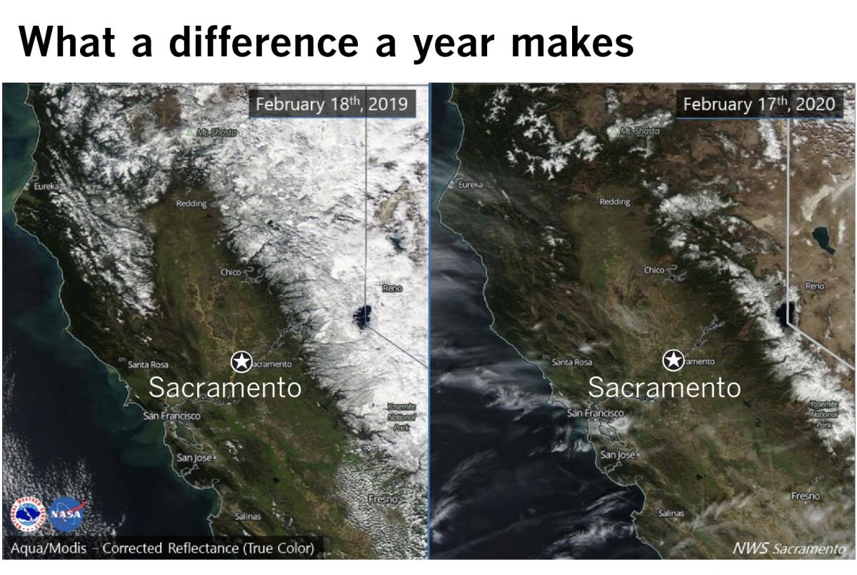
Two satellite photos released by the National Weather Service in Sacramento tell the story of California’s dry winter.
The photo above on the left shows the Sierra Nevada blanketed with snow on Feb. 18, 2019. The photo on the right from Feb. 17 of this year shows the same portion of California with scant snow cover.
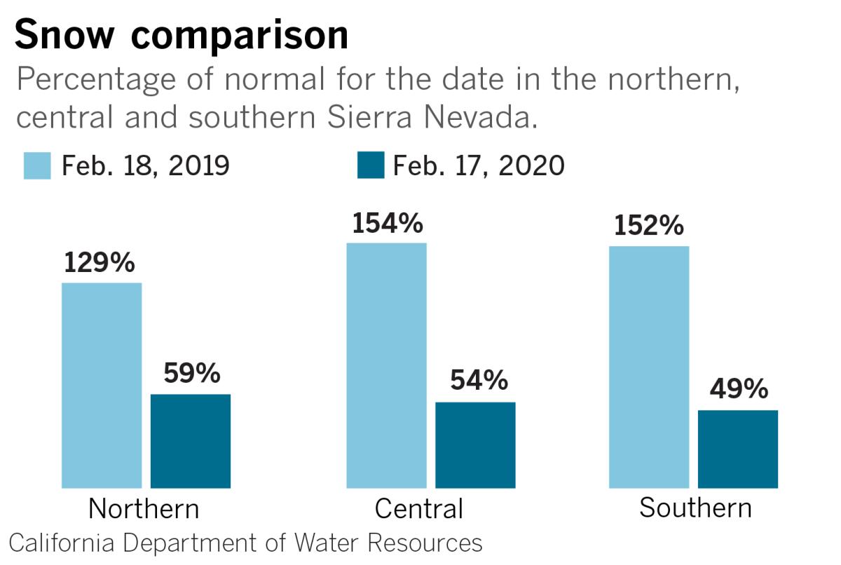
Last year at this time, the northern Sierra had a snowpack that was 129% of normal for the date. This year, the snowpack in the northern Sierra stood at 59% of normal. This mountainous area includes the state’s biggest dams. It is crucial for water customers throughout the state, and in particular for Southern California.
The snowpack this year is below normal, and dry weather is expected to continue for the remainder of the month as persistent high pressure in the eastern Pacific diverts storms away from California and into the Pacific Northwest. February is normally California’s wettest month.

Precipitation figures suggest that California has been locked in a two-decade drought, according to climate scientist Bill Patzert. Rainfall measured in downtown Los Angeles shows 14 years from 1999 through 2019 that are below the 143-year average, although there were a few wet years interspersed during that period.
Precipitation last year was above average, but not exceptional.
More to Read
Sign up for Essential California
The most important California stories and recommendations in your inbox every morning.
You may occasionally receive promotional content from the Los Angeles Times.


