A Santa Barbara area canyonâs residents are among many Californians living in harmâs way in fire-prone areas

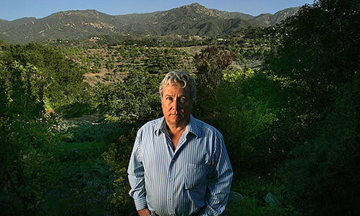
SANTA BARBARA â Sometimes when Ralph Daniel looks out the huge plate-glass windows of his 1959 ranch house, a bobcat stares back at him from the patio. He delights in the quiet, the bird songs, the expansive view of the Santa Ynez Mountains.
Like millions of other Californians, Daniel, 63, likes to live on natureâs edge. He is a 10-minute drive from both downtown Santa Barbara and Los Padres National Forest. But he has no illusions. One day he expects to see a wildfire bolt through the chaparral and down the slopes toward his house on the fringes of Mission Canyon.
âThatâs where I think itâs going to come from,â he says, pointing to a ridgeline from a seat on his patio.
When it does, getting out could be a nightmare. Like many rustic communities in the West, Mission Canyon is a maze of narrow, twisting roads, dead-end drives and too few exits.
From the stateâs earliest days, Californiaâs growth has been one endless push into the combustible wild, whether it was Gold Rush-era log cabins in the Sierra foothills, the canyon retreats of the Hollywood elite or new subdivisions sprouting on brushy Riverside County hillsides.
About 40% of the more than 12 million homes in the state are on land with a high to extreme threat of wildfire, according to the California Department of Forestry and Fire Protection. Most of them are not in the boondocks, but in developed areas bordering wildlands -- places like Mission Canyon, Malibu, Sierra Madre, Santa Clarita.
Every year, more houses go up in what is known as the wildland-urban interface, where development meets the flammable wild.
An analysis by U.S. Forest Service and University of Wisconsin researchers found that between 1990 and 2000, 61% of the new housing in California, Oregon and Washington -- more than 1 million homes -- was built in the interface.
In Southern California alone, the Forest Service estimates that roughly 189,000 homes were constructed in fire-prone areas from 2003 to 2007.
Wildfire losses in California have shot up dramatically as a result of such growth. In the 1960s, an average of 100 structures a year were destroyed by wildfire on lands protected by state firefighters. In the 1990s, the figure topped 300. In this decade, wind-driven firestorms have pushed the average past 1,500.
The toll will only get worse, says Bill Stewart, a former assistant deputy director of Cal Fire. âWe havenât seen how bad it can be. . . . We build with wood, and we have hot, dry winds. Thereâs no house you can say has a zero chance of ever burning.â
The escalating destruction has sparked new state construction standards as well as a growing recognition of the limits of firefighting.
Some argue it is time for bolder steps: Curb building in areas of high fire danger. Close national forests to the public on days when the Santa Ana winds howl. Bury power lines in the backcountry so they donât topple in fierce winds and spark infernos, as happened last October. Require retrofitting of existing homes to make them more fire-resistant.
âI ultimately think the fire problem in Southern California is not something fire managers will solve. Land managers will solve it. That is the frontier,â says Jon Keeley, a research scientist with the U.S. Geological Survey who has studied fire in the regionâs shrub lands for decades.
Wildfires are not natural disasters, says Tim Duane, an associate professor of planning at UC Berkeley. âThey are natural processes that become disasters because of human decisions. . . . Why was the subdivision there? Why was it spread out the way it was?â
No easy way out
Mission canyon has been a retreat for Santa Barbarans since the Spanish colonial era. The nearby mission dammed its creek for water. Locals hiked and picnicked on its slopes and established a botanical garden. After World War II, hundreds of homes were built there.
Bounded on the north by the Los Padres and on the south by Santa Barbaraâs city limits, the canyon has remained unincorporated county land, served by a road network established in the 1920s.
Daniel, a psychologist, grew up in the New York area, went to graduate school in the Bay Area and moved to Santa Barbara in 1985, drawn by the ocean and the weather. Five years later, in a foothill neighborhood a few miles west of Mission Canyon, he encountered a less alluring side of Southern California.
Pushed by local winds known as sundowners, the Painted Cave fire raced from the mountains to the 101 Freeway in a couple of hours. It jumped the highway and wiped out more than 600 buildings -- including three homes near his.
Daniel and his then-partner lived on a cul-de-sac next to county parkland. They watched 15-foot flames run through the grass.
âAs we were packing the car, all of a sudden the fire was on us, so we got the hell out of there,â he said. The streets were clogged with bumper-to-bumper traffic. âEverybody was fleeing and going downhill in all lanes. Nobody could go uphill. No fire engine. And thatâs whatâs going to happen here.â
Daniel has lived in Mission Canyon since 2000, balancing the dangers against the pleasures of canyon life. âI canât think of too many places I could live without any risk at all -- and those places, I think, would be kind of boring.â
In a 2005 research paper, Thomas Cova, an associate geography professor at the University of Utah, posed a question: Should places like Mission Canyon have population limits, just as movie theaters have occupancy limits to ensure everyone can escape in an emergency?
His study, published in the journal Natural Hazards Review, includes two aerial photographs of upper Mission Canyon. One, taken in 1928, shows a scattering of trees, an orchard, four houses and two main routes in and out.
The second, taken decades later, shows abundant landscaping and houses packed together. More than 400 homes were using the same two ways out.
After his research was published, he received e-mails from all over the West. âPeopleâs genuine concern is that they moved into a canyon that wasnât too populated 20 years ago and they canât stop the development,â Cova says.
Newer subdivisions are required to have wider roads and better access for fire engines than Mission Canyon does.
But Cova says planning regulations around the country pay scant heed to the number of people who will have to use exit roads in a wildfire.
He grew up in the Bay Area. His career has been shaped by the 1991 Oakland Hills fire, which destroyed nearly 3,000 structures and killed 25 people in a matter of hours. Many of them died in or near their cars at the end of a long line of traffic, trying to flee a neighborhood of narrow, winding roads that funneled to four exits, two of which were blocked by the fire.
âIt was an ugly thing,â Cova says. âI was living a couple of miles from where the people died.â
He vividly remembers the wide band of flames roaring through eucalyptus trees, the news accounts of victims: The family that burned to death in their pickup truck. The teenage girl who became disoriented in the smoke.
Later, in graduate school at UC Santa Barbara, Cova chose wildfire evacuations as his thesis topic. Was Oakland an isolated situation? he wondered.
He studied the Santa Barbara area because its mountainous backdrop has a fiery history: the Refugio blaze in 1955, the Coyote in 1964, the Sycamore in 1977, the Painted Cave in 1990.
âSome of these fires were enormous and very violent, but there were no homes in the area where the fire occurred. But now the homes are out there.â
This month, the Gap fire threatened Goleta.
The West, Cova found, is studded with scenic firetraps. âThere are literally thousands of fire-prone communities. . . . with a static road network and steadily increasing housing stock,â he wrote in his 2005 journal article. âIn most of these areas the likelihood of an extreme fire is increasing. . . . â
Preparing for the worst
Jenny Cushnie has called Mission Canyon home for more than 30 years. She didnât think about fire when she arrived. âI came here from Switzerland and before that from Scotland. Fire was not an issue,â she says. âMold was.â
In 1977, the 805-acre Sycamore fire erupted a few miles away, burning more than 200 buildings. Then at a canyon barbecue about 15 years ago, a Santa Barbara County fire official gave a talk.
He said a wildfire racing through the leafy canyon would sound like a speeding train. It would ignite spot fires a half mile ahead of the main front. It would kill people.
Cushnie went straight home and started hacking down brush near her house. âIt was terror,â she says with a slight Scottish burr. âSomehow before that, I never got it.â
Ever since, she has been on a campaign to increase fire awareness in the canyon. For years she has chaired the fire committee, which promotes brush clearance and emergency readiness.
When the sundowners rage and itâs 90 degrees at 11 p.m., Cushnie stays up, watching and sniffing the air. She keeps a fire hose and plastic jugs of retardant in a storage area. When she and her contractor husband built their current house in the early 1980s -- their third home in the canyon -- they did so with fire in mind.
The deck is saltillo tile, the outside walls are stucco and the eaves are enclosed to ward off ignitions.
âWeâve done a lot. But is it enough?â she asks. âI donât know.â
Cushnie doesnât expect to see firemen in her driveway defending her house if the upper canyon turns orange with flame. âItâs too dangerous for them,â she says matter-of-factly.
She stays in the canyon âbecause of the people and because of the place.â
âItâs like a village,â she says. âIf thereâs a problem, you can count on each other . . . Itâs so beautiful -- the birds, seeing deer walking up your steps.â
In designing their home, Cushnie and her husband anticipated new state building codes intended to make all of a houseâs exterior inhospitable to flame and embers. But the standards, which took full effect in January, apply only to new construction in fire hazard zones -- an estimated 35,000 homes a year.
âThe larger problem of wildland fire is all the older homes in the state,â says Ventura County Fire Chief Bob Roper.
Stewart, the former state forestry department official, says âthe next logical stepâ is to require owners of existing homes to retrofit for fire, at least when they remodel. âPeople say itâs expensive. But so is earthquake insurance.â
Homes are fuel. âThere is actually more flammable material in a house per square yard than in a forest,â says UCLA climate dynamics professor Michael Ghil.
Last summerâs Angora fire in South Lake Tahoe underscored the point. Many of the more than 250 buildings that burned caught fire from embers blown from other houses, not from the surrounding woods.
In many California neighborhoods, including parts of Mission Canyon, homes are so close together that a neighborâs bedroom or living room is within the 100-foot perimeter fire officials say should be cleared of flammable material.
Mission Canyon residents have gotten better about removing brush and low-growing trees in recent years, Cushnie says. But itâs not hard to spot the makings of a bonfire in many yards.
âHere is a place where you have pepper trees under eucalyptus trees,â Ray Smith says disapprovingly as he drives his 1989 VW bus past a house in the lower canyon. âSomebody ought to take them out. This is a disaster.â
Smith, a retired UC Santa Barbara geography professor, lives with his wife, an elderly dog and a small flock of caged birds just down the road from Cushnie in a pink adobe-style house surrounded by graceful, long-limbed oaks.
He has cut down three big eucalyptus and two pepper trees on his one-acre lot. He has sawed lower limbs off the oaks to eliminate a natural fire ladder. He typically spends $3,000 to $5,000 a year to have brush cleared from the slopes beneath his house.
He has installed high-pressure faucets for fire hoses, has metal covers to place over his windows in case of fire and is thinking of building a lap pool. âNot because we want a pool so much -- but we want 5,000 gallons of water.â
Since studying Mission Canyon, Cova has switched the focus of his research. Barring a wildfire equivalent of Hurricane Katrina, he doesnât think politicians will place a building cap on the Westâs firetrap canyons.
âWho makes money if a house isnât built?â he asks. âNobody.â
Now he is studying community facilities where people can take shelter -- golf courses, public swimming pools and the like.
If he lived in one of those canyons -- and he concedes they are charming -- Cova says he would construct an underground bunker with water.
âMy family and I would not get in our car and try to navigate the smoke and flames with bumper-to-bumper taillights,â he says. âWe would just calmly open up, just like they do in Tornado Alley -- open the trap door and head downstairs. Wait 20 minutes, maybe less, and come back and extinguish the embers around the home.
âThey do it for other hazards. We did it for the Cold War.â
Times staff writer Julie Cart contributed to this report.


