Titanic’s debris field revealed; sonar map ‘lit up’ the site
- Share via
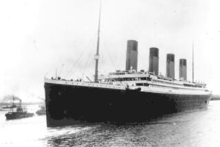
The Titanic was the paradigm of something too big to fail, yet too ill-fated to succeed. It inspired songs, books and hit movies, most notably one starring Leonardo DiCaprio and Kate Winslet as star-crossed lovers. Now, almost on the eve of the 100th anniversary of its settling in its final resting place at the bottom of the North Atlantic, scientists have completed a comprehensive map of the debris field of the Titanic.
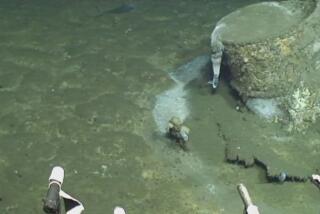
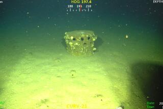
The field, roughly three miles by five miles, was mapped by an expedition team using sonar imaging and more than 100,000 photos taken by underwater robots.
The mapping took place in the summer of 2010 during an expedition led by RMS Titanic Inc., the legal custodian of the wreck, along with Woods Hole Oceanographic Institution of Falmouth, Mass., and the Waitt Institute of La Jolla. They were joined by other groups, as well as cable TV’s History channel.
Details on the new findings at the bottom of the ocean are being closely held, pending a two-hour documentary to air April 15 -- 100 years after the Titanic sank on its maiden voyage from Southampton, England, to New York City. The ship hit an iceberg late on the night of April 14, 1912, causing the plates that made up the hull to buckle and allowing water to rush into the ship.
The Titanic soon sank, killing more than 1,500 of the 2,200 passengers and crew on board.
“With the sonar map, it’s like suddenly the entire room lit up, and you can go from room to room with a magnifying glass and document it,” historian Parks Stephenson, who was involved with the expedition, told the Associated Press. “Nothing like this has ever been done for the Titanic site.”
According to a Woods Hole news release: “Researchers will help their expedition colleagues map the ship’s hull and debris field in high definition and in three dimensions. Large portions of the wreckage are believed to be in danger of collapse after nearly a century 2.5 miles beneath the surface of the Atlantic.”
“Their images and data will help provide a detailed picture of the condition of the wreck. In addition, many deep-sea animals have made the hull their home, and studying the wreckage as a marine ecosystem may help scientists who study deep-water reefs and the unique plants and animals that inhabit the deep ocean,” the release said.
While researchers are hoping that the new mapping will help unravel some of the remaining mysteries of how the ship broke apart and sank, the story of the Titanic is more than the science. It’s the tragedy of its opulent era that resonates through the decades.
Carrying both some of the wealthiest people of the time as well more than 1,000 immigrants seeking a new life in the New World, the Titanic was equipped with some of the best safety and communications equipment of the age. But after the blow from the iceberg, passengers and crew rushed to lifeboats, only to find there were only enough to accommodate perhaps a third of those onboard.
Despite several attempts, the exact location of the wreck of the Titanic remained unknown until 1985. About 5,500 artifacts have been recovered since.
ALSO:
Michigan cuts off food aid for $1-million lottery winner
Solar storm a bit of a dud -- but wait, there’s more to come
Chants of “USA!” -- directed at Latino team -- roil San Antonio
More to Read
Sign up for Essential California
The most important California stories and recommendations in your inbox every morning.
You may occasionally receive promotional content from the Los Angeles Times.


