With fierce El Niño forecast, county officials look for vulnerabilities

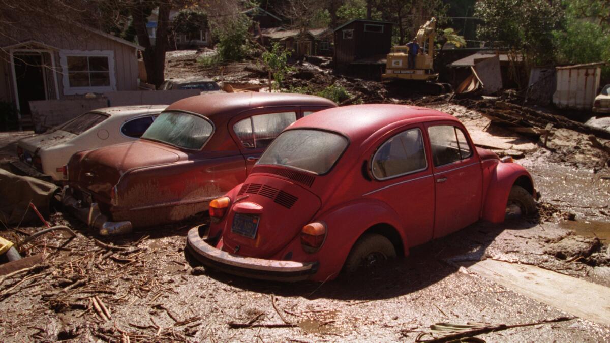
Mudslides after heavy rain destroyed property in Laguna Canyon in 1998.
- Share via
With forecasters predicting a winter of heavy rains thanks to El Niño, officials are beginning to plan for potential flooding.
Los Angeles County supervisors voted unanimously Tuesday to call for a report on the county’s state of preparedness for potentially heavy storms.
The National Weather Service’s Climate Prediction Center said last week that this El Niño is shaping up to be as strong as the 1997-98 El Niño, which sent storms that killed 17 people and caused more than $550 million in damage in California.
See the most-read stories this hour >>
Supervisors Michael D. Antonovich and Hilda Solis, who represent the San Gabriel Valley and some of the county’s most fire- and flood-prone areas, asked for the assessment, saying it is “critical that the county assess its risks and vulnerabilities and prepare for emergency response.”
The report, due back in 30 days, will examine the capacity of county infrastructure to prevent flooding and capture storm water to replenish groundwater basins.
The supervisors also asked staff to look at the county’s preparedness for wildfires that could be sparked by storms and to develop a communications plan to keep other government agencies and the public informed in the event of weather-related emergencies.
At Devil’s Gate Dam in Pasadena, debris that accumulated as a result of the Station fire has put neighborhoods downstream along the Arroyo Seco in danger of flooding.
Los Angeles County plans to remove 2.4 million cubic yards from the Hahamongna flood-control basin above Devil’s Gate Dam over the next five years. Some neighbors, outdoor recreation enthusiasts and environmentalists who oppose the project are suing to stop it.
But the sediment removal project will not start until next year. The county has not yet awarded a contract for the work, said Keith Lilley, who oversees a group of county Department of Public Works staffers who respond to storm events.
There is a risk of flooding south of the dam-- affecting the 110 Freeway, Pasadena, South Pasadena and northeast Los Angeles -- if the San Gabriel Mountains are soaked with a series of unrelenting storms and send large amounts of mud, rocks and burned trees into a full basin, officials said.
“If we had multiple major storms with sediment, the reservoirs would fill up and we would have very little capacity for flood control and water capture,” Lilley said.
A 2011 county report painted a grim picture of what would occur if huge rainstorms hit Devil’s Gate. Under a worst-case scenario, torrential rains could send mud, rocks and water over the dam, with flooding reaching the Rose Bowl, South Pasadena and northeast Los Angeles in less than 40 minutes.
A subsequent report said the Rose Bowl probably wouldn’t be flooded in a single storm but could be at greater risk after a series of storms if sediment isn’t quickly removed from areas downstream from the dam.
Twitter: @sewella
ALSO:
Massive Rocky fire was sparked by faulty water heater, investigators say
Former L.A. sheriff’s captain is expected to plead guilty in jail scandal
Steve Lopez: Pizza maker burns time and dough on red tape
More to Read
Sign up for Essential California
The most important California stories and recommendations in your inbox every morning.
You may occasionally receive promotional content from the Los Angeles Times.


