This earthquake fault in northeast L.A. and Pasadena isn’t well known, but experts say it poses dangers
- Share via
California officials have mapped a new stretch of an earthquake fault through northeast Los Angeles — a fault that could cause major damage in the heart of the metro area.
The Raymond fault has long been known as a potentially dangerous fault for Los Angeles and the San Gabriel Valley, and caused the magnitude-4.9 Pasadena earthquake in 1988, said Tim Dawson, senior engineering geologist with the California Geological Survey.
But it’s a fault that can pack a punch. That 1988 earthquake literally threw seismologist Lucy Jones out of bed. “The wave was coming up at me,” Jones recently recalled. “It was the most scared I have been in earthquake shaking.”
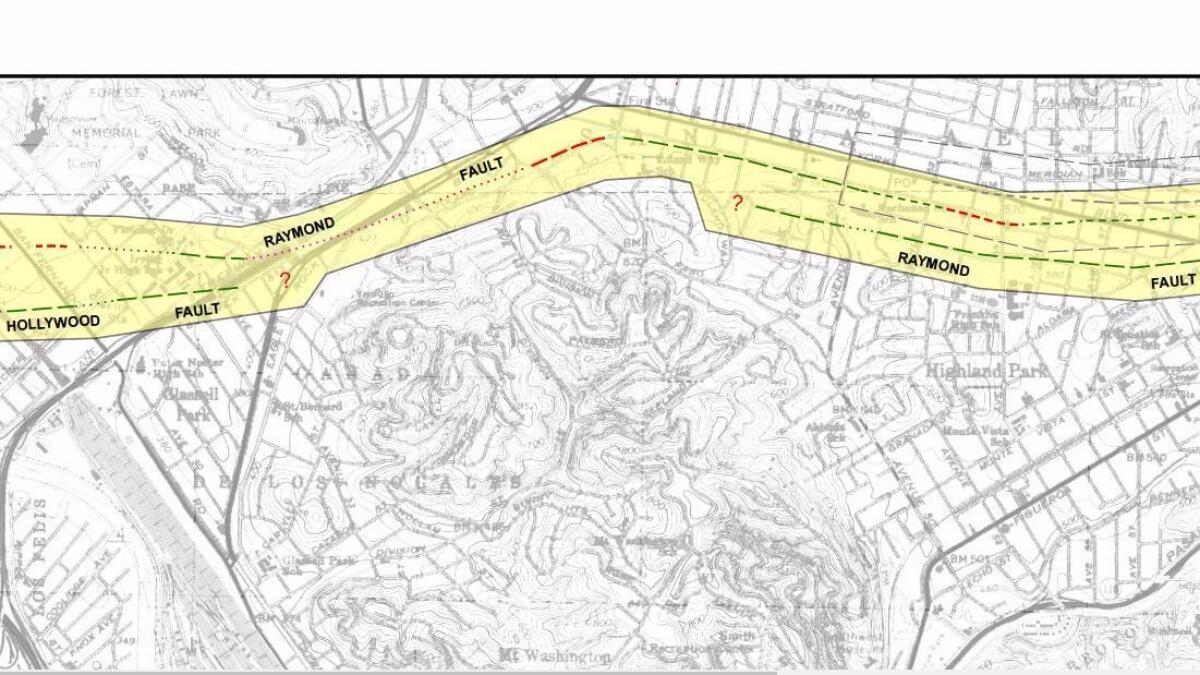
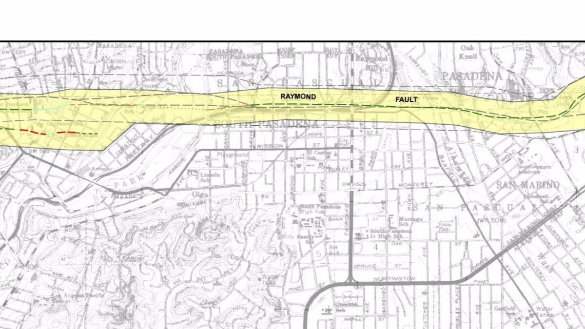
And it’s capable of a much worse earthquake. It could cause an earthquake as large as a magnitude 7. The Raymond fault runs from northeast L.A. through South Pasadena, Pasadena, San Marino, Arcadia, Monrovia and the unincorporated area of East Pasadena. For stretches, the fault runs alongside parts of Eagle Rock, York and Huntington boulevards, and under a stretch of the 110 Freeway in South Pasadena.
A known hazard
Earthquake faults are giant cracks in Earth's surface; a boundary line of sorts between shifting tectonic plates. When a major earthquake hits a fault like the Raymond, the plates suddenly move in opposite directions along the path of the fault.
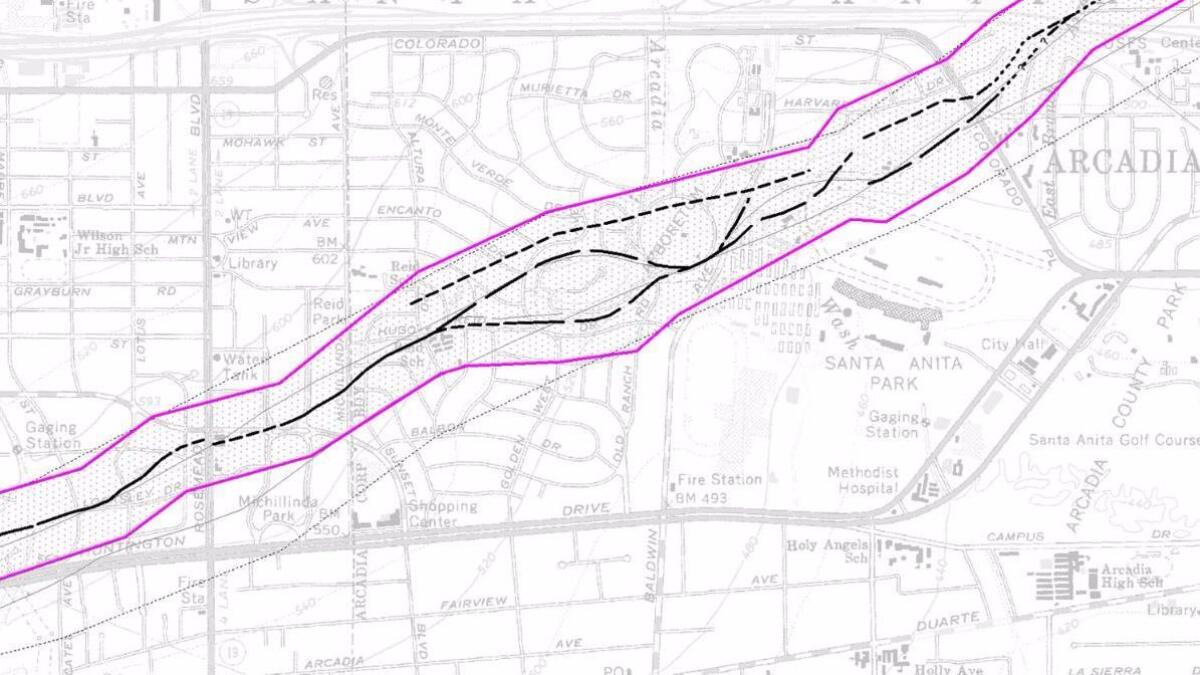
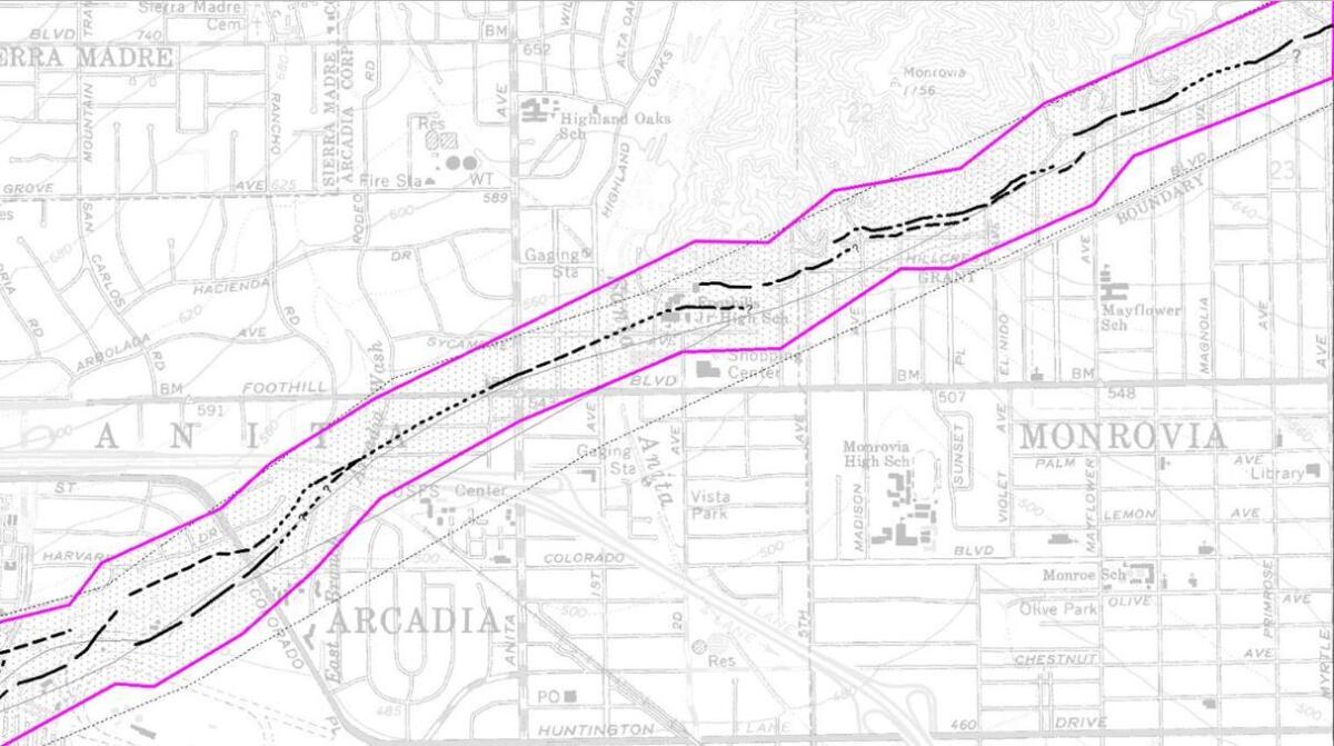
The Raymond fault has long been known to experts, and much of the fault was mapped in the 1970s by the state. On June 15, the California Geological Survey issued a revised map of the Raymond fault.
The most significant changes involved extending the fault to the west, adding areas of Glassell Park, Eagle Rock and Highland Park to the Raymond fault zone. The fault zone was also moved farther south in Highland Park.
In the San Gabriel Valley, changes to the so-called Alquist-Priolo earthquake fault zone were minor.
Anyone seeking to build a new structure for human occupancy in an earthquake fault zone is required to conduct testing to determine whether they would be building directly on top of a fault.
State law generally bans construction of new buildings directly on top of an earthquake fault.
California Geological Survey updated maps of Raymond fault »
‘It is an active fault’
A big earthquake on the Raymond fault could produce catastrophic damage locally. It’s also possible that it could rupture almost simultaneously with the Hollywood fault.“This is a fault right in the urban area,” Dawson said. “It is an active fault. There are a lot of buildings in close proximity of the fault.”
Vulnerable communities in the fault’s path
Los Angeles has taken steps to reduce the threat of major earthquakes; city leaders in 1981 ordered that brick buildings be retrofitted or demolished and in 2015 passed a new law requiring vulnerable wood apartments and and concrete buildings to be retrofitted.
Suburbs are far behind.
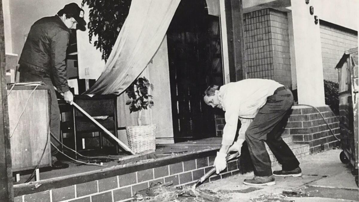
South Pasadena only recently decided to take a new look at brick buildings and found out that nearly half of the 60 brick structures — including stores, restaurants, apartments and churches — in that city were not retrofitted. Last year, the City Council voted to require the rest of them to be fixed, giving owners a deadline of 2½ years to comply once they receive a new order to do so.
Also a problem: Apart from L.A., Santa Monica and West Hollywood, most cities across Los Angeles County have not mandated retrofitting of wooden apartment buildings with flimsy ground floors that serve as carports or garages. Such vulnerable apartments are common across the region on top of the fault, like in South Pasadena, and near the fault, such as in Alhambra.
Sixteen people died in the collapse of such an apartment building during the 1994 magnitude-6.7 Northridge earthquake.
Raymond fault quakes created area’s lakes and hills
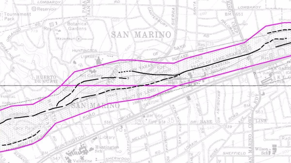
Evidence for the fault has been clear to geologists for decades. A lake that once sat at what is now Lacy Park in San Marino was created by the fault, a result of land sinking from past earthquakes, Dawson said.
The past earthquakes also created the hills that are now part of the Los Angeles County Arboretum & Botanic Garden in Arcadia, as well as those that give the commanding views at the Huntington Library, home to a historic estate, library, art collection and gardens established by railway magnate Henry Huntington.
“The Huntington Library sits on the upthrown side of the Raymond fault. When the Huntingtons moved there, they moved there because it had a nice view — that view was created by the fault,” Dawson said. “Over many earthquakes, that hill has gone up.”
A slow-moving fault
Compared with the fastest moving faults in the state, the Raymond fault moves slowly. The Raymond fault moves at about one-tenth the speed of the infamous San Andreas fault, Dawson said.
That means that the Raymond fault doesn’t rupture as often as the San Andreas, a stretch of which north of L.A. is believed to experience a big quake every 100 years on average. That section of the fault last caused a magnitude 7.9 earthquake in 1857.
Scientists suspect the last time the Raymond fault produced an earthquake of magnitude 6 or above was 1,000 to 2,000 years ago. They believe that such events happen every few thousand years on average.
But earthquakes don’t happen like clockwork, and scientists cannot say for certain when the Raymond fault will rupture next.
UPDATES:
10:55 a.m.: This post was updated with a comment from seismologist Lucy Jones.
This post was originally published at 9:10 a.m.
Sign up for Essential California
The most important California stories and recommendations in your inbox every morning.
You may occasionally receive promotional content from the Los Angeles Times.


