Tsunami would flood large swath of Southland coast, USGS says

- Share via
A large tsunami hitting California would cause major flooding in Long Beach and parts of Orange County and force 750,000 people to evacuate coastal areas in a few hours, according to extensive simulation published Wednesday by U.S. Geological Survey.
The study, released two years after a tsunami killed thousands in Japan, identified several communities that are particularly vulnerable to flooding because of their low elevation and lack of protection from waves. They include Marina del Rey, the ports of Los Angeles and Long Beach as well as a swath of low-lying coastal areas between San Pedro and Newport Beach.
The report, compiled by dozens of scientists, emergency responders and industry representatives, is the most extensive examination of what a tsunami would do California’s coastline. The research simulated a 9.1 quake off the Alaska coast that would send damaging waves to California.
While waves would be larger in Northern California — between 10 feet to 23 feet — the damage could be greater in Southern California because the region has more coastal development and fewer protective coastal cliffs.
Tsunami waves of 3 feet to 10 feet could submerge blocks of Long Beach south of Ocean Boulevard, including the Aquarium of the Pacific, Long Beach Convention Center as well as the Shoreline Village and Pike shopping centers. Those same sized waves could cause flooding around the affluent communities of Newport Bay and Huntington Harbour as well.
California has been preparing for decades to deal with major earthquakes. But only more recently have officials begun extensive tsunami planning, including establishing evacuation routes in coastal cities. The research for the simulation was expanded after the Japan tsunami focused more attention on the risk, said Lucy Jones, the U.S. Geological Survey seismologist who led the project.
“The idea is to say: Look, these are not distant events, these could actually happen here,” added Kathleen Tierney, director of the Natural Hazards Center at the University of Colorado-Boulder. “This is meant to get tsunamis on the public’s radar.”
Under the study’s scenario, the first waves would hit Crescent City, in the far north of the state, in as little as four hours. The wave would make their way down the coast, arriving in San Diego two hours later.
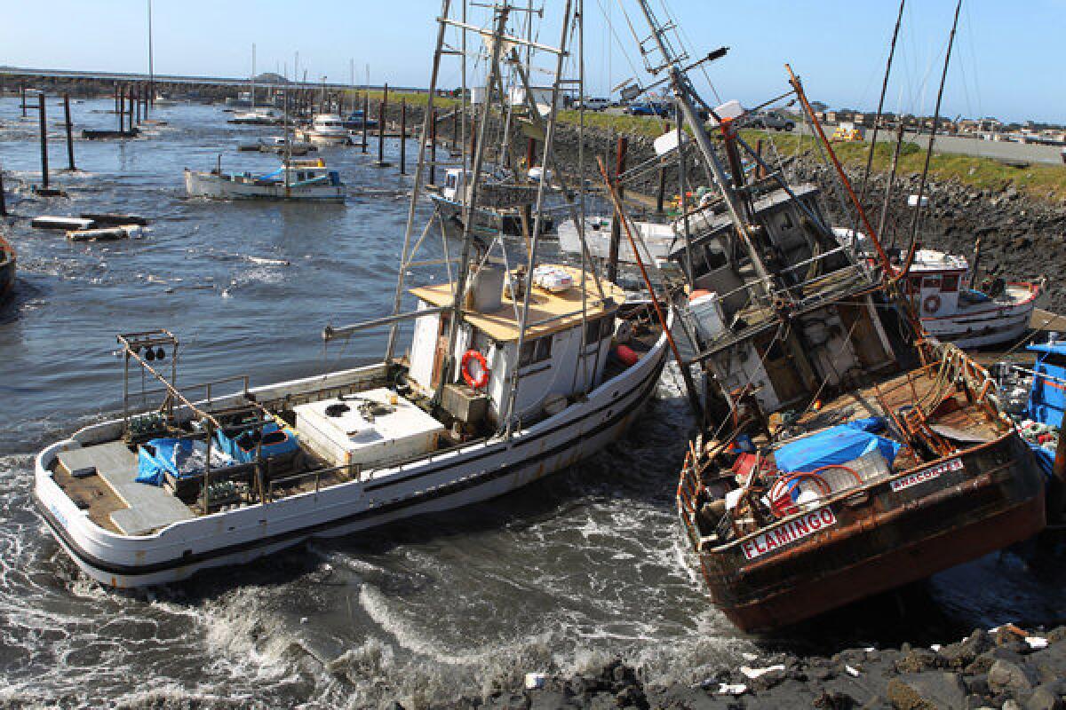
Researchers said the waters would cause sewage to foul beaches, damage fishing boats in marinas and make more than 8,000 people homeless. A tsunami could also travel several miles inland up coastal rivers. Statewide, one out of three boats in coastal harbors and ports could be damaged or sunk, and the cost of the disaster could approach $8 billion.
The biggest challenge will be evacuating everyone before a tsunami hits. Some areas, like Balboa Island in Newport Beach, have only narrow roads to evacuate.
During summer beach season, evacuation could be significantly more difficult. More than 250,000 people at beaches and coastal parks would have to evacuate in the spring. And that number jumps to 1 million in the summer.
ALSO:
Siskiyou County votes to pursue secession from California
Possible pipe bomb blast at Santa Ana hardware store investigated
Authorities trying to determine if burned body is that of missing teen
More to Read
Sign up for Essential California
The most important California stories and recommendations in your inbox every morning.
You may occasionally receive promotional content from the Los Angeles Times.


