L.A. area has many freeways that stayed on the drawing board
- Share via
When suburbs began spreading out across Southern California after World War II, officials envisioned a sprawling freeway system to get people around.
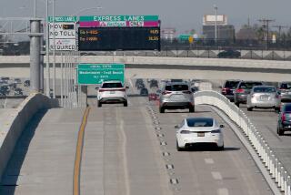
But big chunks of that system were never built, and that’s one cause for the clogged commutes many face.
Unbuilt freeways were planned in what are today some of L.A.’s most congested areas. The Beverly Hills Freeway was supposed to connect the 101 and 405 freeways along Santa Monica Boulevard and Melrose Avenue. Another freeway was supposed to run alongside La Cienega Boulevard, La Brea and Highland avenues, connecting Los Angeles International Airport to the Hollywood Bowl. Routes were also planned following Pacific Coast Highway and train tracks that would have connected Manhattan Beach to the 405.
So what caused the era of the new freeway to end in Los Angeles?
Brian Taylor, director of UCLA’s Institute of Transportation Studies, writes that it was soaring costs and a lack of funds that spelled the end of the freeway building program.
Initially, money for freeway building flowed. California gasoline taxes were raised in 1947 and 1953, and Congress passed the Federal-Aid Highway Act of 1956. Seizing homes for freeways was astonishingly easy after World War II; Taylor writes it took less than three weeks for the state to begin tearing down homes along the 110 Freeway route south of downtown after asking a court for permission.
The last freeway project in L.A. County, the 105 Freeway, needed nearly 20 years to do the same.
Other factors? In some areas, freeway revolts were successful, the most famous being in Beverly Hills and South Pasadena, whose residents organized against construction. But even freeways that were actually popular with locals were abandoned as speculators snapped up property along the planned route, hoping for a windfall when the state wanted to take over the land, according to a report co-written by Taylor.
Modern freeways also cost more. The oldest freeways in California, such as the 110 between downtown and Pasadena, can handle a maximum speed of only 55 mph. But most freeways were eventually built to handle 70-mph speeds, Taylor writes, which forces much more land to be acquired so they can be built with more gentle curves. By 1980, the cost of highway construction in California was nearly six times what it was in 1960, far exceeding inflation.
Remnants of old freeway stubs remain around Los Angeles. The abbreviated California 2 Freeway that ends in Silver Lake and Echo Park was meant to connect with the Beverly Hills freeway — that’s the reason for the extra-wide parcel of land between the northbound and southbound lanes of the 101 at Vermont Avenue, which was meant for a freeway interchange.
In Burbank, a portion of a planned freeway has been turned into Whitnall Highway Park.
Pictured here is a 1949 Automobile Club of Southern California map that closely resembles the one published in 1946 by the Los Angeles Metropolitan Parkway Engineering Committee and signed by the city’s mayor and the chairman of the county Board of Supervisors.
More to Read
Sign up for Essential California
The most important California stories and recommendations in your inbox every morning.
You may occasionally receive promotional content from the Los Angeles Times.


