‘Way, way, way above normal’ rains could set all-time L.A. record as wet weather continues

- Share via
After a comparatively dry fall in Southern California, there was a point last December when it seemed like the fears of a strong, wet El Niño winter may have been overblown.
So much for that.
In a matter of weeks, a succession of powerful storms flipped the script, dumping a stream of record-setting, intense rainfall across California, much of it on the state’s southwestern region.
That wet pattern has continued as winter has given way to spring, with this past weekend’s storm dumping up to 4 inches of rain in some areas — pushing Los Angeles to a new two-year rain total not seen since the late 1800s and forestalling any hope for a quick end to the rainy season.
As of Monday morning, downtown Los Angeles had received 52.46 inches of rain in the latest two water years, the second-highest amount in recorded history. The only other two-year October-through-September period — the period for the so-called water year — that saw more rain was from 1888 through 1890, according to the National Weather Service.
“When you consider the records since 1877 in downtown L.A. ... the second [largest total] is hugely significant,” said Joe Sirard, a meteorologist with the National Weather Service in Oxnard. “We’re obviously way, way, way above normal for two years in a row now. For a dry climate like the Los Angeles area, it’s huge.”
And there’s probably more on the way. A low-pressure system is brewing off the California coast, expected to move inland later this week, weather officials said, driving above-average precipitation forecasts for much of the state through April 10.
The Easter weekend storm moving into Southern California is expected to create hazards across the region, with possible flooding, thunderstorms, heavy snow and strong winds.
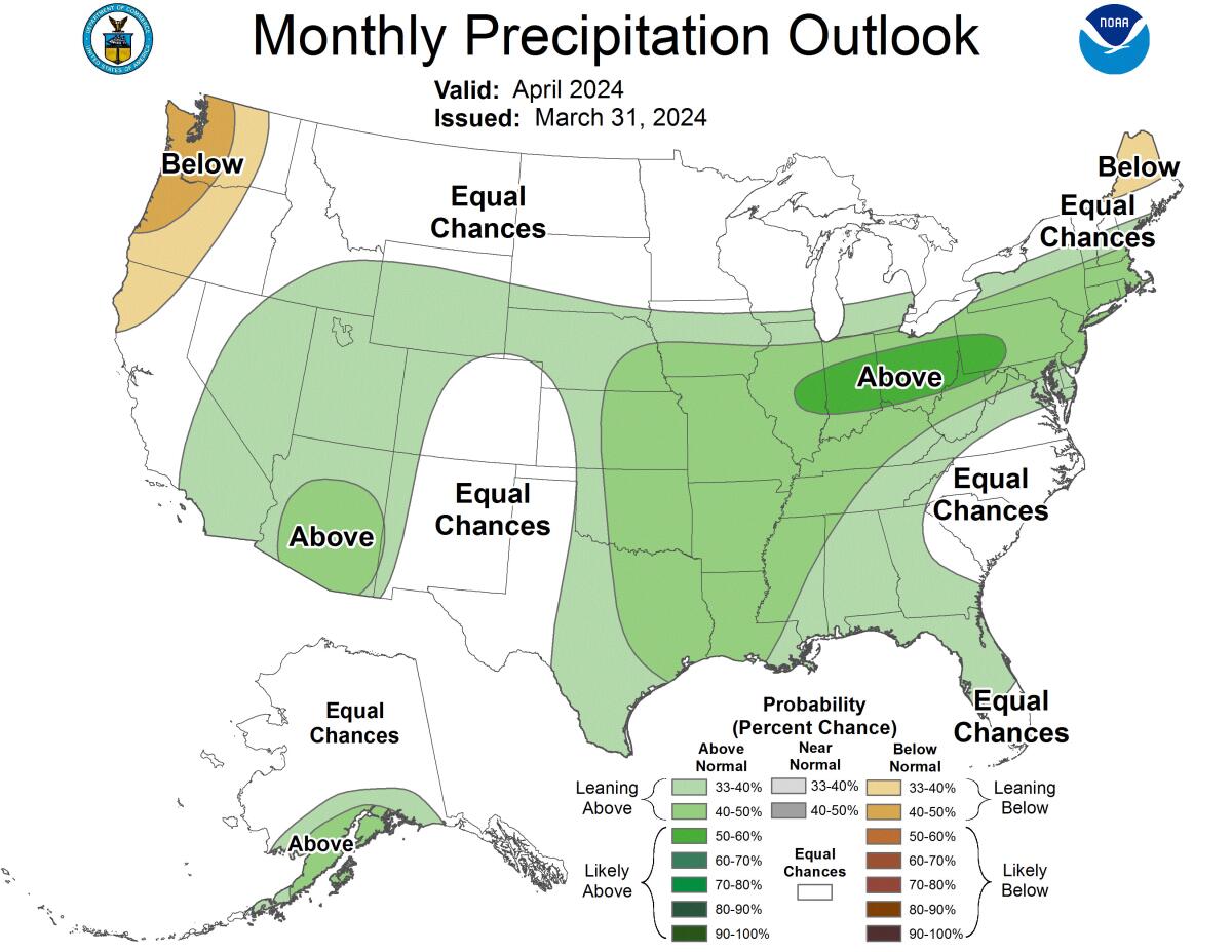
Nor do forecasters expect that storm to close out the wet season, with the long-range forecast for April favoring slightly-above-average precipitation in Southern California, according to the Climate Prediction Center.
“We don’t think it’s the end of the rainy season yet,” said Anthony Artusa, meteorologist with the National Weather Service’s Climate Prediction Center. He said a wetter pattern should linger through April and maybe into early May, fueled by the last vestiges of an El Niño-Southern Oscillation — the climate pattern in the tropical Pacific that tends to drive wetter weather in California.

The current El Niño is transitioning to a more neutral pattern, and a La Niña is expected to take over by the summer, bringing typically cooler and drier weather. But because the atmosphere tends to lag behind the changes to the Pacific’s surface temperatures, Artusa said, “we’re seeing an extension of these [El Niño] effects even later on into April.”
Indeed, this year’s soggy winter was in many ways a “canonical” El Niño event — particularly because most of the storms arrived in late winter and are continuing through spring, according to Alexander Gershunov, a research meteorologist at the Scripps Institution of Oceanography at UC San Diego.
“El Niño and La Niña signals typically kick in — when they do kick in, because it’s not always the case — in January, February, March, and that’s exactly the part of the year that was anomalously wet this year,” he said.
However, not all of the wet weather can be attributed to El Niño. Last year’s soaking storms occurred during a La Niña event, and Gershunov noted that some of the state’s wettest years this century have occurred during La Niña years, which also included 2011 and 2017.
“In all of these cases, atmospheric river activity was extremely strong,” he said. “What we are finding out is that atmospheric rivers don’t always dance to the tune of [El Niño], and they can make or break” the textbook El Niño pattern.
There’s a 55% chance La Niña could develop between June and August, and a 77% chance it could develop between September and November, NOAA said.
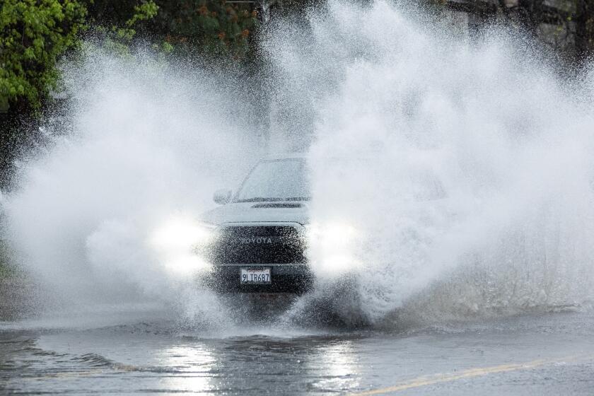
This latest Easter weekend storm caused some freeway flooding, brought brief hail and dropped 2 to 4 inches of rain across the region, with some mountain areas hitting totals closer to 5 inches, according to the weather service. It was far from the strongest storm this rainy season, but it still brought impressive rain totals: 2.1 inches in downtown L.A., 4.67 inches in Lytle Creek, 4.09 near Lynwood, 3.92 in Compton and 3.54 in Stunt Ranch.
The heaviest and most widespread rain fell from late Friday into early Saturday, setting several daily rainfall records for March 30, including in downtown L.A. with 1.73 inches, Long Beach with 1.86 inches and Palmdale with 1.12 inches. Snowfall totals hit 22 inches in Green Valley Lake, 14 inches in Snow Valley and 10 inches in Big Bear City, according to the National Weather Service.
Last month, though, daily rainfall totals more than doubled the March 30 records when a deadly atmospheric river storm walloped the Southland and much of the Golden State, triggering hundreds of mudslides, significant flooding and destruction. That system dumped 4.1 inches of rain on downtown L.A. in one day, making Feb. 4 the wettest day in February history.
That system followed a string of strong storms that brought significant rains and severe flash flooding in some areas. Most notably, in late December, a month’s worth of rain fell in less than an hour and inundated Oxnard. Then in January in San Diego, historic rainfall filled one-story homes, turned roads into rivers and forced rooftop rescues.
“We’ve had a number of very heavy, high-intensity rainfall events,” Sirard said.
With more rain on the horizon for Southern California, Sirard said he wouldn’t be surprised if this two-year period ends up the wettest in City of Angels history, as the current count is less than 2 inches short of the all-time record, 54.1 inches, which fell from 1888 to 1890.
“We actually have a very decent chance of setting the all-time record,” Sirard said.
Last year became the seventh-wettest water year in L.A.’s history with 31.07 inches falling from Oct. 1, 2022, through Sept. 30, 2023. National Weather Service meteorologists consider 14.25 inches the area’s normal annual rainfall, making last year’s total more than 200% of average. With six months left to go, this water year has recorded 21.39 inches, currently the 22nd wettest in recorded history.
From California to New England to Europe, many areas of the Northern Hemisphere are approaching a ‘snow-loss cliff’ due to global warming, researchers say.
This year’s wet winter may also have broader climate impacts, Gershunov said, including potential effects on the coming wildfire season. Mountain and forest ecosystems will probably see less fire activity because late winter and spring snowpack tends to melt gradually, promoting wetter soils and less combustible vegetation in the summertime.
On the other hand, anomalous precipitation in coastal ecosystems — such as the strong storms that fell this winter and spring in Los Angeles and San Diego — are promoting the growth of new grasses and other light plants that could potentially feed flames.
“All of that is going to be dry when the coastal fall wildfire season rolls around with the onset of Santa Ana winds next October,” Gershunov said.
And while this year seemed to follow the El Niño playbook, he noted that the climate pattern doesn’t always live up to the hype, such as the El Niño of 2015-16, which was billed as a monster event that ultimately produced average precipitation in California. In fact, when measured on a statewide basis, precipitation is hovering just around average this year, with 20.9 inches since the start of the water year on Oct. 1, or about 107% of average for the date, state data show.
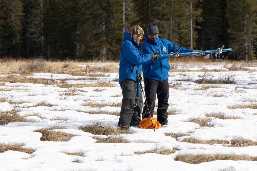
With more than 30 million acre-feet of water in storage, the state’s reservoirs are at 116% of their historical average. Meanwhile, snowpack is at 105% of its average for April 1, the date when it is typically at its peak.
“It’s important to realize that ‘average’ precipitation very rarely occurs in California,” Gershunov said. “California’s hydroclimate is volatile — we get either dry years or wet years, and that’s pretty typical. It’s very unusual to get an average year in terms of precipitation in California.”
Such swings between wet and dry conditions are expected to worsen as climate change upends traditional patterns in the years and decades ahead. Already, global warming is contributing to shrinking snowpacks in part due to warmer storms that are falling as rain instead of snow.
“We can still get very heavy snow years like last year, which saw many cold winter storms,” Gershunov said. “But those years are expected to become less and less frequent.”
More to Read
Sign up for Essential California
The most important California stories and recommendations in your inbox every morning.
You may occasionally receive promotional content from the Los Angeles Times.


