‘Unusually heavy’ rains caused Rolling Hills Estates landslide, city report finds
- Share via
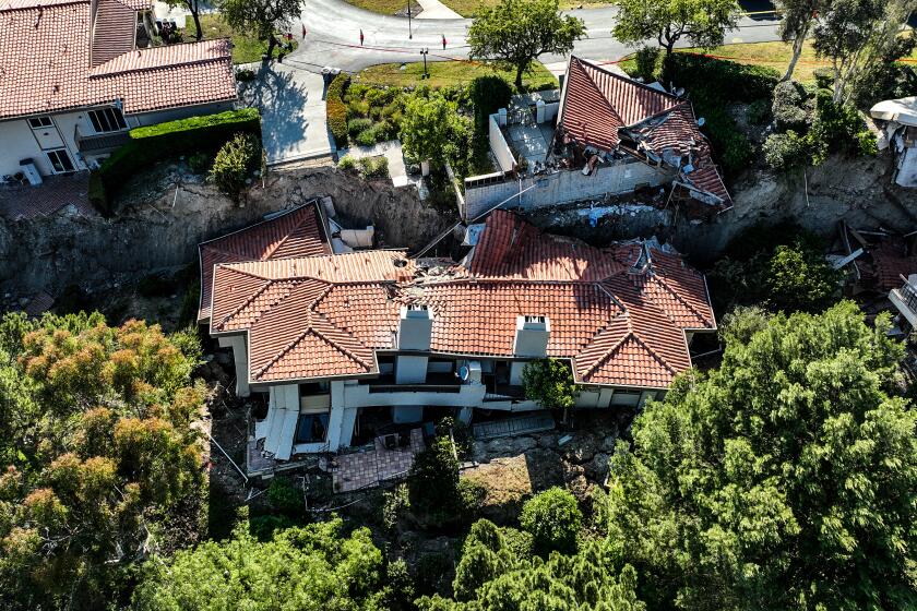
Excessive rainfall last winter from a string of atmospheric river storms caused a landslide in Rolling Hills Estates in July that destroyed eight homes and deemed several others unsafe, according to a city report released this week.
The report, prepared by an outside geotechnical engineering firm, found “the primary factor that caused the Peartree Lane slope failure was the unusually heavy rainfall that occurred during the winter of 2022-2023.” The 277-page analysis, conducted by Irvine-based GeoKinetics and reviewed Friday by The Times, is considered a preliminary assessment.
The report also identified secondary factors that “impacted the timing of the slope failure,” including “long term changes in the hillside vegetation” and “failures along the relatively steep slope.” The findings were based on a review of historical geologic and topographic information, engineering analyses, soil testing and rainfall data.
But a different analysis prepared by a separate company for the neighborhood’s homeowners association, as well as an ongoing examination requested by attorneys, has left some residents skeptical of the city’s findings.
“We are not satisfied with the city’s preliminary assessment,” said Steve Blum, an attorney specializing in landslide litigation who is representing a majority of residents affected by the landslide. “It would not be unusual for a report like this prepared for a client … to be self-serving.”
It could be up to two months before geological experts evaluating the Rolling Hills Estates landslide have any preliminary answers.
But Glenn Tofani, the principal engineer on the GeoKinetics report prepared for the city, stood by his findings Friday.
“The conclusions presented in our report are objective and based on the available facts and information,” Tofani said in an email. “Our conclusions are not affected by who we are working for.”
Tofani also pointed out that he worked in close contact with GMU Engineers and Geologists, an Orange County firm hired by the homeowners association.
“Based on my discussions with the GMU representatives, I believe that our conclusions are generally very similar,” he said. “We are continuing to work together to gather additional information and to identify actions that should be taken moving forward.”
However, the city’s report also made clear that it remains “distinct and separate” from the homeowners association’s private investigation from GMU.
The city’s report, compiled with support from the Los Angeles County Office of Emergency Management, was prepared as part of a disaster reimbursement from the Federal Emergency Management Agency, according to city spokesperson Alexa Davis. The report was submitted to FEMA last week, she said.
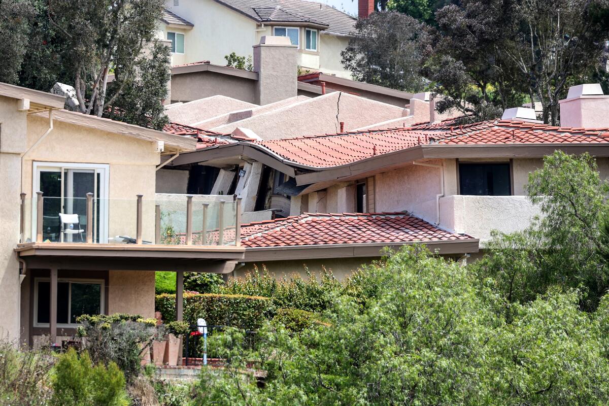
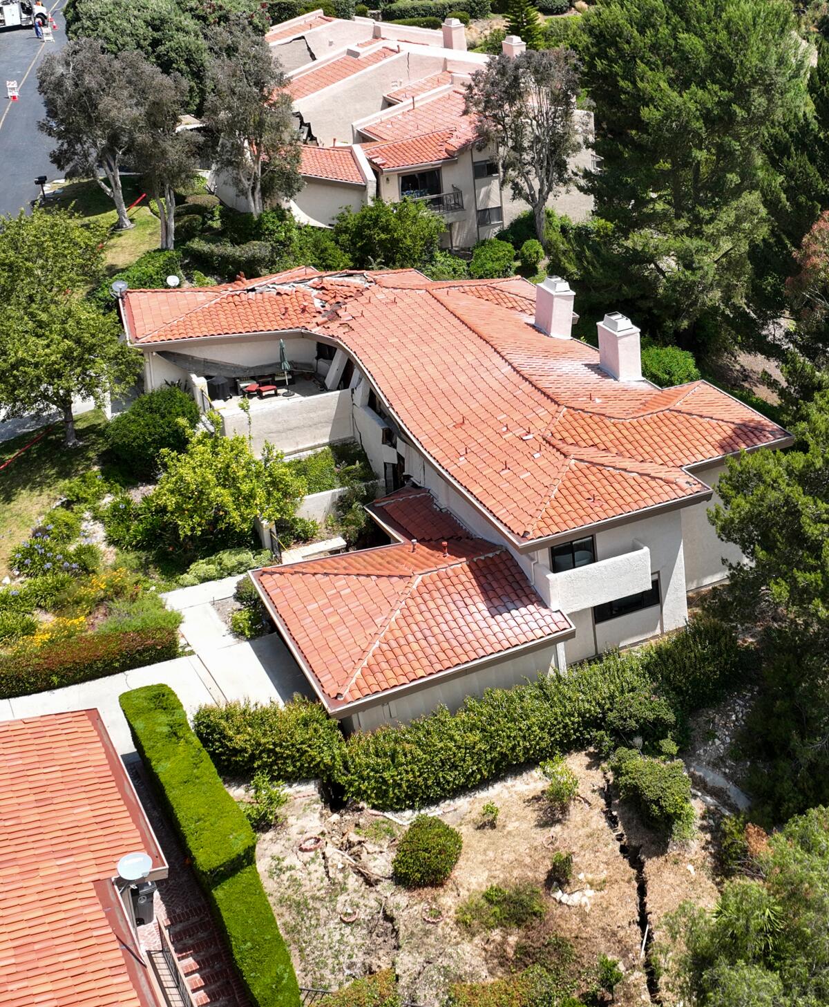
The devastating landslide on Peartree Lane in the Rolling Hills Park Villas community forced the evacuation of a dozen homes on July 8, when the hilltop street started to sink. Within hours, many homes had fallen down the canyon slope, their roofs caved in and foundations destroyed.
The new report shows the landslide moved the existing slope about 45 feet down the canyon. Eight homes were destroyed, four others remain red-tagged and five more are still yellow-tagged because of utility damage from the land movement. Most of the red-tagged homes have been ruled structurally unsound and all have been deemed unsafe for reentry. The yellow-tagged homes — which do not sit directly atop the steep canyon wall — have had their water shut off from a damaged sewer line, making them accessible by residents, but not livable.
Just the roof of Weber ‘Wei’ Yen’s home is visible from his street in Rolling Hills Estates. He worries over the mementos he may never get back.
Blum hasn’t filed a lawsuit on residents’ behalf — yet. He said his team is waiting to complete its own analysis of what prompted the landslide. He questioned how this year’s rains could be the primary cause, given prior rainy seasons that have been more extreme, something GeoKinetics noted in the city’s report.
“Since the site was developed in the late 1970s and early 1980s, there have been three prior winter seasons with winter rainfall totals higher than that which occurred during the winter of 2022-2023,” the report said.
Blum didn’t question that rain was likely a factor in the slide — one of many — but said that “over the years, there have been bigger [rainfalls] than this rainfall.”
The preliminary investigation from the HOA’s geotechnical firm — which homeowners officials said is ongoing — pointed to “progressive failure” involving erosion from stormwater running through the bottom of the canyon, which “exposed weak bedding of the sedimentary rock, allowing local downslope movement to initiate,” according to a presentation shared with residents and reviewed by The Times. That movement caused surface cracking, which was “likely infiltrated” by groundwater and rainwater and resulting in the slope failure, the presentation said.
In contrast, the city’s report from GeoKinetics did not focus on erosion or call it a factor in the slide.
“Erosional cutting along the canyon invert into the slope ... does not appear to have occurred,” the report said.
Instead, it pointed to the presence of surface failures “along the relatively steep slope” that were not apparent in prior rainy years but had developed last winter, the report said. These failures “likely resulted from saturation along the face of the slope during the major storm events.”
The report does reference at least one prior land movement issue in the neighborhood — a 1986 incident at 21 Peartree Lane, just west of the recent slope failure — which was caused by “poor fill compaction and associated settlement/creep.” Consultants at that time found “no indication of gross slope instability,” the report said.
The homeowners management company, Scott Management, declined to comment or respond to questions from The Times. GMU officials also did not respond to questions.
The city’s report also disputed some concerns among Rolling Hills Estates neighbors, saying its team found “no pre-existing slope failure.”
“The recent failure appears to represent a new feature as opposed to the reactivation of a pre-existing slope failure,” the report said. It also ruled out leaks from public utilities.
Residents, already worried about their homes’ safety and value after the disaster, say they are now facing the expensive and lengthy process of trying to mitigate the slope failure, a process the HOA has told members would cost $4.3 million. They recently presented a plan to divide that cost among the almost 200 homeowners, for a fee of almost $24,000 each.
The first step is to work on a city-mandated “winterization” of the slope, including a stormwater line through the canyon, sandbags, plastic sheeting and filling cracks with concrete, according to the homeowners association presentation.
More to Read
Sign up for Essential California
The most important California stories and recommendations in your inbox every morning.
You may occasionally receive promotional content from the Los Angeles Times.
