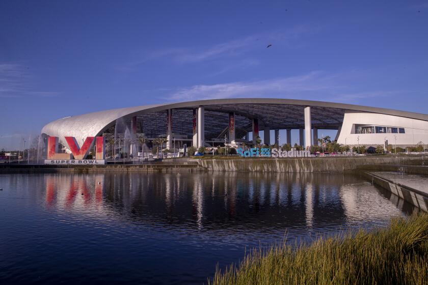
Is climate change heating up the Super Bowl?

- Share via
With Los Angeles in the grip of a winter heat wave, this year’s Super Bowl might be the warmest on record, prompting some to ask if climate change has collided with the nation’s biggest sporting event.
Experts say it’s not that simple and warn of the difficulty of attributing a single meteorological event to a long-term trend like global warming.
But at the same time, they said, rising temperatures are driving up the probability that unseasonable heat events will occur.
“Due to climate change, we’re basically shifting the baseline toward these warmer temperatures,” said UCLA climate scientist Karen McKinnon. “All else being equal then, that makes an event like this more likely.”
The National Weather Service has issued a heat advisory for the Los Angeles coast and the San Fernando and San Gabriel valleys that’s in effect through 6 p.m. Sunday, said Rich Thompson of the National Weather Service. Usually based in Oxnard, Thompson is currently working from Inglewood’s Joint Information Center as an incident meteorologist for Super Bowl LVI.
Such a weather advisory is unusual — potentially unheard of. The Weather Service’s Oxnard office has never issued one in February going back to at least 2006, Thompson said.
“I can pretty much guarantee that before 2006, we issued very, very, very few heat products in February, if any at all,” he said. “So this is definitely a rarity for us.”
Temperatures have been reaching highs of 85 to 90 degrees, about 15 to 20 degrees above normal for this time of year, he said. Multiple daily records were set Thursday, with Bob Hope Airport in Burbank hitting 89 degrees, breaking the record of 87 set in 1971.
If the heat continues through Sunday, as expected, the Super Bowl’s field temperature at kickoff could surpass the record 84 degrees reported at L.A.’s Coliseum on Jan. 14, 1973 — the current record-holder for the hottest Super Bowl.
“We’ll be pushing that,” Thompson said. “We definitely have a chance to be the warmest on Sunday. It’s something we’ll be watching.”
Temperatures could be 20 degrees above average, with no rain forecast, thanks to an unusually strong high-pressure system over California.
The heat is a big concern for public health authorities, who are stressing that people should stay hydrated and limit outdoor activities, he said.
“You have a lot of people coming in from out of town from colder climates so they’re definitely not acclimated to this,” he said.
There are a couple factors that could influence whether the heat breaks the 1973 record, some of which are still taking shape.
This Super Bowl will be played later in the year than any other in the past, because the NFL added a regular season game, said state climatologist Michael Anderson.
“As we get further away from the winter solstice and the length of the day gets longer, we have more hours of sunlight,” he said. “So we have an opportunity for that temperature to get warmer, just from a climate perspective.”
At the same time, the 1973 game started at 1:30 p.m., whereas this year’s kickoff is at 3:30 p.m. Generally speaking, the highest temperatures tend to occur around 1 or 2 p.m., but that can vary from day to day based on how the wind is blowing, Thompson said.
Another difference is the location. This year’s game is taking place at SoFi Stadium in Inglewood, which is closer to the coast than the Coliseum. Temperatures tend to be slightly cooler in coastal areas, but they’re tricky to forecast because they are determined by how strong the sea breeze or offshore flow is, Thompson said.
“Just a slight difference in pressure gradients from one day to the next can cause the sea breeze to come in a couple hours earlier and make temperatures a few degrees cooler than we forecast or do the opposite,” he said. “It’s kind of a microclimate thing, dealing with the sea breeze and temperatures in the coastal plain. It can be quite the challenge.”
The heat wave is caused by a ridge of high pressure building aloft high in the atmosphere, bringing sunny, cloudless skies, Thompson said. That’s combined with Santa Ana winds, which originate inland, gaining speed, warming up and drying out as they move from higher to lower elevations and squeeze through narrow canyons and passes.
The condition is not uncommon for this time of year — Santa Anas tend to occur throughout the winter, Thompson said. What’s anomalous is the duration of the event, he said.
“Usually we get maybe a day or two of this setup, but this is four to five continuous days of this setup which is pretty unusual this time of year,” he said.
Inglewood residents wait to see what the nation’s biggest sporting event will mean for a place that yearns to once again be a ‘City of Champions.’
The strength and scale of the high pressure system are also unusual, Anderson said, noting it covers most of the western U.S., almost up to the border with Canada.
“In terms of size, it’s just massive,” he said.
It’s unclear whether climate change is influencing the high pressure system itself, but it’s possible, Anderson said.
“In a warming world, you have the possibility for the weather system to have more energy,” he said. “And how it uses that energy is strong storm systems and stronger high pressure systems. The fact that it has more energy to work with means they can become stronger, larger and more intense.”
In order to figure it out, scientists would need to run extensive computer simulations to determine whether natural variability allows for a high pressure system this large and strong to be in place for this long and if not, what elements of anthropogenic warming could explain it, he said.
This is what climate scientists call the dynamic response to climate change — how the atmospheric circulation and weather systems might be affected by rising temperatures — and it’s still being studied, McKinnon said.
“These larger questions of, are heat waves getting more intense due to a change in the circulation, that right now is something that’s still up for debate,” she said.
Better understood is the thermodynamic effect of climate change, she said. An increase in the atmospheric concentrations of greenhouse gasses has very clearly led to increases in temperatures, which have on average risen about a half a degree per decade since 1945, she said.
“Our baseline of what the average February temperature looks like is increasing, and that’s clearly related to climate change,” she said. “But whether or not the probability of this specific circulation pattern that we’re seeing that’s causing the heat wave right now is changing with climate change, that’s an area still of active research.”
More to Read
Sign up for Essential California
The most important California stories and recommendations in your inbox every morning.
You may occasionally receive promotional content from the Los Angeles Times.


