A breezy, bone-dry Christmas holiday is likely in the Los Angeles region

- Share via
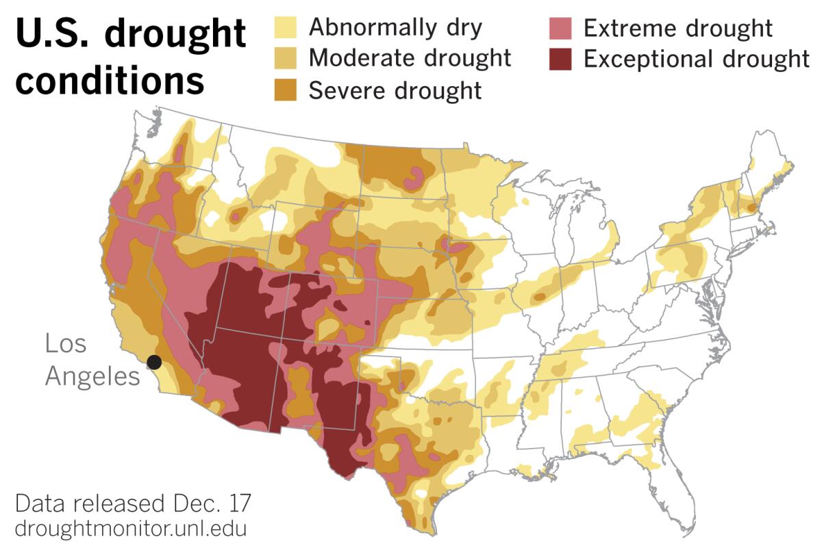
Areas of severe and extreme drought expanded in Southern California, an area that has received less than 25% of its normal rainfall during the last three months, the U.S. Drought Monitor reported Thursday.
That’s not likely to change in the coming week, as gusty Santa Ana winds bring elevated fire weather conditions to the region through Monday, the National Weather Service said. More strong, gusty north to northeast winds are possible Wednesday into Thursday, causing elevated to near critical fire conditions at times.
“The odds are pretty darn low, but there is a slight chance of something on Christmas Day itself,” said Kathy Hoxsie, a meteorologist with the National Weather Service in Oxnard. Some sprinkles are possible, she said, depending on which model you look at. But it’s “a glimmer of hope that will probably be dashed as we get closer to it.”
She added that if the region goes all the way to the end of December without significant rain, “that will be unusual.”
All of California is at least abnormally dry, according to the Drought Monitor. More than 95% of the state is in at least moderate drought, and a sliver of eastern California, mostly where San Bernardino County borders Nevada, has slipped into the exceptional drought category, according to the latest data.
Southern California joins much of the Southwest in experiencing unusual conditions. As the Drought Monitor reported, exceptional drought expanded in Clark County, Nevada, the home of Las Vegas. Through Dec. 1, McCarran International Airport chalked up its driest six-month period (June 1 to Nov. 30) on record, having received only a trace of precipitation. A trace is an amount more than zero but essentially too small to be measured.
Extreme drought also expanded in southwestern Arizona, the Drought Monitor said. Parker, Ariz., on the lower Colorado River, has received no precipitation since June 1. That sets a record for the driest six-month period (June 1 to Nov. 30.)
After a disappointing monsoon season last year, the monsoon failed in the U.S. Southwest this year. The region is experiencing a “double whammy,” Hoxsie said, because it didn’t get a monsoon and now the precipitation season is late to start.
That also affects Southern California because the region depends on the Colorado River for part of its water supply.

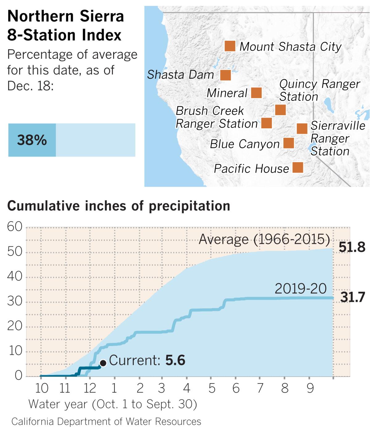
The region also depends for a large portion of its water supply on the Northern Sierra Nevada, an area where rivers flow into some of the state’s biggest reservoirs. As of Friday, the Northern Sierra 8-Station Index is at 38% of average for the date, according to the California Department of Water Resources. The index is the average of eight precipitation measuring sites that provide a representative sample of the Northern Sierra’s major watersheds. These watersheds include the Sacramento, Feather, Yuba and American rivers.
Typically, in a La Niña year like the current one, storms are pushed farther north and Southern California and the Southwest remain dry. But if the region finds a lump of coal in its Christmas stocking, there is always hope for a belated holiday gift. “Some years the pattern shifts in about mid-January,” Hoxsie said.
More to Read
Sign up for Essential California
The most important California stories and recommendations in your inbox every morning.
You may occasionally receive promotional content from the Los Angeles Times.


