What causes the deep marine layer that played a role in the Kobe Bryant helicopter crash?

- Share via
On Sunday morning, when Kobe Bryant, his daughter Gianna and seven others were killed in a helicopter crash near Calabasas, there was a thick marine layer and patchy dense fog that obscured some of the terrain.
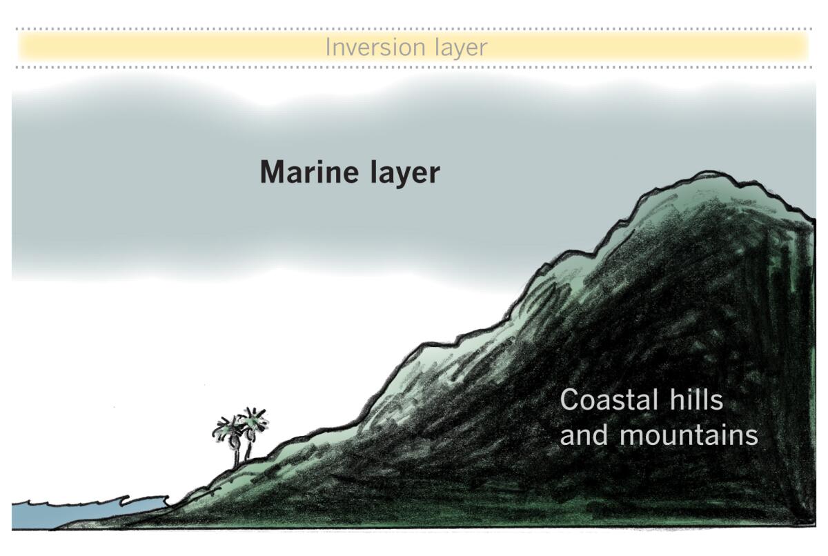
The conditions were the result of a deteriorating cold front passing through the area with moist northwest flow, which caused low clouds to pile up against the northern slopes of Ventura and L.A. County mountains. There were showers to the north, and clouds pushing into coastal valleys were thick enough to cause drizzle along the coast and in nearby foothills, according to the National Weather Service. A webcam at Oat Mountain, northwest of Porter Ranch, suggested that the marine layer was 3,000 feet thick.
What causes the marine layer?
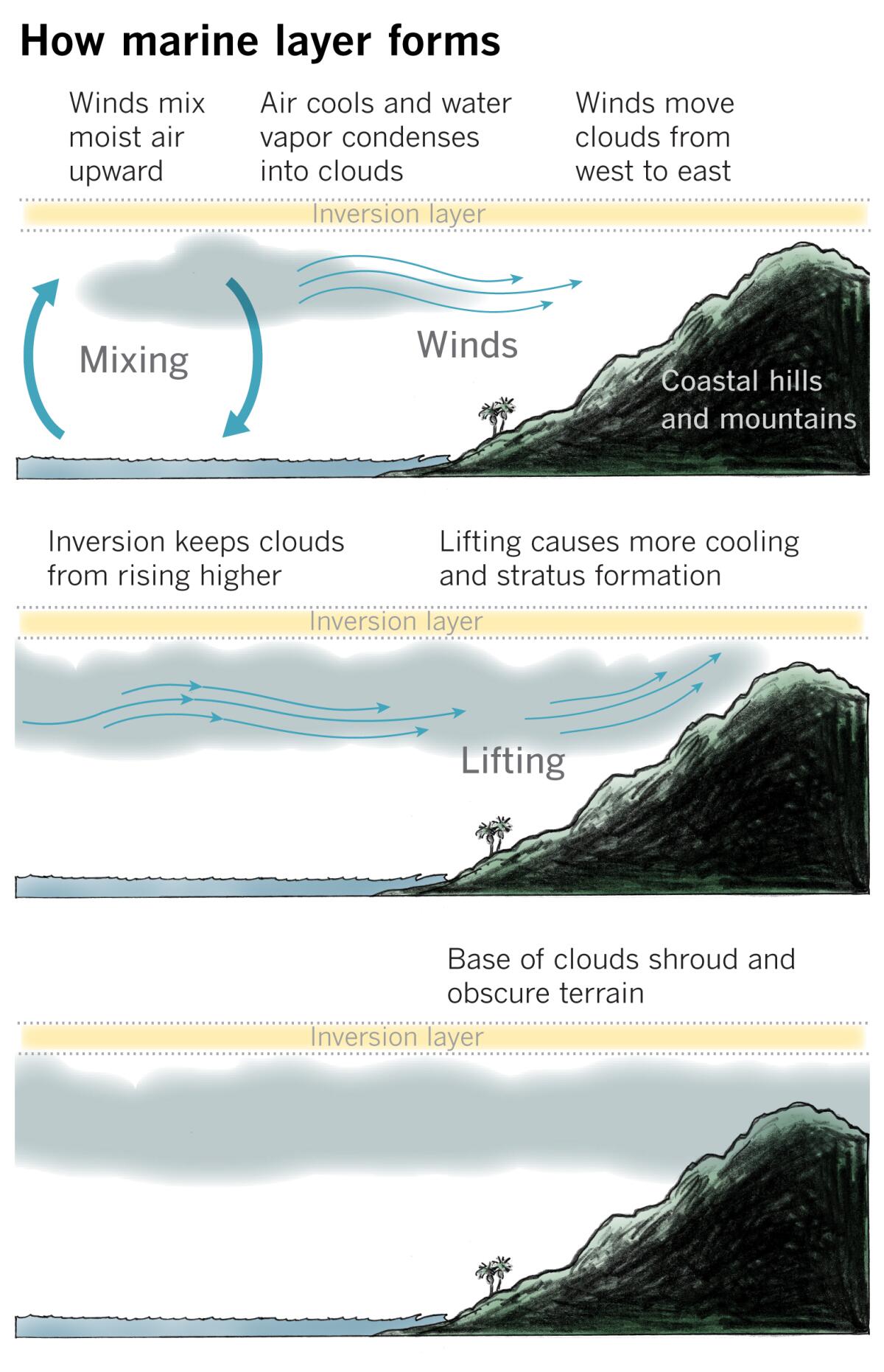
Marine stratus clouds are created when winds blowing over the Pacific Ocean mix moist surface air upward in the atmosphere. The air cools as it rises, which is important because colder air carries less water vapor than warm air. When the air’s relative humidity reaches 100%, the water vapor condenses into tiny liquid droplets around minuscule condensation nuclei, which can be sea salt from surf or spray and even tiny amounts of iodine from kelp.
A strong inversion layer is necessary for the marine layer clouds to form, providing a lid that keeps them from rising off into the atmosphere. Relatively cold ocean water temperatures cool the air near the surface, creating a strong contrast with warmer air a little higher in the atmosphere. This layer of warmer air is the inversion layer, and it creates a cap limiting the vertical extent of the mixing near the surface.
Winds blowing from west to east move these marine clouds toward the California coast. This horizontal movement is called advection. Cooling continues as the air is moved over cold water. When it reaches the coast it is forced to lift as land elevations rise, which causes additional cooling and cloud formation. The terrain channels the wind-borne stratus clouds through canyons and valleys — which are the same routes used for highways, such as the 101 Freeway. The clouds spread inland until they encounter a barrier in the form of hills and mountains that rise to a higher elevation than the clouds. Coastal hills and valleys are then shrouded in low clouds and fog. Fog is merely a cloud that is in contact with the ground.

At the time of the helicopter crash, Van Nuys Airport was reporting a ceiling of 1,300 to 1,400 feet, but some terrain around Calabasas is higher, so some of it was most likely obscured by the base of the marine clouds. In addition, dense patchy fog was reported in the area. These factors would cause low visibility and could cause spatial disorientation for someone piloting an aircraft.
The depth of marine layer clouds usually peaks around sunrise, then the clouds dissipate as the day progresses and the sun rises higher in the sky. The sun warms the the atmosphere above the clouds, and the sunlight that penetrates them begins to warm the land. Land heats up faster than water, and the warming air rising off the surface mixes into the cloud layer. As the cloudy air warms, its relative humidity falls below the 100% level, and the droplets of water begin to return to water vapor — because warmer air can hold more water vapor. In other words, the cloud evaporates. Warm, dry winds above the clouds can accelerate this process. A deeper marine layer requires more time for warmer or drier air to evaporate the clouds.
More to Read
Sign up for Essential California
The most important California stories and recommendations in your inbox every morning.
You may occasionally receive promotional content from the Los Angeles Times.


