On the Ground: Olympic celebrations of Korean unity belie the state of anxiety on the DMZ, a short drive north
The aging, two-story blue structure stands just across the eerie border separating North and South Korea, inside the broader buffer area known as the demilitarized zone.
The building has a military telephone, set up so that international troops under the United Statesâ command can relay messages to their North Korean adversaries in the hope of avoiding any unintended conflict.
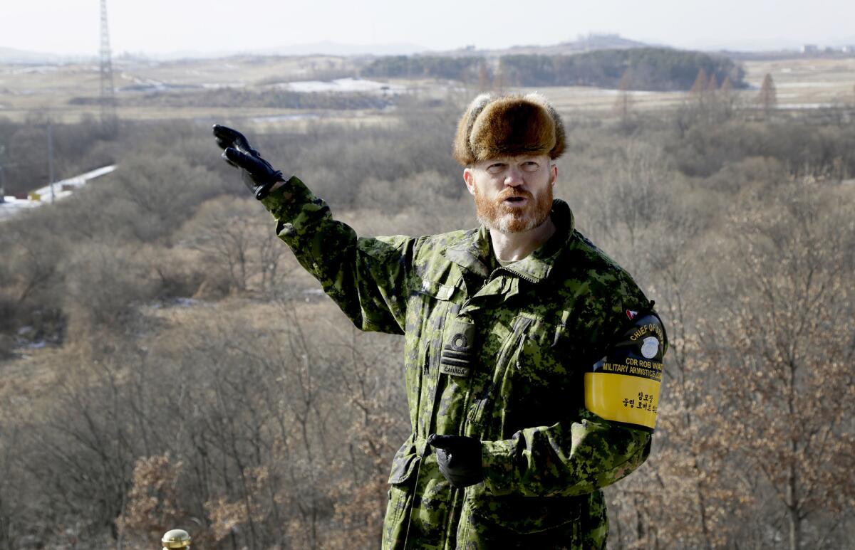
âThey havenât answered since 2013,â said Cmdr. Robert Watt, a scruffy Canadian military officer who helps U.S.-led forces keep the peace here. âWeâve resorted to calling out, essentially, with a bullhorn.â
This Joint Security Area is part of a 2 1/2-mile-wide demilitarized strip dividing one of the most heavily fortified borders in the world, a place where the tense international confrontation over North Koreaâs unbridled development of nuclear weapons plays out in a landscape of lightly armed soldiers, squat buildings â and the occasional bullhorn.
As the Winter Olympics play out just over 100 miles to the southeast in Pyeongchang, this site, where negotiators last month inked a deal securing North Koreaâs participation in the Games, is a symbolic reminder that the United States and its allies remain in a tense, decades-long stalemate with the totalitarian state.
The site is a study in symmetry, only about 2,500 feet in diameter and split by the technical border known as the Military Demarcation Line. Three low-slung, sky-blue huts straddle that line, allowing chaperoned tourists from both nations to cross into opposition territory.
The huts, designed for military talks, are shadowed by two gleaming granite buildings, local headquarters for the North and South. Watchtowers at high points on both sides rise above it all, their dark or mirrored windows hiding the surveillance inside.
Itâs an anxiety-inducing place for some â frigid in winter and sweltering in summer â thatâs been the scene of deadly skirmishes between North Korea and forces serving the United Nations Command, which is controlled by the top American general in Seoul, about 35 miles south.
The most-recent incident involved a gaunt North Korean soldier shot five times by his own comrades during a brazen defection in November from across the border. Several bullet holes are still visible in a tall, silver utility tower where the soldier fell before being rescued by a South Korean commander.
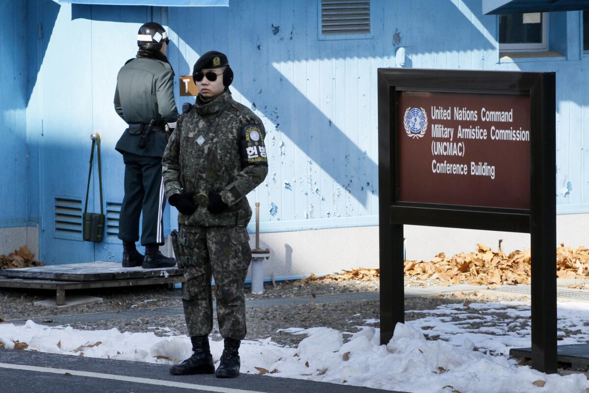
The site is awash in elite soldiers on both sides, carrying only sidearms, who are sometimes separated by mere yards. Those on the United Nations side, dressed in army camouflage or green dress uniforms, wear dark sunglasses to avoid eye contact â and potentially misunderstood glances â with soldiers from the North.
The Southâs guards often stand stone-faced, in sturdy taekwondo stances, their legs spread wide and their fist-clenched arms jutting down, slightly bent and to the front. Those from the North, who wear bulbous helmets, dress slightly more formally in brown uniforms with ill-fitting pants.
They all become oddly acquainted over time, though words are rarely, if ever, exchanged â especially in recent years. Those on the Southâs side refer to one on the other side as âBob,â named for his movements back and forth between pillars during watch.
The whole scene â heightened when the 100,000 tourists and dignitaries who visit each year arrive â is surrounded by cameras, barbed wire and, if one ventures too far, land mines.
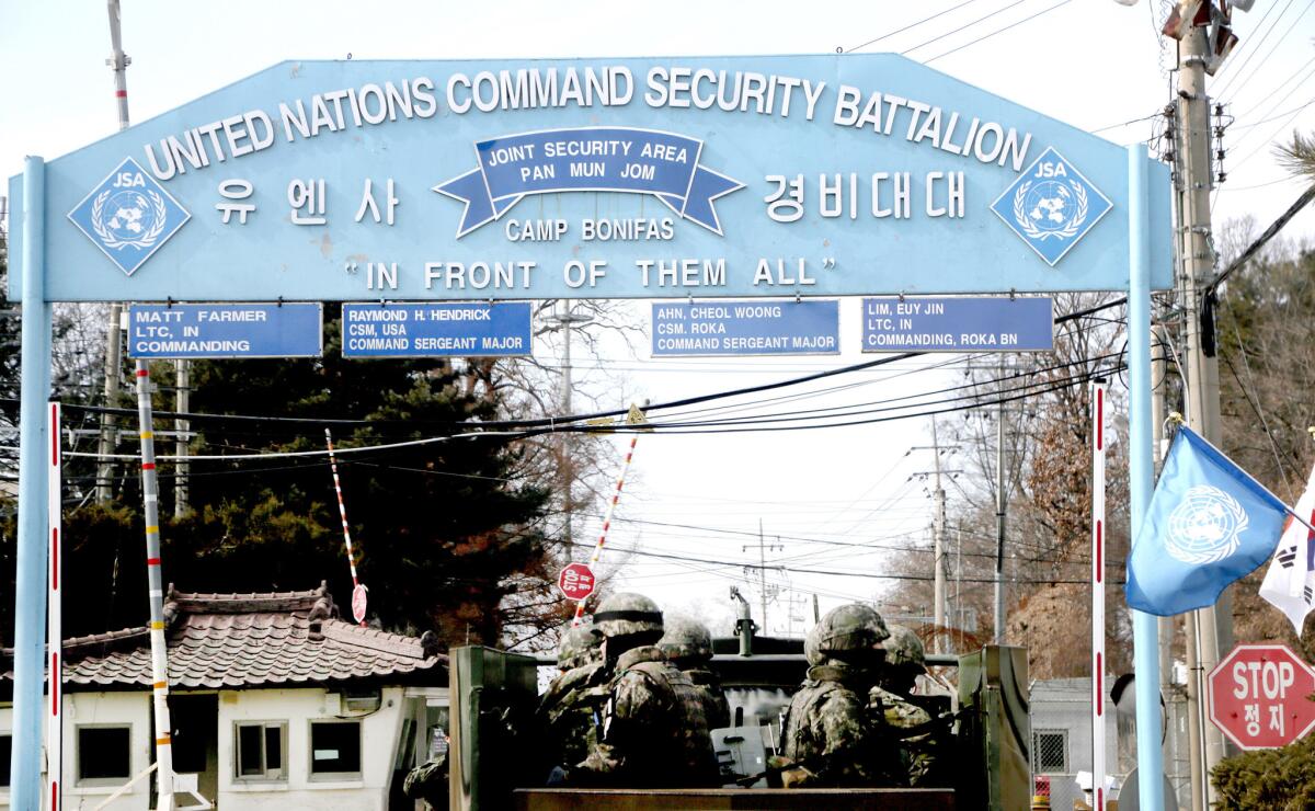
To enter, vehicles from the South pass over the Tong-il Bridge, which crosses the Imjin River, a site of some of the brutal battles that marked the civil war that ended in 1953. Thereâs an imposing security checkpoint, blocked by black-and-yellow road barriers, on the way in to Camp Bonifas â a military base named for an American officer who was one of two U.S. soldiers killed with an ax by North Korean soldiers in 1976 as he supervised the pruning of a poplar tree that blocked guardsâ view.
North Koreans said the tree had been planted by their nationâs founder, Kim Il Sung.
A focal point is a central hut known simply as âT-2,â a place envisioned six decades ago as a temporary home for high-level military talks after the Korean War. When U.S. Secretary of State Rex Tillerson toured the compound last year, a North Korean guard peered inside the dust-covered windows on his side of the building.
.
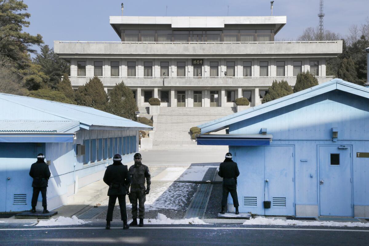
In winter, footprints are sometimes visible in the snow outside the buildingâs perimeter, even if the Northâs guards canât be seen.
Inside, thereâs a deep-brown rectangular conference table, an equal number of chairs placed on each side of the border.
A United Nations command flag stands in the middle, and a blue door with three brass locks leads out one side to the North.
Exiting the wrong door could be a potentially fatal mistake.
Those in charge from the South know the risks, shouting instructions to visitors to remain in line, avoid hand gestures or loud comments and not to take photographs in the direction of secret installations, such as the building that houses the neglected telephone line.
âThe U.N. is not here in a peacekeeping capacity,â Watt, a tall man with a thick red beard who wears a muskrat-trimmed cap, told a recent tour group of international journalists. âWe are here to combat the North Koreans.â
Those North Korean soldiers have become much less visible since the November defection. The North dug a trench afterward, and added other security features on its side, probably to prevent similar incidents.
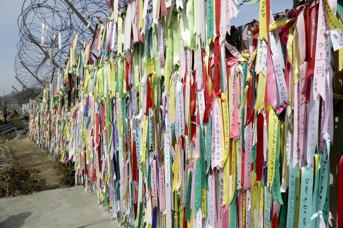
It also appeared that the Northâs previous security force was replaced after the incident â âBobâ hasnât been seen in months.
The landscape along the zone is a largely untouched wooded area that stretches two miles north and south of the border. It runs spans about 150 miles miles long, from east to west, effectively splitting the peninsula.
Wild boar â the males are âthe size of tractors,â Watt claims â and âvampire deer,â an indigenous variant of the ubiquitous North American species that have fangs extruding from their mouths, roam the area.
âMost of it has no human presence. Itâs essentially one giant wildlife preserve,â Watt said.
The area behind the huts provides a sweeping, mine-riddled view of the Northern countryside â the area where cameras in November captured the defectorâs speeding green military-style vehicle, which passed through an internal checkpoint before winding through the complex and getting stuck in a grassy area near the line to safety.
Watch dramatic video showing North Korean forces chasing, firing on defecting soldier »
The North Korean soldier jumped from the vehicle, his comrades racing behind on foot, firing in vain to stop him. At least one pursuer crossed the border, a violation of the armistice, which also forbids firing across the line.
Also part of the stunning panorama is the infamous âBridge of No Return,â a mine-laden crossing last used in 1968 to release American sailors captured by the North during an ill-fated mission of a U.S. spy ship, the Pueblo. The vessel remains a propaganda piece for the North, docked in the Potong River in central Pyongyang, the capital.
To the northeast of the lookout post is a North Korean checkpoint and a museum at the site where generals from the United States, North Korea and China signed the armistice in the 1950s.
In the distance is the North Korean village of Kijong-dong, which U.S. officials say is largely vacant; an imposing 560-foot tower flies the nationâs flag. The industrial complex known as Kaesong, once home to a North-South economic partnership but closed amid recent tensions, is also visible.
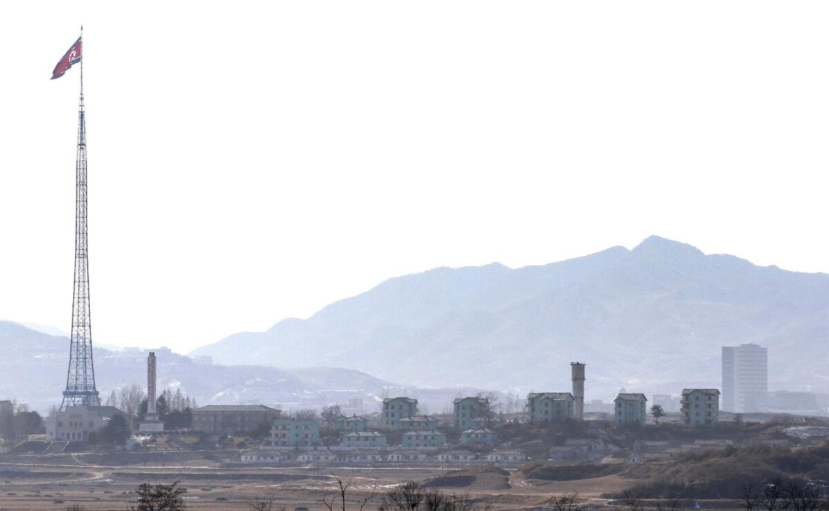
In the background are mountain peaks known as the Kaesong Heights, where the North has installed numerous artillery batteries in bunkers and caves that can be used in the event of a conventional weapons assault on Seoul.
Those weapons are important: They give Pyongyang a strategic advantage to counter any potential U.S. military strike designed to deter North Korea from its nuclear weapons and missile ambitions.
These batteries could launch a massive counterattack on the more than20 million residents living in Seoulâs metropolitan area.
The mountains serve as a reminder to the soldiers that, despite the daily routine and ritual inside the compound, the threat theyâre countering is deadly serious.
Stiles is a special correspondent.
UPDATES:
For the Record, 4:50 a.m. Feb. 15:
An earlier version of this post gave the distance between Panmunjom and Pyeongchang as 40 miles. It is just over 100 miles.
Sign up for Essential California
The most important California stories and recommendations in your inbox every morning.
You may occasionally receive promotional content from the Los Angeles Times.


