Francine gains strength, expected to be a hurricane when it reaches U.S. Gulf Coast
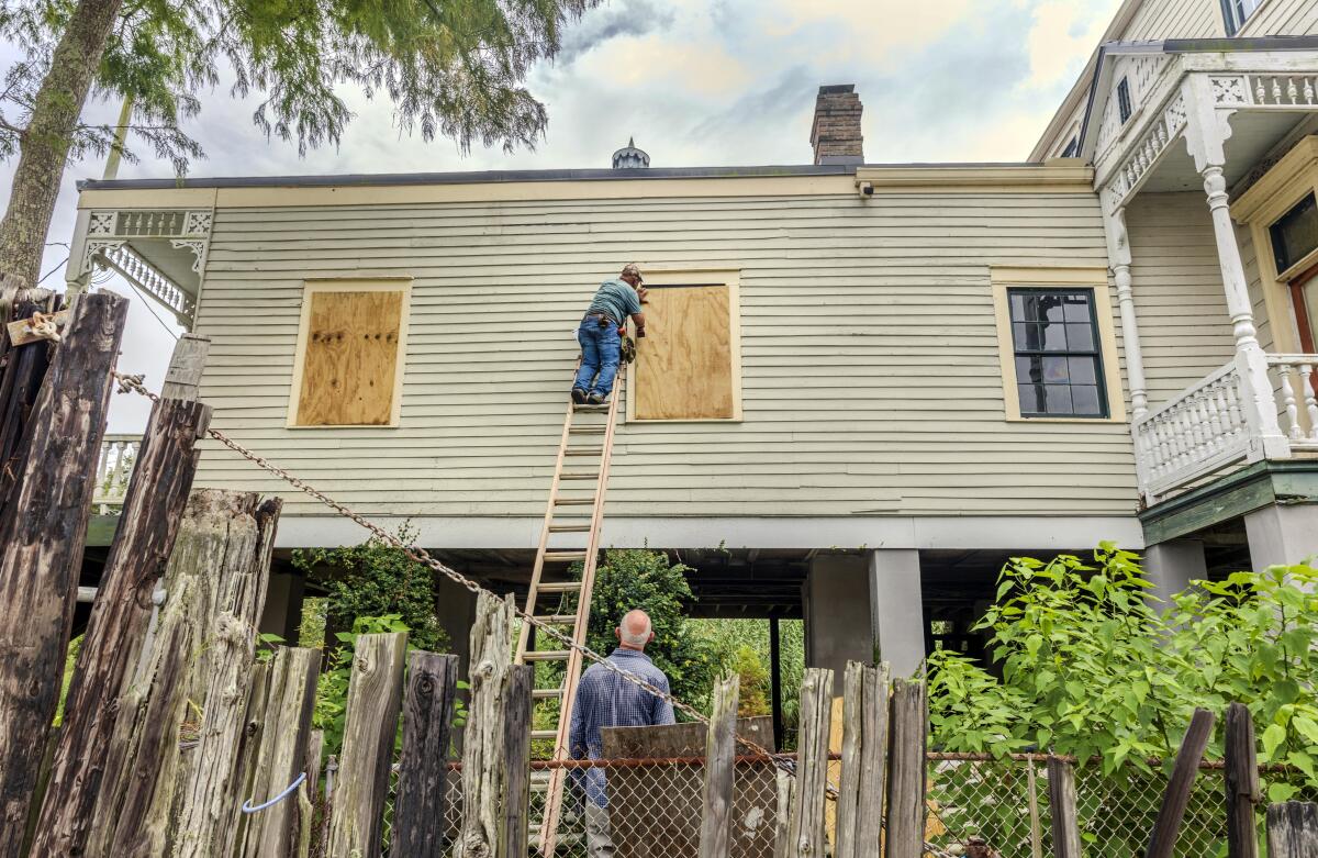
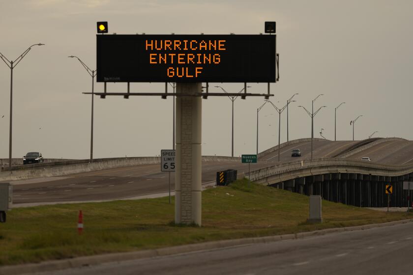
BATON ROUGE, La. ŌĆö Tropical Storm Francine churned in extremely warm waters in the Gulf of Mexico with increasing strength and was expected to reach hurricane status Tuesday before making landfall in Louisiana on Wednesday.
A hurricane warning was in effect along the Louisiana coast from the border with Texas eastward to Grand Isle, about 50 miles south of New Orleans, and a tropical storm warning extended eastward from there to the mouth of the Pearl River, according to the National Hurricane Center. A storm surge warning stretched from just east of Houston to the mouth of the Mississippi River south of New Orleans. Such a warning means thereŌĆÖs a chance of life-threatening flooding.
Louisiana Gov. Jeff Landry urged residents ŌĆ£not to panic, but be preparedŌĆØ and heed evacuation warnings. Forecasters said FrancineŌĆÖs landfall in south Louisiana was expected Wednesday afternoon as a Category 2 hurricane with winds of 96 to 110 mph.
ŌĆ£We do not want people to wait to the last minute to get on the road and then run out of fuel,ŌĆØ Landry said. ŌĆ£We put a lot of information throughout the summer, throughout hurricane season, so that people can be prepared. The more prepared we are, the easier it is for us.ŌĆØ
As of late morning Tuesday, Francine remained at tropical storm strength with maximum sustained winds of 65 mph, according to the National Hurricane Center. The system was located about 120 miles southeast of the mouth of the Rio Grande and was moving north-northeastward at 8 mph.
The last time the Atlantic failed to produce any named storms between Aug. 13 and Sept. 3 was in 1968 ŌĆö more than 50 years ago.
The storm is moving over extremely warm Gulf waters that will serve as fuel to strengthen it. Water temperatures are about 87 degrees where Francine is located, said Brian McNoldy, senior research associate at the University of MiamiŌĆÖs Rosenstiel School of Marine, Atmospheric, and Earth Science.
ŌĆ£The ocean heat content averaged over the entire Gulf is the highest itŌĆÖs been on record for the date,ŌĆØ McNoldy wrote on his blog.
Francine is the sixth named storm of the Atlantic hurricane season. ThereŌĆÖs a danger of life-threatening storm surge associated with this storm as well as damaging, life-threatening hurricane-force winds, Brad Reinhart, a senior hurricane specialist at the National Hurricane Center, said Tuesday morning.
ThereŌĆÖs also the potential for 4 to 8 inches of rain with the possibility of 12 inches locally across much of Louisiana and Mississippi through Friday morning, Reinhart said. That heavy rainfall could also cause considerable flash and urban flooding.
Francine is barreling toward a Louisiana coastline that has yet to fully recover since hurricanes Laura and Delta decimated Lake Charles in 2020, followed a year later by Hurricane Ida. Over the weekend, a 22-story building in Lake Charles that had become a symbol of storm destruction was imploded after sitting vacant for nearly four years, its windows shattered and covered in shredded tarps.
FrancineŌĆÖs storm surge on the Louisiana coast could reach as much as 10 feet (3 meters) from Cameron to Port Fourchon and into Vermilion Bay, forecasters said.
Hurricane BerylŌĆÖs growth into an unprecedented early storm shows the literal hot water the Atlantic and Caribbean are in right now.
ŌĆ£ItŌĆÖs a potential for significantly dangerous, life-threatening inundation,ŌĆØ said Michael Brennan, director of the hurricane center, adding it could also send ŌĆ£dangerous, damaging winds quite far inland.ŌĆØ
He said landfall was likely somewhere between Sabine Pass ŌĆö on the Texas-Louisiana line ŌĆö and Morgan City, La., about 220 miles to the east.
Louisiana officials urged residents to immediately prepare while ŌĆ£conditions still allow,ŌĆØ said Mike Steele, spokesperson for the GovernorŌĆÖs Office of Homeland Security and Emergency Preparedness.
ŌĆ£We always talk about how anytime something gets into the Gulf, things can change quickly, and this is a perfect example of that,ŌĆØ Steele said.
Residents of Baton Rouge, LouisianaŌĆÖs capital, began forming long lines as people filled gas tanks and stocked up on groceries. Others filled sandbags at city-operated locations to protect homes from possible flooding.
ŌĆ£ItŌĆÖs crucial that all of us take this storm very seriously and begin our preparations immediately,ŌĆØ Baton Rouge Mayor-President Sharon Weston Broome said, urging residents to stock up on three days of food, water and essentials.
Beryl is hurtling across the warm waters of the Gulf of Mexico on a collision course with Texas.
A mandatory evacuation was ordered for seven remote coastal communities by the Cameron Parish Office of Homeland Security & Emergency Preparedness. They include Holly Beach, a laid-back stretch dubbed LouisianaŌĆÖs ŌĆ£Cajun Riviera,ŌĆØ where many homes sit on stilts. The storm-battered town has been a low-cost paradise for oil industry workers, families and retirees, rebuilt multiple times after past hurricanes.
In Grand Isle, LouisianaŌĆÖs last inhabited barrier island, Mayor David Camardelle recommended residents evacuate and ordered a mandatory evacuation for those in recreational vehicles. Hurricane Ida decimated the city three years ago, destroying 700 homes.
Officials warn that flooding, along with high winds and power outages, is likely in the area beginning Tuesday afternoon through Thursday.
In New Orleans, Mayor LaToya Cantrell urged residents to prepare to shelter in place. ŌĆ£Now is the time to finalize your storm plans and prepare, not only for your families but looking out for your neighbors,ŌĆØ she said.
City officials said they were expecting up to 6 inches of rain, gusty winds and ŌĆ£isolated tornado activityŌĆØ with the most intense weather likely to reach New Orleans on Wednesday and Thursday.
As rain fell Monday in northern Mexico, more than a dozen neighborhoods in Matamoros ŌĆö across the border from Brownsville, Texas ŌĆö flooded, forcing schools to close Monday and Tuesday. Marco Antonio Hernandez Acosta, manager of the Matamoros Water and Drainage Board, said they were waiting for MexicoŌĆÖs federal government to provide pumps to drain affected areas.
The storm was expected to be just offshore of the coasts of northeastern Mexico and southern Texas through Tuesday before making landfall Wednesday in Louisiana.
Cline and Stengle write for the Associated Press. Curt Anderson in St. Petersburg, Fla., and Alfredo Pe├▒a in Ciudad Victoria, Mexico, contributed to this report.
More to Read
Sign up for Essential California
The most important California stories and recommendations in your inbox every morning.
You may occasionally receive promotional content from the Los Angeles Times.
