Tropical Storm Debby threatens flooding, up to 25 inches of rain
Low-lying neighborhoods in northern Florida remained threatened by possible flooding on Monday as Tropical Storm Debby slowly worked its way through the Gulf of Mexico.
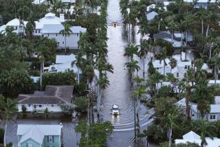
Fierce winds and heavy rains lashed the Sunshine State, causing flooding in several areas and warnings to residents to seek higher ground. The storm seemed to be stalled or moving but slowly from its perch in the waters of the gulf. Drenching rains and a slow-moving storm center mean that parts of Florida could get 10 to 25 inches of rain in the coming days, forecasters said.
At least one death, from a storm-related tornado, has been reported in Florida, and officials in Alabama were looking for a person who disappeared in heavy surf.
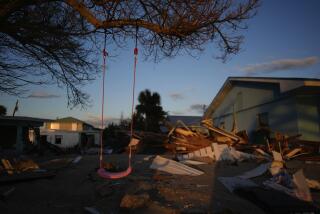
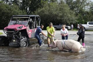
PHOTOS: Tropical Storm Debby wreaks havoc
According to a morning update from the National Hurricane Center, the storm was about 75 miles south of Apalachicola and was moving northeast at about 3 mph. It was carrying top sustained winds of 45 mph.
“Debby is currently stationary, and no significant motion is expected through the next day or so as a weak steering flow remains in the region,” said the Florida Division of Emergency Management. “All of the Florida Panhandle near and west of the Suwannee River is in the 3-day error cone and most areas north of a Port Charlotte to Cape Canaveral line are within the 5-day error cone.”
According to Florida officials, areas within the three-day cone have a 40% or greater chance of receiving tropical-storm-force winds. Flash-flood watches were in effect for most of the Florida Panhandle as well for parts of the northeast, west-central and southwest areas of the state. Additionally, flood warnings are in effect for several west-central Florida rivers, officials said.
The latest projections have the storm moving into northern Florida somewhere between Destin and Tampa in the next three to five days, officials said.
“Tropical storm force winds, heavy rainfall and isolated tornadoes are the main concerns today,” according to the Florida Division of Emergency Management posting. “Rainfall amounts of 5+ inches today and tonight may lead to continued flooding for many areas of the state. In addition, locally heavy rainfall of potentially up to 10-20 inches through the next few days will continue to exacerbate flooding concerns of some areas.”
So far, the most damage has occurred in the western portion of the state, which has felt severe blows from the rains and reported tornadoes. High winds forced a roadway bridge that spans Tampa Bay and links St. Petersburg with areas to the southeast to be closed. Some streets were under water in Tampa, officials said.
St. George Island was also hard-hit and had lost electricity. The bridge linking it to the mainland was closed by officials.
ALSO:
Colorado wildfires force thousands to evacuate
Utah shooters spark 20 wildfires -- and a gun rights controversy
Jerry Sandusky letter to abuse victim: ‘There has been love in my heart’
Join Michael on Google+. Email: [email protected]
More to Read
Sign up for Essential California
The most important California stories and recommendations in your inbox every morning.
You may occasionally receive promotional content from the Los Angeles Times.


