2 wheels and an open road
Itâs 9 a.m., and the toilet seat is, predictably, up at the Shell station in La Canada Flintridge. It is Sunday, sunny, warm. Perfect riding weather for the (predominantly male) motorcyclists making their pilgrimage up Angeles Crest Highway, where they will power through scores of turns over several miles at ever-increasing altitudes.
The Shell station is their last-chance pit stop -- for Pop-Tarts, Starbucks and other high-octane fuels that will propel them east along one of the most beloved stretches of asphalt in Southern California -- and manager Sabir Enabi is ringing up customer after leather-clad customer. A bottle of Mountain Dew goes to a man in a Ducati jacket. A pack of Camels is sold to another in a back protector and jeans.
More than 100 motorcycles stop at the station to fill up on any Sunday, Enabi said as he scanned bar codes and swiped credit cards to a live soundtrack of revving engines.
âMaybe closer to 1,000,â said a tall man in a Vanson racing suit, paying cash for a bottle of Dasani before wading into the alphabet soup of sport bikes parked on the pavement outside the door.
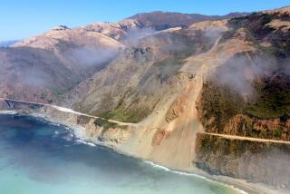
R1s. GSX-R600s. Ducati 1098s. Theyâre the tools of the trade for a ride on Angeles Crest Highway. Running from La Canada to the Antelope Valley, the full 66-mile stretch of switchbacks and straightaways is a hub for area bikers. Since March 2005, however, a 9-mile swath of this adrenalinized alpine retreat through the San Gabriel Mountains has been closed, forcing riders to hit the brakes and do a U-turn when they get to the pine-topped overlook at a place called Islip Saddle.
But this Wednesday at noon, the word âclosedâ will be removed from the green sign that marks the Crestâs beginning in La Canada. Up the road, at the intersection of Islip and Highway 39, the metal gate will be unlocked. And the lawyers, musicians, students and other members of the diverse riding public will again be allowed to wheel their rubber over a portion of rural highway thatâs been off-limits since a winter storm washed much of it away.
Angeles Crest is a place where the outcasts of roads better traveled can be with like-minded souls. Where the wave of a gloved hand conveys a common compulsion. Where the pleasures of the pavement are elemental.
Itâs the sound of competing exhausts, the smells of the chaparral, the physical sensations of simple physics -- of pulling oneâs body and bike through the turns. Itâs the smooth texture of the roadâs concrete asphalt, the gentle grade and graceful arcs of its curves and the community that has formed around a shared appreciation for these attributes.
Of course, the highway cuts through Angeles National Forest, which is loved by many types of outdoor enthusiasts, some of whom view the bikes as noisy and their riders as inconsiderate. They are among the chorus who say the Crest is a dangerous strip cutting through a nature getaway.
Leading up to the roadâs reopening, workers for the California Department of Transportation have been driving the remote and rock-strewn stretch of unopened highway to mitigate some of the dangers they can control.
Theyâve been honking the horns on their orange plow trucks to scare away the big-horn sheep, bears and other wild animals that have been calling this part of the Crest home since it was closed four years ago, and theyâve been making daily ârock runsâ to clear the slag, snow and rubble that regularly tumble from the steep climes on either side of the pavement.
Motorcyclists, meanwhile, are checking their tire pressure and polishing their windscreens, getting ready to extend their rides into an area where the city -- and their real lives -- seem farther away the higher they climb. The views from this 7,000-foot, pine-dappled perch are as alluring as the drops are precipitous.
Mike Noxon, a longtime motorcyclist and an assistant manager at Newcombâs Ranch, a biker hangout on the Crest, tries to explain the attraction.
âItâs a great loop,â he said, referring to a ride that will take him and his Suzuki DR650 up the about-to-open portion of the Crest through Wrightwood and across Pearblossom Highway. âIâve ridden many, many different roads and thereâs no road that compares to this one. The corners are just perfect. The scenery is tops. Itâs close to L.A., yet you can come up here and get away from everything and ride this incredible road.â
A sprawling log cabin with an oversized parking lot to accommodate the weekend masses, Newcombâs is located 27 miles (and 198 turns) up the Crest, past corners with names such as Moronâs Point -- so-called for the switchback where a California Highway Patrol officer is known to lurk -- but before Squidâs Leap, a surprisingly sharp turn that has jettisoned many an inexperienced rider over the edge. Many of the Crestâs secrets are revealed in such names as well as in its many skid marks.
The constant echo of accelerating and decelerating motorcycles through the crisp forest air help define Angeles Crest -- a road known to and ridden by bikers worldwide.
Cars, however, were the Crestâs intended users. Designed to save motorists several miles of travel on their way from L.A. to the recreational areas of Angeles National Forest, Angeles Crest Highway took 27 years and $10 million to build. It was spearheaded by the Automobile Club of Southern California, the Pasadena Chamber of Commerce and other agencies that wanted to make the area more accessible to city dwellers in need of a nature escape.
From 1929, when construction began, to 1956, when the road finally opened, prison labor from San Quentin and the Chino Institution for Men cleared the rocky, pine-covered wilds, blasting away boulders with the 1,000 pounds of dynamite they were given each day and rolling the debris into the 500-foot canyons below.
Angeles Crest was painstakingly designed, and many of the decisions made in building the road have contributed to its popularity among motorcyclists today.
Understanding that roads often disfigure the scenic areas to which they provide access, the Crestâs builders had the construction rubble carted out of view. The 10% grade and 200- and 300-foot-radius turns that modern motorcyclists consider perfection? Those were a necessity due to the forestâs steep slopes. The plants at roadâs edge? Many were the results of early experiments in erosion control.
The new Angeles Crest Bridge on the about-to-open section of the highway is a modern mirror of those early erosion-control efforts. The second bridge of its kind in the state, the $2.76-million, 208-foot span at Vincent Gap allows rocks and debris from an adjacent 75-degree slope to flow under, rather than on to, the road.
âFalling rocksâ are among the many hazards Ernie Gutierrez has experienced in the 19 years heâs been riding Angeles Crest, along with âanimals, crazy riders and crazy drivers.â
âYou never know what youâre going to run into,â said Gutierrez, a custom pool-cue maker from Encino who describes his weekly ride as ârelaxing,â despite its many hazards.
The inherent dangers of Angeles Crest are part of the roadâs appeal. The pleasures of its twists and turns are merely heightened by its risks -- and successfully overcoming them.
Not every rider is so lucky, however, which has led to the Crestâs reputation as the most dangerous road in California and one of the five most dangerous in the country. According to the Statewide Integrated Traffic Records System, 33 motorcyclists have died on Angeles Crest since 1998, many of them on Woodwardia Bridge, just a few miles from the roadâs start.
In January 2007, the California Highway Patrol stepped up enforcement in the area, dedicating two officers to monitor Angeles Crest. The L.A. County Sheriffâs Department also keeps a helicopter on the Crest. Staffed with two paramedics and a doctor, the helicopter is on call seven days a week from dawn to dusk, not only for crashed motorcyclists but for cars as well as hikers who accidentally fall down ice chutes or are pushed off a cliff by the wind.
With the storm-damaged stretch of road about to reopen, the Sheriffâs Department search-and-rescue team anticipates more action.
âFrom Newcombâs up, itâs a totally different environment. Thereâs a lot less people up here, but weâve seen some pretty bad accidents up here in the past,â said Sheriffâs Deputy Lyle Koegler. âItâs a lot more road.â
--
More to Read
Sign up for The Wild
Weâll help you find the best places to hike, bike and run, as well as the perfect silent spots for meditation and yoga.
You may occasionally receive promotional content from the Los Angeles Times.


