
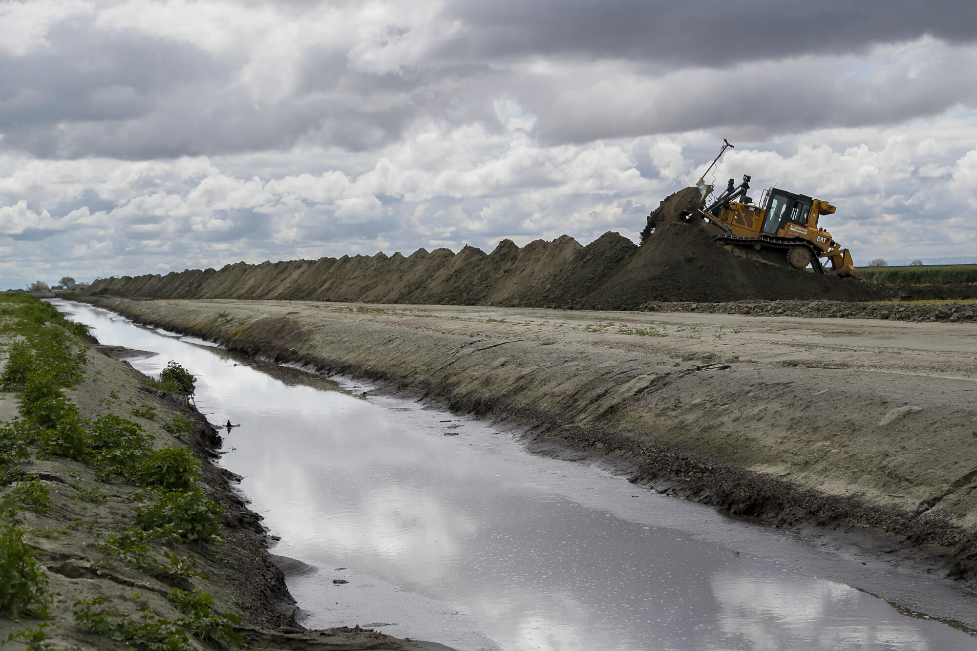
CORCORAN, Calif. — Earlier this year, as floodwaters rushed toward the San Joaquin Valley city of Corcoran — home to roughly 20,000 people and a sprawling maximum-security state prison — emergency workers and desperate local officials begged the state for help raising their levee.
Corcoran had been sinking, steadily, for years because of persistent overpumping of groundwater by major landowners in the Tulare Lake Basin that has sent the valley floor into a slow-motion collapse. And the levee raises made in 2017 — a multimillion-dollar effort funded by local property tax hikes and the prison system — were no longer up to the job. Ultimately, the state agreed to pour $17 million into another round of levee engineering in an effort to save the town.
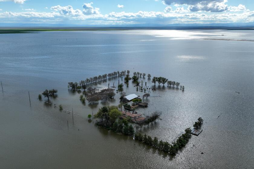
Farmers, meanwhile, were frantic as the basin’s phantom lake reemerged for the first time in 25 years and floodwaters surged onto croplands that had not flooded in modern times. The same overpumping that was sinking Corcoran had caused geologic transformations across the basin. What was once high ground suddenly wasn’t; infrastructure critical to drainage had in some cases shifted; water flowed in unexpected ways.
Lost in the chaotic scramble was the fact that just months before the water began rising in the ancient Tulare lakebed, the local agencies responsible for managing groundwater pumping had insisted that subsidence — and the subsequent flooding and destruction it might cause — was not an immediate problem.
It was an assessment they’d doubled down on in reports to state regulators, despite evidence that the ground had been sinking in some places at a rate of more than one foot a year, fracturing roads and irrigation channels and depleting drinking water stores. Since 2015, Corcoran has experienced nearly 5 feet of subsidence, while areas just outside the town have sunk as much as 6 feet. Before the 2017 emergency work, the 14-mile earthen levee that protects the town had been repaired twice by the U.S. Army Corps of Engineers, in 1969 and 1983.
Now, the state is finally trying to enforce the requirements of a nearly 10-year-old law limiting groundwater pumping that major landowners in a half-dozen regions — including the Tulare Lake Basin — have blatantly resisted. In October, state water regulators announced they’re taking the first step toward putting the Tulare Lake region on “probation” for its lack of progress.
The move sets the stage for a confrontation, at long last, between state regulators and the powerful land barons who have long controlled water use in the heavily farmed Tulare Lake Basin. If the State Water Resources Control Board deems an area “probationary,” it has the power to require the big landowners to install meters on the wells they draw from for irrigation, start reporting how much they are pumping and begin paying fees based on the water they draw.
The state’s crackdown — or at least threat of a crackdown — follows years of foot-dragging by the legacy farming families and agribusiness conglomerates that run massive operations in the Tulare Lake Basin to fall in line with state regulations that call for major reductions in groundwater pumping.
Under a 2014 state law, the five water agencies that make up the Tulare Lake subbasin were supposed to be working as a team to craft a plan for reducing pumping to levels that would stabilize groundwater levels and ease the subsidence as of 2040.
But those water agencies — some of which are run by representatives of the biggest landowners — have made virtually no progress toward that goal. Infighting among agencies was fierce; board members resigned in frustration and water officials wrote accusatory letters to state officials about each other’s failings. The group’s first plan, submitted in 2020, was deemed “incomplete.” Two years later, the group submitted a revised proposal — which was then rejected as inadequate.
It was the second proposal, called the amended Tulare Lake Groundwater Sustainability Plan, that sparked the state’s pending disciplinary action. Rather than providing a blueprint for sustainability, the plan allows groundwater levels to drop even further — by as much as 319 feet below historical lows in some areas — and fails to address what that might mean for subsidence in the region. The State Water Board staff’s critique of the Tulare Lake plan spans 176 pages and lists multiple “deficiencies.” A Times analysis of the proposal, the staff critique and various other responses found:
- The proposal fails to provide details on how much water landowners in the basin extract. It notes that some landowners preferred to keep their data private.
- It fails to provide details about the risks that further subsidence would pose to critical infrastructure in the southern San Joaquin Valley such as roads, railroad tracks, bridges and levees.
- It calls for a level of groundwater pumping that, according to state estimates, could result in nearly 700 domestic drinking wells in the region going dry between now and 2040.
- It appears to cherry-pick water quality data in a way that allows the local water districts to eschew responsibility for drinking water contamination associated with lowered groundwater tables.
Regulating groundwater in the West has never been easy, especially in a region where decisions about water and land use have, for decades, predominantly been decided by a small group of farming clans and farming companies hostile and unaccustomed to government interference. And some of the basin’s biggest landowners have sent seething responses to a state effort they see as unnecessary regulatory overreach.
Land barons seized control of the Tulare Lake Basin generations ago. This year’s destructive flooding left troubling questions about the power they wield.
J.G. Boswell Co., the area’s largest landowner, grows tomatoes, cotton and other crops on vast acreage in the Tulare lakebed. Wall Street analysts have valued the company not just for what it grows, but for its access to that most precious resource of the American West: water. The company objected to the state’s actions in a letter to the State Water Board, saying the regulators’ draft report contains false assumptions and “many deficiencies.”
Nathan Metcalf, a lawyer representing Boswell, wrote in the letter that the company believes the area’s groundwater plan “can be revised to avoid probationary status.” He made clear the company — like other big landowners — prefers that water remain under local control.
Metcalf objected to the state’s proposed pumping fees of $300 per well and $40 per acre-foot of water extracted, calling those amounts “excessive,” and said the state lacks authority to impose such fees. He said based on the amount of water pumped annually from an estimated 2,300 wells in the area, those fees could total more than $31 million.
Doug Verboon, a fourth-generation farmer in the region and a member of the Kings County Board of Supervisors, isn’t sure he wants the state coming in, either. But he recognizes problems with the lack of government oversight when it comes to the Tulare Lake Basin and its water — although not the same ones the state has identified.
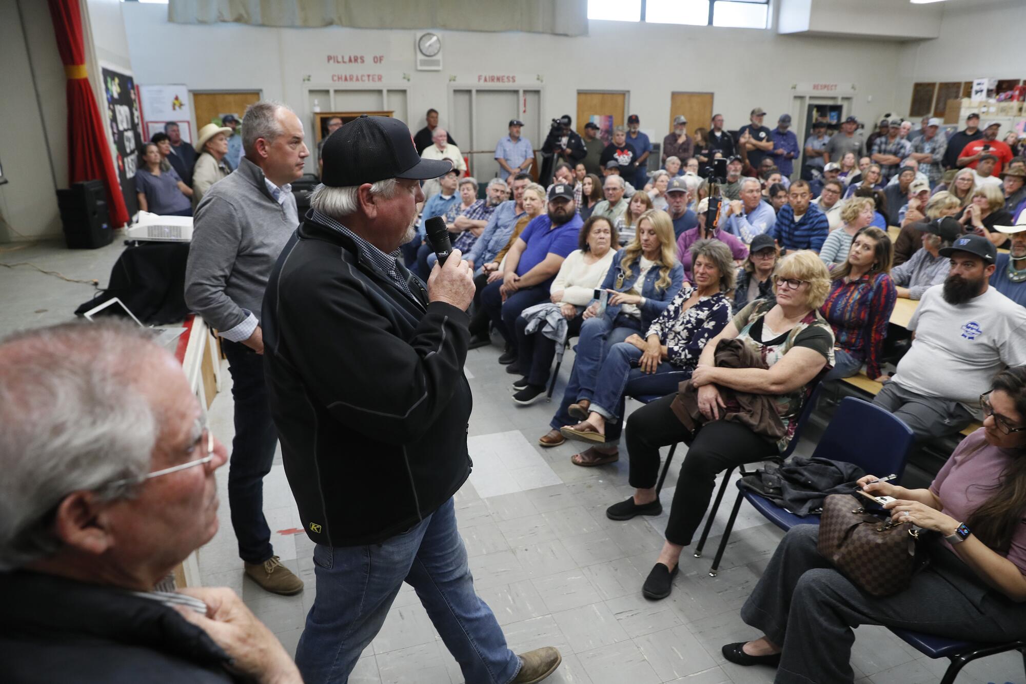
Verboon suspects some big landowners are pumping the groundwater beneath Kings County, even as they sell some of their water supplies at exorbitant rates to water-hungry farming interests in other counties. Details on water sales are scant, but state records indicate that Boswell in 2019 agreed to sell up to 35,000 acre-feet of surface water to a Kern County water agency in an exchange deal that also involved another water district.
Another large landowner in the basin, John Vidovich, has acknowledged selling water in the past, though recently he has declined to discuss the issue.
After his election to the board in 2014, Verboon crafted an ordinance that would require a permit to transfer groundwater across county lines. It took him until last year to get the board to consider and approve the measure — and it’s now tied up in a lawsuit brought by the El Rico Groundwater Sustainability Agency, a Boswell-controlled entity that encompasses roughly 43% of the subbasin’s land area.
“The people that are taking the water are very powerful,” Verboon said. “I was told that I better get a bodyguard.”
Farmers have been heavily pumping groundwater in the San Joaquin Valley for generations. But it wasn’t until recent decades — as farming operations expanded and landowners drilled far more wells at ever deeper elevations — that the effects became hard to ignore.
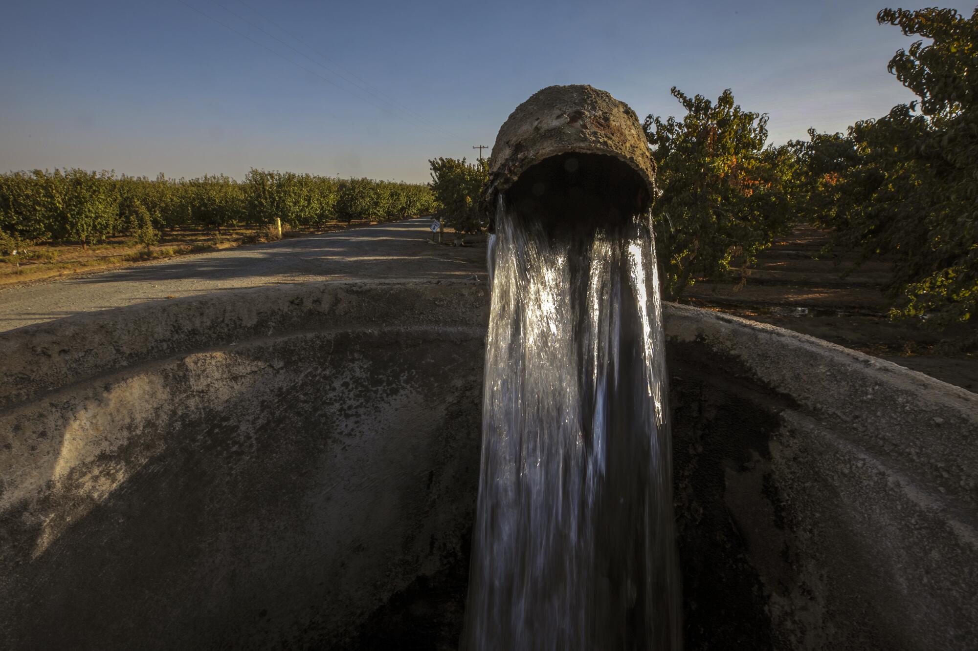
Wells went dry, canals collapsed, roads cracked, railroad tracks warped and levees sank. The reason has been extensively documented in scientific studies: As groundwater is pumped at levels not easily replenished, the soil beneath compacts and the valley floor sinks.
A 1969 study by the U.S. Geological Survey showed that in the Tulare Lake region, “800 square miles had undergone more than 1 foot of subsidence, and as much as 12 feet of subsidence had occurred locally since the first detailed topographic maps were prepared in 1926.”
A famous 1977 photo taken just outside the town of Mendota, 65 miles northwest of Corcoran, shows Joseph Poland, a USGS scientist wearing a trilby hat and brown pants, standing next to a utility pole with signs reading 1925, 1955 and 1977. The 1925 sign is 30 feet above the ground — the amount the land had sunk over 50 years.
In the early 2000s, government researchers called the San Joaquin Valley the “single largest alteration of the land surface attributed to humankind.” And the Tulare Lake area is now the epicenter of the most rapid subsidence since 2015, part of the reason the 2023 floods sent water coursing into areas that emerged unscathed in previous floods.
During the past decades, when drought conditions gripped the state and surface water dwindled, farmers around the basin’s dry lakebed ramped up their pumping and drilled deeper, below the Corcoran Clay, a dense layer several hundred feet underground. It’s an area, say scientists, that when overpumped is complicated to recharge because the thick clay blocks water from percolating.
In recent years, the demand for groundwater was amplified as basin farmers joined a broader shift in the Central Valley toward planting lucrative nut crops such as pistachios and almonds, rather than seasonal crops such as tomatoes and cotton. In bad water years, land devoted to seasonal crops can go dormant. But nut orchards require sustained irrigation — in wet years and dry ones — to survive.
“Why is that area subsiding more than others? It’s because it has more clay than some parts of the valley,” said Ryan Smith, an assistant professor of civil and environmental engineering at Colorado State University. “But it’s also because there’s just a lot of pumping going on there right now.”
As the drought worsened in 2014 and the NASA satellite imagery showed the bowl depressing even further, state lawmakers grew increasingly concerned. It wasn’t just a matter of sinking farmland, after all. It was taxpayer money going down the drain to pay for damaged infrastructure.
According to some experts, subsidence — in terms of road and rail repair, canal and levee restructuring, the retrofitting of bridges and buildings — has cost the state and federal government billions of dollars, said Jim Borchers, an independent hydrogeologist in Davis.
Take the California Aqueduct, which runs along the western part of the Tulare Lake subbasin and transports water from the Sacramento-San Joaquin River Delta to Southern California. The concrete aqueduct is vulnerable to land shifting beneath it. The Department of Water Resources has spent more than $80 million since 2017 to protect and retrofit the structure.
In 2014, lawmakers penned a landmark law, the Sustainable Groundwater Management Act, that aimed to combat the widespread problems of overpumping and declining water levels across the state. The law called for the creation of local groundwater sustainability agencies, or GSAs, and required them to develop plans to curb overuse.
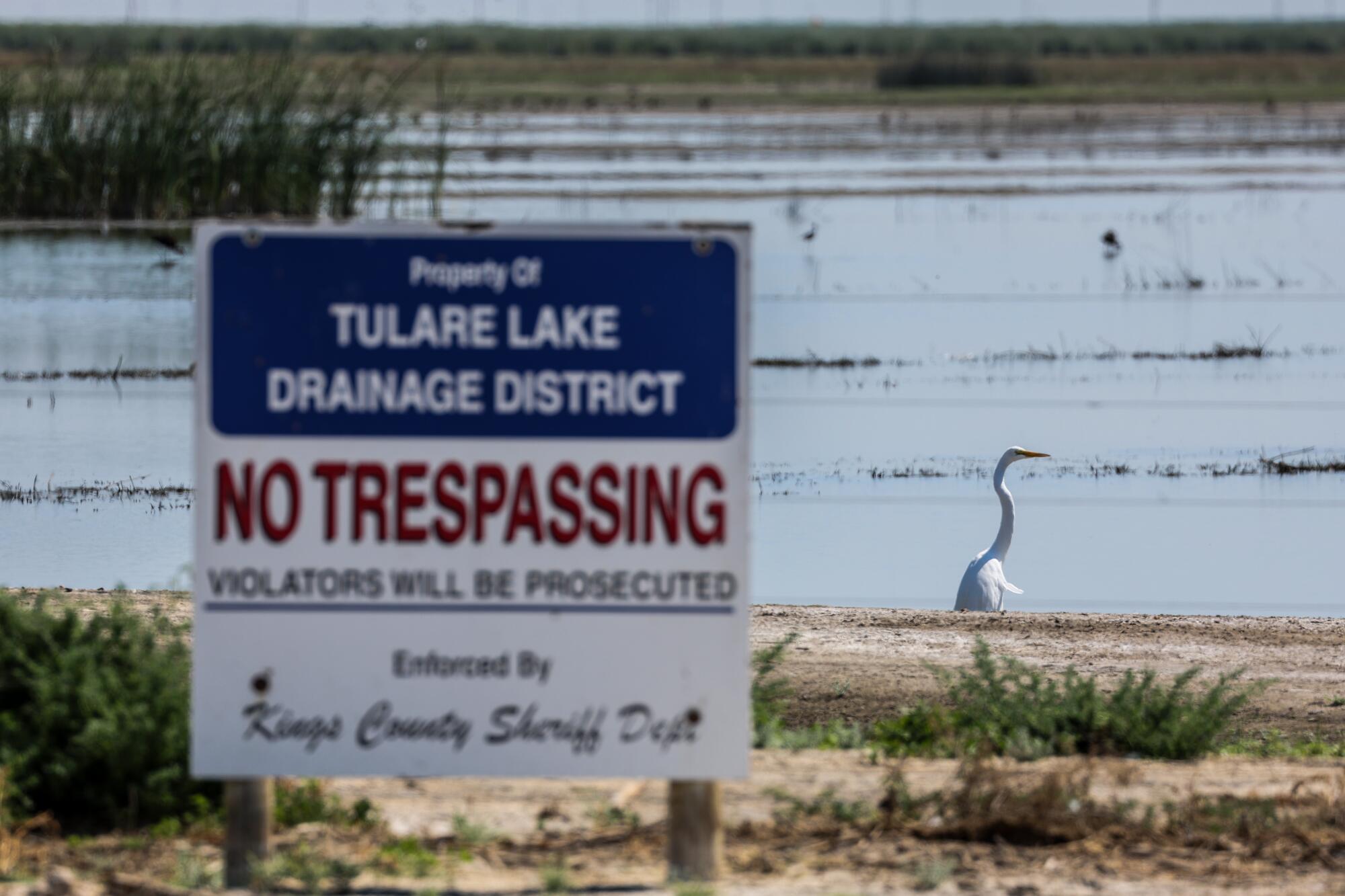
The Tulare Lake Basin is one of 21 groundwater basins deemed to be “critically overdrafted,” where local agencies are required to achieve sustainability goals by 2040. The law broadly defines sustainability as managing groundwater in a manner that doesn’t cause “undesirable results.” And it specifies several types of “undesirable results” to be avoided, including chronic lowering of groundwater levels and “significant and unreasonable” land subsidence.
Most of the 21 basins now have sustainability plans in place that are state-approved and underway. In contrast, Tulare Lake is among six subbasins in the San Joaquin Valley whose plans have been deemed inadequate. Also dinged were local agencies in Chowchilla, Delta-Mendota, Kaweah, Tule and Kern, which together encompass large portions of San Joaquin Valley farmland.
In their Oct. 12 critique of the Tulare Lake plan, State Water Board staff recommended the board put the region on probation and impose requirements to manage groundwater pumping. The board is scheduled to consider the recommendation at an April 16 hearing.
“Designating the subbasin probationary is critical for getting the subbasin back on track to achieve sustainability,” the staffers wrote.
First order of business: Installing well meters to quantify how much water is being extracted.
Among the concerns cited by staff was the lack of concrete information regarding the amount of groundwater being withdrawn — and no plan to slow it down. Although some wells in the basin are set up with technology that can monitor groundwater levels, many others are not, the Tulare water agencies said in their plan. In other cases, they noted, that information might be available, but landowners have decided not to share.
As a result, state staff noted a sparse network of “representative” monitoring wells in the subbasin — that shrank as the years went by. In 2020, the agencies claimed to have 70 such wells across the subbasin. By 2022, that number had mysteriously been reduced to 56.
In addition, the state had called on subbasin agencies to set minimum thresholds for their groundwater tables, levels that represent the lowest depth water could be drawn before trouble would occur. While most subbasins set minimum thresholds at or above historic lows — meaning groundwater tables would rise or at least drop no further — the Tulare plan calls for minimum thresholds in a portion of the aquifer that are on average 65 feet below the historic lows.
It is unclear how drawing water to depths far below recorded levels “would not cause significant and undesirable results,” the staffers wrote.
The state law calls for the subbasin agencies to list critical infrastructure and assess susceptibility to subsidence. For instance, a bridge might become unstable should the ground drop another foot. Or, a levee that protects a major town and prison — such as the Corcoran levee — could become useless if it sinks an additional 5 feet.
In the first go-around, the Tulare proposal neglected to mention any infrastructure other than the California Aqueduct, which runs through the western part of the basin. The Corcoran levee wasn’t mentioned. Nor were any roads, bridges, canals or railroad tracks.
Regulators told the local agencies they needed to address infrastructure that protects towns or allows people to move and travel. In the second proposal, Tulare leaders listed broad categories and stated subsidence would be a problem only if such structures “cannot be operated as designed, requiring either retrofitting or replacement to a point that is economically unfeasible.”
The proposal offers no details on what they’d consider economically unfeasible. They opted to exclude roads altogether.
Especially alarming to advocates for farmworker communities, whose residents tend the basin’s fields and orchards, was the state estimate that were the plan to be adopted, roughly 700 domestic drinking water wells could dry up.
“Overall, we support the state’s recommendation to put the basin into probation,” said Nataly Escobedo Garcia, policy coordinator for the group Leadership Counsel for Justice and Accountability. “We don’t have confidence that the way that the plan is written right now is actually going to protect domestic wells and small water systems.
“Most of those boards do not represent the folks that we work with,” she added. “That is really a big problem.”
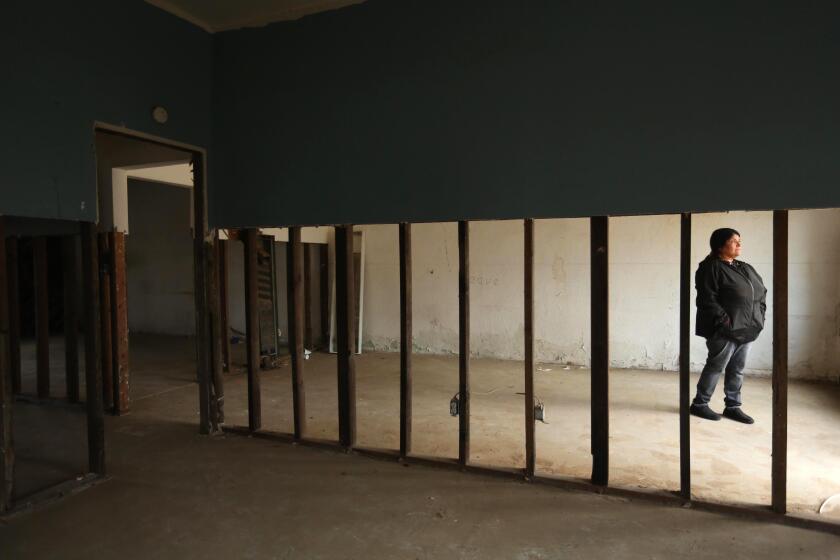
During the epic rains of 2023, atmospheric rivers pounded areas rich and poor in California with equal ferocity. But poor rural communities bore the brunt of the damage.
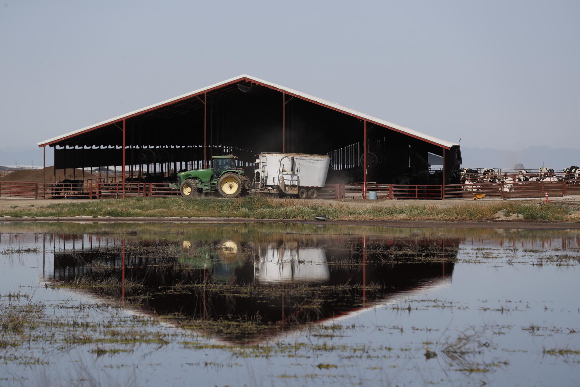
The local agencies also failed to account for potential worsening of groundwater contamination linked to declines in aquifer levels. In many areas, groundwater is recharged by snowmelt and stormwater. As these waters seep into aquifers, they can carry contaminants from the surface, such as nitrate from dairy operations. As pumping draws down groundwater levels, the water often contains higher concentrations of toxic contaminants.
State regulators were particularly concerned about five contaminants in the subbasin’s groundwater. These include arsenic, nitrate, uranium and a group of contaminants known as total dissolved solids. More than one-fifth of the Tulare basin wells sampled had concentrations of contaminants exceeding regulatory standards.
Groundwater sustainability agencies are not responsible for water quality before 2015, when the law took effect. However, the law requires that they monitor groundwater quality and establish a level at which action needs to be taken. In the case of the Tulare Lake proposal, local leaders chose to use the highest level detected pre-2015 as their baseline. Anything they found below that — anywhere — no need to intervene.
Water board staffers “strongly” objected, saying the approach would allow for an overall degradation of water quality.
It was this kind of approach — cherry-picking data — that alarmed the subbasin’s neighbors.
Just west of the Tulare Lake subbasin is the Westside subbasin, administered by the Westlands Water District, where state officials have approved the local groundwater plan. Westlands’ managers set minimum thresholds for the amount of groundwater that could be drawn and laid out objectives for the future.
But for Westlands’ plan to be successful, its leaders noted in communications with the state, agencies in the Tulare Lake subbasin also need to maintain water levels. Russ Freeman, Westlands’ deputy general manager, said that continued lowering of groundwater levels in the Tulare Lake subbasin would “adversely affect” Westlands’ ability to implement its plan.
Although the general manager, Allison Febbo, was reluctant to speak about her neighbor to the east, she said one difference between the two areas is that in Westlands, there are hundreds of groundwater pumpers, “not just a few making the decision.”
For now, at least on paper, state regulators appear ready to move forward with disciplinary action against the Tulare water agencies. State Water Board officials said they expect to issue a “draft resolution” in March to support putting the subbasin on probation.
“What we need them to do is fix the subsidence problem,” said Karla Nemeth, director of the Department of Water Resources.
Instead, powerful interests in the basin appear to be gearing up for a fight.
Many of the landowners have a long tradition of refusing to talk to the media or making their business dealings public. And the groundwater agencies they control often follow suit. Despite requests, officials at the five local groundwater agencies failed to respond to requests for comment for this story.
But their responses to the state bristled with the kind of litigious language often deployed in legal filings to overturn government decisions. In his letter, Boswell’s lawyer employed phrases such as “arbitrary and capricious decision-making,” “violates equal protection” and “without adequate reason.”
In the city of Corcoran, which for a time appeared at risk of being swallowed in this year’s flooding, officials largely echoed the message of the region’s big landowners. City Manager Greg Gatzka said in his letter to the water board that the city is “gravely concerned with the potential unintended financial consequences” resulting from “excessive fines and penalties to our rural agricultural region.” The city’s letter didn’t once mention the word “subsidence.”
The power of big farmers is such that many residents contacted by The Times were loath to be quoted on the issue of pumping and subsidence, with some saying it was too political.
Margaret Lirones, who has lived in Corcoran for a decade, was one of the few who voiced concerns that the town is subsidizing growers engaged in an unsustainable practice. She described subsidence in the area “like an elevator, very slowly going down,” but so slowly you don’t notice.
What she has noticed, she said, is the bill to pay for the fallout. She paid more than $500 in property tax assessments as part of the financing for the 2017 levee work, and even more on behalf of her church, which turned to its congregation to cover the tax bill.
“Everybody is paying to raise the levee,” she said. And though the state stepped up this year to fund more levee work, she said it wasn’t clear who would pay the next time it needs raising.
“California taxpayers are basically subsidizing overdraft of groundwater,” she said, “subsidizing the profits of a few who take a resource that is shared by all.”




![[20060326 (LA/A20) -- STATING THE CASE: Marchers organized by unions, religious organizations and immigrants rights groups carry signs and chant in downtown L.A. "People are really upset that all the work they do, everything that they give to this nation, is ignored," said Angelica Salas of the Coalition of Humane Immigrant Rights. -- PHOTOGRAPHER: Photographs by Gina Ferazzi The Los Angeles Times] *** [Ferazzi, Gina -- - 109170.ME.0325.rights.12.GMF- Gina Ferazzi/Los Angeles Times - Thousands of protesters march to city hall in downtown Los Angeles Saturday, March 25, 2006. They are protesting against House-passed HR 4437, an anti-immigration bill that opponents say will criminalize millions of immigrant families and anyone who comes into contact with them.]](https://ca-times.brightspotcdn.com/dims4/default/34f403d/2147483647/strip/true/crop/1983x1322+109+0/resize/840x560!/quality/75/?url=https%3A%2F%2Fcalifornia-times-brightspot.s3.amazonaws.com%2Fzbk%2Fdamlat_images%2FLA%2FLA_PHOTO_ARCHIVE%2FSDOCS%2854%29%2Fkx3lslnc.JPG)