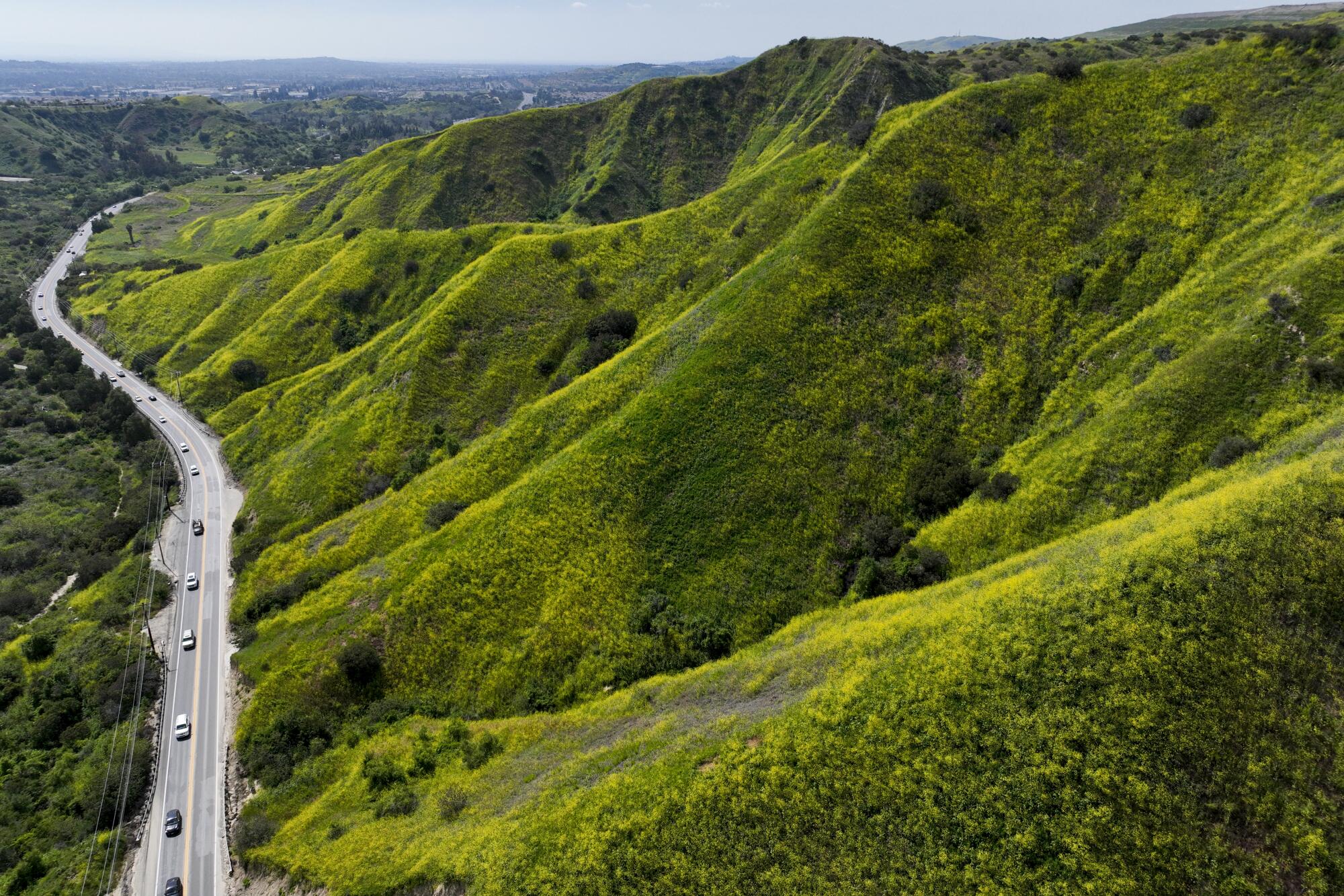
The typically parched, brown hills above Los Angeles are a vibrant shade of green â a rarity for early October.
In state parks, waterfalls and rivers that were vastly reduced are now gushing with water.
And in Lake Oroville, boats float on deep blue water that only a year ago was shrinking toward record lows.
The transformed landscape is the result of a remarkable California water year that saw 141% of average rainfall statewide, officials announced this week. The state received 33.56 inches of rain â nearly twice the amount of rain recorded during the previous water year and nearly three times the amount from the year prior. The water year runs from Oct. 1 to Sept. 30.
âThis was as close to a miracle year as you can get following the intensity of drought conditions,â said Karla Nemeth, director of the Department of Water Resources, during a briefing Tuesday. The three previous years were Californiaâs driest on record.
Aggressive and impactful reporting on climate change, the environment, health and science.
But with abundance comes risk: Forecasters are warning of another potentially wet winter fueled by El Niño, which could bring levee breaches and flooding to the state once again.
âMother Nature really helped us out, and she did help us out in a really, really big way in certain parts of the state,â Nemeth said. âBut there are always ways in which Mother Nature can throw us a curve ball, and we shouldnât expect that necessarily again. Thereâs a lot of work to continue to be done â particularly when it comes to flooding and protecting our communities.â
This yearâs soggy conditions were due primarily to 31 atmospheric river storms that unleashed torrents on the Golden State this winter and spring, as well as a very wet August marked by the rare arrival of Tropical Storm Hilary.
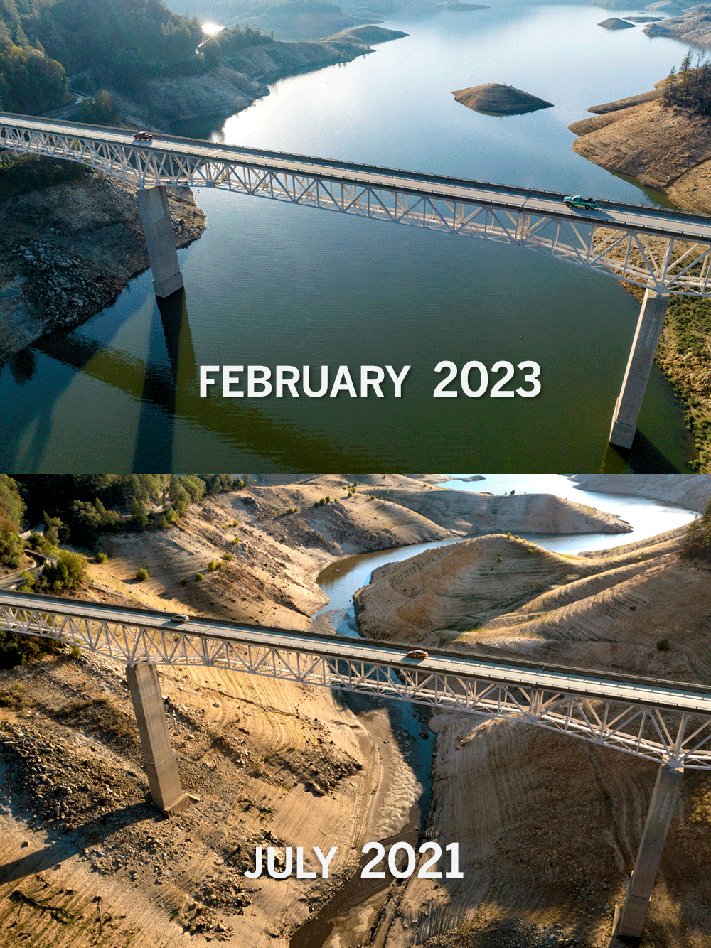
The deluge replenished major reservoirs that only a year ago were dangerously low. State reservoirs are now holding about 27.4 million acre-feet in storage, or 128% of normal. That includes Californiaâs two largest reservoirs, Lake Shasta and Lake Oroville, which are both at 73% capacity. At the same time last year, they were at 33% and 35% capacity, respectively.
Orovilleâs increase was particularly dramatic, said Ted Craddock, the DWRâs deputy director of the State Water Project. Between December and the end of the snowmelt period this spring, the reservoir gained more than 240 feet in elevation â âthe largest increase weâve seen in Oroville storage in a season ... since the lake was built in the 1960s.â
Land barons seized control of the Tulare Lake Basin generations ago. This yearâs destructive flooding left troubling questions about the power they wield.
The difference between now and a year ago is âlike night and day,â said Jay Lund, a professor of civil and environmental engineering at UC Davis.
âThis year was a good reminder that we do have this tremendous variability in water availability in California,â he said.
Many parts of Central and Southern California saw essentially âtwo seasons in one,â or more than 200% of normal, according to the National Weather Service.
For example, a weather station at USC in Los Angeles recorded 31.07 inches â more than twice the areaâs normal rainfall of 14.25 inches a year, the agency said. Ontario and Fullerton each saw about 25 inches compared with their normal 12 inches.
The water year also saw record snow. At its peak on April 1, snowpack measured 237% of normal â the deepest ever recorded since the state established a network of snow sensors in the mid-1980s.
Water was so plentiful that officials with the Metropolitan Water District were able to refill Southern Californiaâs largest reservoir, Diamond Valley Lake, for the first time in several years, with General Manager Adel Hagekhalil exclaiming at the time that ânature gave us a lifeline.â
But while California has been known to swing from wet to dry, climate change is making both conditions more extreme. So-called âaverageâ years are also likely to become less frequent, Lund said.
âOur discussions about water tend to be a little fickle,â he said. âIf itâs a dry year, weâll talk about drought, or if itâs a wet year, we have these problems with floods. But really, we need to worry about both in any year and every year.â
There is a 95% chance that El Niño will persist into next year, and a 71% chance that it will become a âstrongâ El Niño, officials say.
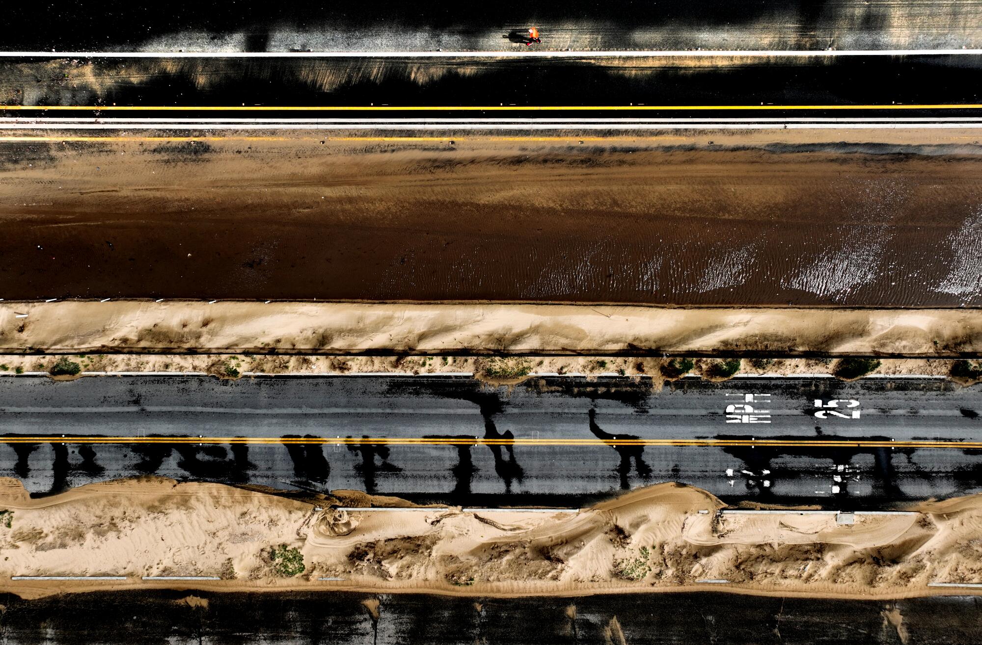
Indeed, after the stateâs three driest years on record, officials this year scrambled to keep up with all the rain. As storms hammered California, multiple levees breached and sent water rushing into towns and communities, including the small migrant community of Pajaro. Thousands of homes were flooded, and by the time the storms dissipated, at least 22 people had died across the state.
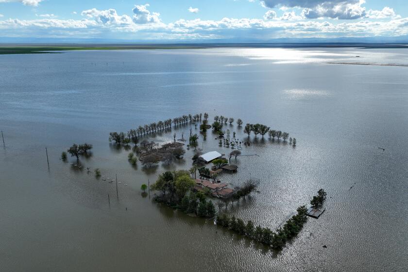
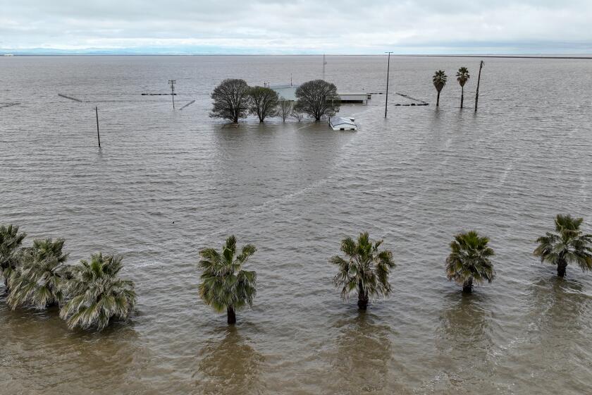
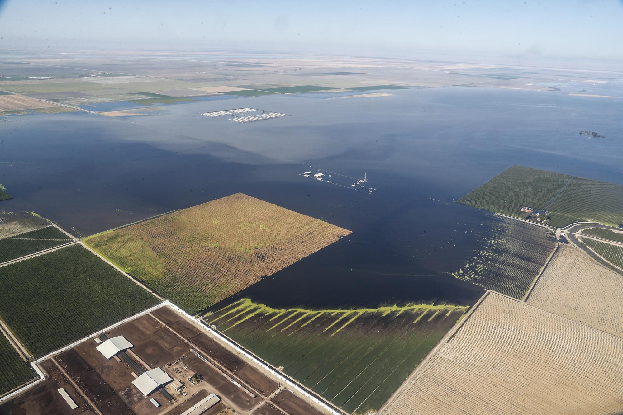
In the San Joaquin Valley, the long-dry Tulare Lake reemerged for the first time since 1997, leaving low-lying fields buried under deep and stagnant water.
State officials on Tuesday said the events were a wake-up call to the challenges of forecasting in a rapidly changing climate, and the need for greater preparation for both wet and dry conditions.
âWeâve always had intense variability in California, but the suddenness of the shift from âvery extreme dryâ to âvery extreme wetâ is something that we think needs additional research to understand how changes in the climate may have played a factor, or not, in that extreme shift,â Nemeth said.
Adding to the challenge is the possibility of a strong El Niño event this winter. The climate pattern is often associated with wetter conditions in Southern California, but is less informative about Northern California, which is where most of the stateâs water supply comes from.
Still, the possibility of more storms â particularly along the coast â is cause for concern, officials said. Storms coming straight off the Pacific could equate to more coastal impacts like those seen in Pajaro.
âThe coast was particularly hit hard, and that keeps me awake a little bit at night with going into an El Niño year,â said Gary Lippner, DWRâs deputy director of flood management and dam safety. âI think there is potential for a lot of strong storms to come into California and have coastal issues. And we just do not have extensive flood systems on the coast of California, so thatâs an area that weâre paying particular attention to going into this year.â
Among the stateâs preparations are $52 million in funding to assist with local flood projects and critical levee repairs. The state is also readying more flood control material than last year, including more âmuscle wallâ â or material to help shore up levees and contain water â and 2.4 million additional sandbags, officials said.
âWe really are going to focus this year on the timing, the pace and the scale of the storms when that storm door is open,â said state climatologist Mike Anderson.
He noted that the state and federal officials are also employing new technology, including atmospheric river reconnaissance flights, which collect storm data and help improve forecasting, and laser spectrometry to help measure snowpack and better predict runoff.
Diamond Valley Lake â a backbone of the regionâs water storage system â should refill to its full capacity by the end of this year, officials said.
Lund, of UC Davis, said that while large cities tend to be fairly well defended against flooding, many smaller places such as Pajaro arenât adequately protected.
âThese floods and droughts identify weaknesses in the system,â he said. âHopefully, the failures will bring us to action on some of these.â
In addition to flood threats, the abundance of water this year also led many to question whether the state was doing enough to capture all of that water â including some lawmakers who called for officials to relax environmental pumping restrictions that limited the amount of water that could be captured from the Sacramento-San Joaquin River Delta during the storms.
In March, the State Water Resources Control Board approved a plan to divert some floodwaters from the San Joaquin River to replenish aquifers that had been depleted by agricultural pumping and years of drought. Nearly 400,000 acre-feet was diverted from the river and sent to areas where it could spread out and percolate down into the ground, with an additional 1.2 million acre-feet in temporary permits issued by state agencies.
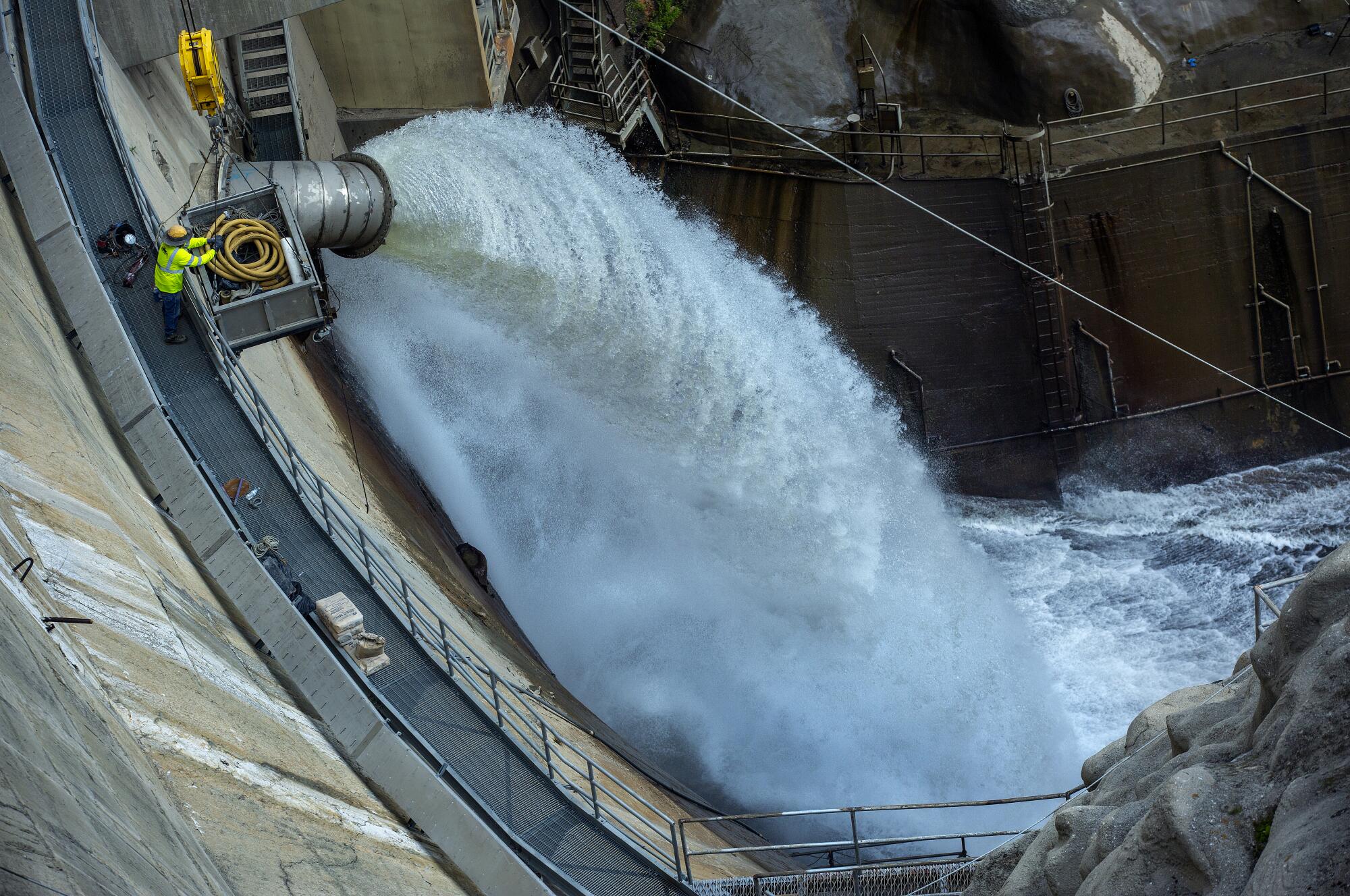
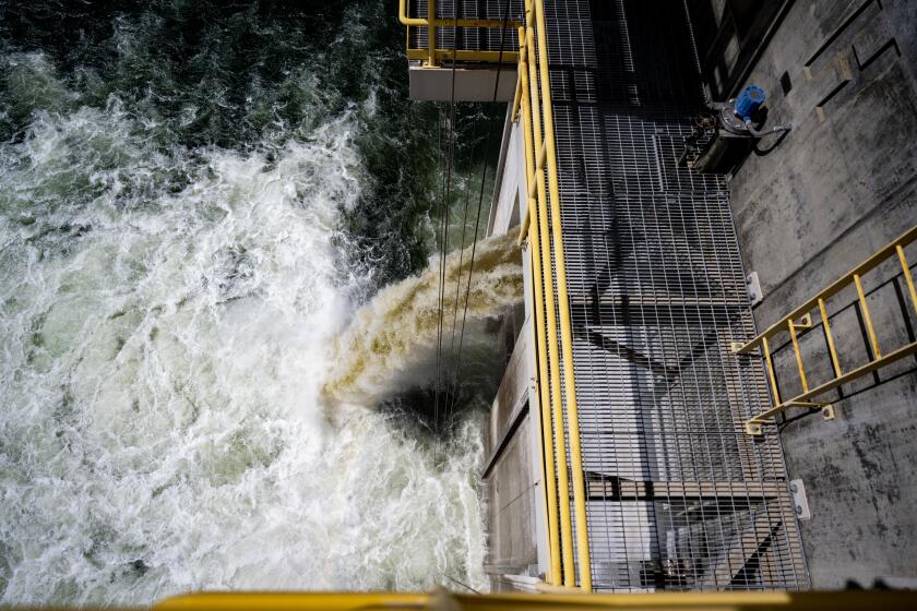
Water is released at 15 cubic feet per second from the Santa Anita Dam in January.
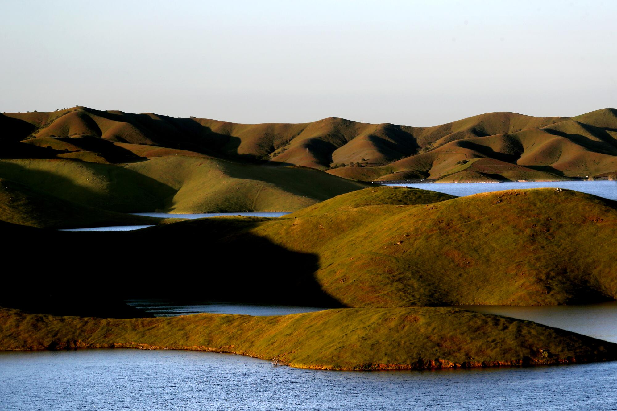
Water fills coves along the shore of the San Luis Reservoir, near Los Banos, in April, following a series of heavy rainstorms.
But while groundwater storage saw a boost this year, it will take more than one wet season to replenish supplies that have been sapped by years of overuse and drought. Aquifers in some parts of the state â particularly heavily agricultural regions of the Central Valley â remain much below normal, state data show.
âIt will likely require several more years in addition to what happened this past year â and more focused efforts on groundwater recharge and reduced demand,â said Paul Gosselin, DWRâs deputy director of sustainable groundwater management.
And while winter looks potentially wet, the state is also contending with warming conditions that could further sap supplies. June, July and August marked the warmest summer on record for the Northern Hemisphere, while September broke global heat records by a large margin.
For the time being, however, much of Californiaâs landscape remains somewhat drenched, including parts of Southern California that received several inches of rain in August from Hilary. That could signal an end to this yearâs mild fire season, although experts caution that drying winds could change the outlook quickly.
The wet year âcertainly dampened the likelihood of fires for much of the state,â Lund said. âI would much rather have had the rains than not.â

