Here’s where California’s cliffs are collapsing into the sea the fastest
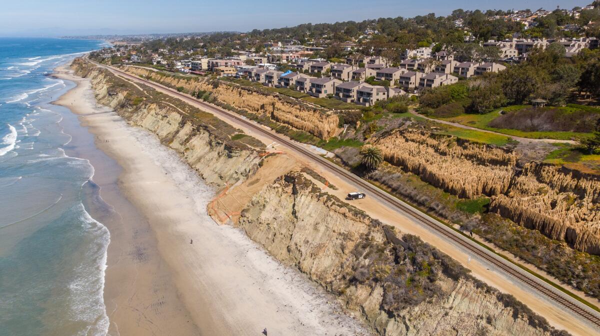
Cliffs along California‚Äôs northernmost coast have been eroding faster than the more populated bluffs of Southern California ‚ÄĒ one of many conclusions highlighted in a new map and study that analyzed, for the first time with high-resolution data, every cliff along the state‚Äôs long and varied shoreline.
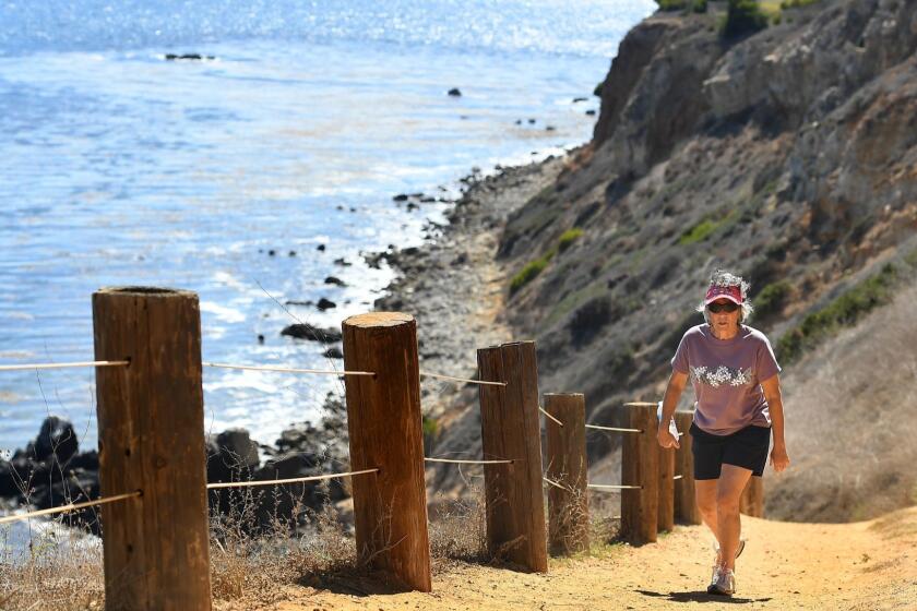
The study, conducted by researchers at UC San Diego’s Scripps Institution of Oceanography, also identified hot spots in areas both north and south: The rate of cliff collapse was more than 16 feet per year in places such as the Palos Verdes Peninsula, Big Sur, Point Arguello and Martins Beach just south of San Francisco.
Overall, the highest rates of erosion were detected in the counties of Mendocino, Humboldt and Del Norte. Hot spots there include Usal Beach, the King Range, Centerville Beach ‚ÄĒ which are all part of a region known as the Lost Coast ‚ÄĒ and an area about two miles north of the Klamath River.
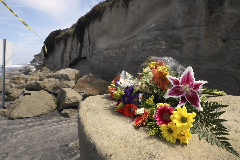
The consequences of cliff erosion have already proven to be severe on major roads, railways and other critical infrastructure, and coastal officials have increasingly turned to scientists for help. A recent cliff collapse that killed three women has also intensified the pressure to better understand this hazard looming over much of the California coast.
Like hurricane forecasting, projecting when and how much a cliff will erode ‚ÄĒ especially in the face of sea level rise ‚ÄĒ is in high demand. But coastal cliffs are infamously difficult to study, and the data that scientists need to feed into these forecasting models have been few and far between.
A more detailed picture has finally come into focus with this latest study, which was published in the journal Geomorphology and turned into a searchable website. Researchers and coastal officials across California now have a more nuanced assessment of this daunting issue that could affect more than 530 miles of the state’s shoreline.
‚ÄúIt‚Äôs pretty exciting. ‚Ķ When you start to develop these kinds of datasets that are highly detailed ‚ÄĒ spatially, and ultimately temporally ‚ÄĒ we can then learn even more about ‚Ķ how cliffs behave over short time periods,‚ÄĚ said Patrick Barnard, who, as research director of the U.S. Geological Survey‚Äôs Climate Impacts and Coastal Processes Team, has built complex models to forecast cliff erosion in California. ‚ÄúThis is what we need to know to be able to support coastal management and reduce hazard risk and get people out of harm‚Äôs way.‚ÄĚ
Cliff collapses like the one in Encinitas that killed three women are one of California‚Äôs many hidden dangers. We know what areas they‚Äôll most likely happen ‚Äď but nailing down when, and how big, is not an exact science.
Barnard, who was not affiliated with the Scripps study, explained that cliffs are particularly tricky to study. Cliff height, the strength of the rock, wave action, the slope of the beach and the slope of the seafloor could all factor into a cliff’s stability. How rainfall and groundwater seep into cracks can also build up pressure and lead to collapses.
The human urge to develop right to the edge ‚ÄĒ whether it‚Äôs a blufftop home, landscaping or the coastal highway ‚ÄĒ also affects erosion by altering water drainage and adding weight to the cliff.
Compounding all this is sea level rise, as waves hammer away at the crumbling coastline with every tide and storm. Along just the Southern California coast, the cliffs could erode more than 130 feet by the end of the century if the sea keeps rising, according to recent projections by Barnard and his team.
It’s not just beaches and sand that are disappearing as the ocean pushes inland.
Communicating to the public on how a cliff erodes, however, has been challenging.
Scientists tend to think in averages, which can delude people into a false sense of safety. Stretched over a long period of time, an average rate of erosion ‚ÄĒ say, a few inches or a foot a year ‚ÄĒ might not sound like much.
But cliffs, in reality, tend to crumble slowly over time, punctuated with a sudden collapse (often without warning) from a landslide or during a big storm. A cliff averaging one foot a year might actually not do anything dramatic for 20 years, and then suddenly a 20-foot collapse will happen in one go.
Adam Young, a coastal geomorphologist at Scripps who oversaw the most recent study, sought to piece together a more comprehensive picture of how cliffs in California have been changing over time. He sorted through all available historical data (much of it was discontinuous and didn‚Äôt cover the whole coastline) and analyzed everything with newer lidar data ‚ÄĒ an advanced laser-imaging technology ‚ÄĒ that had been collected from a plane in 2009-2011 and 2016 by state and federal agencies.
With fellow co-author Zuzanna Swirad of the Polish Academy of Sciences in Warsaw, Young created sophisticated digital elevation models and examined both the average and maximum collapse in a given area. And rather than just study the top of the cliff, which has been the default way to measure cliff erosion, they also looked at the entire cliff face. This way, their analysis could also account for landslides that start when the bottom of a cliff becomes unstable.
Patterns began to emerge as they studied the data. Erosion was detected along more than half the state‚Äôs cliffs during the time period studied ‚ÄĒ with the fastest rates observed north of Bodega Bay and in areas with weaker rocks.
Why this is the case is not yet certain, but Young said that the northernmost parts of the coast tend to be subject to heaver rain and more intense waves. The Southern California coast, which is more urbanized, is also buffered by more seawalls and cliff hardening devices that slow erosion.
In a counterintuitive twist, Young and Swirad also found that cliffs that are fronted by sandy beaches eroded twice as fast as cliffs without beaches. This finding was striking because beaches are often considered an extra buffer between the sea and the cliffs.
‚ÄúThe waves, when they‚Äôre large enough, can actually pick up the sand and use it as an abrasive and rub at the cliff, kind of like sandpaper,‚ÄĚ Young said.
Going forward, much more analysis could be done on a year-by-year, or perhaps even season-by-season basis. The technology now exists to measure and monitor the coast more frequently, but statewide surveys are currently only conducted every five or so years.
Young is in the process of proposing a mapping program in which a lidar team would go out every year to collect fresh data along the entire coast. The hope is that by understanding the patterns of past collapses in a more nuanced way, projections on how a cliff might erode in the future will be sharper and more refined.
These forecasts could ultimately help inform the tough decisions that many communities will have to confront in the coming years. Officials could use this data, for example, to determine how far to set something back if they are planning to build on top of a cliff. Blufftop residents might get a clearer sense of when it might be time to move, and beachgoers could be alerted when a cliff is becoming too precarious.
‚ÄúBy better understanding how the coastline is evolving now,‚ÄĚ Young said, ‚Äúwe can make better predictions for the future.‚ÄĚ
Watch L.A. Times Today at 7 p.m. on Spectrum News 1 on Channel 1 or live stream on the Spectrum News App. Palos Verdes Peninsula and Orange County viewers can watch on Cox Systems on channel 99.
