Tropical moisture mixes with CaliforniaŌĆÖs heat, driving storms, flood potential, fire risks

CaliforniaŌĆÖs latest heat wave has drawn tropical moisture into the region, causing severe thunderstorms in some inland areas that forecasters warn could continue to cause flash flooding and dangerous lightning through at least Wednesday night.
Some areas of Southern California, including the San Gabriel mountains and ranges across San Bernardino County, have the potential for strong, slow-moving storms to develop Wednesday afternoon. The storms ŌĆ£may produce heavy rainfall amounts and some flash flooding,ŌĆØ the National Weather Service warned.
The Sierra Nevada and surrounding foothills also have a high risk for severe thunderstorms, with a chance for excessive rainfall causing flooding across much of eastern and southeastern California, according to the the National Weather ServiceŌĆÖs Weather Prediction Center.
ŌĆ£In recent days, even isolated storms have been able to produce flooding due to the sensitivity of the soils in those areas,ŌĆØ forecasters at the Weather Prediction Center warned. ŌĆ£Thus, isolated flash flooding is likely, ... though exactly where that happens is very difficult to say.ŌĆØ
A section of Mono County remains under a flood watch through Wednesday night, and forecasters warn that ŌĆ£excessive runoff from thunderstorms may result in flooding of burn scars, creaks, streams and other low-lying and flood-prone locations.ŌĆØ
This monsoonal moisture driving the storms is a fairly typical summer weather pattern that occurs due to a change in wind currents, said Stephen McCoy, a meteorologist with the National Weather Service in Hanford.
ŌĆ£We have an upper-level high-pressure system thatŌĆÖs currently located over southern Nevada,ŌĆØ McCoy said. ŌĆ£The rotation around this high-pressure system is driving moisture up from the tropics into our area.ŌĆØ
That high-pressure system continues to heat up the region, with most of the Central Valley and interior Southern California under excessive heat warnings through Thursday evening.
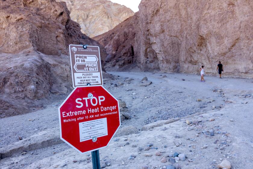
Temperatures across the state are expected to remain in the triple digits, with highs in the Mojave Desert forecast to reach up to 114 degrees; in the San Joaquin Valley, highs could hit 111, in the Antelope Valley up to 110 and in Death Valley up to 125. Forecasters continue to warn that little relief will come at night, with low temperatures remaining above 70 or 80 in many areas.
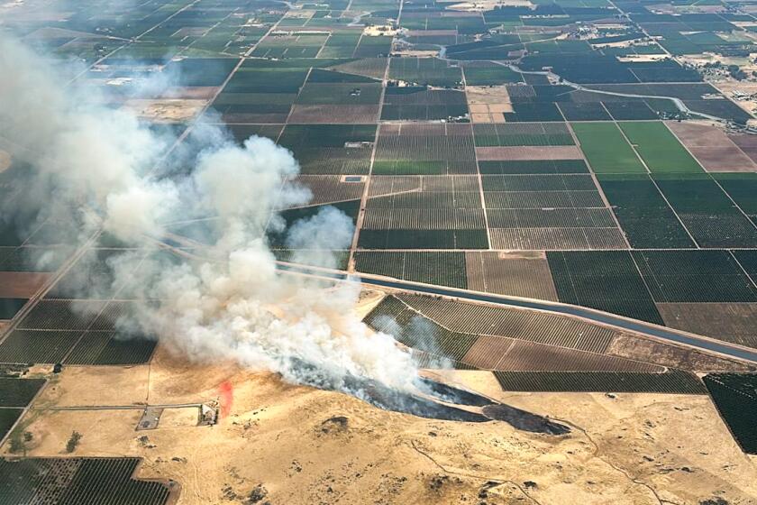
Remnants of Tropical Storm Alberto produced hundreds of dry lightning strikes across CaliforniaŌĆÖs Central Valley on Monday, sparking several wildfires in the area.
With the heat and thunderstorms, thereŌĆÖs an increased risk for wildfires, especially if thereŌĆÖs dry lightning.
Storms on Tuesday caused over 1,500 lightning strikes across the San Bernardino, Riverside and San Diego county mountains and deserts, and even more were recorded in northeastern Los Angeles County and over the Sierra Nevada. However, officials said most of those strikes hit during a wet storm, as will likely be the case Wednesday.
The increased danger of heat waves is not occurring equally in all regions ŌĆö in the hot, dry conditions of the Southwestern U.S., heat wave intensity and frequency is increasing particularly rapidly.
ŌĆ£Yesterday and today, we have had the lightning but itŌĆÖs been associated with rainfall,ŌĆØ McCoy said Wednesday morning. ŌĆ£The fire potential isnŌĆÖt as high as it has been in the past,ŌĆØ but itŌĆÖs certainly still a risk.
Dry lightning has already been linked to at least four fires that ignited Monday in the Plumas National Forest, forcing some evacuations in nearby resort towns. The Gold fire complex had grown to a total 2,858 acres as of Wednesday, with warnings that structures remain threatened and evacuations ŌĆ£could increase depending on fire growth and behavior,ŌĆØ the U.S. Forest Service said in an update.
Federal officials fighting the fire there said the cooling trend expected to begin later this week should help temper the blaze, but noted that WednesdayŌĆÖs chance for thunderstorms could bring ŌĆ£gusty, erratic winds which can cause unpredictable fire spread.ŌĆØ
The crews have not yet reached any containment on the Gold fire complex.
In Los Padres National Forest, the Apache fire ignited Tuesday and forced some nearby evacuations, according to Ventura County Fire Department officials. Burning about 30 miles northeast of Ojai, the blaze continued to grow Wednesday, estimated at about 800 acres. It wasnŌĆÖt immediately clear the cause of that fire. No containment has been established there.
But with the amount of moisture in the atmosphere, weather officials said flash flooding will be the largest threat Wednesday.
ŌĆ£The big concern that we have today, alongside the lightning strikes, is a slight risk for potential flooding,ŌĆØ McCoy said.
More to Read
Sign up for Essential California
The most important California stories and recommendations in your inbox every morning.
You may occasionally receive promotional content from the Los Angeles Times.


