Heavy rain to hit Southern California; thousands flee flooding in Central Valley

- Share via
ALLENSWORTH, Calif. — A weary, storm-soaked California is bracing for another bout of heavy rain and snow, power outages and potential flooding this week as a cold weather system takes aim at the state.
Light rain was falling in many regions Monday, the first day of spring, with precipitation expected to gain strength early Tuesday and linger into Wednesday.
Unlike recent warm atmospheric river storms that pulled moisture from the tropical Pacific, the incoming system will be a “cold, powerful, dynamic storm coming out of the northwest,” said David Sweet, a meteorologist with the National Weather Service in Oxnard. The greatest effects are expected in Southern California.
“The main event starts to approach tonight, and it really hits us hard tomorrow — that’s when we’re going to get the heaviest rain, the strongest winds and the heaviest snow in the mountains,” Sweet said. High temperatures will be 10 to 15 degrees below normal.
Thousands of residents have been told to evacuate their homes in California’s Central Valley as another storm arrives.
Lower mountain and foothill areas around Los Angeles could see up to 4 inches of rain, with up to 3 inches possible along the coast and in the valleys, Sweet said. Up to 4 feet of snow is possible at elevations above 6,000 feet, with a significant threat of avalanches.
Damaging winds — including gusts of up to 60 mph along the coast and in the valleys and up to 80 mph in mountain and desert areas — are possible, which could down trees and cause power outages. But the arrival of more moisture remains a top concern.
“We’ll have our eye on [wildfire] burn areas; we’ll have our eye on just about any location, really, for the possibility of flooding,” Sweet said. “At this point, we’ve gotten so much rain that any additional rain has the potential to cause problems.”
That was certainly the case in Central California, where Tulare County residents continued to deal with flood threats from surging rivers and breached levees.
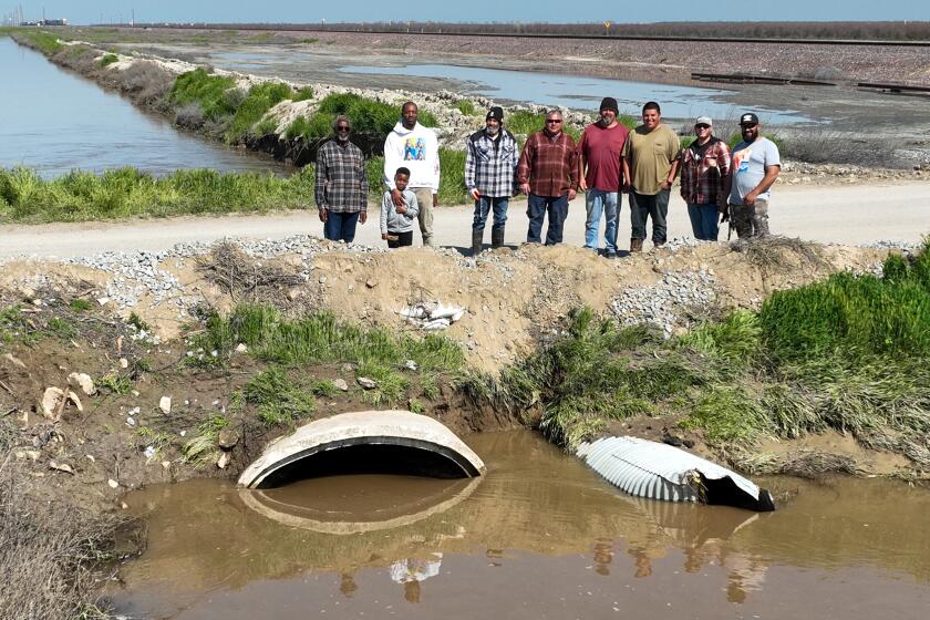
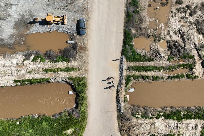
The Tulare County Sheriff’s Office on Sunday ordered evacuations in Alpaugh and Allensworth because of a nearby levee breach, with at least one official indicating the breach may have been caused by someone intentionally cutting through an earthen barrier with machinery.
Allensworth resident Perla Estrada said Monday she was worried that water from the coming storm could climb higher toward the doorstep of her mobile home.
“We don’t see a solution,” Estrada said as she walked in sandals through the muddy floodwater that covered her front yard. She added that she had been asking local emergency workers for help.
Her son, Juan Espinoza, walked through shin-deep water on the dirt road in front of their home. He said he had been using a small pump to try to drain water from the yard. He also used a shovel to dig trenches, trying to create a path for the water to drain away.
“But it didn’t help at all,” Espinoza said. “We’re just trying to get this water out.”
People in the rural California community of Allensworth have been fighting floodwaters by building berms, and are bracing for the next storm.
Meanwhile, evacuations were also underway in nearby Porterville along both banks of the Tule River because of erosion and high water levels, officials said. More than 100 people were in emergency shelters in Exeter, Ivanhoe and Porterville, and nearly 15,000 people were under evacuation orders and warnings.
The area is threatened by water flowing out of the mountains into Lake Success, said Carrie Monteiro, spokeswoman for the Tulare County Emergency Operations Center. Over the weekend, the lake’s spillway was releasing as much as 7,000 cubic feet of water per second to make room for incoming flows, putting additional pressure on the river and tributaries downstream.
Though the incoming storm is expected to bring less rainfall, “our waterways are significantly stressed,” Monteiro said.
“We have over 500 personnel working on this incident,” she added, “ready, prepared for wherever a levee break or breach may happen because our canals, waterways, creeks and streams are very, very saturated, very stressed, and not used to having this amount of water.”
Though the breach near Allensworth has been temporarily repaired, it’s a “Band-Aid,” she said.
“We are going to have some significant work ahead of us to go back and re-engineer and re-secure these breaks, and with these incoming storms, we know we’re going to have more runoff and more water,” Monteiro said.
At least seven homes in Tulare County have already been destroyed by floodwaters, primarily in Springville, while 62 structures have suffered major damage and 177 minor damage.
Officials are asking the public to remain alert and be ready to leave should another breach occur. Tulare County residents are encouraged to sign up for emergency notifications at AlertTC.com.
Forecasters said the incoming storm was expected to bring more rain to the Tulare area on Tuesday and Wednesday, including the chance of thunderstorms. The southern Sierra Nevada could see up to 4 feet of snow in areas around Yosemite.
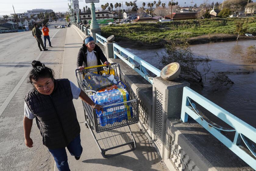
Founded as a labor camp for agricultural workers, the small community of Pajaro has long languished in the shadow of nearby Watsonville.
However, much of the focus Tuesday will be on Southern California.
“The heaviest rain is definitely going to be in Southern California, and L.A. and San Diego will both probably see more rain out of this storm than a lot of other storms this winter,” UCLA climate scientist Daniel Swain said during a briefing Monday.
Swain described it as “an unusually rapidly strengthening low-pressure system,” the likes of which is not often seen off the coast of California. The center of the system will probably be over the San Francisco Bay Area, but the strongest winds and heaviest rain are expected to stretch from the Monterey Bay region “all the way south to the Mexican border,” he said.
The storm in Southern California will be associated with a moderate atmospheric river, while Northern California won’t have an atmospheric river component but will be affected by the low-pressure system itself, he said.
“This is going to bring a whole litany of concerns that are probably greater than we had initially anticipated a few days ago,” he said of the storm.
In Orange County and the Inland Empire, rainfall totals are likely to range from 1.5 to 2 inches, with storm activity ramping up late Monday and continuing through Wednesday, said Samantha Connolly, a meteorologist with the National Weather Service office in San Diego. Lower-lying mountain areas “will see some pretty significant rainfall” — about 3 to 5 inches, though higher localized amounts are possible, she added.
The additional showers will threaten to further saturate hillsides already thoroughly soaked after weeks of wet weather, and flooding is expected in low-lying roads and urban areas that have poor drainage. In San Clemente, several buildings were evacuated last week after a major landslide — and officials warned additional rain could exacerbate the danger.
“There is more rain on the way. If you live in an area that is susceptible to flooding, landslide or other hazards, please be observant and report anything that you feel needs to be inspected,” San Clemente Mayor Chris Duncan wrote in a community message Saturday.
Fresh snow is expected in the San Bernardino Mountains, where at least 13 people were found dead this month after a historic blizzard trapped residents in their homes. Areas around Wrightwood and Big Bear Lake can expect an additional 2 to 5 feet of snow. Above 7,000 feet, even more than 5 feet is forecast.
At lower elevations, snow accumulations of just 3 to 10 inches are likely. By Wednesday morning, the snow level could fall as low as 4,000 feet.
San Bernardino County officials said they were pre-positioning equipment and mobilizing swift-water rescue teams, as well as public works and flood control crews, in anticipation of the latest storm. County officials urged residents — particularly those in the mountains and areas prone to flooding — to stock up on necessary supplies and limit travel during adverse weather.
The San Bernardino County communities of Oak Glen, Forest Falls, Mountain Home Village, Angelus Oaks and northeast Yucaipa will be under an evacuation warning starting Monday night because of the expected heavy storm and possibility of mud and debris flows, authorities said.
“Residents and businesses should be aware that plowing all county thoroughfares and roads takes time, and that priority is given to main arteries,” officials wrote in a community bulletin over the weekend. “A snowplow not being visible on your street does not mean county crews are not out in full force. They will arrive.”
Though recent storms have cut California’s drought by half, record snowpack will increase the threat of spring flooding, forecasters say.
Elsewhere in the state, residents were similarly girding for more wet weather. After light rain in the San Francisco Bay Area on Monday, heavier downpours were expected late Monday night into Tuesday, with showers lingering into Wednesday, the weather service said.
The Bay Area can expect up to 2 inches of rain along the coast and in inland hills, but the greatest rainfall totals will be in the Santa Cruz and Santa Lucia mountains, with up to 3 and 4 inches, respectively. A high wind warning was in effect for areas including the Santa Lucia Mountains, Los Padres National Forest and Pinnacles National Park, with wind gusts of up to 70 mph possible.
Monterey County, which saw significant flooding along the Pajaro River last week, is likely to avoid more heavy rain but will see minor street flooding and rising creeks, said meteorologist Sean Miller of the weather service’s Bay Area office.
Officials with Monterey County said Monday it could take at least a week for people to gain access to their homes. Dozens of structures have experienced major or minor damage, according to ongoing damage assessment mapping.
In the Greater Sacramento area, Shasta County saw heavy rain, small hail and minor flooding Sunday night, while two people in Placer County were hospitalized after a tree fell and struck their vehicles on Auburn Folsom Road. Showers are forecast for Tuesday and Wednesday, including the potential for thunderstorms, heavy precipitation and up to 2 feet of snow in mountain areas.
Swain said one of the biggest threats moving forward wasn’t so much another huge flood pulse but, instead, prolonged periods of high flows along rivers as the state’s near-record snowpack continues to melt through the spring.
“The consensus is that there’s just so much water stored up there in the snowpack — and we’re already seeing flood issues— that, unfortunately, the likelihood that it gets worse before better is almost 100% at this point,” he said. “It’s just a question of how much worse it gets before things improve in late spring and early summer, eventually.”
A break in the weather is expected in much of the state Thursday through Sunday, though unsettled patterns may begin again around Monday, said Sweet, the weather service meteorologist in Oxnard.
“We have our eyes on another storm for early next week,” he said.
Times staff writer Michael Finnegan contributed to this report.
More to Read
Sign up for Essential California
The most important California stories and recommendations in your inbox every morning.
You may occasionally receive promotional content from the Los Angeles Times.


