How atmospheric rivers and a bomb cyclone add up to mayhem for California
An atmospheric river will arrive in California starting Wednesday and linger through Thursday. Another is forecast to arrive Saturday. (NOAA)
Monumental weather conditions are hitting California this week, with heavy rain, strong winds, snow and choppy surf thanks to a set of weather events known as a ŌĆ£bomb cycloneŌĆØ and a series of atmospheric rivers.
Flood advisories are in effect for most of Northern and Central California.
Northern California already had seen an earlier deluge due to a storm system that culminated in a wet New YearŌĆÖs Eve, while other areas, such as the San Joaquin Valley, have seen winter weather advisories due to strong wind, rain and fog.
On Wednesday an atmospheric river arrived in California, battering the north with pounding rain and winds, prompting evacuations and knocking out power to tens of thousands. Another system is set to arrive Saturday. The weather events will raise the risk for flooding across already saturated areas.

What is an atmospheric river?
For the record:
10:18 a.m. Jan. 4, 2023A previous version of this article described an atmospheric river as condensed water vapor when it should have read concentrated water vapor.
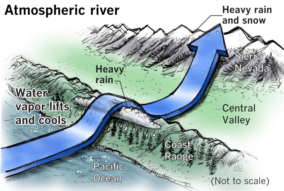
The term is used to describe a flowing column of concentrated water vapor that makes its way through the atmosphere. The atmospheric rivers that arrive in California flow over the Pacific Ocean, originating near Hawaii. The jet stream picks up moisture along the way, which can increase the amount of rainfall.
ŌĆ£The atmospheric river event is able to tap into the moisture over the Pacific and bring in higher moisture to California,ŌĆØ said Cory Mueller, a meteorologist with the National Weather Service in Sacramento.
In simpler terms, an atmospheric river is an area of high-level moisture strung out on a narrow band moving west to east, meteorologist Jan Null with Golden Gate Weather Services said.
ŌĆ£They are not a storm, but just a source of water vapor increasing the precipitation in an already developing storm,ŌĆØ Null said.
When the stream hits CaliforniaŌĆÖs mountainous coasts, the atmospheric river pushes to higher altitudes to continue moving east, gathering more moisture along the way. This tends to cool and condense the moisture in the tropical storm front, which then leads to additional rainfall.
Last weekend saw record-breaking rainfall in the San Francisco Bay Area and surrounding region due to a strong atmospheric river. The slow-moving storm stalled over the region, according to meteorologists, leading to a steady downpour.
How does the atmospheric river fit into CaliforniaŌĆÖs water cycle?
In many ways, California depends on atmospheric rivers to bring water and snow to the state.
ŌĆ£ItŌĆÖs not crazy unusual to see a strong atmospheric river arrive during the water year,ŌĆØ Mueller said. ŌĆ£ItŌĆÖs when you get one after the other that it starts to become an issue.ŌĆØ
Extreme rainfall from atmospheric river events can wreak havoc on coastal regions.
In February 2017, a series of atmospheric river events bombarded Northern California, effectively ending a five-year drought. Reservoirs were filled to the brim, and the surrounding soil became over-saturated. The record-shattering rainfall severely taxed the stateŌĆÖs flood control network. Damage to spillways at Lake Oroville spurred the evacuation of more than 100,000 residents downstream from the dam.
But California saw drought conditions creep back in starting at the end of 2019 and into 2020.
What is a bomb cyclone?
The atmospheric rivers arriving in California this week are being fed in part by a storm system sitting several hundred miles off the northern Pacific coast.
Meteorologists are already referring to the system as a bomb cyclone as it builds in intensity. ŌĆ£BombogenesisŌĆØ occurs when the systemŌĆÖs barometric pressure rapidly drops over a 24-hour period, generating a vacuum-like effect that funnels the storm and causes it to generate strong winds. In essence, the atmospheric rivers will be accompanied by the bomb cyclone storm system.

The storm that hit Wednesday evening was expected to generate both a warm front and a cold front. More intense and colder rain was forecast in the mountains along with snow and strong winds as high as 60 mph in the San Joaquin Valley.
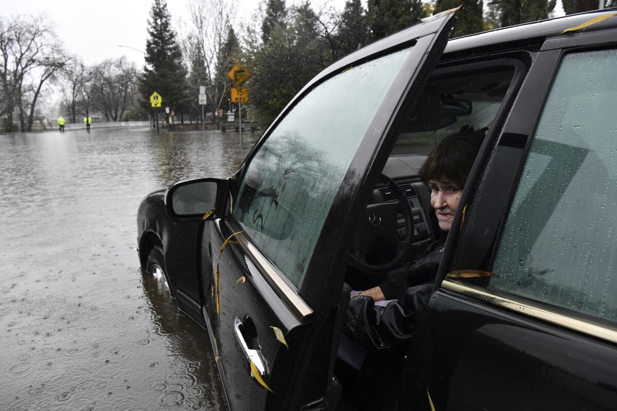
Meteorologists are warning travelers not to drive through floodwaters in their vehicles. They are also urging residents and visitors to be aware of hazardous surf and ocean conditions through Friday in Los Angeles and Ventura counties, along with areas farther north.
Officials warn that drivers should be aware of downed trees, debris flows and floods. The Los Angeles County Department of Public Health issued an advisory for elevated risk of bacteria due to significant rainfall.
More to Read
Sign up for Essential California
The most important California stories and recommendations in your inbox every morning.
You may occasionally receive promotional content from the Los Angeles Times.


