Some evacuation orders lifted in San Bernardino County towns hit by debris flows
- Share via
Authorities lifted some evacuation and shelter-in-place orders Tuesday in San Bernardino County communities hit by heavy rain that had caused flash floods and debris flows near recent burn areas.
Cleanup efforts continued in the mountain communities as more than 120 personnel searched for survivors, said Battalion Chief Mike McClintock of the San Bernardino County Fire Protection District.
No injuries or deaths have been reported so far.
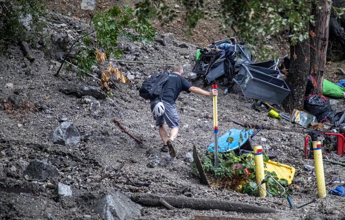
“Some of the damage is pretty significant to both infrastructure and homes,” McClintock said Tuesday afternoon. “We have significant mudflows. They’re impacting roadways. We have no power, and water’s impacted to a significant amount of Forest Falls.”
To address the scorching heat, L.A. has set up cooling centers. But most Angelenos choose to hunker down in a sliver of shade.
In Oak Glen, evacuation orders were lifted at 6 p.m. Tuesday for Oak Glen Road and Wildwood Canyon to Upper Potato Canyon Road, and for Oak Glen Road and Casa Blanca Avenue to Chagall Road, according to the San Bernardino County Sheriff’s Department.
The area was open to residents only, and Potato Canyon Road remained closed.
A shelter-in-place order for the nearby community of Forest Falls also expired at 6 p.m. Tuesday, deputies said.
The area was open to residents only, and an evacuation order from Canyon Drive south to Prospect Drive, south of Valley of the Falls Drive, remained in place.
In a livestream on Twitter from the National Weather Service in San Diego, warning coordination meteorologist Alex Tardy walked along Oak Glen Road near Potato Canyon and showed roads overwhelmed with mud, debris, large boulders and logs, and downed power lines. Some of the mud was nearly a foot deep, Tardy said, adding that the area had been hit four times in the past year and a half, and that removal could take days.
‘Whether you live in a luxury house or in an apartment, we all have to reduce water consumption,’ says UC Davis professor Samuel Sandoval Solís.
Photos and videos from the areas showed mudflows several feet high, sections of homes collapsed, an overturned car covered in mud, creeks gushing with water and roads covered in rocks and debris.
Elizabeth Schenk, a meteorologist at the National Weather Service in San Diego, said that some areas in the Apple and El Dorado burn scar area received more than 2 inches of rain per hour.
“That was pretty remarkable,” Schenk said. Strawberry Creek, which is in the burn scar area, received the highest amount of precipitation, with 2.88 inches of rain Monday. Several other locations recorded more than an inch of rain.
Both Highway 38 and Highway 18 were reopened early Tuesday morning after portions of each roadway were knocked out of commission Monday night by storm damage, according to social media posts by Caltrans District 8.
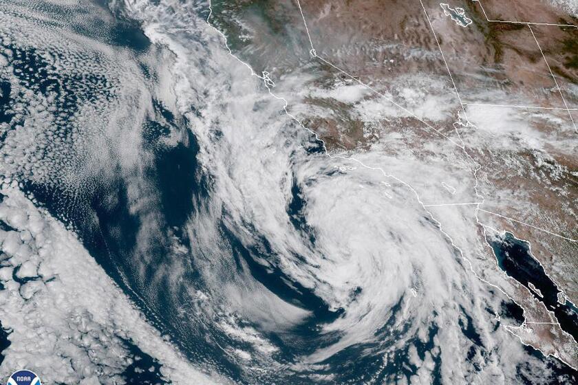
NOAA’s satellite image showed Tropical Storm Kay hovering Saturday off the coast of Southern California and Mexico’s Baja Peninsula.
Leftover moisture from Tropical Storm Kay, which churned off the Southern California coast last week and was the region’s closest brush with a tropical storm in 25 years, helped generate the storms.
Few storms formed Tuesday, and none affected the Oak Glen and Forest Falls areas, said Mark Moede, a meteorologist with the weather service in San Diego.
Brief showers moved over the Big Bear area between 4 p.m. and 5 p.m., Moede said. Around the same time, stronger storms moved across Interstate 40 near Daggett, just outside Barstow, affecting traffic.
Andrew Rorke, a senior forecaster with the National Weather Service in Oxnard, said some storms rained down on parts of Los Angeles County on Monday, including localized flooding in the Antelope Valley. .
The La Niña climate pattern, which tends to bring dry conditions to the Southwest, is expected to persist for another year amid the ongoing drought.
No storms hit the L.A. County mountains and the Antelope Valley on Tuesday, said Kristen Stewart, a meteorologist with the weather service in Oxnard.
Last week, the National Weather Service Climate Prediction Center estimated that the La Niña climate pattern, which likely factors into the unrelenting drought in the U.S. Southwest, could last through November.
While La Niña points to a drier winter than normal, California could escape its fate, Rorke said.
“We can come up and roll that seven if we are lucky,” Rorke said.
More to Read
Sign up for Essential California
The most important California stories and recommendations in your inbox every morning.
You may occasionally receive promotional content from the Los Angeles Times.
