After a series of stormy superlatives, California settles back into a more seasonable pattern

After a week when California was buffeted by bomb cyclones and atmospheric rivers, the state will return to more typical late October weather in the next few days.
High pressure will begin to build in the region on Tuesday, with gusty northwest winds in the mountains, the National Weather Service said.
Surface high pressure developing in the Great Basin will set up weak offshore winds on Wednesday and Thursday, the weather service said. Temperatures will climb into the 80s in the valleys and coastal side of the mountains, with Thursday being the warmest day.
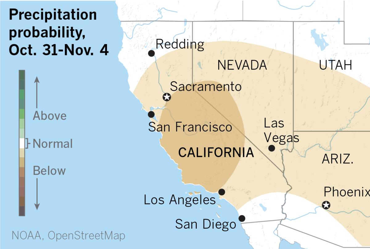
The extended outlooks from the National Oceanic and Atmospheric Administration call for above-normal temperatures across the entire state and below-normal chances for precipitation for most of the state into early November.
Peak northeast winds on Wednesday and Thursday are expected to gust to about 35 mph — possibly 40 mph — in L.A. and Ventura counties.
High pressure gradually shifting east from the Pacific will spread into the Western U.S., lifting temperatures to the 90s in some inland valleys and the lower deserts. The high pressure will weaken over the weekend as low pressure passes to the north.
More to Read
Sign up for Essential California
The most important California stories and recommendations in your inbox every morning.
You may occasionally receive promotional content from the Los Angeles Times.


![[20060326 (LA/A20) -- STATING THE CASE: Marchers organized by unions, religious organizations and immigrants rights groups carry signs and chant in downtown L.A. "People are really upset that all the work they do, everything that they give to this nation, is ignored," said Angelica Salas of the Coalition of Humane Immigrant Rights. -- PHOTOGRAPHER: Photographs by Gina Ferazzi The Los Angeles Times] *** [Ferazzi, Gina -- - 109170.ME.0325.rights.12.GMF- Gina Ferazzi/Los Angeles Times - Thousands of protesters march to city hall in downtown Los Angeles Saturday, March 25, 2006. They are protesting against House-passed HR 4437, an anti-immigration bill that opponents say will criminalize millions of immigrant families and anyone who comes into contact with them.]](https://ca-times.brightspotcdn.com/dims4/default/34f403d/2147483647/strip/true/crop/1983x1322+109+0/resize/840x560!/quality/75/?url=https%3A%2F%2Fcalifornia-times-brightspot.s3.amazonaws.com%2Fzbk%2Fdamlat_images%2FLA%2FLA_PHOTO_ARCHIVE%2FSDOCS%2854%29%2Fkx3lslnc.JPG)