Storm will bring snow to L.A. mountains, may close 5 Freeway over the Grapevine

- Share via
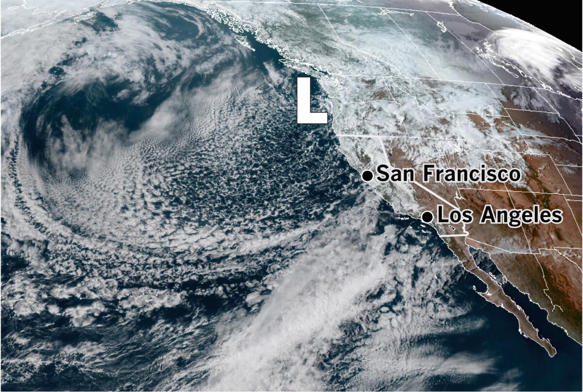
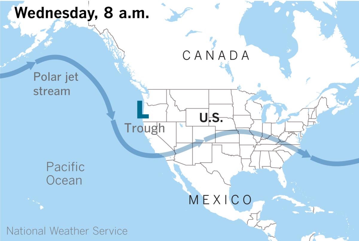
A cold Pacific storm is chugging toward Southern California, bringing relatively limited moisture expected but dropping snow levels into mountain passes, including the 5 Freeway over the Grapevine, the National Weather Service said.
The upper-level trough pushing down from the Pacific Northwest will continue to drift south Wednesday before moving into the Southland on Thursday.

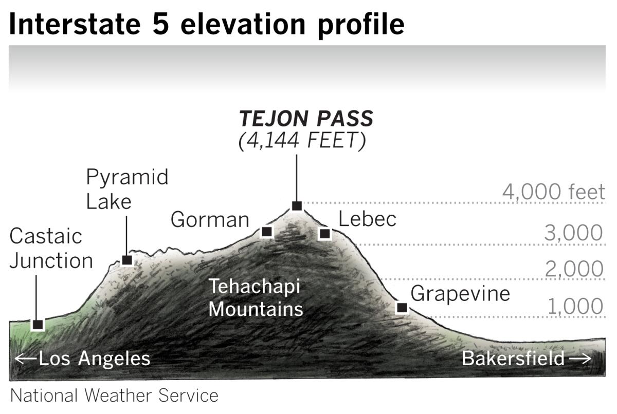
“We’re expecting snow down to 3,000 feet,” said Kathy Hoxsie of the National Weather Service in Oxnard. “There’s not a lot of precipitation with this system, but we definitely expect snow down to the level of the major passes, with a dusting in the Antelope Valley.”
Snow showers in the Antelope Valley foothills could affect Highway 138, and winter driving conditions in the mountains may result in travel delays and road closures.

The storm may bring scattered showers to the coastal and valley areas, with precipitation more likely in the mountains, especially on north-facing slopes. Because of the cold air, there’s also a chance of thunderstorms Thursday evening as the coldest, most unstable part of the low-pressure trough moves over the region, forecasters said. During thunderstorms, there is a chance of brief, heavy downpours, small hail, gusty winds and lightning.
Rainfall amounts are expected to vary across the region, with only about 0.15 inches for the coast and valleys and about a third of an inch in the mountains, although up to half an inch is possible with thunderstorms.
Snow levels will start at 4,500 feet Wednesday and lower to 2,500 to 3,000 feet overnight.
Accumulations of 2 to 4 inches are possible above 6,000 feet, especially on north-facing slopes. One to 3 inches of snow is forecast through 3,000- to 3,500-foot elevations, causing potentially hazardous driving conditions on the 5 corridor in the Tehachapi Mountains, where the Tejon Pass sits at 4,144 feet.

The storm follows a low-pressure system that originated in the Gulf of Alaska earlier this week that brought record-breaking rain to parts of Southern California and triggered a mudslide in Sherman Oaks.
Spring officially began almost a week ago, but “March is a transitional month, and this is not that rare,” Hoxsie said in explaining the wintry forecast. She compared it to the way hot days can linger into the fall after summer ends.
Temperatures are forecast to hover well below normal in many areas Wednesday and Thursday, with the warmest valleys and coastal areas reaching only the mid-50s and low 60s. After the front moves out of the region Thursday night into Friday, clearing skies and dry conditions with milder, more springlike temperatures are expected to prevail.
The series of March storms has helped keep parts of Southern California from sinking deeper into drought conditions following a bone-dry start to 2020.
As of last week, roughly 75% of the state was considered to be abnormally dry, down from 78% a week earlier. The portion of the state considered to be in moderate drought conditions dropped slightly as well, down to about 47%, according to the U.S. Drought Monitor.
Times staff writer Hannah Fry contributed to this report.
More to Read
Sign up for Essential California
The most important California stories and recommendations in your inbox every morning.
You may occasionally receive promotional content from the Los Angeles Times.


