In spite of this week’s storm, Northern California’s seasonal precipitation remains below normal

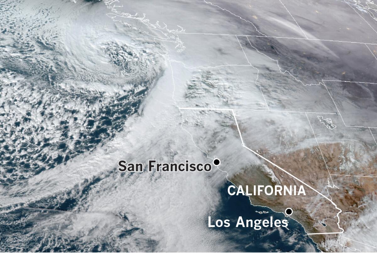
A cold Pacific storm this week dropped heavy rain and snow on Northern California, but precipitation in the state’s most important watersheds continues to lag below normal, according to Jan Null of Golden Gate Weather Services.
San Francisco was pounded with heavy rain and local Bay Area peaks such as Mt. Hamilton, Mt. Diablo and Mt. Umunhum in the Santa Cruz Mountains were blanketed with snow. In the Sierra Nevada near Lake Tahoe, resorts such as Tahoe Donner received 26 inches of snow, and Squaw Valley got 25 inches, according to the National Weather Service. An avalanche Friday morning at the Alpine Meadows Ski Resort, also near Lake Tahoe, left one person dead and one injured.
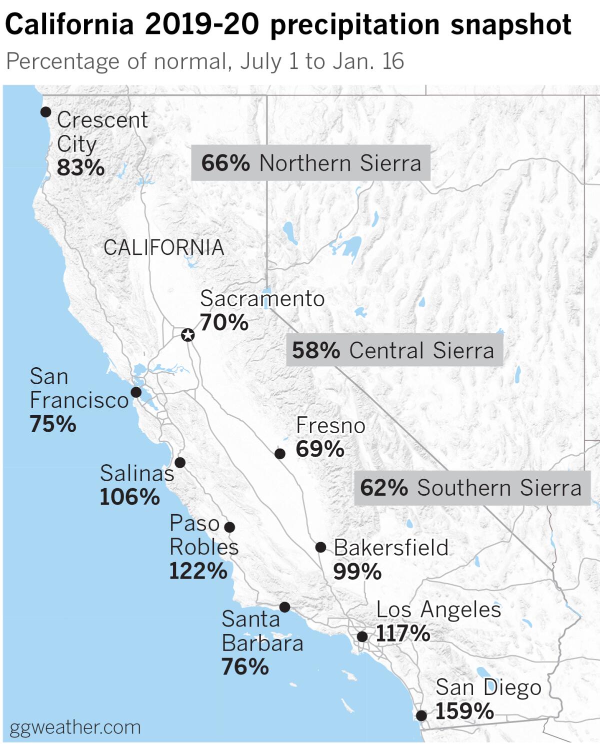
Yet as of Thursday, the Northern Sierra 8-Station Index stands at 66% of normal for the rainfall season that began July 1. That’s down from 73% on Dec. 30. The eight sites that comprise this index are in a mountainous area that includes the Sacramento, American and Feather river watersheds, as well as the state’s biggest dams. It is crucial for water customers throughout the state, and in particular for Southern California.

The Central Sierra 5-Station Index is at 58% of normal for the season, down from 68% at the end of last month, and the 6-station index for the southern Sierra, which covers the Tulare Basin, stands at 62% of normal. It had 73% of normal on Dec. 30.
Crescent City, in the far northwestern corner of the state, has received 83% of its normal rainfall, an improvement of 10 percentage points over its Dec. 30 figure; San Francisco, at 75%, improved from 73%; and Sacramento, at 70%, slipped by 9 percentage points.
Coastal locations in Central California, such as Salinas and Paso Robles, have fared better, holding at 106% and 122% of their normal rainfall, respectively. Inland, however, Fresno is at 69%, down from 80% on Dec. 30.

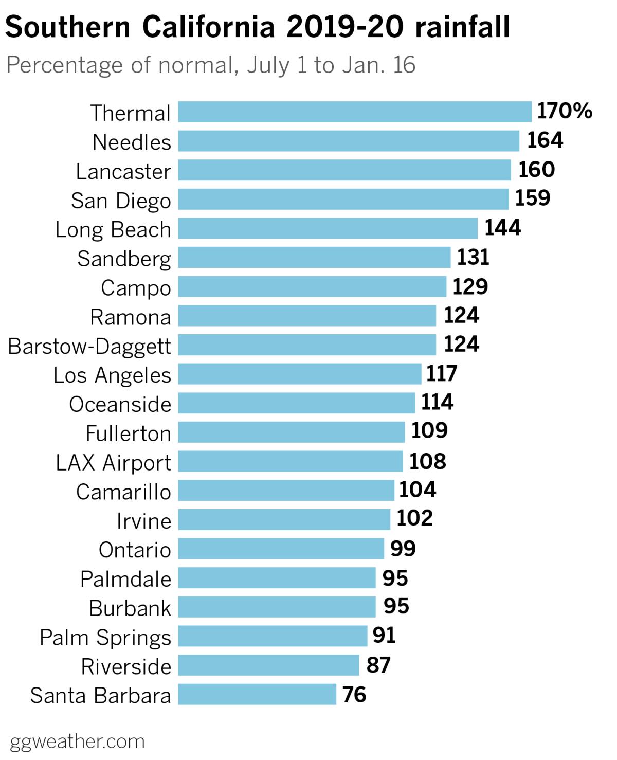
Moving south, much of the Southland is still above normal. Los Angeles stands at 117% of normal and San Diego is at 159%, down from 166% and 211%, respectively. Santa Barbara is a bit of an outlier among Southern California coastal locations with just 76% of normal, having dropped from 103% at the end of 2019. Inland Empire spots such as Riverside, for example, fell to 87% of normal, down from 118%.
Northern California had a dry, windy, extended fire season in 2019, and the rainy weather got a late start there. Meanwhile, big storms affecting the entire state gave Southern California a little bit of a jump on its rainy season.
The next chance for precipitation may come next Tuesday or Wednesday as a trough moves into Northern California, but after that the extended forecast models get more uncertain.
More to Read
Sign up for Essential California
The most important California stories and recommendations in your inbox every morning.
You may occasionally receive promotional content from the Los Angeles Times.


