L.A. Has Its Warmest January Ever
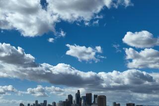
This has been the warmest January on record in Los Angeles. And, despite an El Nino condition that has led many forecasters to predict a wet winter, itŌĆÖs been one of the driest too.
Forecasters say several records could be broken today) as temperatures approach 90 degrees in the San Gabriel and San Fernando valleys and the mid-80s in downtown L.A.
It has been about 5 degrees warmer than normal this month downtown, with an average temperature of 62.8 degrees, about half a degree warmer than the old January record of 62.2, set in 1994. The average is computed by adding the maximum and minimum readings each day and dividing by two.
The warm, dry weather has been largely the product of a continuing series of high-pressure systems that have parked on or near the coast, said Stuart Seto, a meteorological specialist with the National Weather Service.
He said this high pressure has been blocking the southern flow of high-altitude jet stream winds that carry cool, wet storms from the northern Pacific into Southern California.
If it doesnŌĆÖt rain today -- and it almost certainly wonŌĆÖt -- this will be only the fourth January since they started keeping records in 1878 that no measurable rain has fallen in downtown Los Angeles. The other years were 1948, 1972 and 1976.
But the weather service and the National Oceanic and Atmospheric Administration say the dry weather should end abruptly, with above normal rainfall in the Southwest during February, March and April.
Other meteorologists arenŌĆÖt so sure. The weather service expectations of wet weather are based largely on El Nino, a cyclical oceanic and meteorological phenomenon, driven by forces not fully understood, that seems to have a great influence on weather in Southern California.
Surface ocean temperatures fluctuate in the eastern equatorial Pacific. When those temperatures are relatively warm, high-altitude jet stream winds tend to drift south over California, carrying with them storm systems that often bring heavy rain to the Los Angeles area.
An example was the winter of 1997-98, when an unusually strong El Nino brought more than 31 inches of rain to Los Angeles, about twice as much as normal.
This yearŌĆÖs El Nino, expected to begin taking effect here within the next few weeks, is characterized as moderate, and Seto said that could mean as much as 7 or 8 inches of rain over the next three months. That would mean a total for the 2002-03 season of about 13 to 15 inches, close to normal.
Because El Ninos funnel in storms from the central and tropical Pacific, temperatures should continue to be warmer than normal, Seto said.
A lot of people hope the weather service is right about the rain because much of the Southwest is still suffering from drought conditions brought on by last yearŌĆÖs dry winter. Although water supplies in Los Angeles County are still adequate, due largely to ample supplies shipped in from the much wetter northern part of the state, only 4.42 inches of rain fell in L.A. in the fall, winter and spring of 2001-02, making it the driest year in history.
Bill Patzert, an oceanographic meteorologist with the Jet Propulsion Laboratory in Pasadena, said more rain soon is anything but certain.
ŌĆ£The people at the weather service and NOAA could be right, but itŌĆÖs a crapshoot,ŌĆØ he said Thursday. ŌĆ£WeŌĆÖre in a dry pattern now, and that could continue.ŌĆØ
Although El Nino is a factor, Patzert said, so are several other forces, including another cyclical phenomenon, rooted in surface water temperatures north of the equator, known as the Pacific Decadal Oscillation.
He said the decadal oscillation is in a dry phase that could largely override the effects of El Nino.
More to Read
Sign up for Essential California
The most important California stories and recommendations in your inbox every morning.
You may occasionally receive promotional content from the Los Angeles Times.


