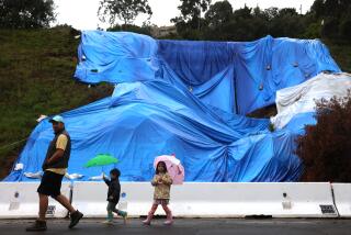
O.C. May Avoid Brunt of Storm
Rain was expected to pelt Southern California today, making a soggy Los Angeles Marathon the prelude to a wet period that could bring 3 to 6 inches by Tuesday morning, forecasters said.
The Los Angeles area is under a flood watch through Monday because of expected heavy runoff, and it will be windy at times, according to Weather Central, a private forecasting service.
Mountain areas are under a winter storm watch, with 3 to 5 feet of snow expected, according to the National Weather Service. High winds will produce blizzard conditions. The snow level will be relatively high--6,500 to 7,000 feet--and the new snow will be wet and heavy, forecasters said.
ŌĆ£If people in the mountains have not cleared the snow from their roofs, it is very important that they do so now,ŌĆØ said meteorologist Ray Tanabe of the weather service.
Even before todayŌĆÖs storm, rainfall totals were well above normal: 15.66 inches so far, 4.5 inches above the norm for this point in the season, the weather service said.
Showers were expected to begin around sunrise this morning, with rain growing heavier throughout the afternoon and overnight.
The heaviest rain was expected along the foothills and in the mountains of southern Santa Barbara and Ventura counties this afternoon and tonight, bringing more than an inch per hour during the wettest periods.
Orange County is likely to escape the heaviest rain, but meteorologists, nevertheless, promised a good dousing for the county, with the possibility of some scattered thunderstorms.
Forecasters were predicting that the storm would begin breaking up late Tuesday and that Wednesday would bring decreasing showers and mostly cloudy skies.
Until then, meteorologist Tanabe said, ŌĆ£ItŌĆÖs gonna rain, rain, rain.ŌĆØ
More to Read
Sign up for Essential California
The most important California stories and recommendations in your inbox every morning.
You may occasionally receive promotional content from the Los Angeles Times.


