Powerful Hurricane Churns Off Mexico Coast
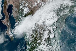
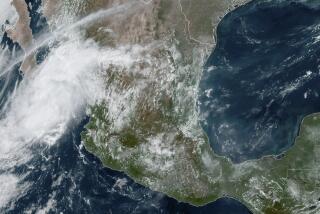
The most powerful hurricane ever observed off the west coast of Mexico is headed toward Los Angeles, and forecasters say the leading edge of the storm could strike before the end of the weekend.
If Hurricane Linda--packing winds of up to 170 mph late Friday--does get here, the winds and rains almost certainly will have diminished, but gale-force gusts, heavy seas and downpours capable of triggering mudslides and flash floods are still a possibility.
While the much-discussed El Nino meteorological condition did not create Linda, it has intensified the storm, according to Wes Etheredge, a meteorologist with WeatherData Inc., which provides forecasts for The Times.
ŌĆ£WeŌĆÖve never seen one this big before in the eastern Pacific,ŌĆØ Etheredge said.
The last time Southern California felt the effects of a hurricane was in September 1976, when a diminishing storm hammered the southern deserts with up to 13 inches of rain, the forecaster said.
Etheredge said that by nightfall Friday, Linda was centered about 320 miles south of Cabo San Lucas, the southern tip of Baja California, and continuing to intensify. The stormŌĆÖs projected track would place its center about 100 miles west of ScammonŌĆÖs Lagoon, roughly half way up the Baja peninsula, by Sunday afternoon, he said.
ŌĆ£After that, one of two things will happen, and we canŌĆÖt be sure which,ŌĆØ he said.
Either an upper-level low pressure system farther west will draw the storm away from the mainland, or an upper-level trough of low pressure over the Southwest will pull it over Southern California.
In either case, Linda will be moving over cooler water, which will lessen its intensity. But El Nino has tossed a wild card into the deck. The phenomenon involves the interplay between warm ocean currents west of South America and changes in atmospheric temperature, wave patterns and rain levels in much of the Western Hemisphere.
Ocean temperatures are already as much as five degrees above normal along the West Coast, and that means LindaŌĆÖs intensity wonŌĆÖt diminish as fast as it would in an ordinary year. If the storm does hit Southern California squarely, it probably wonŌĆÖt be a hurricane anymore but will still pack enough punch to deal a heavy blow by late Monday or early Tuesday.
Etheredge said swells up to 12 feet high could hammer beaches, damaging piers and causing some coastal flooding. Up to several inches of rain could fall on mountain slopes, triggering flash floods and mudslides. Winds of up to 50 mph could tear up roofs and down power poles.
Scattered high clouds from the fringes of the storm are expected over parts of Southern California late today. If Linda continues to head this way, warm, muggy weather should be the rule by midday Sunday.
More to Read
Sign up for Essential California
The most important California stories and recommendations in your inbox every morning.
You may occasionally receive promotional content from the Los Angeles Times.


