L.A. River--a Force to Reckon With
- Share via
Spring flood devastation in the Dakotas, Minnesota and Manitoba, Canada, is a reminder that Mother Nature can be fickle and turn even the most harmless-looking streams into instruments of destruction.
For this reason, L.A. residents should be grateful that the L.A. County Flood Control District and U.S. Army Corps of Engineers have resisted efforts to refashion the Los Angeles River.
A lack of respect for the unsightly river has always concerned authorities, who are continually pressured by civic-minded residents who want to make it more attractive and useful.
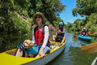
A group that calls itself Friends of the Los Angeles River has for years lobbied to remove the concrete, and convert the river bottom into an attractive natural habitat, with parks and picnic grounds for the public’s enjoyment.
Angelenos have also been fascinated with a conflicting idea, and that is to use the river as a transportation corridor. This goes back to 1921 when it was proposed by Harlan Bartholomew, who designed Los Angeles’ old civic center. In 1989, then-Assemblyman Richard Katz championed an ingenious plan to relieve traffic congestion on the Ventura Freeway by converting one-third of the river channel into an expressway for commuters. Fortunately, Katz’s proposal, like Bartholomew’s, was rejected.
As admirable as these suggestions may seem, there is a good reason why the river’s concrete straitjacket should not be removed or its surface used for vehicles. The harmless-looking trickle that is normally seen masks one of the most dangerous rivers in the United States.
This is because the drop in elevation during its 50-mile length is greater than the Mississippi has in its entire 2,300 miles. As a result, flood runoff is capable of reaching speeds of 70 mph; it can become a killer in the blink of an eye. On these occasions, even a warning system for picnickers and other users would be of little value.
The danger was demonstrated in 1815 and again in 1825, when Los Angeles was a pueblo and the river was an attractive above-ground stream flowing in its natural state.
In 1815, a 10-day deluge sent the L.A. River bursting out of the San Fernando Valley, carrying everything before it. The debris of trees and rocks was so great that it created a natural dam at the narrows, near Elysian Park, forcing the river to turn right. It made a second right turn where 9th Street is today and flowed west to join Ballona Creek and empty into the ocean at Playa del Rey.
Ten years later, on a clear moonlit April night, residents were awakened when a huge wall of water roared into the narrows and broke through the 10-year-old debris dam with earth-shaking force. The flood continued on a southerly course, carving out a new channel to its present outlet at Los Angeles-Long Beach Harbor.
Astonishingly, although a heavy rain had fallen on the pueblo the day before, the rain had stopped on the day of the flood and the river showed no sign of danger. Historians speculate that a tremendous torrential rain had probably occurred in the Angeles National Forest in the area of Big Tujunga Canyon.
The process of lining the river was begun in the 1930s to keep it in its present channel and protect property along the banks. After another flood inundated downtown in 1938, the Sepulveda Dam was built by U.S. Army engineers in 1941 to hold storm waters in check.
Today the contained river flows through a heavily populated area, and one can easily imagine what would happen if the river were restored to its natural state and floods similar to those of 1815 and 1825 were to occur again.
Although the creeping nature of flooding in the flatlands of the northern states is unlike the flash-flooding the Los Angeles area can experience from its surrounding mountains, there is one commonality. And that is the desire to protect life and property from these extremes of nature, however rare.
In flooded Grand Forks, N.D., for example, businesses have threatened to relocate unless authorities do something to prevent a similar “500-year flood.” As a result, Grand Forks is considering constructing a channel around the city to protect it from the Red River.
In Manitoba, where many communities were also flooded by the Red River, the provincial capital of Winnipeg was spared--by a massive trench that circles the city.
This news should provide everyone who lives in the communities bordering the L.A. River with a new appreciation for their own flood-control facilities. Those who support this life-saving system are also friends of the L.A. River.
More to Read
Sign up for Essential California
The most important California stories and recommendations in your inbox every morning.
You may occasionally receive promotional content from the Los Angeles Times.


