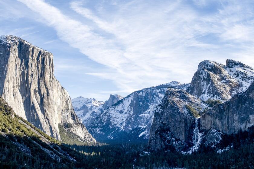
Hiking Heaven : The San Gabriel Mountains offer one of the most scenic stretches of the 2,638-mile Pacific Crest Trail.
- Share via
In a short ceremony at Acton on June 5, Interior Secretary Bruce Babbitt inaugurated the Pacific Crest Trail, a project that has spanned three quarters of a century. The trail is likewise long in distance, 2,638 miles from Mexico to Canada. Had the secretary wanted to show off one of its handsomest Southern California stretches, he would have chosen one in the nearby San Gabriel Mountains.
The Pacific Crest Trail idea grew out of Southern California’s “great hiking era.” Lasting from the late 19th Century through the 1930s, the period was well-named. In a typical year, 1935, 2 million people flocked to the San Gabriels and 140,000 hiked 10 miles or more.
They came as individuals and families, as members of the Boy Scouts, Sierra Club and other outdoors organizations. By the 1930s, such groups had joined with public entities to form the Mountain League as a focus for their activities. The league’s Trails Magazine, a popular quarterly subsidized by Los Angeles County, published essays, news, bad poetry and trail trips at 10 cents an issue.
Mountain League President Clinton C. Clarke of Pasadena became a prime advocate of establishing the Pacific Crest Trail. Talked about since the 1920s, the proposal turned into action after a 1935 meeting in Yosemite chaired by a young photographer named Ansel Adams. Linking such existing paths as the John Muir and Cascade Crest trails, it extended 2,350 miles, much of it on today’s route.
Soon people could walk that first version. Trails Magazine reported on hiking groups doing relays, a third of the distance each summer. The first relay started in 1935 at Campo, near the U. S.-Mexico border, and reached Lake Tahoe. The second went on to central Oregon in 1936 and the third made it to Vancouver in British Columbia in 1937.
But the great hiking era began to wind down with major flood damage in the San Gabriels in 1938 and the looming prospect of war. It ended with Pearl Harbor in 1941, and the trail faded from public attention. Yet the dream persisted, and in 1968 Congress revived the project. Making the trail permanent by securing rights of-way and connecting sections then took a quarter of a century.
Now, as then, a Southern California highlight is the San Gabriels’ middle high country, where the trail stays closest to the crest. In 12 miles from Islip (pronounced eye-slip ) Saddle to Vincent Gap, it passes four peaks to climax at a fifth, 9,399-foot Mt. Baden-Powell. Except for having the Angeles Crest Highway at the two end points these days, the territory looks much as it did in 1936 when Trails Magazine touted it for having “the finest forests, grandest scenery and highest mountains.”
You ascend through yellow-pine forest to where stout trees, often battered by summer lightning, grow stunted in rarefied air. Farther up, lodgepole pines herald the alpine zone. The highest elevations belong to limber pines, at least one of them a gnarled patriarch 2,000 years old.
You cross open, garden-like patches of mounding manzanita, bush chinquapin and snow brush, shoulder-high at 6,000 feet, knee-high at 8,000. Four springs along the way nurture lush oases of currant, shooting star and other water-loving plants. Short side trails reach summits marked by cairns and monuments that speak of the past.
The shortest middle-high-country samples this land’s variety: Islip Saddle to Little Jimmy trail camp and spring, and then Windy Gap on the crest beyond. A Mt. Islip side trip adds a peak conquest and a sweeping view. From Windy Gap east, the trail climbs toward Mt. Hawkins. Just short of that peak, it drops 240 feet in half a mile through shady north-slope forest to a green, moist glade around Lily Spring.
Back at the crest and on east past Throop (pronounced troop ) Peak and Mt. Burnham, you reach a climactic passage through an ancient limber pine forest to the top of Baden-Powell. Across a chasm deeper than the Grand Canyon, if you believe writers in Trails, the view over to Old Baldy is magnificent. Finally you descend Baden-Powell’s steep north face to Vincent Gap with Lamel Spring along the way.
However far you walk, you experience the kind of country that inspired the Pacific Crest Trail. After this middle-high-country segment, you have only 2,626 more miles to go.
WHERE TO GO
Park at Islip Saddle on Angeles Crest Highway, 40.5 miles from La Canada Flintridge. Across the road, the Pacific Crest Trail heads east along the range crest, then down Mt. Baden-Powell to the Vincent Gap trail head, 11 miles east by road. A two-mile spur trail from Dawson Saddle, 5.6 miles east of Islip, reaches the Pacific Crest Trail near the midpoint, just east of Throop Peak.
At 6,500 to nearly 9,500 feet, you huff and puff compared with sea level, so plan more moderate distances. Note the one-way mileages. Islip Saddle to Windy Gap is 2.5 miles; to Mt. Islip, 3.5 miles; to Throop Peak, five miles; to Baden-Powell, eight miles. Vincent Gap to Baden-Powell is four miles; to Throop, seven miles; to Islip Saddle, 12. A shuttle trip with a car at the Islip Saddle and Vincent Gap end points means a 12-mile walk. A car at Dawson Saddle means 1,300 feet less climbing in both directions and shorter mileages to Islip Saddle, 7.5, or Vincent Gap, 8.5.
More to Read
Sign up for The Wild
We’ll help you find the best places to hike, bike and run, as well as the perfect silent spots for meditation and yoga.
You may occasionally receive promotional content from the Los Angeles Times.


