Commuters Get the Traffic Picture From Armchairs : Transportation: A computerized freeway monitoring system from Caltrans makes its debut on cable TV stations during rush hours. The map points out trouble spots and offers advice on alternate routes.
- Share via
At first glance, viewers of Los Angeles’ cable television Channel 35 may have been alarmed by the tangle of yellow and green lines and flashing red lights that filled their screens early Wednesday morning.
What they saw was a new computerized traffic watch system from Caltrans called Freeway Vision, which uses a color-coded map to indicate traffic conditions on the Southland’s 750 miles of freeways to help commuters find alternate routes.
The service, which is updated every 30 seconds, airs Monday through Friday from 5 to 8 a.m. and again from 4 to 6 p.m.--at no cost to Los Angeles’ 500,000 cable television viewers.
“This is about driving smarter,” said Jerry B. Baxter, Caltrans District 7 director, at a City Hall news conference to launch the service.
“If you’re a commuter, you know where slowdown occurs because of peak traffic,” Baxter said. “What you don’t know is where the accidents are, or where someone had a flat tire or stalled out causing severe backup--that’s where the real value of this is.”
The map is a replica of a much larger one on display at the downtown Caltrans Traffic Operations Center, which is connected to sensors embedded in the pavement at half-mile intervals.
As vehicles drive over the sensors, they instantly transmit information to the operations center about traffic volume, speed and congestion.
On the map, green indicates traffic flows above 35 m.p.h.; yellow indicates speeds between 25 and 35 m.p.h., and red means speeds below 20 m.p.h. Flashing red lights mean stopped traffic, seek alternate routes.
The information has been used for 20 years by Caltrans traffic managers to identify incidents, dispatch maintenance crews and activate changeable “Freeway Condition” message signs.
The map offered to television viewers covers an area bordered on the north by the junction of the Golden State Freeway and the Antelope Valley Freeway; on the south by the Garden Grove Freeway; on the west by the San Diego Freeway, and on the east by the Orange Freeway north of the Riverside Freeway and the Newport Freeway.
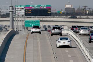
“Traffic congestion is an unpopular reality in Los Angeles,” City Council President John Ferraro said at the news conference.
“While we can’t always change conditions on the freeways, we can find ways to work around them,” Ferraro said. “Caltrans and L.A. Cityview 35 are providing Angelenos with a useful service that will help reduce delays, improve traffic flow and improve air quality.”
Ferraro said the Freeway Vision service will be offered to local commercial television stations in October. He also predicted that “the day will arrive when you’ll have one of these monsters in your own car.”
On an experimental basis, Caltrans officials have outfitted 30 cars with a navigational system called “Pathfinder,” which provides “real-time” traffic information on a map mounted in the dash showing the driver’s location at that moment, as well as suggested routes around congested roadways.
The “Pathfinder” vehicles are being tested along a 14-mile stretch of the Santa Monica Freeway and several parallel streets.
More to Read
Sign up for Essential California
The most important California stories and recommendations in your inbox every morning.
You may occasionally receive promotional content from the Los Angeles Times.


