SOUTH COUNTY : Fabled âRoyal Roadâsâ Route Lost in Time
In San Clemente, itâs the main drag, running the length of the city from Camp Pendleton to the Dana Point border.
In San Juan Capistrano, the remnants of the grand old highway stretch for about a mile behind the cityâs downtown, past Mission San Juan Capistrano and the library until it comes to an abrupt dead-end.
Those interrupted links of paved highway are all thatâs left in the South County of El Camino Real, or âthe Royal Road,â the roadway that in the mid-1700s was a dirt path from Loreto in Baja California--the first capital of California--to the San Francisco Bay.
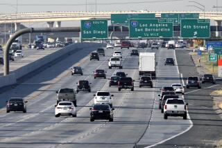
While many historians believe that the Santa Ana Freeway follows the general path of El Camino Real, there has never been a full account of the route, most experts agree.
âA lot of the lore of El Camino Real is rather mythical, sort of by guess and by gosh,â said Jim Sleeper, county historian and author. âWe know it connected the missions, but exactly where it passed through the county, no one is sure.â
Actually, there were two early main routes through the county, the first established by Gen. Gaspar de Portola and his expedition in 1769. De Portola left Loreto on March 9, 1769, and arrived at San Juan Capistrano in mid-summer, Sleeper said.
Sleeper said the early route passed through what later became the town of Olive, and crossed what is now known as the Santa Ana River on its way to San Gabriel, where the next mission north was founded.
In the mid-1800s, that coastal route became the San Diego-Los Angeles stagecoach line, Sleeper added.
In San Juan Capistrano today, the downtown portion of El Camino Real is a side street, much less traveled than the main thoroughfare, Camino Capistrano. At the northern end of that segment of El Camino Real, three tracts of homes now interrupt the old highway and, at its southern end, where Camino Capistrano intersects Del Obispo Street, El Camino Real has been replaced by a Kentucky Fried Chicken outlet and a mini-mall.
âAt the southern end of town, El Camino Real stopped heading toward the ocean and veered off to what used to be called Battery Road,â said Pamela Hallan Gibson, author of âTwo Hundred Years in San Juan Capistrano.â âAfter crossing San Juan Creek, El Camino Real used to be a little road that went up into the plateaus of the foothills toward San Clemente. It never went down along the beach in this area.â
Gibsonâs account puts the San Clemente stretch that the city now calls El Camino Real into question. It is marked with the traditional El Camino Real bells, but is it really the old pathway?
More to Read
Sign up for Essential California
The most important California stories and recommendations in your inbox every morning.
You may occasionally receive promotional content from the Los Angeles Times.


